
State ID: CA
3 letter designator: BDF
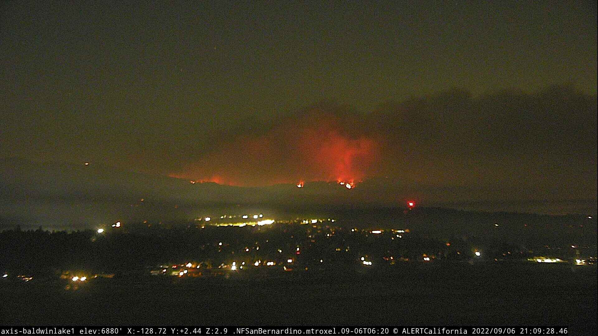
Fire name: Radford
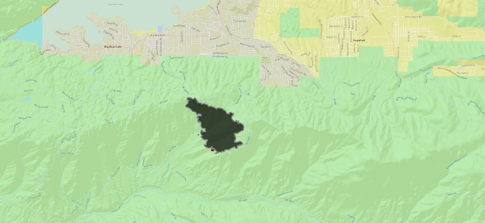
Location: Barton Flats area, south of Snow Summit Ski Area, Big Bear
Reported acres: 350 +
Rate of spread: Last report from Intel 24 was moderate
Report on Conditions: Spot fires running up to ridge (Snow Summit)
Structure threat: Yes
Resources: BDF BC 11 BC 13 BC 32 CH 2 CREW 5 DIV 1 DIV 5 E315 E316 E317 E330 E334 E338 E339 E50 H535 HT 25M HT 2CK PT16 PT19 PT52 PT55* PT57* WT212 WT232 WT234, BDC 2CMD21 AC108 AD350Y BC119 BC121 BC122 BC141 BC1612 BC2805 BC403 BDFBC13 BDFBP15 BDFBP16 BDFBP17 BDFBP19 BDFC-5 VISTAGRANDE BDFDC1 BDFE315 BDFE316 BDFE317 BDFE334
Hazards:
Weather: At time of start @ 1331 hrs Temp 80F RH 23% Winds NE4, G11
Radio channels:
Scanner link: Courtesy of socalmountains.com http://bigbearscanner.com/
Webcam link: ALERT Wildfire
Agency Website: https://twitter.com/sbcountyfire
IR Map at 2335 hrs 9/5

Extended Air Frequencies starting today (9/6)
Air Tactics 168.400
Air/Ground 162.8125
Rotor Vic 134.825
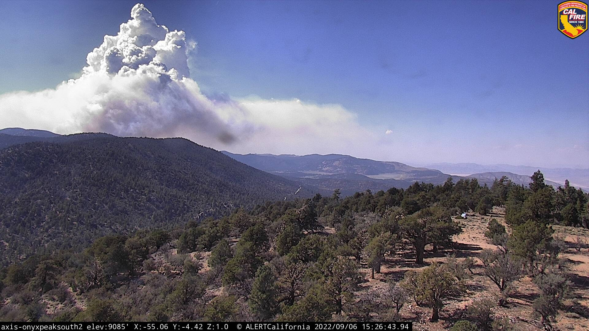
It’s definitely pushing up out of that draw now. It’s going to be a very dynamic day.
SBCo Sheriff just issued and evacuation order for the western edge. Essentially from the areas south of the Village to areas south of Boulder Bay. https://twitter.com/BigBearSheriff/status/1567214685707010048?s=20&t=Go-W0sQDHjN_X77qQHPODA
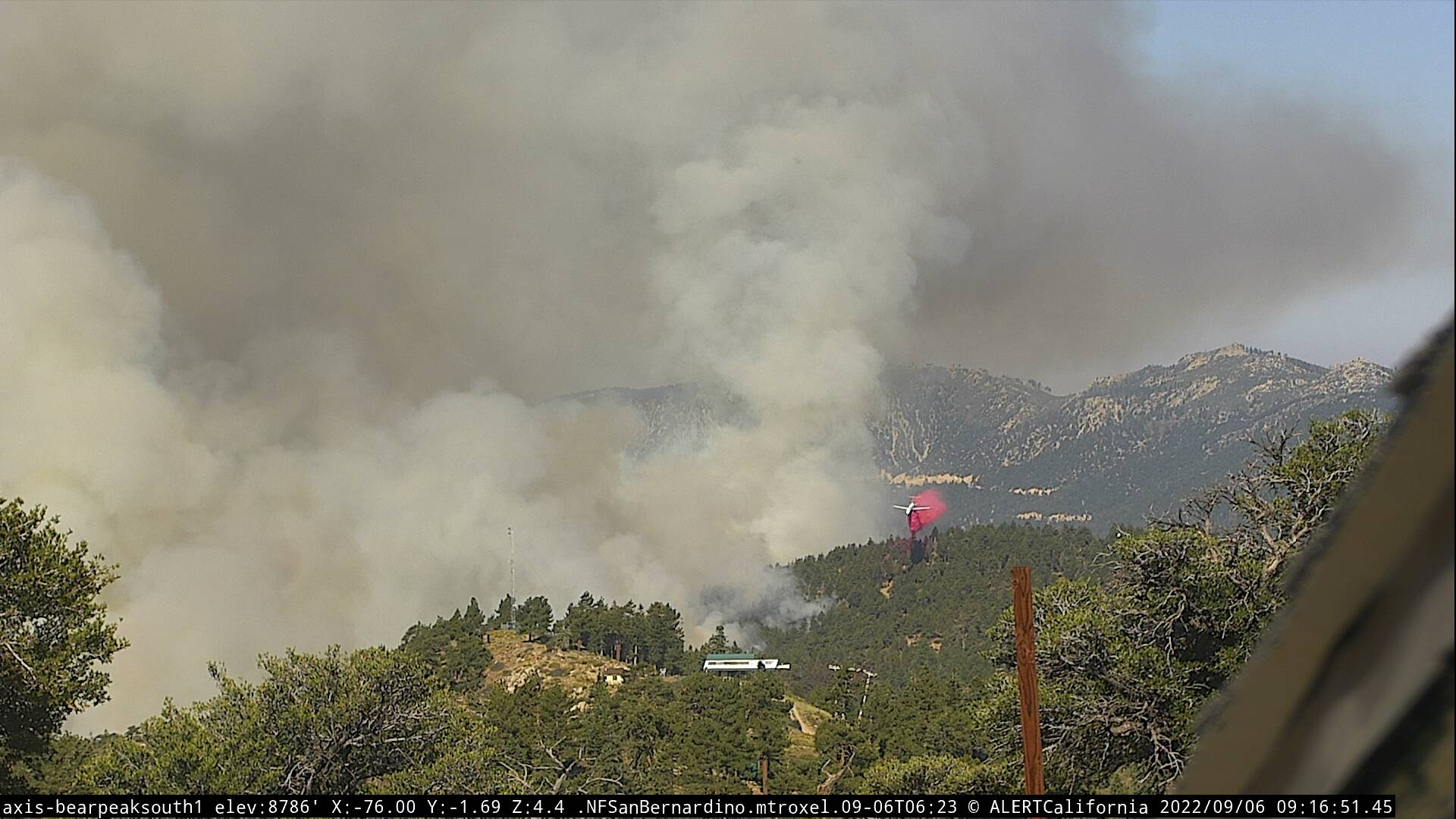
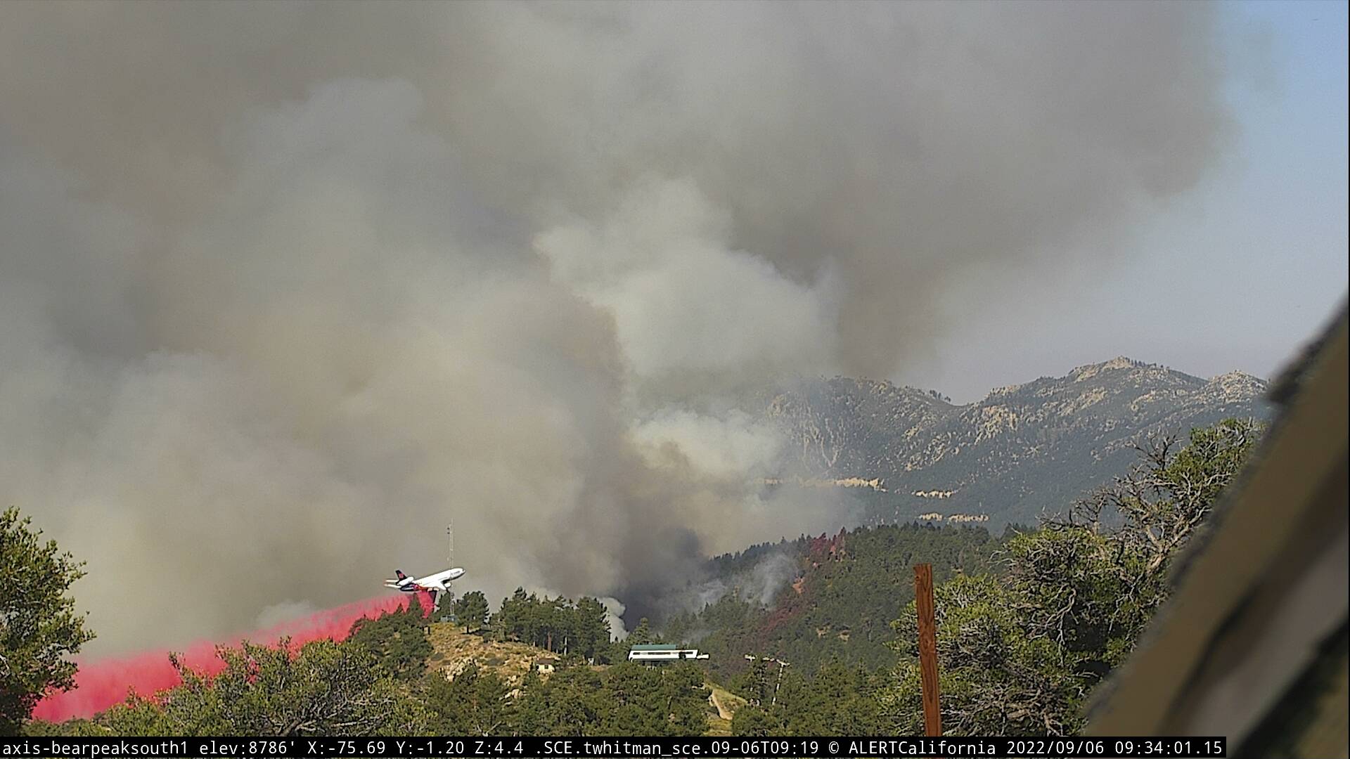
Smoke production overall, and especially in the west seems less. Perhaps all of the monsoon moisture over this area for the last few weeks is moderating things a bit. Sounds like crews working on backfiring down off Radford Truck Trail. Excellent air support all day.
Edit: Or did I miss something. This angle seems a bit more fired up.
2N10 and Sugarloaf, between Summit and Bear ski areas picking up: https://twitter.com/SoCalFirePhoto/status/1567268354892898306?s=20&t=BkHY5fv_JP4gD7wloSp0dw
A new evacuation ordered as fire approached Moonridge area.
“An evacuation order is now in effect for Summit Blvd East to Club View and Evergreen Dr South. Evacuation orders previously established remain in place.”
all fixed wing aircraft off fire except AA…smoked out
The overall flow has changed too. Everything seems to be leaning toward Big Bear Lake community.


Looks like the fire is coming over the ridge into Big Bear proper, as seen on the Deadman camera.
Based on what I am seeing on the Bear North Cam, I believe the fire is moving down into Snow Summit in the timber. Not what I had hoped for.

Edit. here is a before shot, not likely to see the same again:
Worse yet, odd, seems no fire on the south side, it is all in the timber on the Big Bear side, from Keller Peak:

Looks like the sno guns (sprinklers) did their job overnight. Ski areas look okay. Fire moving downslope through timber beteeen Moonridge subdivision and Summit, upslope from Pineknot camground.
Addl victor assigned 126.275
Addl A/G assigned 168.325