
State ID: CA
3 letter designator: BEU
Fire name: Colorado
Location: Palo Colorado road at rocky creek
Reported acres: unknown
Rate of spread: unknown
Report on Conditions: possible structure fire into the vegetation.
Structure threat: yes evacuations underway.
Resources:
Hazards:
Weather: wind 15-35 mph reported.
Radio channels:
Scanner link:BEU CAL FIRE and San Benito County Public Safety Live Audio Feed
Webcam link: ALERTWildfire | Central Coast
Agency Website:
4 Likes
Type 3 engine and water tender requests going UTF.
1 type 3 responding once additional firefighter shows up and sounds like they got a water tender.
The fire is heading for highway 1.
5 Likes

5 Likes
Looks offshore to variable for next 10 hrs. Going west which is good for most part. Just hope homes are not in path. Be safe
2 Likes
Evacuation of coast road underway.
1 Like
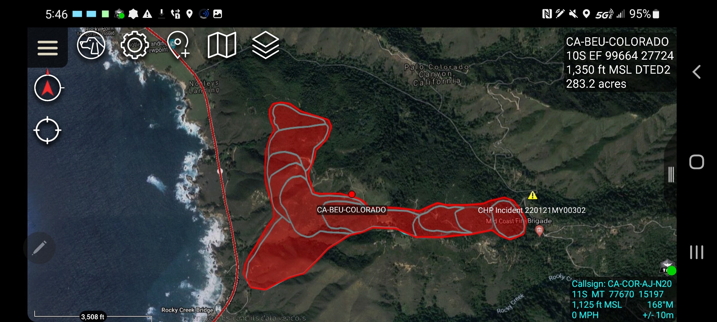
150 acres per ic
2 Likes
Strike team of type 3’s from CZU were just punched out 10 mins ago
3 Likes
Losing heat now that it’s hit the great pacific fuel break.
2 Likes
Did someone forget to wake up Big Sur Kate?
4 Likes
It was only four engines
2 Likes
Kate was on the Twitter giving updates.
3 Likes
Via CHP website 1500 acres.
2 Likes
CHP CAD is putting it at +1500…anyone else hear anything like that?
11:47 PM53[178] C27-022G PER S5 FIRE IS + 1500 ACRES // FIRE CONCENTRATING ON THE W SIDE OF PALO COLORADO and SO WILL BE DOING RE EVACS AGAIN/ TAPING OFF EACH RESD TO CONFIRM ITS BEEN EVAC’D
2 Likes
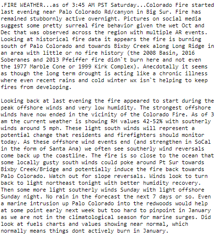
Some forecast thoughts regarding the Colorado Fire. The strongest offshore (northeast) winds have peaked and expected to ease after midnight through sunrise. Humidity should trend higher by 4-6 am. Need to be on the watchout for some light southerly winds early Saturday morning
4 Likes
1 Like
Ventura County Type-3 Strike team toned out enroute for the incident
4 Likes
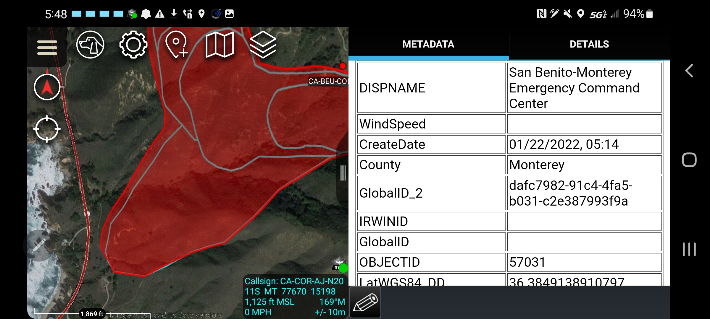
Good morning, anybody have an improved map of the incident?
USDA FS N498DF - flight radar 24
1 Like
@1432 I would guess that FIRIS will take a pass at it this morning or maybe Courtney or probably both for some more refined maps. The Fireguard data is from a satellite based sensor so its geospatial resolution is not as tight as we would get off an aircraft.
2 Likes