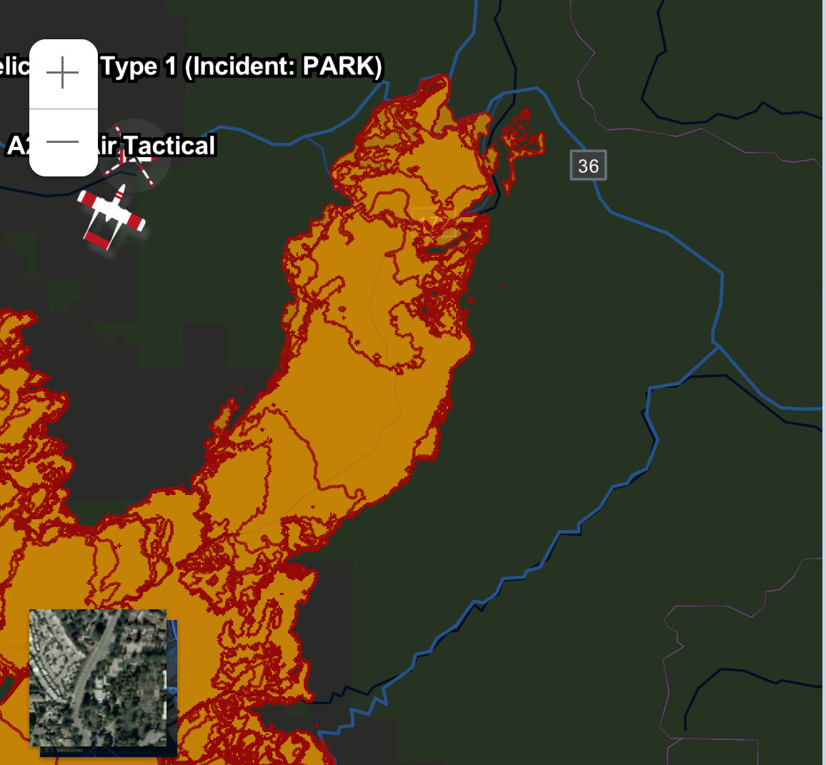
Setting up a fixed wing operation going direct on the line DIV TU below Turner Mtn, going south from the peak. Hoping to slow the flank and slops down, following up with an iron show going direct to hopefully put this piece to bed tonight.
Just ordered up 2 VLAT’s, 4 LAT’s, 2 S2T’s
Is this where the fire got a little excited the other day.
looks like the fire got really excited after seeing the weather report
Looks like T210 just dropped, T 105 and T912 are inbound with T93 right behind him.
T03 is following from Fresno
The winds are picking up, and doing some switching around. At least it’s not a really heavy (20-25) wind from the SW.
With fire comes flood…
https://www.facebook.com/photo/?fbid=914434630712870&set=a.246737254149281
Here are some photos of the Park Fire’s burn severity in Chico Creek Canyon, and in Mill Creek Canyon.
If you click on the external Gigapan links, you can open the panoramas in fullscreen mode (recommended). Use the fullscreen button on left of Gigapan page…
Another ‘Gigapan’ image, taken east of DP-24. This area got hit fairly directly by the column-driven fire as it blasted up out of the canyon, below, on 8/5.
DP-24 itself got pushed out in a major fashion as the fire approached.
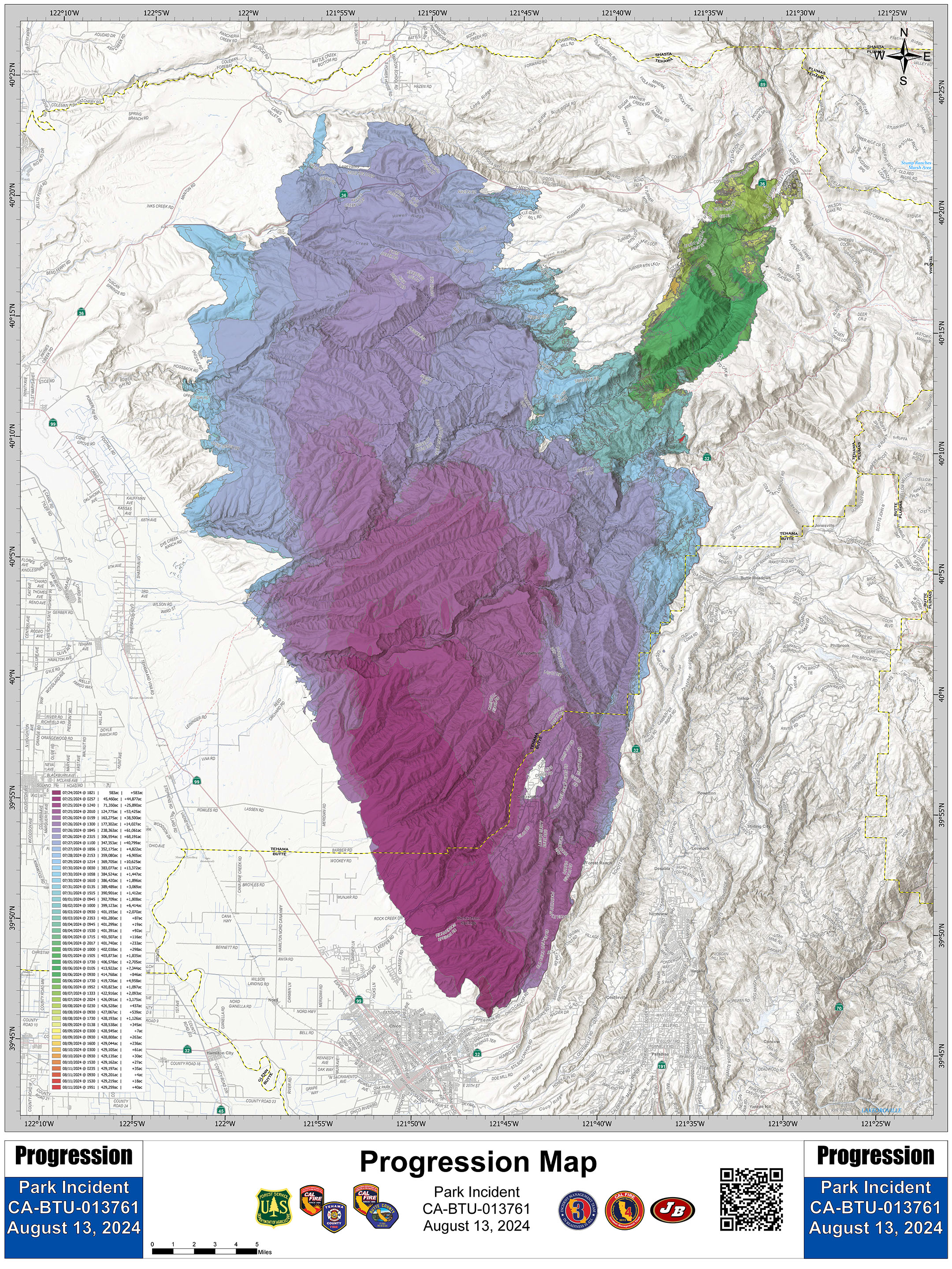
419,460 acres, 65% contained. All Evacuation Orders and Warnings have been lifted…
There is currently a flash flood warning for the Chico area and all other communities downstream of the Park Fire burn scar. Similar warnings will occur with every large precipitation forecast for the coming winter, and maybe, even into winter of 2025-26.
Tonight’s Lookout Livestream is a map-based discussion of the specific flooding hazards for the various communities downstream of the Park Fire. We also look at the City of Chico’s flood control infrastructure, and talk about places that could be problematic during major runoff events.
The last third of the video looks at fire effects in Antelope Creek and Upper Mill Creek, and talks about forest management and the difficulty in sustaining commercial timber operations in high-wildfire-hazard landscapes.
https://youtube.com/live/oUzy0iuoviM
7 pm, 8/23/2024
429,603 acres and 95% contained. Pretty much switching gears and now going Post Suppression mode now.
Yesterday CAL FIRE Team 6 transferred command of fire-affected state lands to CAL FIRE Tehama-Glenn Unit’s local Type 3 IMT.
Southwest Area Complex IMT (CIMT) 2 assumed command Friday morning of the fire area that is on Lassen National Forest lands.
429,603 Acres
100% containment