Tonight’s Lookout Livestream looked at fire severity in Big Chico Creek Watershed, above Chico, and talked about potential for erosion and flooding problems this winter:
We also looked at some 2003 aerial photos I shot along the transmission line corridor between Chico and Highway 36 which the fire covered during its initial couple days of running north and talked about the impossibility of containing a fast-moving fire in that country.
https://www.youtube.com/live/d86NAsH6fJY?si=rHKMa3rfyBQxgyqr&t=1373
10 Likes
Multiple spots across the line running under the trees in Tehama DIV Q, Bryant Ridge section 11. A couple charlies and a golf enroute from neighbor DIV, and 1AA 2 Tankers. Trying to get rotor up but Red Bluff Helibase has some significant wind weather at moment.
5 Likes
Tankers AA 94&95 overhead, 2 ch47s and a uh60 coming in. a helco is also working.
5 Likes
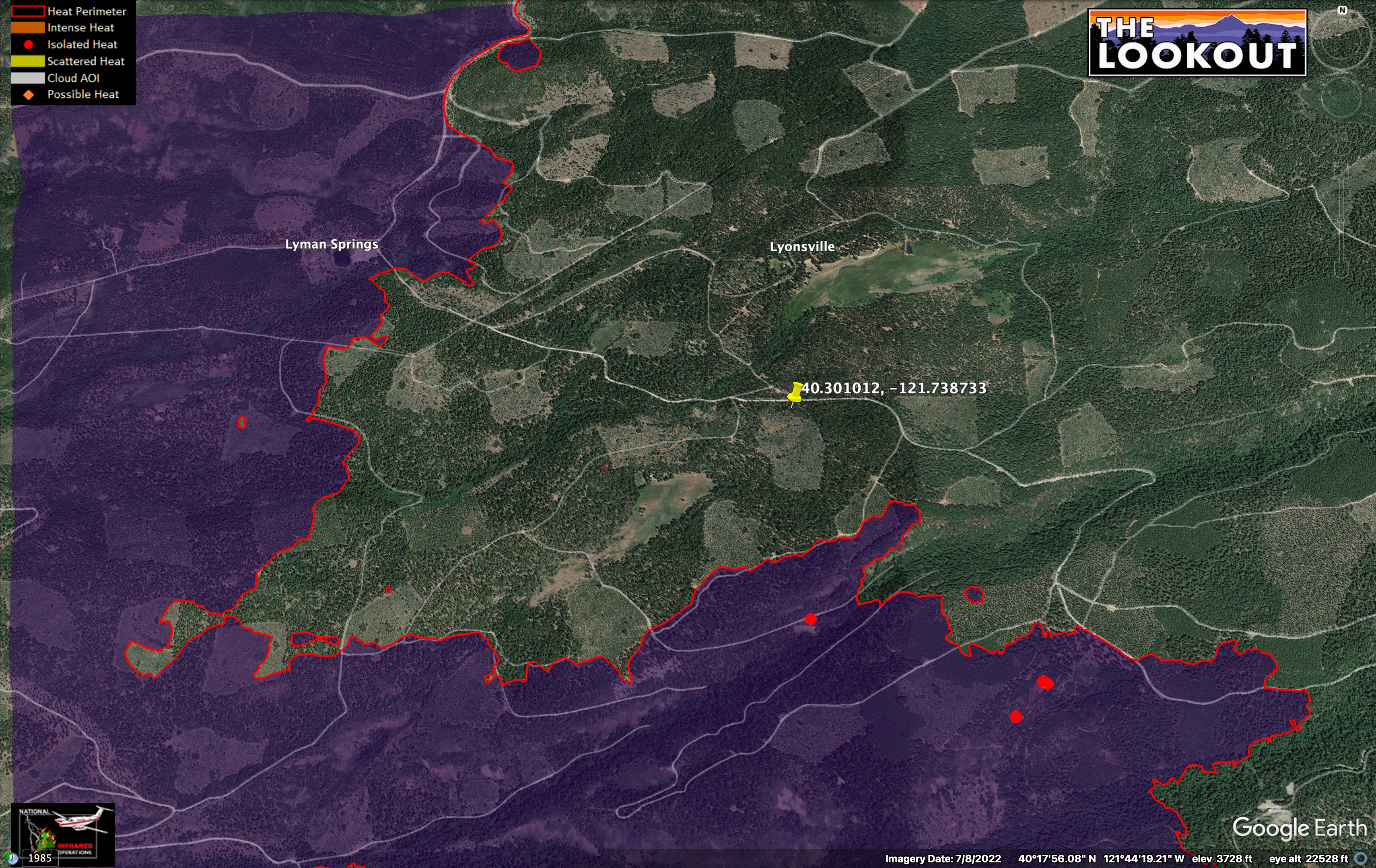
Camera cross puts it about here. IR was showing minimal heat near the line here last night.
Humidities are forecast to be over 80% tonight, and temps below 60.
8 Likes
6 Likes
It’s been a year since the fire and I am working on a series of Park Fire videos.
This first one mixes an interview I did a week into the fire with The Blue Dot Report, a local science radio show, with footage from Lookout supporters and stuff I have shots since the fire.
If you have videos or photos of the Park Fire, or any others, that you want to share for our use on The Lookout, you can upload them to the Dropbox link, below. All materials will be kept anonymous, unless you ask for attribution. https://www.dropbox.com/request/ZVoBoCh4twGqB9FFbi8j
8 Likes