T914 And T912 to the fire
T914 did drop but having tank issue. Returning to SBD to trouble shoot. AA wants 914 to load and return if able to fix tank issue.
Operations is stating that things are coming to life along the 198 and they need Charlie Strike Teams. He requested single resource/increments if necessary.
large firing operation taking place, All tankers on load and hold.
AA is ordering a lead plane.
Looks like burning along Mineral Springs Road to Higway 198 and then down hill to unknown end point. My guess the end point will be Juniper Ridge Fire Road.
AA is asking for specific tankers to the fire. Some of the numbers he read have already been divert to BEU and MMU, will see what he gets
Mineral AA requesting 2 type 1 tankers in addition to the 2 VLAT’S.
Seeing some column develop off Joaquin cam.
14,300 acres and 15% Containment.
Mineral Fire Air Attack just reported to Operations that the main fire front will reach Los Gatos Creek Road in the next 6-12 hours and structure defense should be ready. AA also ordered 8 Tankers for tomorrow, 4-S2’s, and 4 LAT’s.
19,000+ Arces as of 2030hrs
Added a Data Package for ATAK users with todays maps. Drill down through the folders to 2020/Mineral
https://drive.google.com/drive/folders/1GuY-MVWnlo3vlM7FEiDn8Nd3H_AXMpKn?usp=sharing
Punched through the inversion and starting to gain some altitude
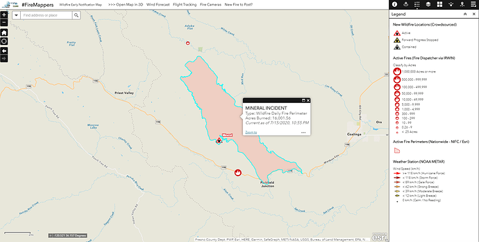
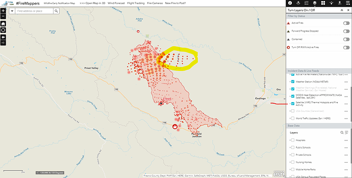
The #MineralFire daily perimeter from last night 7/15 10:55 PM on the #FireMappers map https://arcg.is/1X4aeu1 and IMT map https://arcg.is/a15Pa p.s. you can use the layers button to turn on satellite hot spots, but I am suspicious there were errors due to header / smoke plume
p.s. Bookmark this app as it will auto-update with fire information https://bit.ly/FireMappers
AT dawn the humidity recovery was good. Didn’t help the fuel stick much
ALCALDE Raws at 6 am
temp 74
dew point 49
humidity 42
winds S 3 Gusts 5
fuel temp 68
fuel stick 5
Tankers are up and over the fire.
4 type 1’s and tanker 74 out of paso to the fire.
Crews made good progress on 198 and mineral Springs fired and holding.
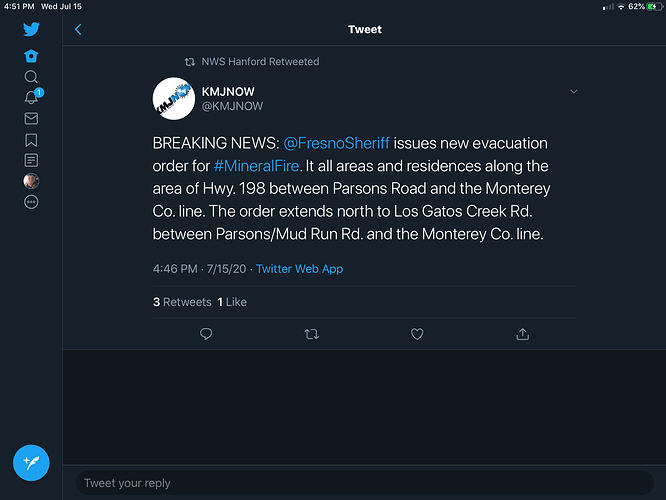
Evacuation WARNING issued for areas north of Los Gatos Creek Rd., east of Derrick Rd., west of South San Joaquin Rocks Lookout Rd. and south of Spanish Lake, following San Joaquin Ridge to Wright Mountain.


