CA-KNF-RIVER COMPLEX(contained)

0700 ONCC Update:

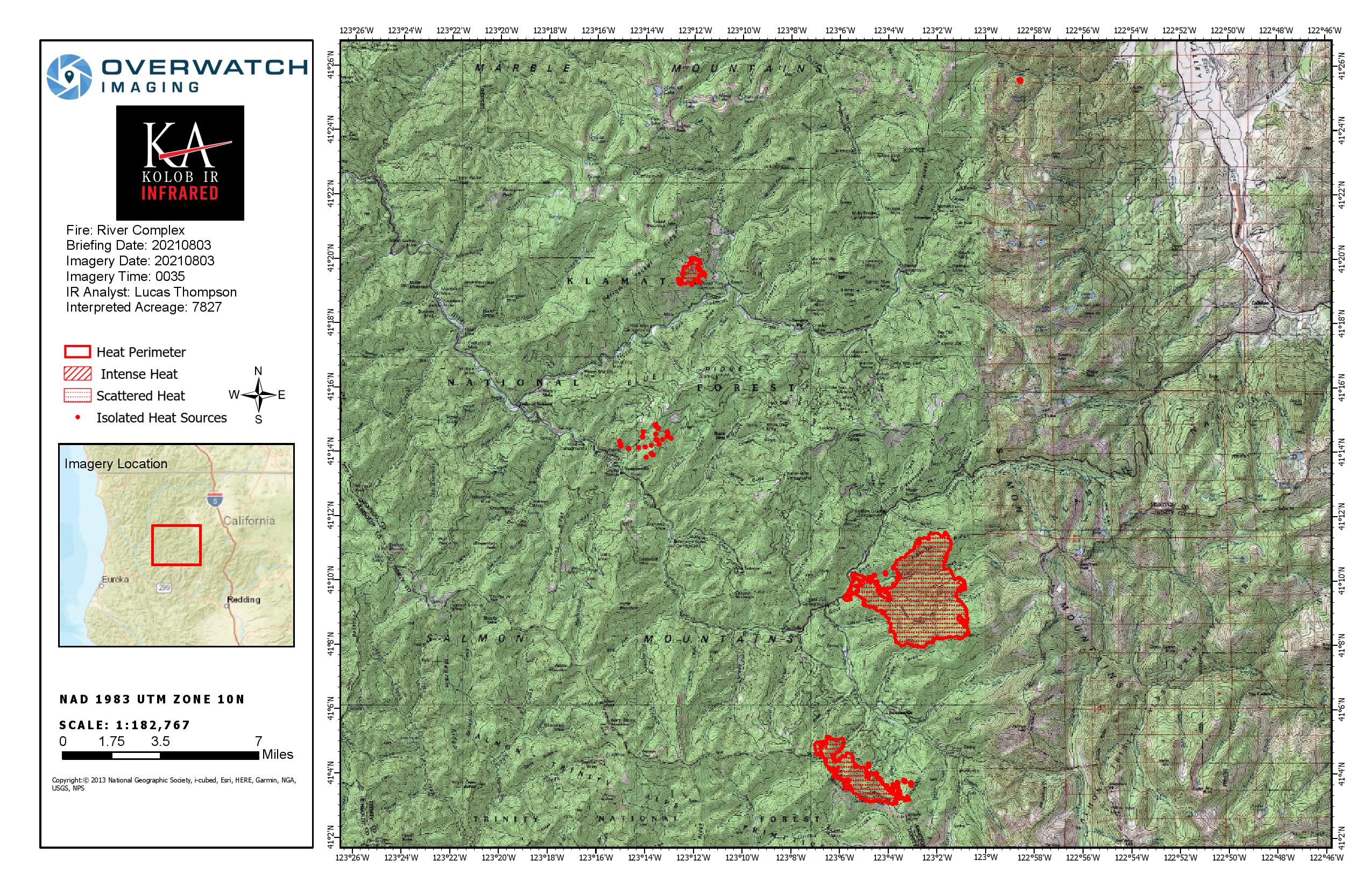
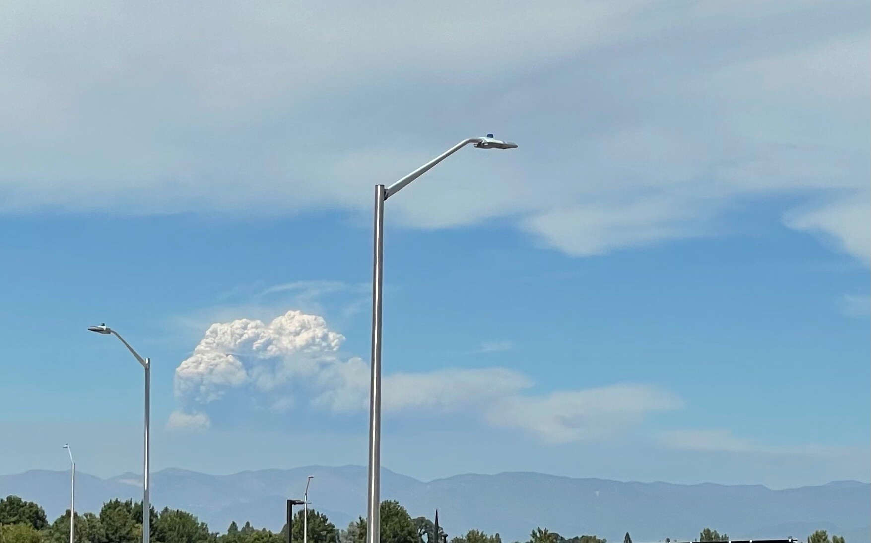
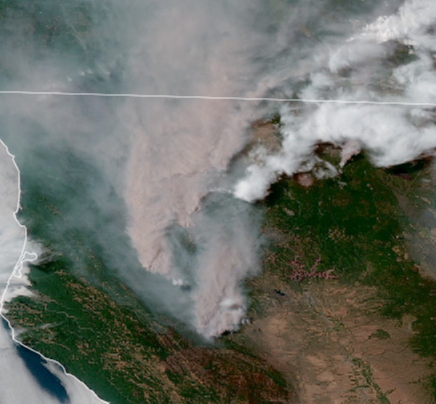
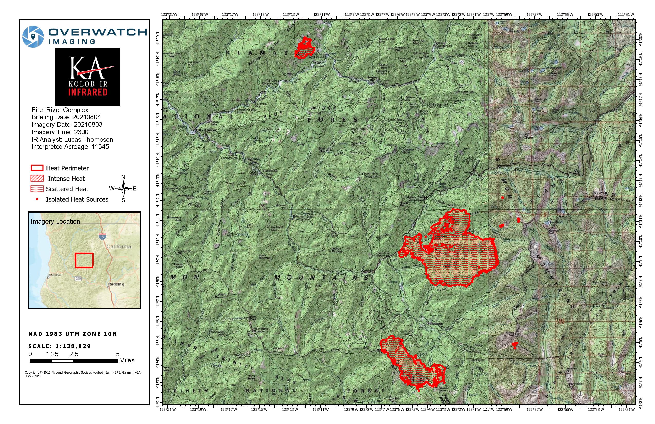
CA-KNF River Complex: 1,180 acres grass and brush, 0% contained.
Structures are threatened, with Evacuation Orders and Warnings issued. Additional threats include communication infrastructure, Class 1 Airshed and wildlife.

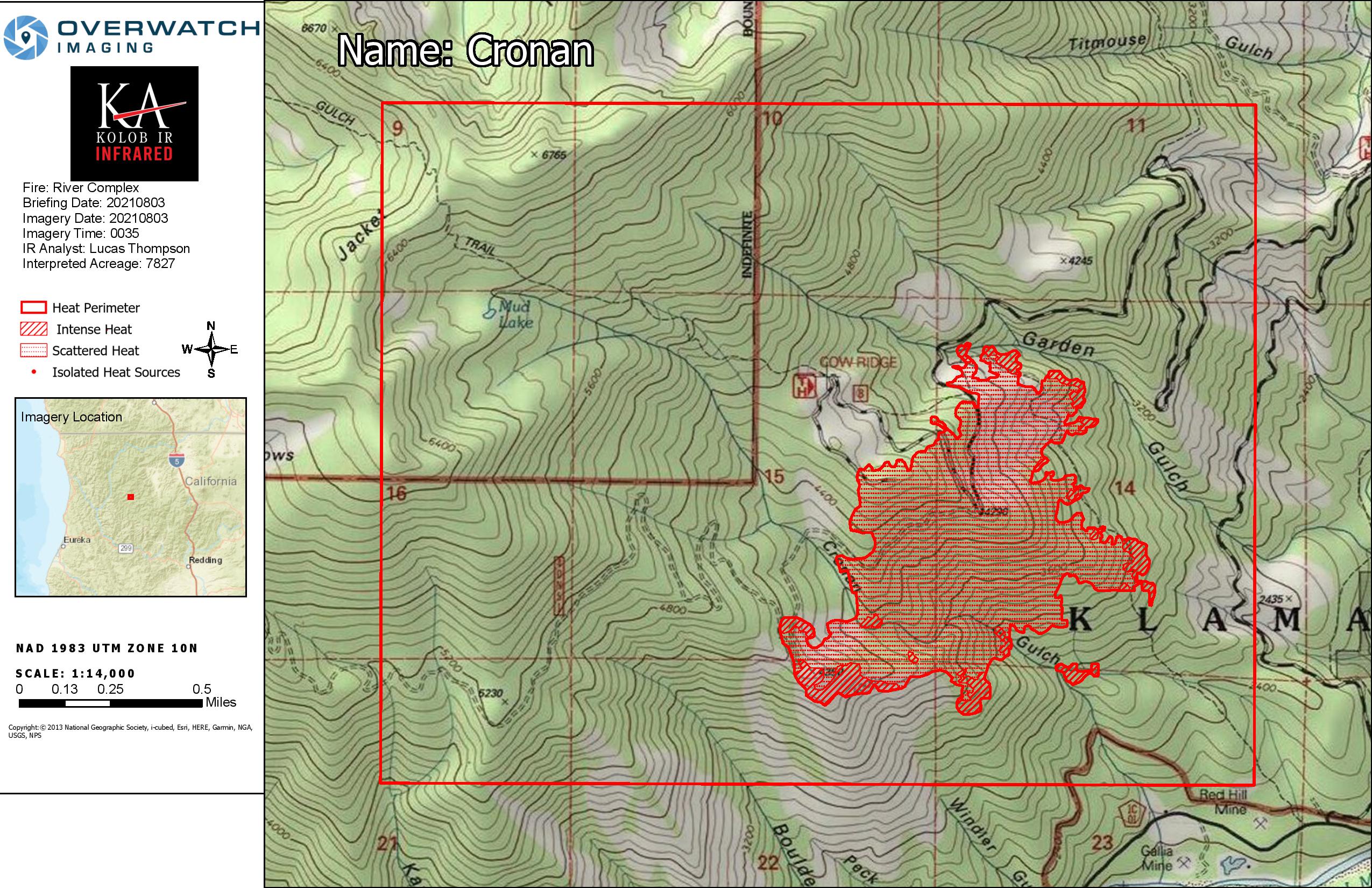
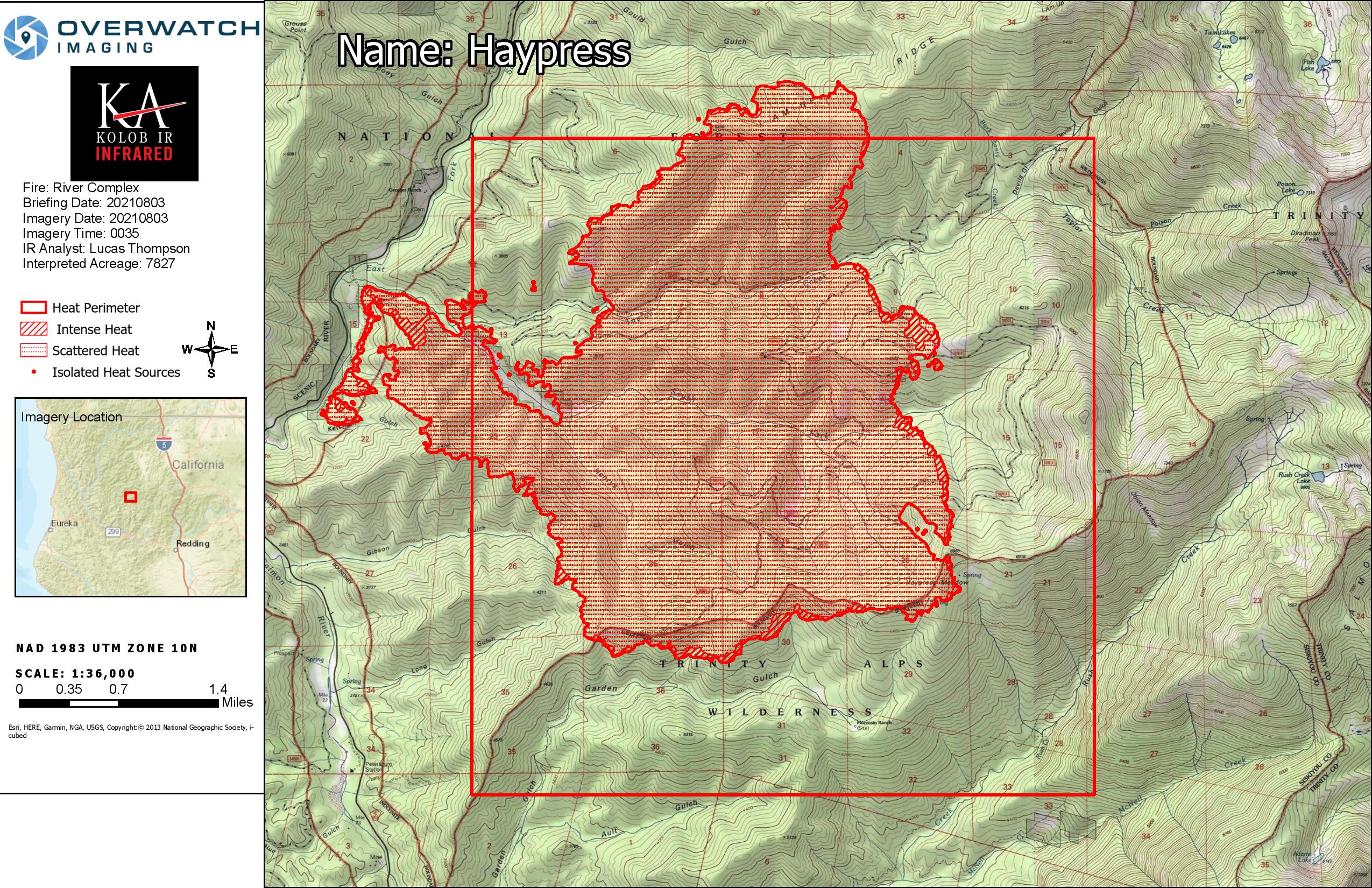
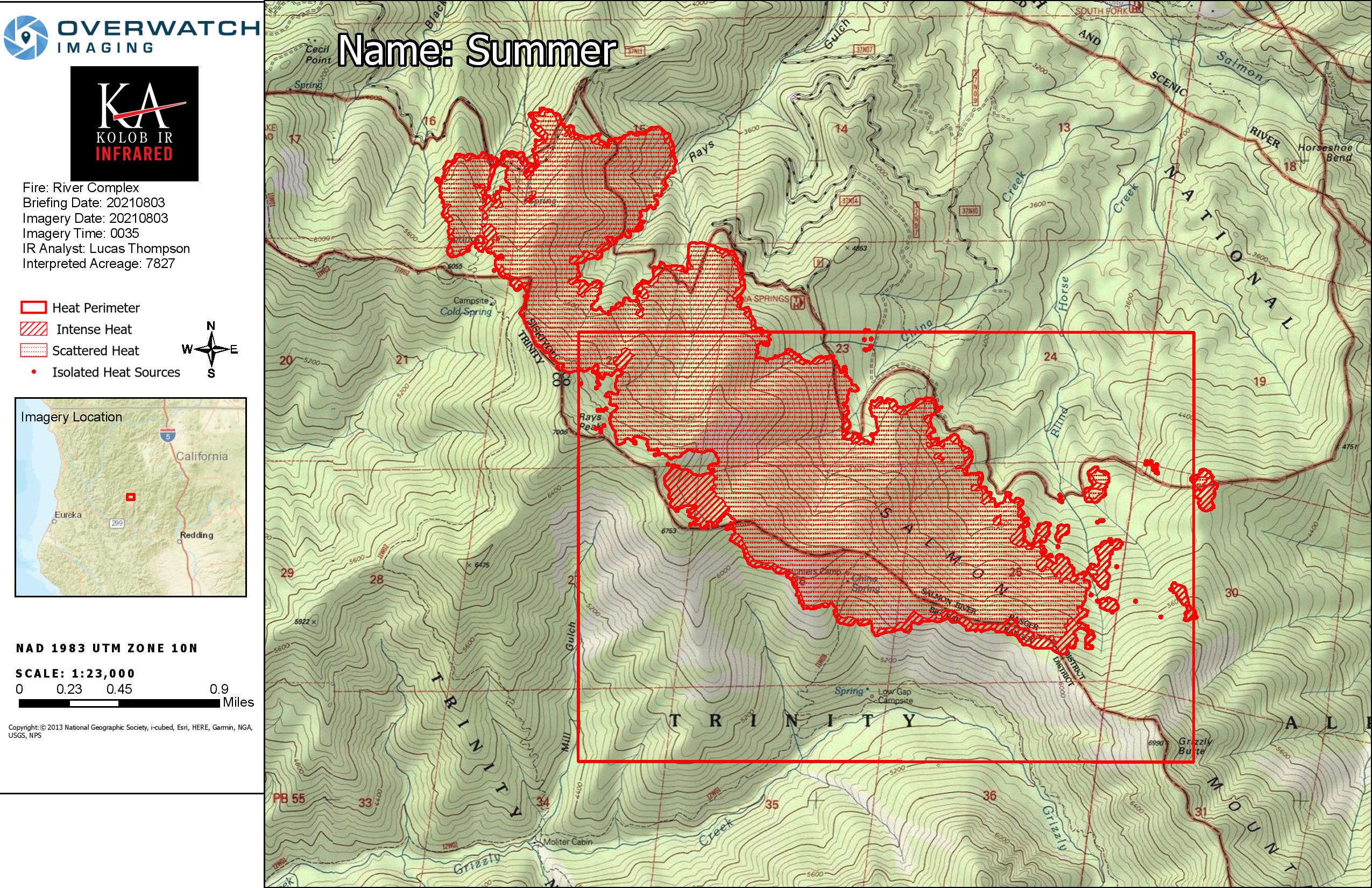
Significant fires within the Complex include: Cronan Fire: 160 acres, 0% contained, Haypress Fire: 800 acres, 0% contained, Summer Fire: 200 acres, 0% contained, Graham Fire: 5 acres, 0% contained.

There are a total of 18 fires within the complex, fires not previously listed are less than 5 acres in size. Fires are burning in steep rugged terrain.There is a Fire Weather Watch issued in the fire area for gusty winds and low relative humidity Wednesday.

Type 2, CA Team 14 (Watkins) on order, scheduled to inbrief today.

2 Likes

IR imagery showing the complex now 7,827 acres.

2 Likes

I thought the numbers in the morning report seemed a little low!

2 Likes

Acreage for each fire was in the IRIN Log.

Trailhead: 2 acres
Summer: 1,631 acres
Cronan: 304 acres
Haypress: 5,890 acres

Detail maps:

6 Likes

My friend just sent me this photo looking north from Redding. I’m ASSUMING its one of the fires in the complex

2 Likes

Actually it could be the Antelope fire which is just NE of Mt Shasta. It’s getting quite a bit of air attack right now. The River Complex is NW of Redding, but the Antelope is just a little E of N from here - I live in Redding, but am in the west foothills (Old Shasta) and don’t have a visual of the main (Sacramento) valley from here. Round Mountain cam shows it with a notable plume. ALERTWildfire | Shasta Modoc

2 Likes

Latest GOES 17 Image

3 Likes

That image is looking west-nw of Redding. Antelope fire is NNE

2 Likes

URGENT - FIRE WEATHER MESSAGE
National Weather Service Medford OR
759 PM PDT Tue Aug 3 2021

CAZ280-282-042100-
/O.CON.KMFR.FW.W.0036.210804T2100Z-210805T0500Z/
Western Klamath National Forest-Shasta-
Trinity National Forest in Siskiyou County-
759 PM PDT Tue Aug 3 2021

…RED FLAG WARNING REMAINS IN EFFECT FROM 2 PM TO 10 PM PDT
WEDNESDAY FOR STRONG GUSTY WIND WITH LOW RH FOR FIRE WEATHER ZONES
280 AND 282…

  • Impacts: Strong, gusty wind with low relative humidity and
    critically dry vegetation will greatly increase the spread
    potential of any new and existing fires.

  • Affected area: In Northern CA…The eastern portion of Fire
    Weather Zone 280, to include the River Complex, and all of Fire
    Weather Zone 282.

  • Wind: South to southwest 10 to 15 mph with gusts to 20 mph.

  • Humidity: 5 to 10 percent.

  • View the hazard area in detail at:
    https://www.wrh.noaa.gov/mfr/HAZARD

4 Likes

Per the IR flight, complex is 11645 acres.

Summer is 2712 acres.
Haypress is 8488 acres.
Cronan is 443 acres.

Overview map below, maps of individual fires are here.

4 Likes

data package posted for the River Complex - maps.takserver.us

2 Likes

Per the IRIN log, complex is 16,773 acres, +5128 acres yesterday.

Summer fire is 4730 acres (+2018).
Haypress is 11552 acres (+3064).
Cronan is 510 acres (67).

IR overview map here. Individual fire IR maps here. IAP here.

2 Likes

data package is up for the river complex maps.takserver.us

1 Like

data package posted for the river complex (NIROPS MAPS not completed yet will upload later) maps.takserver.us

1 Like

river complex data package is posted - maps.takserver.us

4 Likes

25,188 acres

Acreage Per Fire:
Cronan – 1,212 acres
Haypress – 15,601 acres
Summer – 8,362 acres

Detail maps here.

7 Likes

Data package for the river complex is up - maps.takserver.us

2 Likes

Just told EVAC. CECILVIILLE???

1 Like

Is the river fire up and running again?

data package posted for the river complex - maps.takserver.us

1 Like