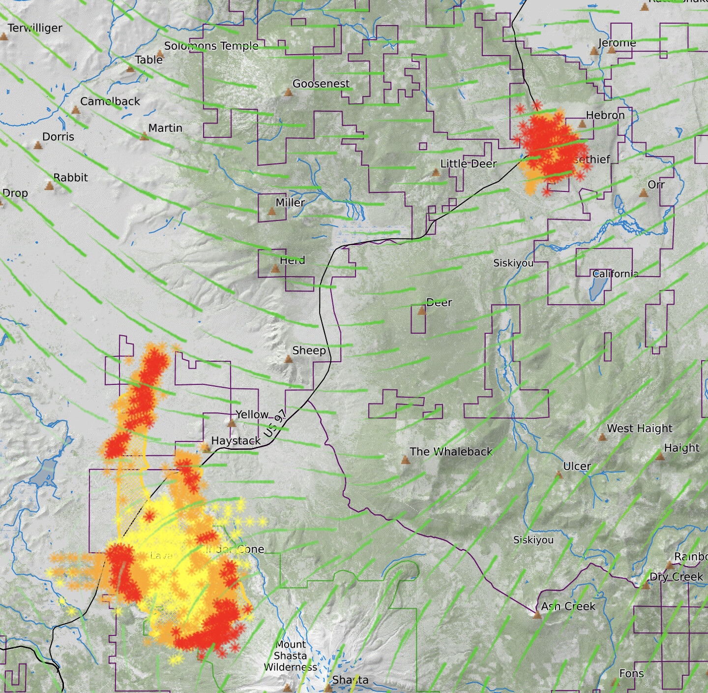
AA requested 2 addl large air tankers. Expanding evacuation orders to the north for both sides of Hwy 97 up to Ball Mountain Rd, Juanita Lake, east to Old State Hwy.
2 Likes
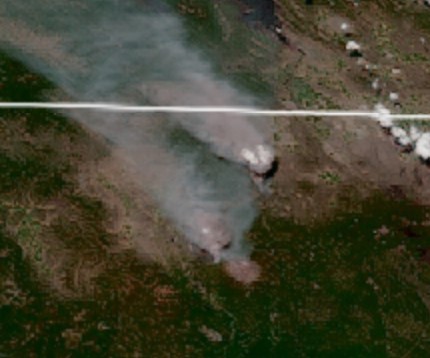
Heat signature is actually bigger than the Lava right now, which appears to be cranking up like it does every afternoon around 3.
3 Likes
Here’s the visual from Goes 17 - poppin’
6 Likes
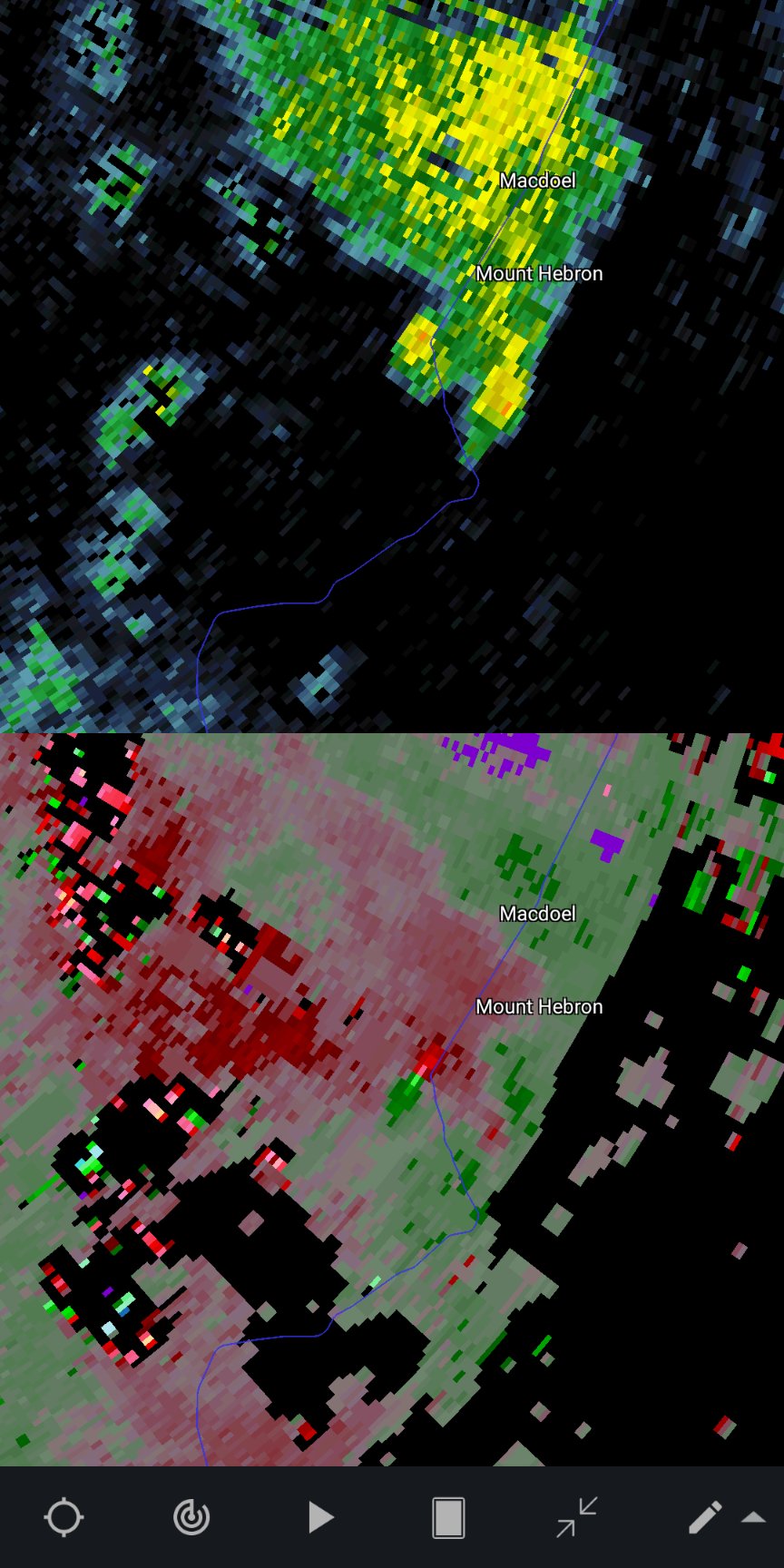
Radar image earlier showed some rotation in the pyrocumulus for an extended time, any info from the ground
4 Likes
Reporting 6000 acres and 5% contained.
3 Likes
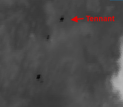
Persistent strong rotation signature on radar right along Hwy 97 a mile or two SW of Macdoel. Strong possibility of a substantial pyrovortex on the ground in that area:
5 Likes
Yikes, edge of a valley… as in the the wind could align with the dreaded “L” shapes?
1 Like
A post was merged into an existing topic: CA-KNF-Tenant??
As of 6/30 8159 acres and 5% contained.
3 Likes
Went unified command around 0800 today. Currently 9,500 acres 6% contained.
6 Likes
from the amount of updates since the change to Unified Command I guess they put the fire out!
7 Likes
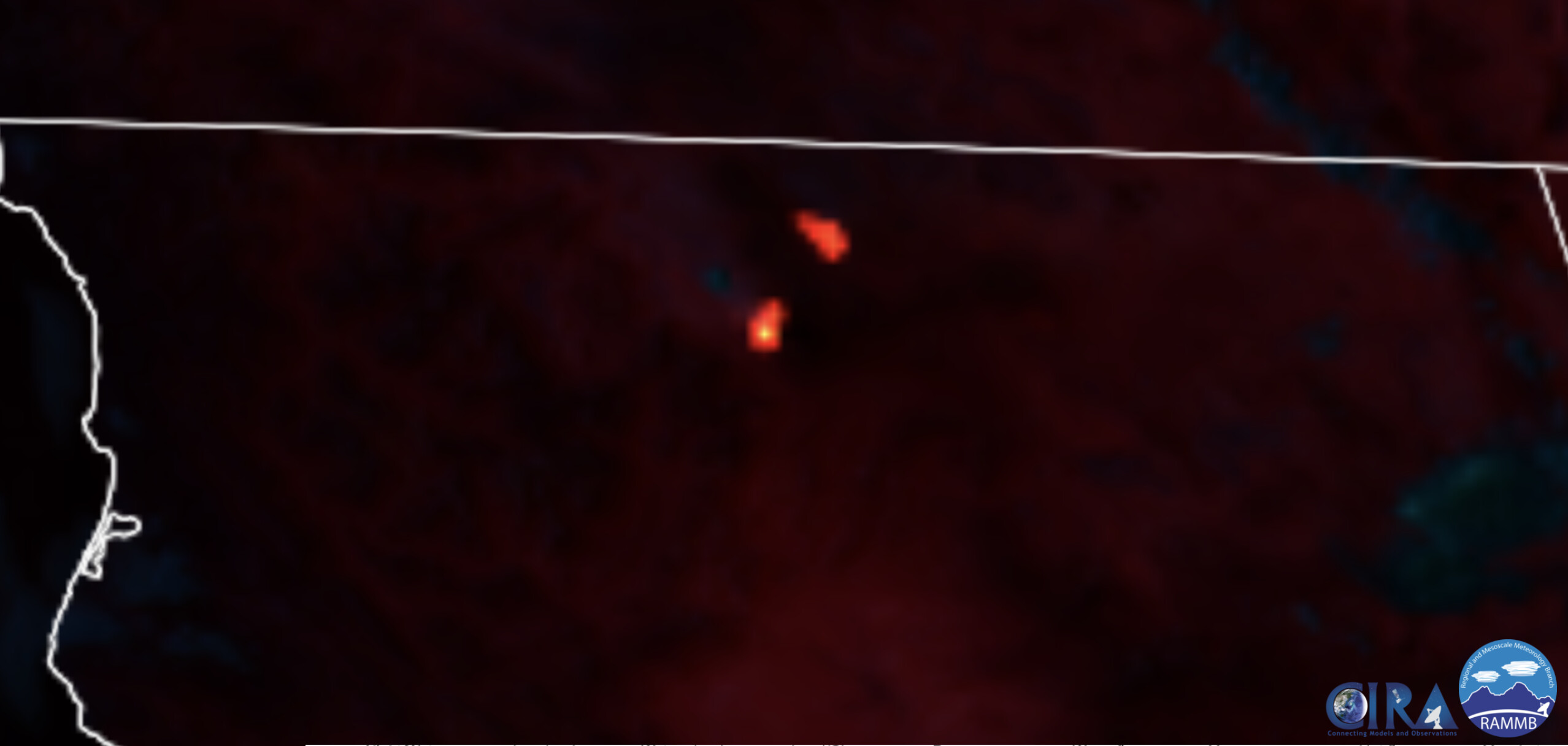
Must not be doing much because there is no heat signature showing.
https://rammb-slider.cira.colostate.edu/?sat=goes-17&sec=conus&x=7309.00048828125&y=3154.000244140625&z=4&angle=0&im=18&ts=1&st=0&et=0&speed=130&motion=loop&maps[borders]=white&lat=0&p[0]=cira_natural_fire_color&opacity[0]=1&pause=0&slider=-1&hide_controls=1&mouse_draw=0&follow_feature=0&follow_hide=0&s=rammb-slider&draw_color=FFD700&draw_width=6
1 Like
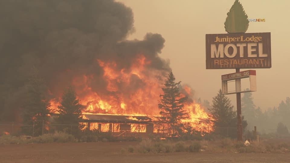
Crazy that a old abandoned hotel makes the news.
1 Like
This went out today from the Klamath. Since I live 8 miles away I wish there was more.
Don
CAIMT15 Lead Public Information Officer
Tom Stokesberry
P: (530) 453-9509
Tennant Fire Community Meeting - Klamath National Forest
YREKA, Calif, July, 2, 2021— California Incident Management Team 15 invites all residents impacted by the Tennant Fire to attend a community meeting to discuss questions and concerns about the fire.
The meeting will start at 18:00 (6 P.M.) on Saturday, July 3rd, 2021. The meeting will be held in person at Butte Valley Community Center, 52900 US-97, Dorris, CA 96023, and will also be live-streamed on Klamath National Forest’s Facebook page.
Officials from CAIMT15, Klamath National Forest, CAL FIRE, and local representatives will all be available to answer questions from the public.
Any questions related to the community meeting can be directed to the Lead PIO for CAIMT15, Tom Stokesberry. He can be reached at (503) 453- 9509, and through email at 2021.tennant@firenet.gov.
QR Code for Klamath National Forest Facebook Page
2 Likes
The fire is showing a heat signature this evening.
4 Likes
That was only a firing op. She ain’t going anywhere…
4 Likes