CA-LAC-Palisades ???

2 acres mros aircraft enroute

3 Likes

Dozers currently working sullivan fire road and down into Camp Josepho. They escorted the gas company in. There is a high pressure gas line running north/south through rustic canyon. multiple tanker drops are working to hold that ridgeline.

5 Likes

Where did you hear this?

12 ST enroute from Oregon

4 Likes

Radio feed on Broadcastify Los Angeles - West County Interagency Fire

The information on the gas line, I knew because my husband used to work in the canyon there.

5 Likes

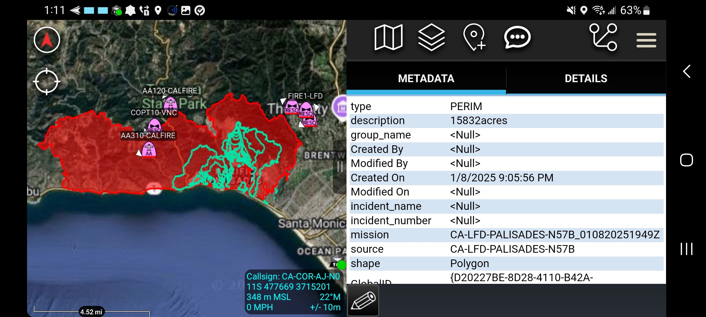
15832 acres per firis.

7 Likes

Per OPS…a church and an apartment complex at 1421 Palisades is going up and no resources in staging to send that way

2 Likes

15,832 Acres.

3 Likes

Anyone have a map link?

1 Like

This kind? CalTopo - Backcountry Mapping Evolved

2 Likes

IAP information and/or radio frequencies?

1 Like

More like an FTP map just showing most recent mapping that’s available

2 Likes

That kinda works thank you

2 Likes

Theres a FIRIS feature layer with it

1 Like

Thank you for the heads up!
Normally they station one VLAT at McClellan, where is the other one usually? San Bernardino?
UDPATE - Tanker 914 inbound…they must have found an avail. VLAT

3 Likes

Air attack stating there is individuals on bikes on a trail system coming down near the fires edge.

3 Likes

Knuckleheads.

5 Likes

Little did we all realize that in the end the Franklin Fire would be the hero that saved Malibu Point from burning again.

8 Likes

You are very polite, and perhaps too kind. :wink:

2 Likes

Video from Cal Fire T-122.

7 Likes