Palisades extended air frequencies assigned for today:
Air Tactics FM: 166.6125
Air Ground: CDF A/G6 159.285 t192.8
Victor TFR: 123.175
Victor: 118.575
TOLC: 123.025
Additionally, vtacs 13, 14, vfires 24, 25, 27, cdf tacs 27, 28 assigned
Palisades extended air frequencies assigned for today:
Air Tactics FM: 166.6125
Air Ground: CDF A/G6 159.285 t192.8
Victor TFR: 123.175
Victor: 118.575
TOLC: 123.025
Additionally, vtacs 13, 14, vfires 24, 25, 27, cdf tacs 27, 28 assigned
From first hand accounts the loss of structures will be staggering. The $ value will probably be the most ever lost in a fire.
Helco and operations sounds like they have some opportunities on the eastern flank to go to work with the helicopters , 20 acre slop over in the same area (old ranch road ) said 20 acres will back down the canyon
AA just checked in over the incident ordering a lead plane.
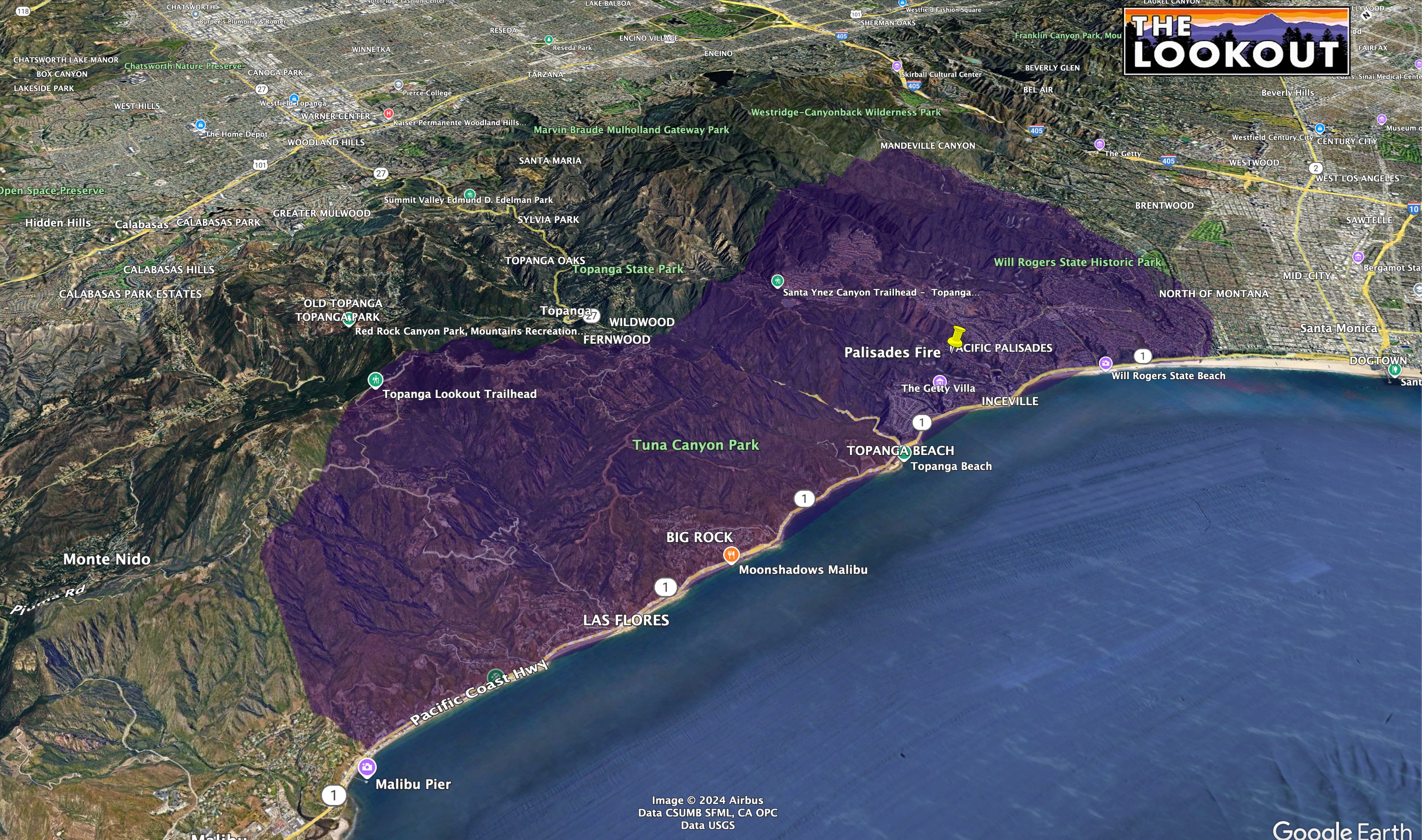
5,000 plus acres. 1k Homes lost per. LA County. Live press brief.
You always have strikes…
Its part of how the state identifies resources in the states mutual aid system. The state is divided into 6 geographic regions and then each region is subdivided in multiple areas (a group of cities/departments). That being said here is a quick break down;
The 1st 3 letters identify the Department/county (if it starts with an X it’s a Strike Team consisting of mixed Departments)
The 1st number represents the states mutual aid region they are from.
The 2 nd number represents what area they are from in that region.
The last 2 numbers represent a block of numbers that area is assigned for spefic Departments in that area.
That’s it in a nut shell!
Can confirm. I’m in an area where we saved 3 probably valued around 50 mil and lost 2 probably valued at 20 mil.
AA just ordered all available LAT’s and VLAT’s. He said he will take everything he can.
Per SoOps Daily Report-No VLAT’s available
C130 over the fire now.
This is where the value estimates get wonky. Go to zillow and look at the estimated value, what part is the structure and what part is the address.
Now that’s a jump in acreage.
11,800
KTLA is over the fire for the first time since the winds called down.
https://fb.watch/w_CplVP2wE/?mibextid=wwXIfr
They are live on the KTLA app if the non FB folks want to download and watch as well.
abc10 is over the fires
Sounds like a new start PCH and Muholland Dr, 1/4 acre moderate rates
2 acres mros aircraft enroute
Dozers currently working sullivan fire road and down into Camp Josepho. They escorted the gas company in. There is a high pressure gas line running north/south through rustic canyon. multiple tanker drops are working to hold that ridgeline.
Where did you hear this?