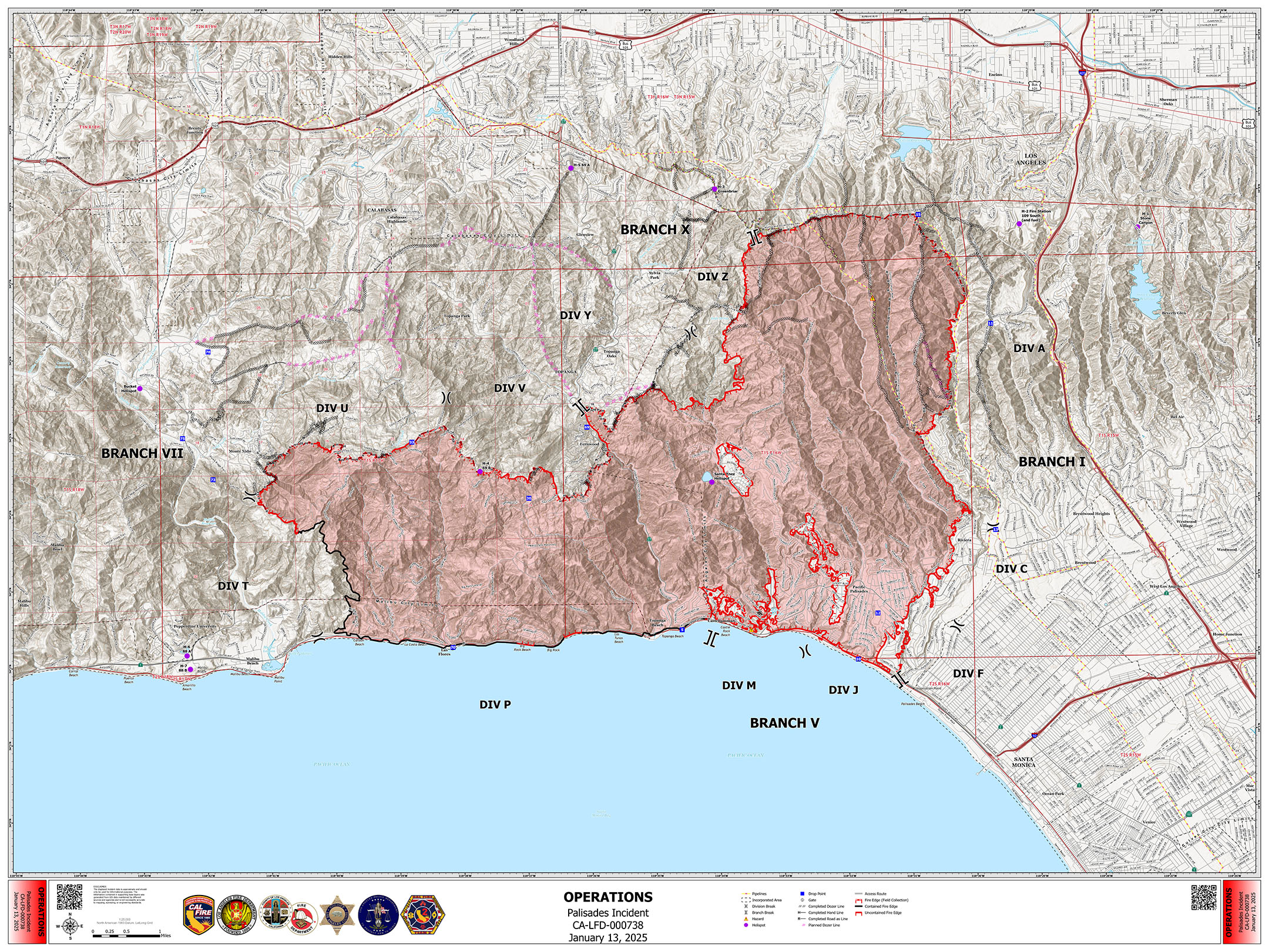
1-13 OPS Map:
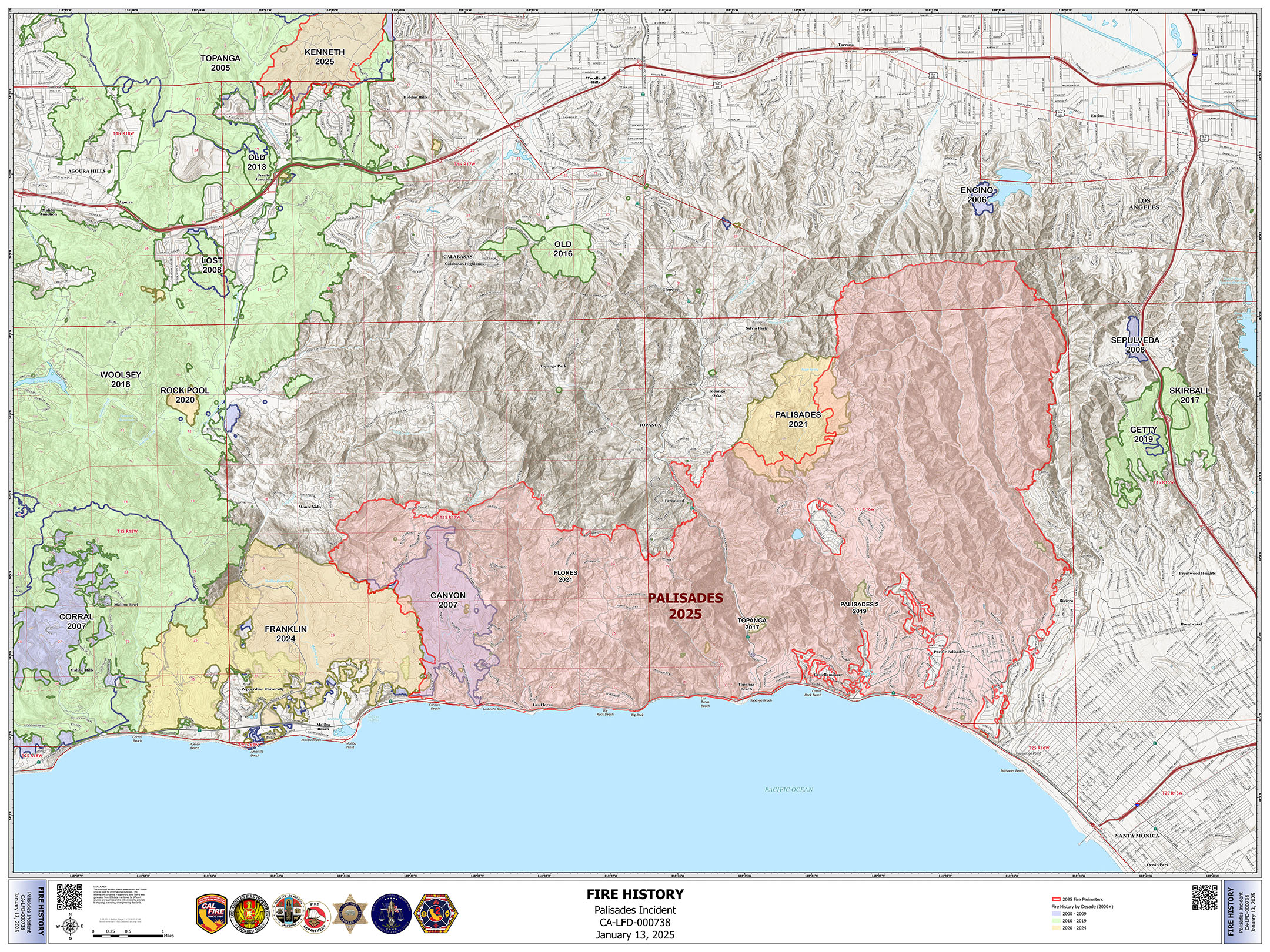
1-13 Fire HX Map:
TAK Data package is up for the Palisades for the 20th. http://maps.takserver.us
Hearing reports of minor debris flows on Palisades Dr and that the PCH is closed to traffic
Topanga Canyon is also closed due to mud flows
Flash flood warning.
https://alerts-v2.weather.gov/id/urn:oid:2.49.0.1.840.0.3e4be3e3434cba1d2d07b5022a7165aa89df3469.001.1
Quite a few severe thunderstorm warnings for the burn scar
As this band of precip. passes through, it has been interesting to watch this sediment dam try and hold things. The tsunami-like surge at 1643 is strange!
Watch the loopCloudcroft debris basin
I hope this question is allowed.
To anyone who responded to the Franklin Fire in Malibu, Dec. 2024 or the Palisades Fire, Jan. 2025. There are Beacon Boxes (beaconbox.us) that are positioned at the entrance to many neighborhoods along pacific coast highway. These boxes contain highly detailed roads maps of the area where the box is located. Over 10 of these boxes were accessed during these two fires. I am looking for intel from anyone that accessed these maps and data to see how they were really used during fire operations. I am also interested in any suggestions you might have in improving the functionality of these boxes.
Thank you for your time.
Jim@flamemapper.com
Amen. I lived in Santa Rosa for 32 years. I was in Coffey Park maybe two or three times. Even when I lived in Larkfield and worked on Piner Ave I went around Coffey Park, not through it. I felt it was just wrong to suddenly decided I need to go tour around and lookie loo at other’s people’s misery.