Tankers enroute: T-72, T-100 from Hemet and T-70, T-71 from Ramona.
3 Likes
Communications Plan:
LAC:
Admin Blue 3
Command LAC V-4
Tactical Vfire 25 and VFire 24
Air to Ground: LFD A/G
Victor 119.975
Air Tactics 21
LFD
Admin LFD T-5
Tactical LFD T-12
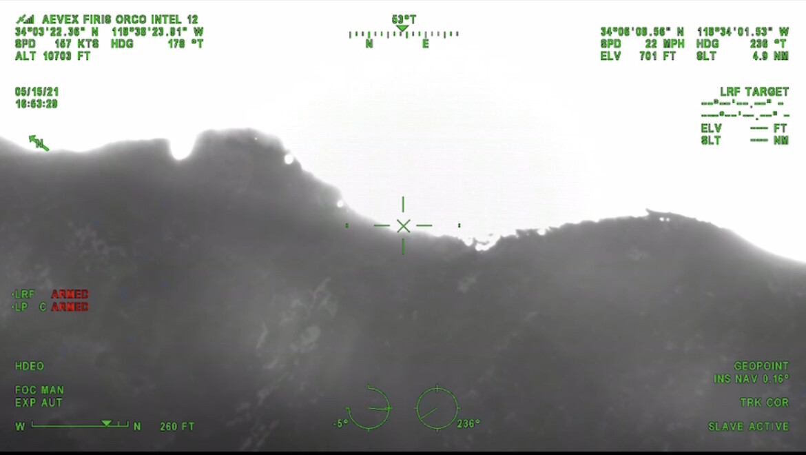
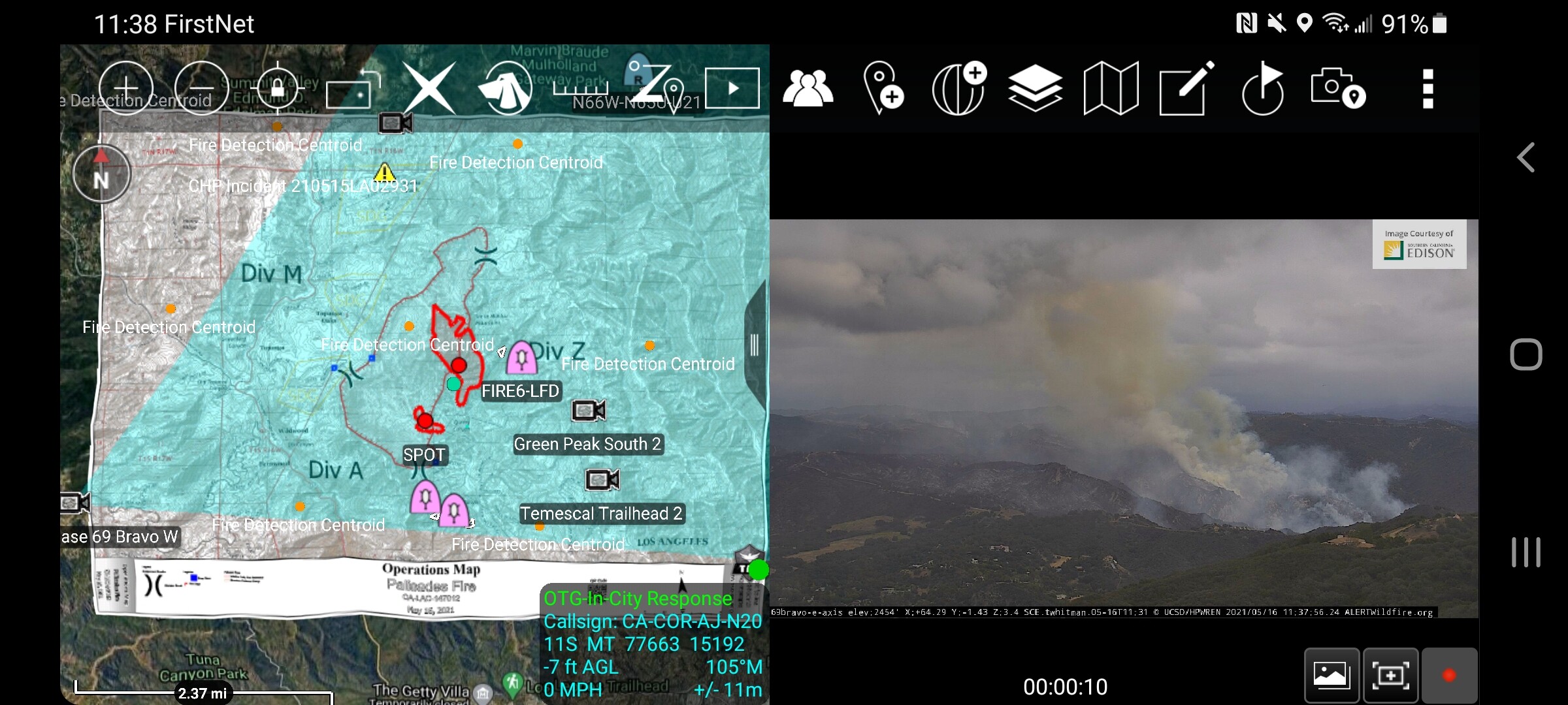
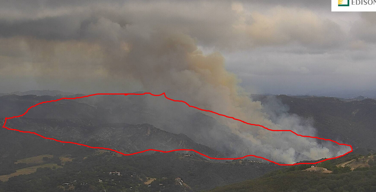
The fire is still making a decent push and is about 50 yards from jumping Topanga Fire Road. This will pose a structure threat at some point, there is chatter about initiating some evacuations. This fire is creating a pretty good heat signature and a Pyro Q at about 10,000 ft. Impressive fire behavior for May in the Marine layer.
3 Likes
Looks it spotted to me.
3 Likes
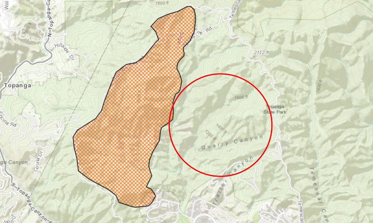
AA-12 reporting 750 plus acres. The fire is now crossing Topanga Fire Rd.
4 Likes
AA suggested evacuations in Sylvia Park area of Topanga Cyn.
4 Likes
Mandatory evacuations for Topenga Canyon.
LA TV stations live remotes showing the fire is still burning quite activity under the marine layer at 11 PM.
2 Likes
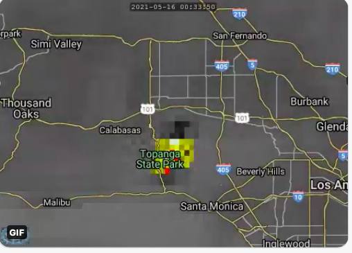
There is enough fire activity to turn the TemascalTrailhead2 camera into Day Mode
TemescalTrailhead2
2 Likes
You can see some night flying helicopters passing into view occasionally on the camera as well.
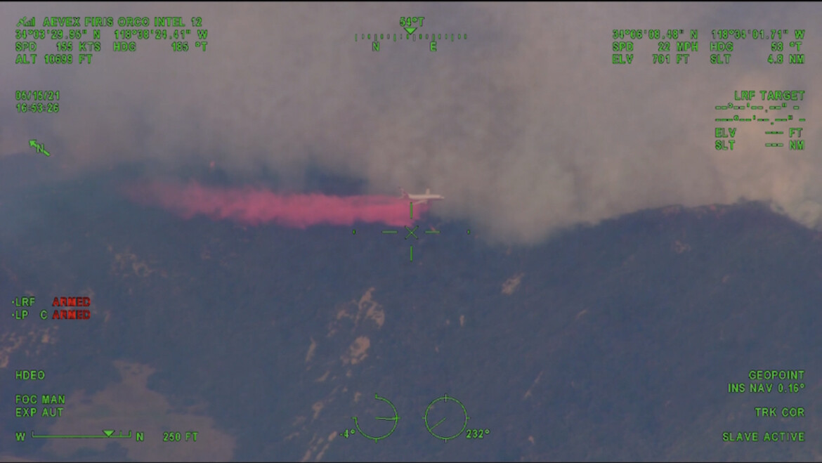
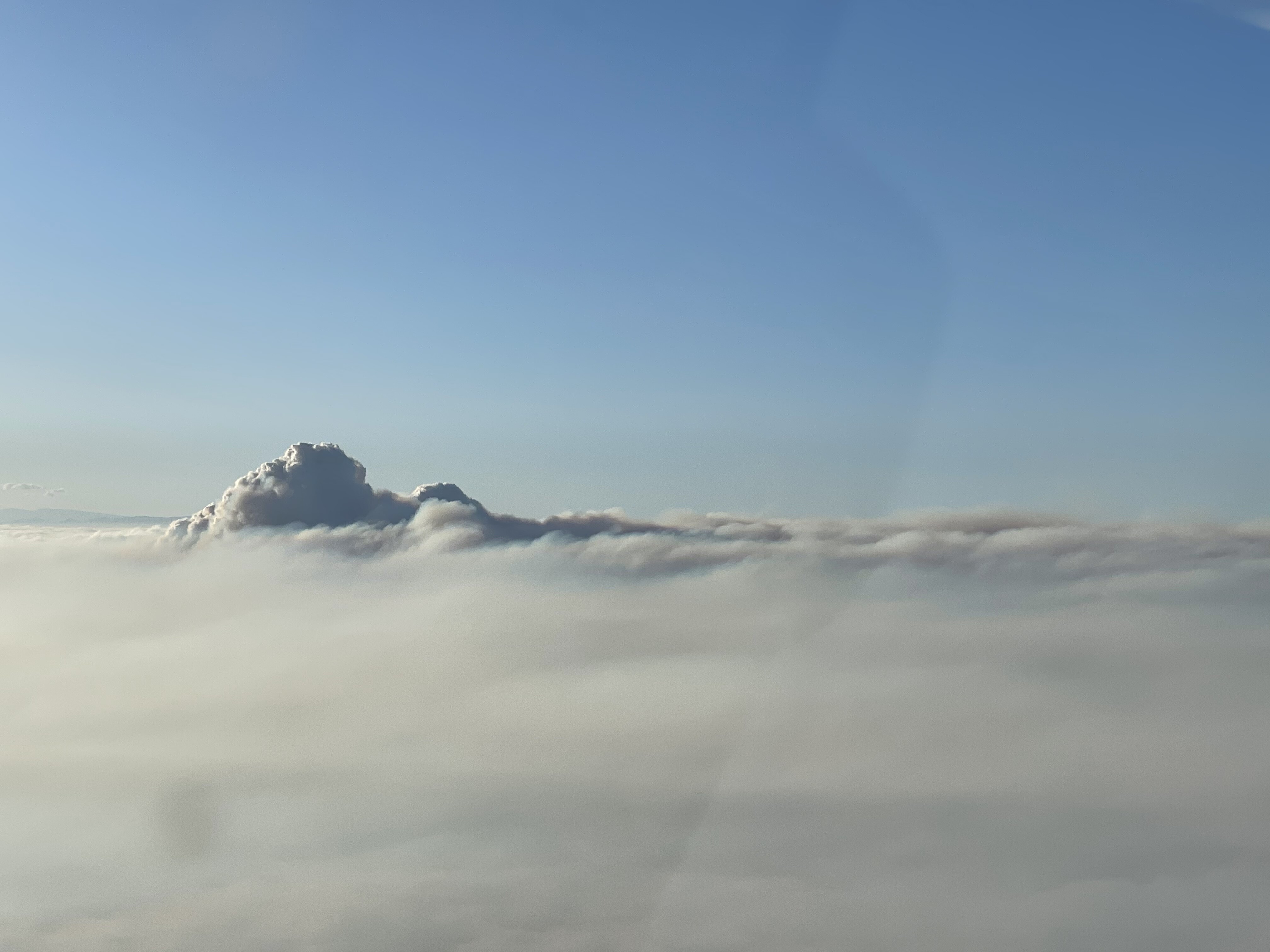
I was flying yesterday afternoon when my route took me adjacent to the column. It was a trip to see a very solid marine layer with what looked like a super active fire below. This clearly makes it difficult (if not impossible) for fixed wing. Tops were around 3600’ and bases 1800’. Spotted the column at 6,000’ from San Diego.
15 Likes
Ops map from LACoFD Twitter this morning: 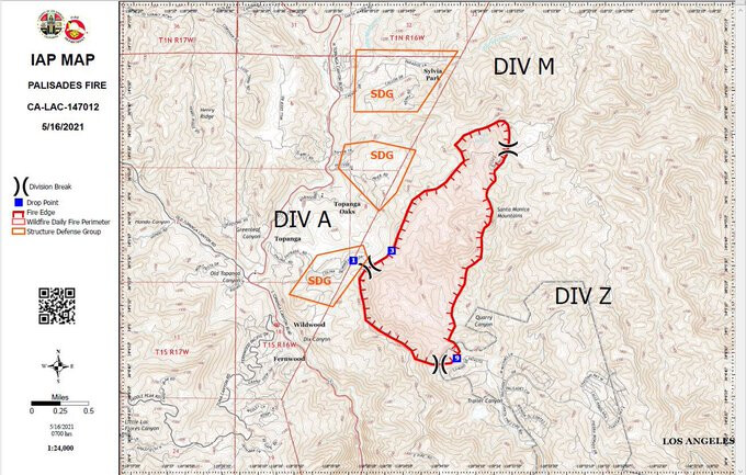
4 Likes
The marine layer is starting to thin out. With the upper level low overhead will have to monitor convective development as it was very active to the north yesterday.
4 Likes
Heat signature from GOES West, credit to 805 Weather on Twitter and Bensweather.com:
https://twitter.com/i/status/1393800411476201474
1 Like
Was there in 93 on the Green Meadow fire, it ran hard on a Santa Ana, almost to Peperdine, and then turned around on a “Catalina Eddy” and ran hard back in the direction it is going now. Very steep, I do not think it has burned since 93???
2 Likes