scanner link for this incident?
1 Like
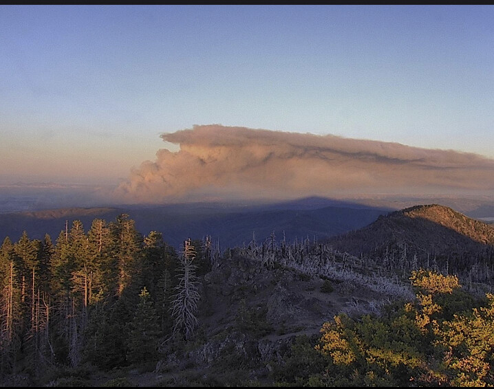
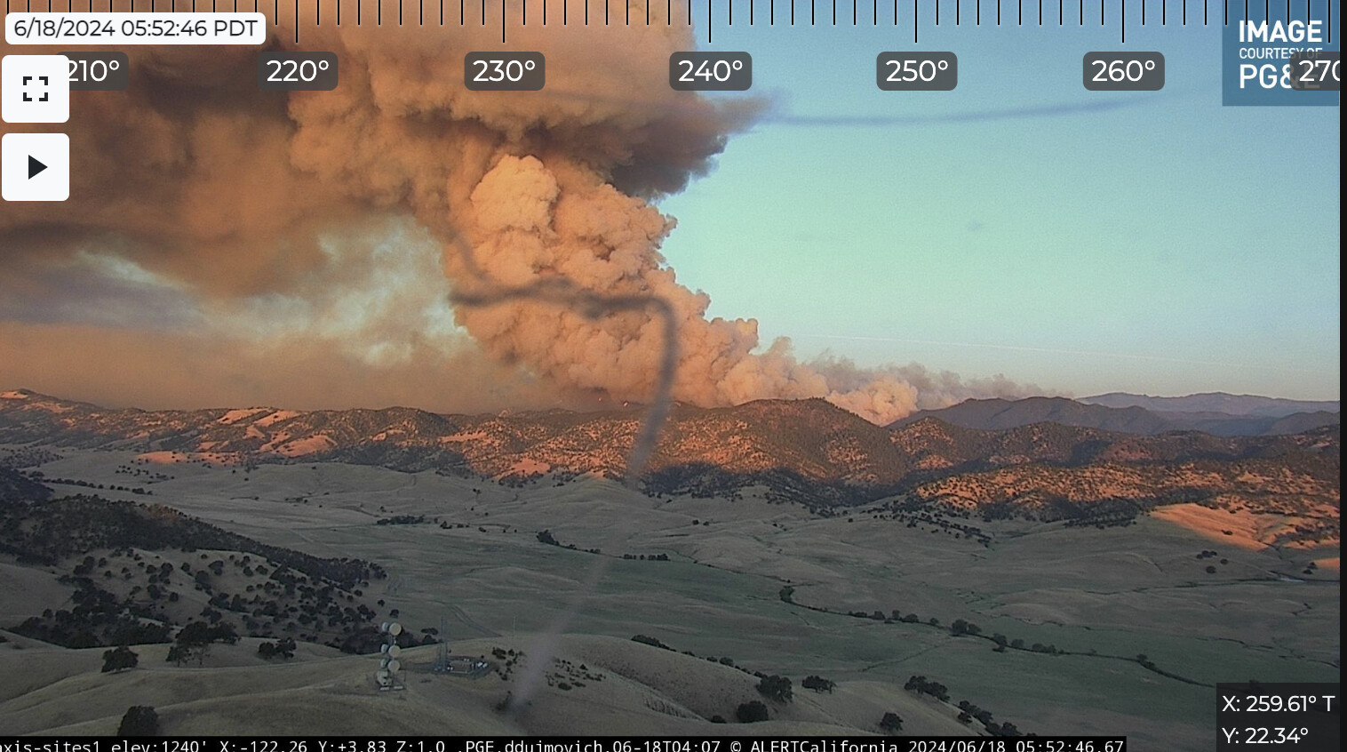
There is now a well established spot fire approx 1 mile out in front of the main fire in the area of Leesville Ladoga Rd near Lambert Hill. The spot is approx 2 acres - per Air Attack
2 Likes
Some command here
3 Likes
Did Team 3 get reassigned from the Post?
My error Team 2 is on the Post.
3 Likes
Team 4 is headed to Sites
3 Likes
No firs planes tonight???
2 Likes
They have to split work amongst at least three fires. They’ll be around.
5 Likes
Seems like once the wind stops blowing it will be a done deal.
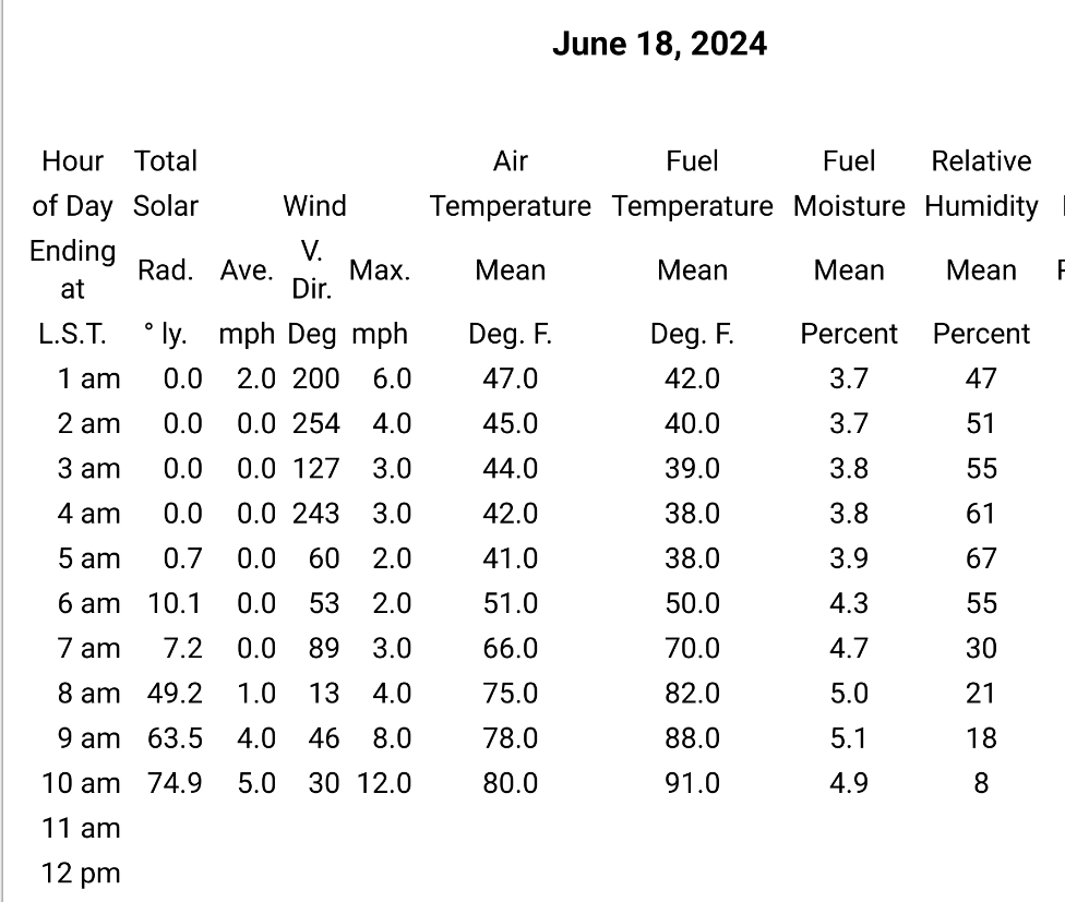
Winds are forecast to transition to more westerly overnight, and start to taper off midday tomorrow.
Firing ops overnight on the west flanks look like they should have favorable winds. Afternoon winds tomorrow look like they will push things back west, but hopefully toward ground successfully fired overnight.
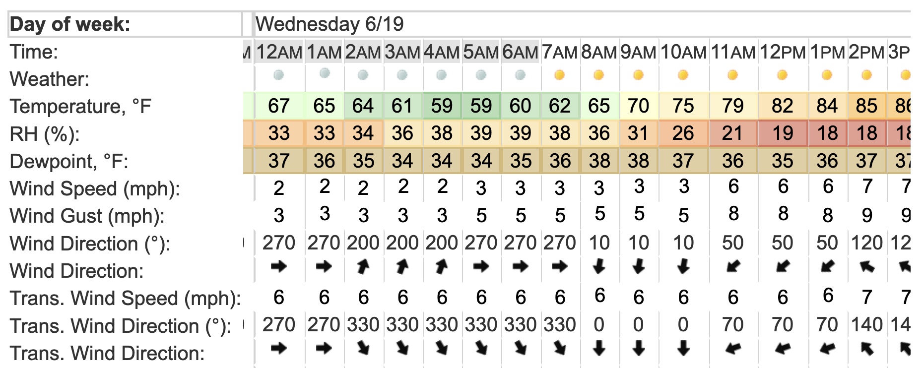
It’s still going to be warm and dry tomorrow, but winds Weds are forecast to be quite calm. Live fuel moistures are still high, and without wind, we’re not going to see a lot of movement on flanks or downhill.
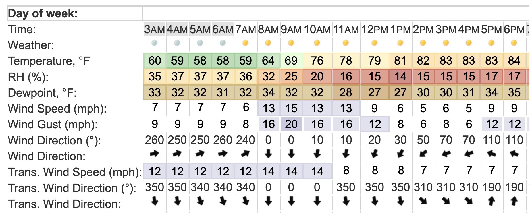
Tmrw’s hourly forecast:
Weds hourly forecast:
14 Likes
I’m not on the ground, wouldn’t second guess anything people there are seeing, I’m just looking at the forecasts and the winds look like they’ll become more favorable in next 24 hrs.
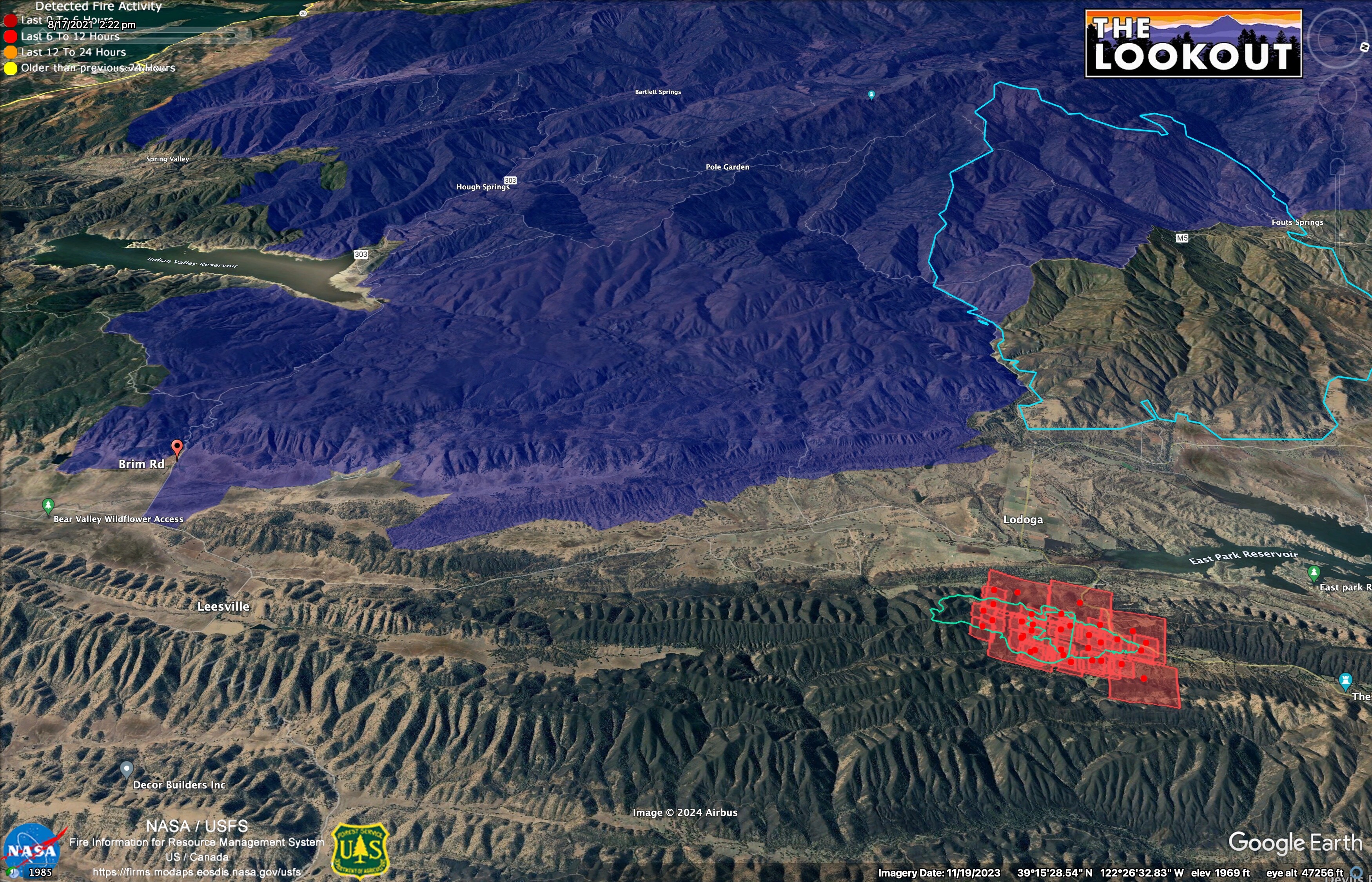
All of the MNF to the west burned in the 2018 Ranch Fire (blue). To the north, the 2012 Mill Fire is in light blue outline.
There’s quite a bit of standing dead in the Ranch Fire footprint, and plenty of grass, but once the winds stop, the live fuel moisture of the resprouting hardwoods will suck a lot of the mojo out of the fire in the 2018 burn.
13 Likes
That wind shift could be deceiving. I was assigned to the Leesville station for 3 yrs. The daily upvalley wind can get quite gusty for 20+ minutes, not to mention the battling winds during that transistion.
7 Likes
Can someone post the Air operations frequencies?
3 Likes
Updated ROs?
1 Like
Or IAPs for the day?
2 Likes
Anyone know where the ICP is?
1 Like
Dry as a bone in Stonyford today, but conditions on the fire look pretty calm/stable from where I’m at on Hwy 45.

6 Likes
They are no longer posted publicly. You’ll need to find a friend or colleague on the incident and get the QR code for that incident. It’s a PITA but necessary for privacy and security concerns. There are bad people out there that would use the info for nefarious activity.
6 Likes
I don’t mean IAP, but the actual location of camp. Is that confidential now?
4 Likes