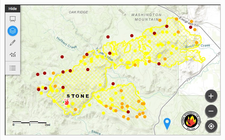
"August 18, 2018, 7:00 p.m. Fire behavior was moderated for most of the day due to smoky conditions and more stability over the fire. Fire crews were able to hold the fire line on the western side of Highway 139. There was a spot fire over the Pit River in the southern portion of the fire. The fire became active in that area, causing firefighters to pull back. Conditions will be reassessed this evening. Dozer lines were constructed and improved on the northeastern portion of the fire along Highway 299.
Tonight crews will prioritize structure defense and assessment around the fire and secure dozer lines. Expected low humidity recovery will allow strategic firing operations throughout the night.
The Fire Weather Watch for tomorrow has been upgraded to a Red Flag Warning for gusty winds and low humidity.
Several mandatory evacuation orders are in effect for the following areas:
West side of Highway 139 from Ambrose to Canby north of 299, including County Roads 214 and 215.
Road closures include County Road 84, west of Highway 299, County Road 85, and east of the fire’s edge, and the north side of Highway 299 between County Roads 84 and 85.
County Road 84 from Bushy Ranch to Canby and County Road 85. "
The Modis Satellite Mapping shows many hot areas outside the current map on the website. I would expect acreage to increase on the next update(s).

