
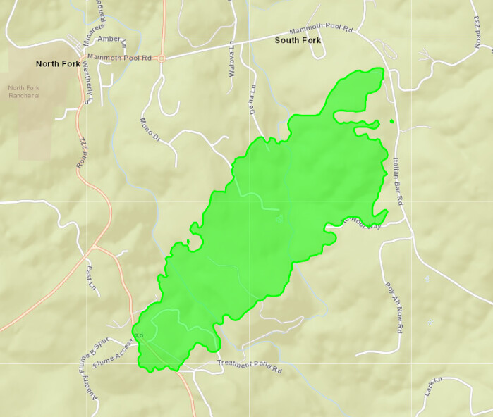
279 acres per intel aircraft
5 Likes
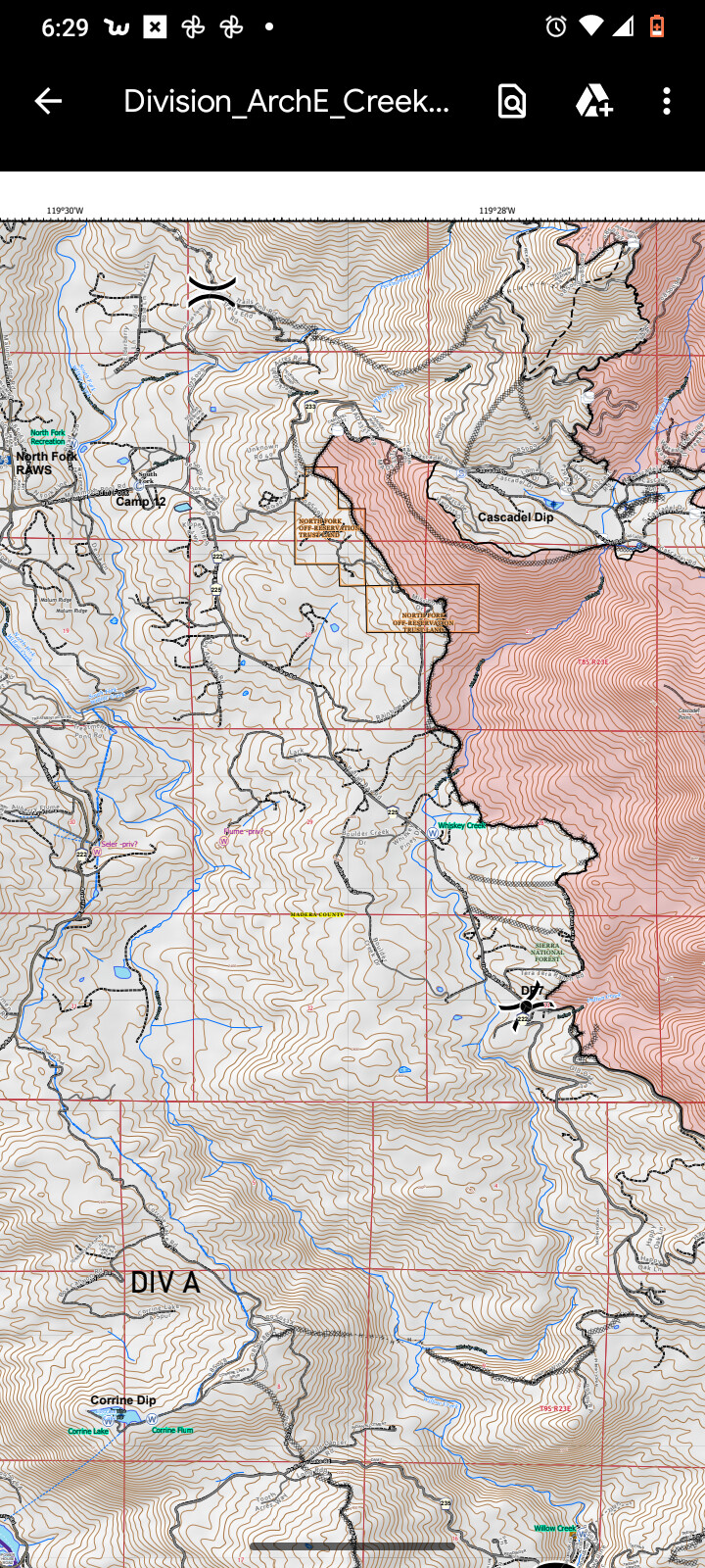
Current evacuation map
https://community.zonehaven.com/?latlon=37.228054165282074,-119.4981143288993&z=12.053897171237685
4 Likes
The wind has shifted to north northwest and an increase in fire activity followed.
(Edit) Fire is getting down canyon winds which always seem to present issues on fires in this area.
2 Likes
400 acres per cal fire MMU
4 Likes

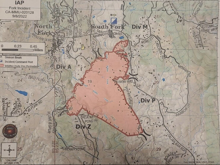
773 acres and 5% contained.
3 Likes
Good morning - extended airshow freqs for Fork
Air Tactics 172.550
Air/Ground 159.405 (192.8) CDF Tac 22
Rotor Vic 125.875
5 Likes
20HT Just left millerton heading that way.
4 Likes
Good morning.
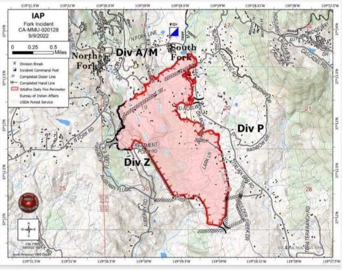
Fork Fire 819 ac/20% containment a/o 0900
Air Attack just took a look at the fire and reported that it “looks good”. No work for the copters, lots of hose on the ground. One snag burning well within the lines, with an engine on it.
Air Attack off the fire, will return at 1500.
8 Likes
The #Forkfire [Final update] is 100% contained. Crews will remain in the area patrolling for hot spots. Please use caution when driving.
5 Likes