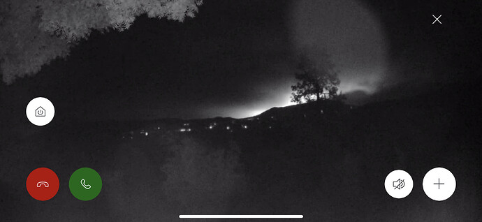
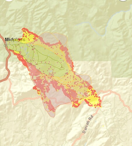
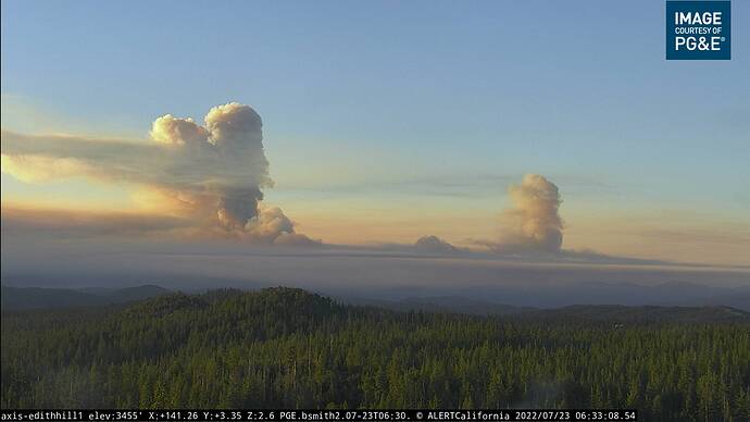
going to be a long night…for the ground crews and well wishers…at least it is not snowing…
My head is about to explode. I’m gonna have to shut down for a while. I’ll be up every couple of hours more than likely though. And people on my FB group are jumping in to report scanner traffic so I’ll try to report back later
CDF Command 1 151.355 tx tone4?, Vfire 22 154.265, CDF tac7 151.340, tac 8 151.37 (cdf tacs are 192hz or 156hz for vfire) AirOps TBD for tonights planning and the frequency coordinator. NorCal Scan guy can come up with those at Dawn.
Tile Cams (hope it is config right) for overview, Bullion, Edith Hill, Miami, Deadwood.
https://beta.alertwildfire.org/tile-display/viewer/?cams=Axis-Bullion&cams=Axis-Edith&cams=Axis-Deadwood&cams=Axis-MiamiPeak1
They were using Tac 7 too
Got civilian’s going up darrah for some reason, now asking chp to shutdown darrah at 49.
They were blowing through the barriers at Darrah and Triangle earlier SMDH
thank you for your dedication and proficiency. have a good night…not my head…just my body.
Keep in mind Mariposa County does operate a County Fire Agency too. I’m sure they are a part of the Command Team too.
There’s lots of stuff headed down this morning for briefing. Are there any links to today’s IP?
@apx8000, you need to do what I recently realized. Update your link from the beta side to the production side. No need for beta anymore.
Mariposa County Fire is now a CAL FIRE Schedule A Contract.
GOES 17 showing a pretty massive heat signature for so early in the burn period, this does not bode well for today. Also, the column is already punching up and is visible in Murphys.
Looks like that fire is tipping its hand for what to expect today! Heads up y’all! Im going to go work on my marine layer dance for you…
The 3 to 5am heat map update on Caltopo:
(Usual 2-3 hour delay for signatures. Also smoke will give some false heat signatures with this size of fire -FYI )
https://caltopo.com/map.html#ll=37.51756,-119.8859&z=13&b=t&o=f16a%2Cr&n=1,0.25&a=mba%2Cfire%2Cmodis_mp
History and Honoring the Past
A little grace from the Mods over the length of this post. I hope it is worthwhile in causing people to think. Late last night and this morning I looked through a fire progression model (WFA) made for this fire shortly after it started. Thankfully it over-predicted the Oak’s progress in size and shape. Primarily it instituted excessive lateral spread instead of the more linear shape it currently occupies. In addition, I believe it was initialized without the benefit of local conditions, so they didn’t attenuate the 1H, 10HR, RH, and Wind Speed like we see in this area after the sun sets. I imagine today’s run will be far more accurate. But an apocalyptic map slapped me into thinking. With that in mind, I’d like to revisit the Chief’s (@FireHawkC3100) comments he made during the Washburn Incident.
Thankfully, the Washburn was under the influence of different geographical features so I didn’t necessarily agree. But his point is extremely relevant and wise. If you look at some of the few fires we’ve had in our area that were in the same Awhahnee and Oakhurst “bowl” there is a definite pattern. It is the same pattern that the Oak has established. Look at fires like.
2014 Courtney Fire
2014 Junction Fire
2017 Ben Fire
2017 Detwiler
And to credit the Chief, the 1961 Harlow Fire. Unless trumped by some transient meteorological condition, all have a very definite pattern to their major spread, from the northwest to the southeast based on our normal diurnal wind pattern and geographical funnel.
Currently the Oak Fire is approximately five miles northwest of the point of origin of the Harlow – that is upwind – read that again. I wasn’t on it, but there are folks on this site who were. The bottom line is that we probably have very similar fuel and weather conditions. The final side of the fire triangle, topography, is certainly completed based on proximity. Those who don’t know, the Harlow occupied the record books for decades with its rate of spread.
The historical perspective is one of the things we need to keep in the back of our minds, whether we are on the line, in the ICP, or at your property. Honor the potential, simple as that. If you look at the towns of Nipinnawasee and Ahwahnee today you would never know they burned in 1961. That demonstrates that homes and infrastructure can and will be replaced. But lives can never be replaced - ever. Honor the potential, I hope I am off base with my concern and get smacked.
A slightly deeper dive if you are interested is at 1961 Harlow Fire Mariposa County California


