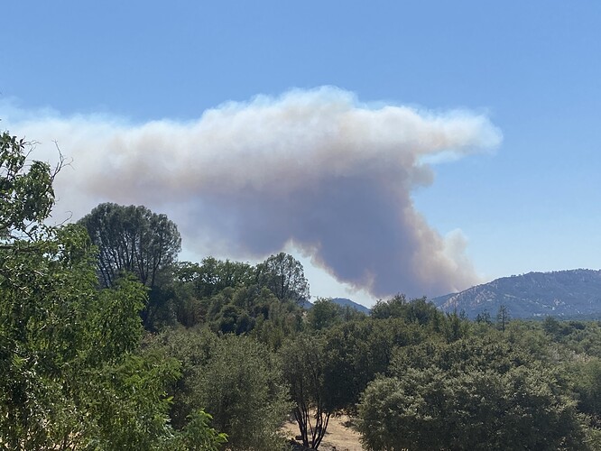
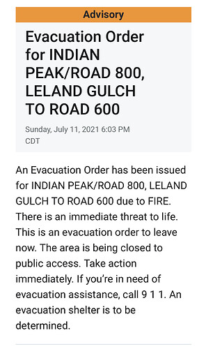
AA just stated 500 acres with the structure threat from left shoulder, across the head and to the right shoulder. Hold the no divert on two tankers…From 70 to 500 is quite impressive if that’s the case…
They just stated it’s pushing towards the middle Fork of the Chowchilla River. This is what it looks like at 500 acres.
It seems to be showing on RAMMB satellites now,RAMMB/CIRA SLIDER: Satellite Loop Interactive Data Explorer in Real-time with GOES-16 and Himawari-8 Satellite Imagery
Waiting for Caltopo, nothing populating this fire.
Head of the fire is at 812/ baily flats.
The old burn mentioned is the Grupe ranch training burn from a month ago.
Tough to hear all the parameters but MCSO is working on Mandatory evacuation, Road 800 from the Indian Hill, Madera county line to Bailey Flats. They stated there weren’t that many residents in that area.
Per IC fire is 200-300 acres.
ST 9430C responding immediate need from Fresno
Just a very rough area map with what can be mapped from the smokey cameras. Not official or for tactical decision making for discussion and orientation only. The hill in center of camera is Twin Sisters South (N37 20.179, W119 46.339) and the road just below it is Grub Gulch Rd.
ST9340C immediate need from SLU.
Negative, they are on the MMU Cover
Missed the number but strike team of type 3 from Santa Barbara County immediate need
River OPS is asking for them to respond directly to the incident. 


(ST9340C)
9322C - Santa Barbara County.
Its never fun to be able to find your house on the same map as the fire.
Tankers 76, 78, 79, 80, 82 & 83 are on it. Reload is Fresno.
Per AA approx. 1000 acres, spotted across the Chowchilla river
http://www.alertwildfire.org/sierra/index.html?camera=Axis-Bullion&v=7a7f1c3
Looking well established!


