XBO 6228C
VCV
OTO
RCF
CHO
APP
Airs clearing up and tankers are inbound.
AA reports several spots over the dozer lines left flank to shoulder and head.
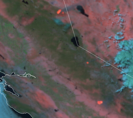
ADD Near realtime (it says) fire map from NASA:
Really have to zoom in to see topo details. Maybe play with the menu layers.
This mapping program has acreage around 11k. I like Caltopo better.
As far as Metcalf gap RAWS, there was talk on command and I search the map and saw it was close but, my error on direction from the origin. It’s showing 100 air temp and 111 fuel temp and 3% 10hr fuel stick at 11am. It’s still a good measure of weather.
Spotted past road 810 toward 600, spot is 200 acres
IC says the fire has begun spotting again, heading for the Road 600 area as it aligns with the slope and wind. An additional Strike Team has been requested for structure defense in that area.
They’re recommending that the road block be moved to Windy Gap and that Indian Hills be mandatory evacuation
Wind has shifted back out of the northwest, deadwood camera is smoked out and it’s just a helicopter show right now.
Is it still pretty active? Very tough to see on the smoked out cameras.
Cal Fire released 8,000 acres and 10%. Fire continues to make runs and spot.
IMT Ordered
Before the camera smoked out there was a header visible.
Smoke is clearing some and visibility is improving. AA is considering trying to work some Tankers back in if visibility holds.
IMT 6 enroute to fire
9,000 acres and 10% contained.
6440C punched out from San Diego
I’m assuming its still too early for an IAP?
Didn’t see the IAP on the FTP site but last nights IR flight was on it.


