Winds have been erratic throughout the day up here. Rain in some areas but not at the fire.
IMG_3862.jpeg
6 Likes
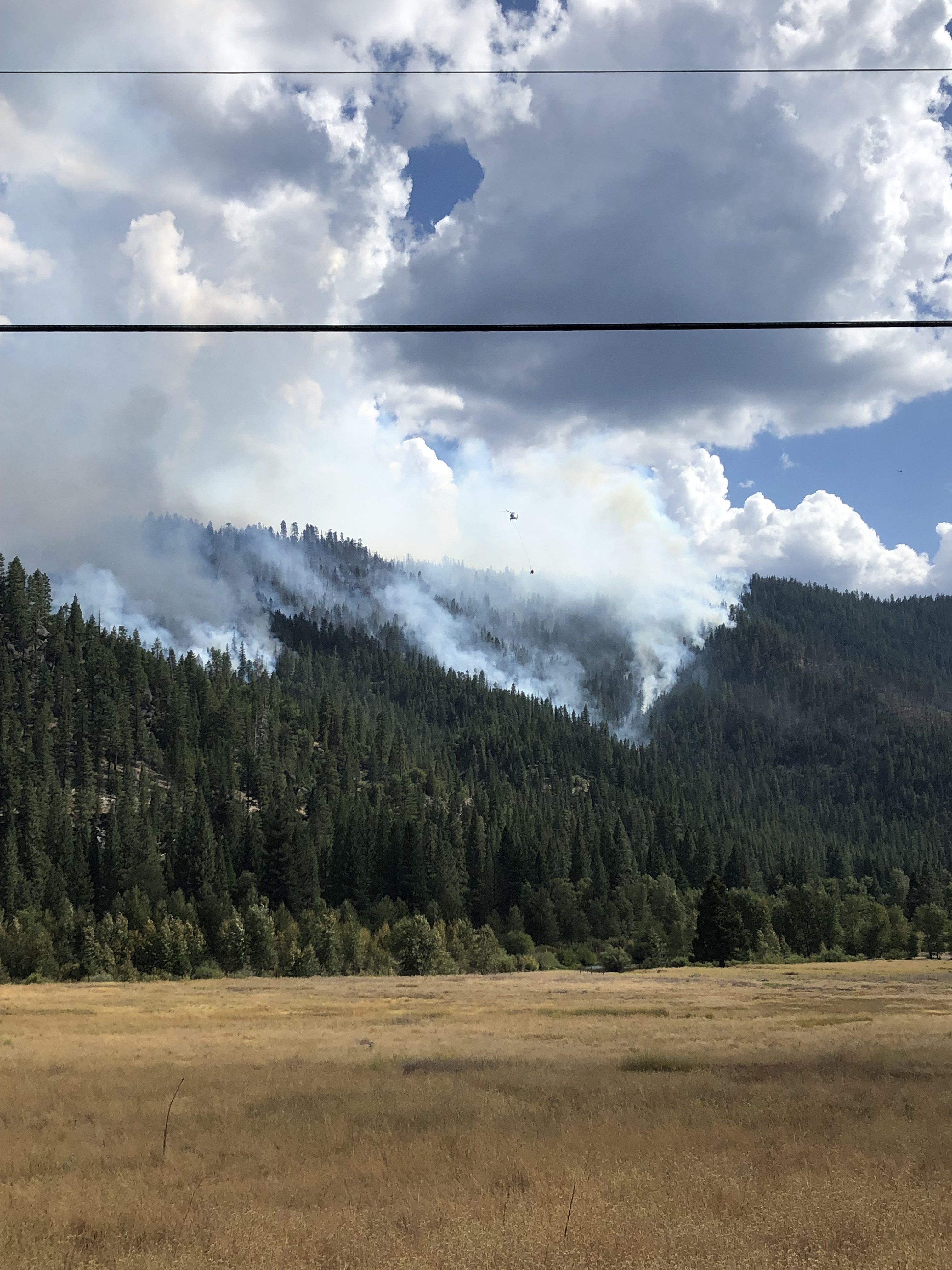
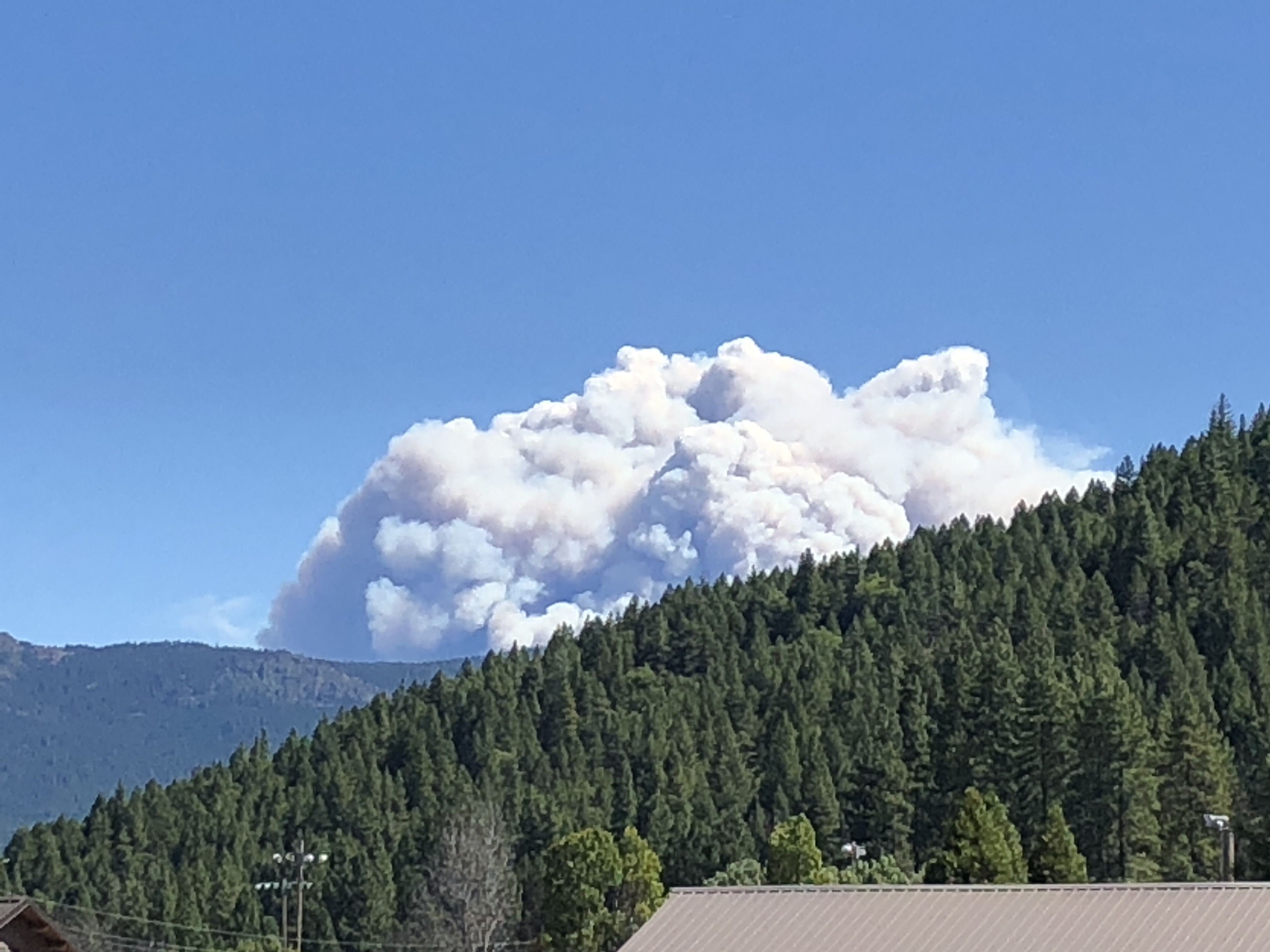
She came off the leash about 1630. The flare-up photo was taken shortly before it became established across Red Clover Creek, just upstream of the bridge on the Beckworth-Genesse Road. As of 1630 the fire had not crossed the paved portion of the Beckworth-Genesse Road.
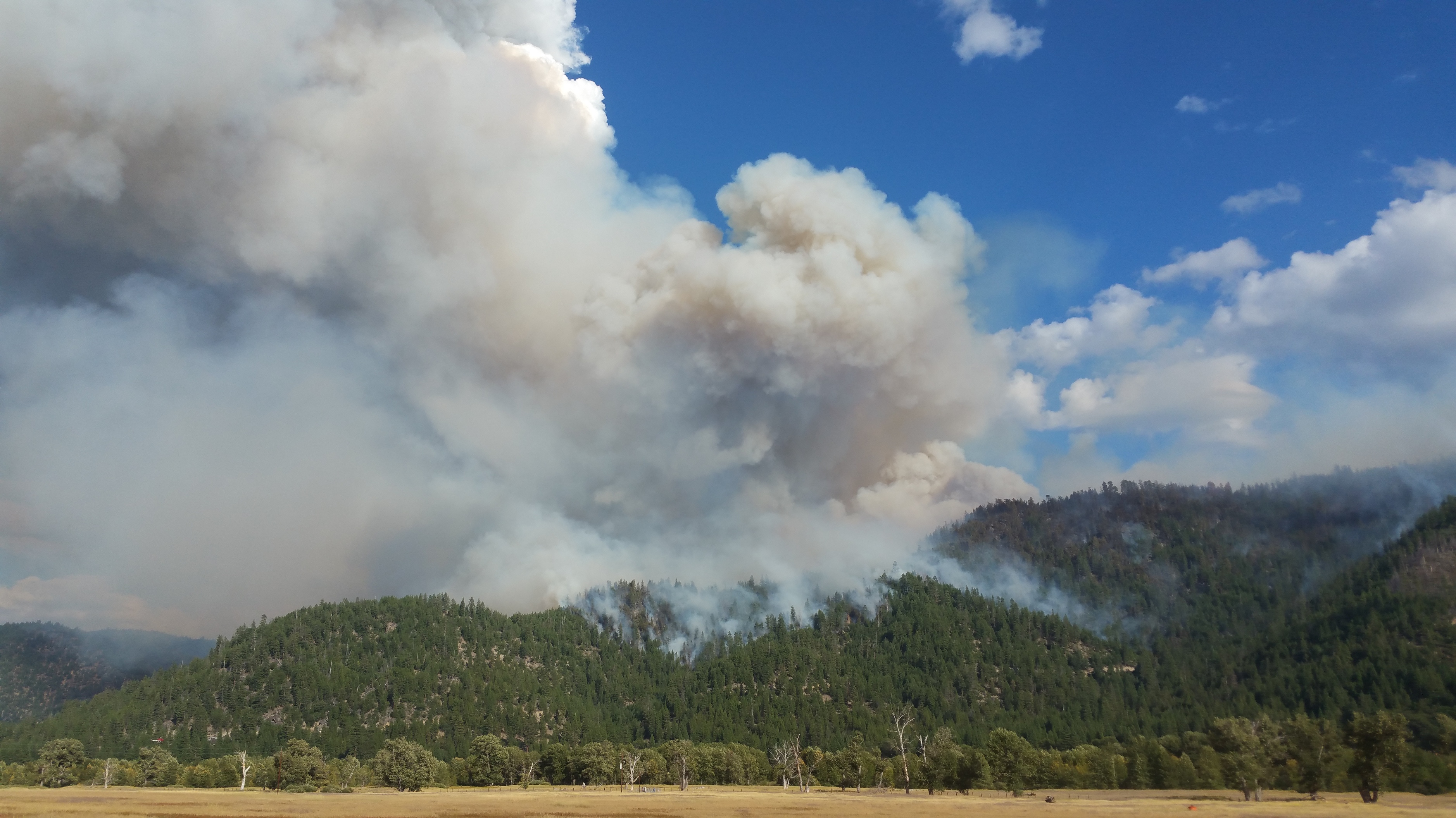
The North edge of the fire is backing nicely down toward Genesee Valley downstream (SW) of the Flournoy Bridge (Div Zulu). Plan there is to let fire back down to the midslope road. Helos were smoked out of Div A most of the day due to smoke, but we’re useful in Zulu to cool the backing fire as it neared the road.
10 Likes
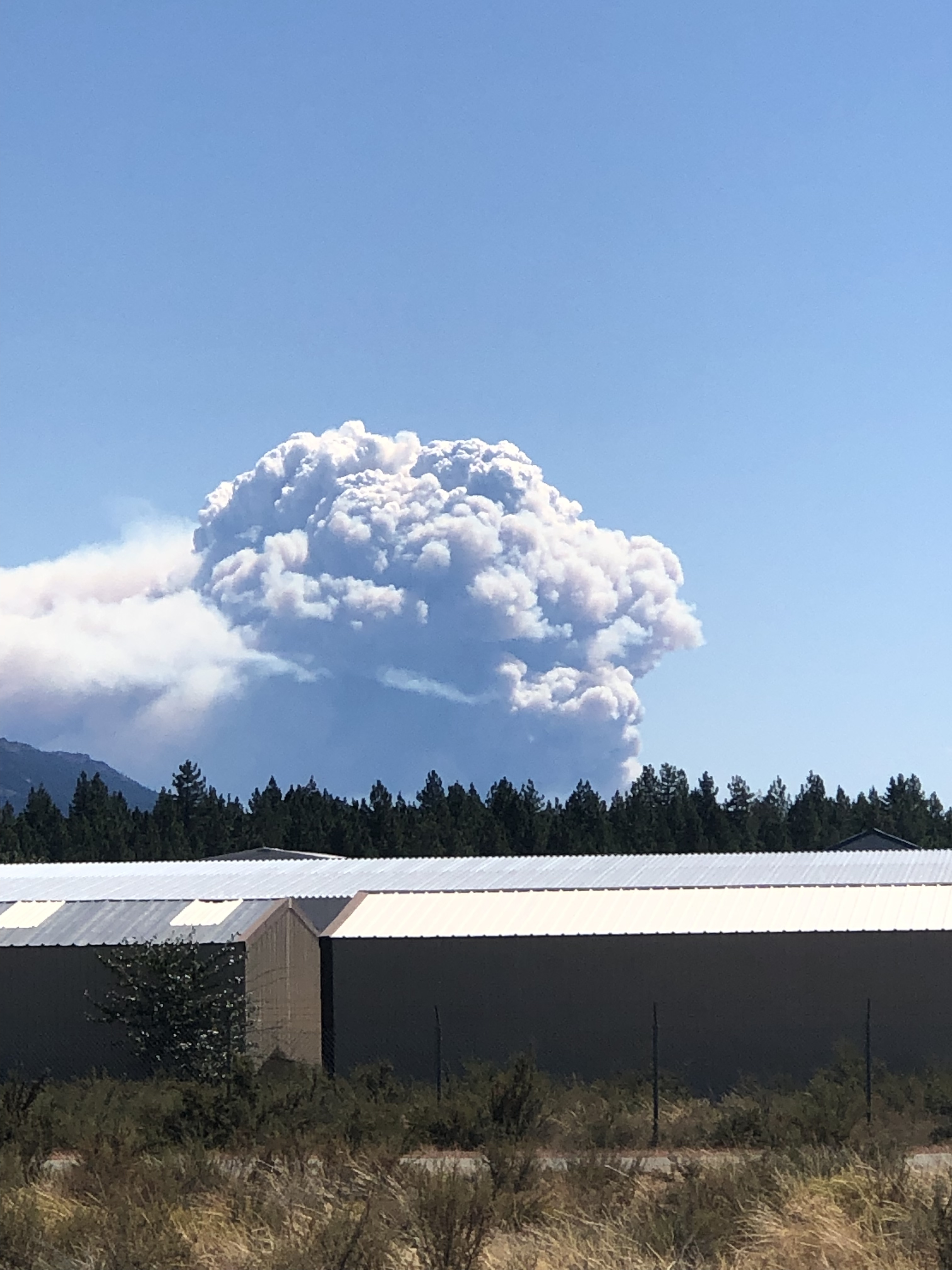
9:00 pm Update - #Walker Fire - Due to downdraft winds from late afternoon thunderstorms, the fire has spotted across the Beckwourth Genesee Road in a north/northeast direction towards Babcock Crossing and is burning in the rugged Elephant’s Playground area. Size is approximately 1800+ acres. We will not be doing a separate update tonight but will again in the morning. #SafetyFirst
4 Likes
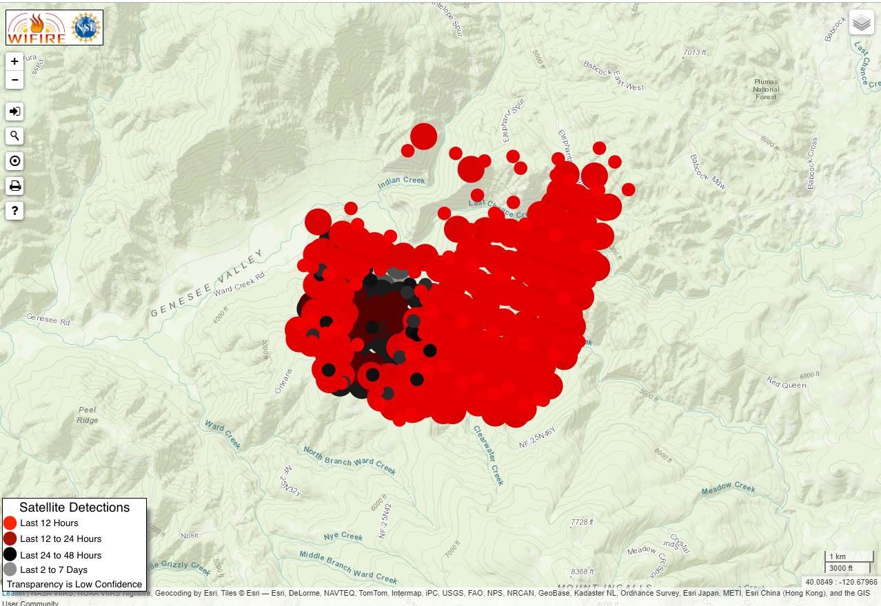
Today’s map:
2 Likes
From the forest 2000 acres 0% contained.
Judging by the satellite fire detections, that map is already out of date. Looks like the fire has crossed Last Chance Creek to the NE.
1 Like
Yes, the east side blew out about 1700. The satellites put it at about 5k acres.
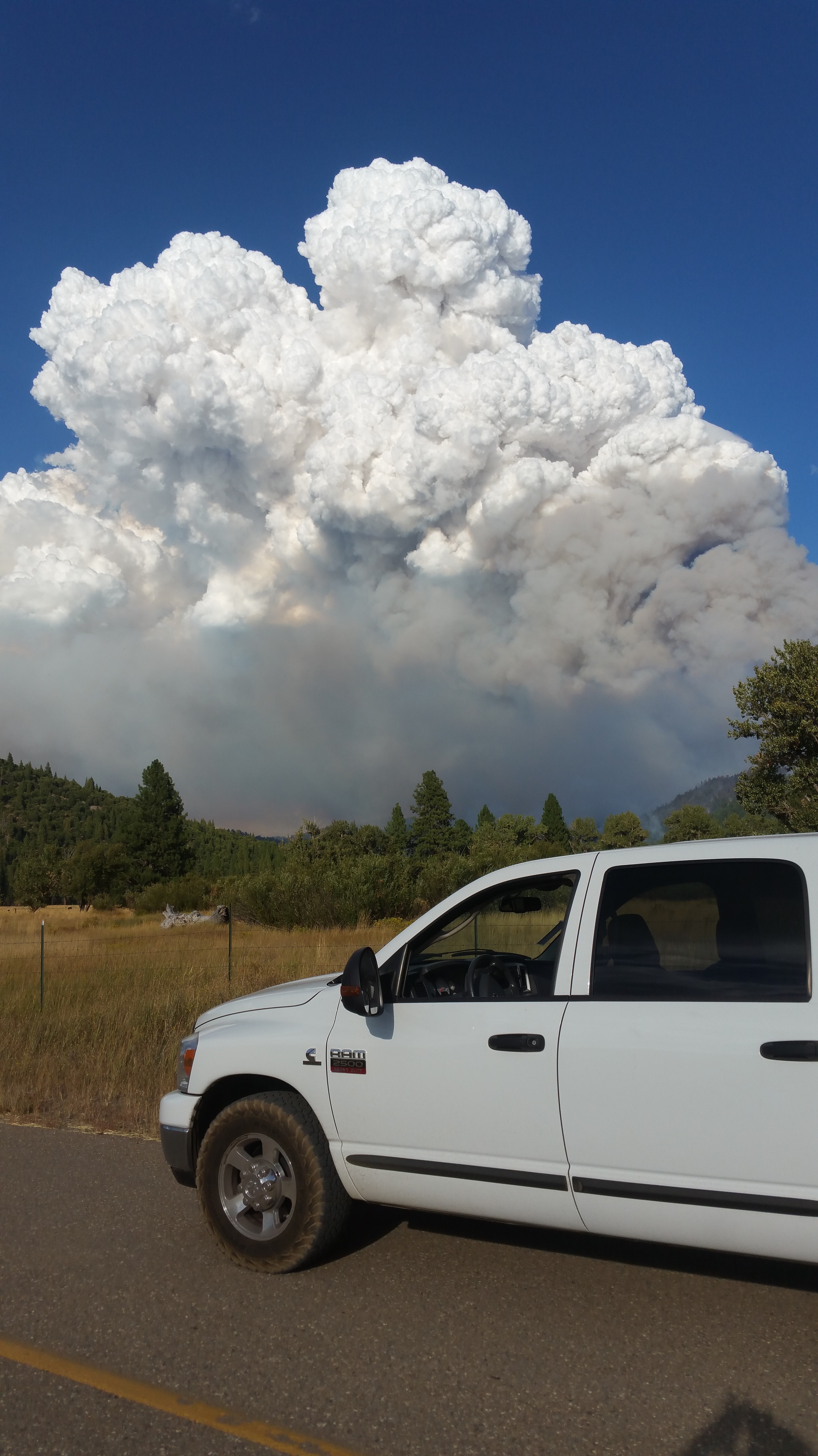
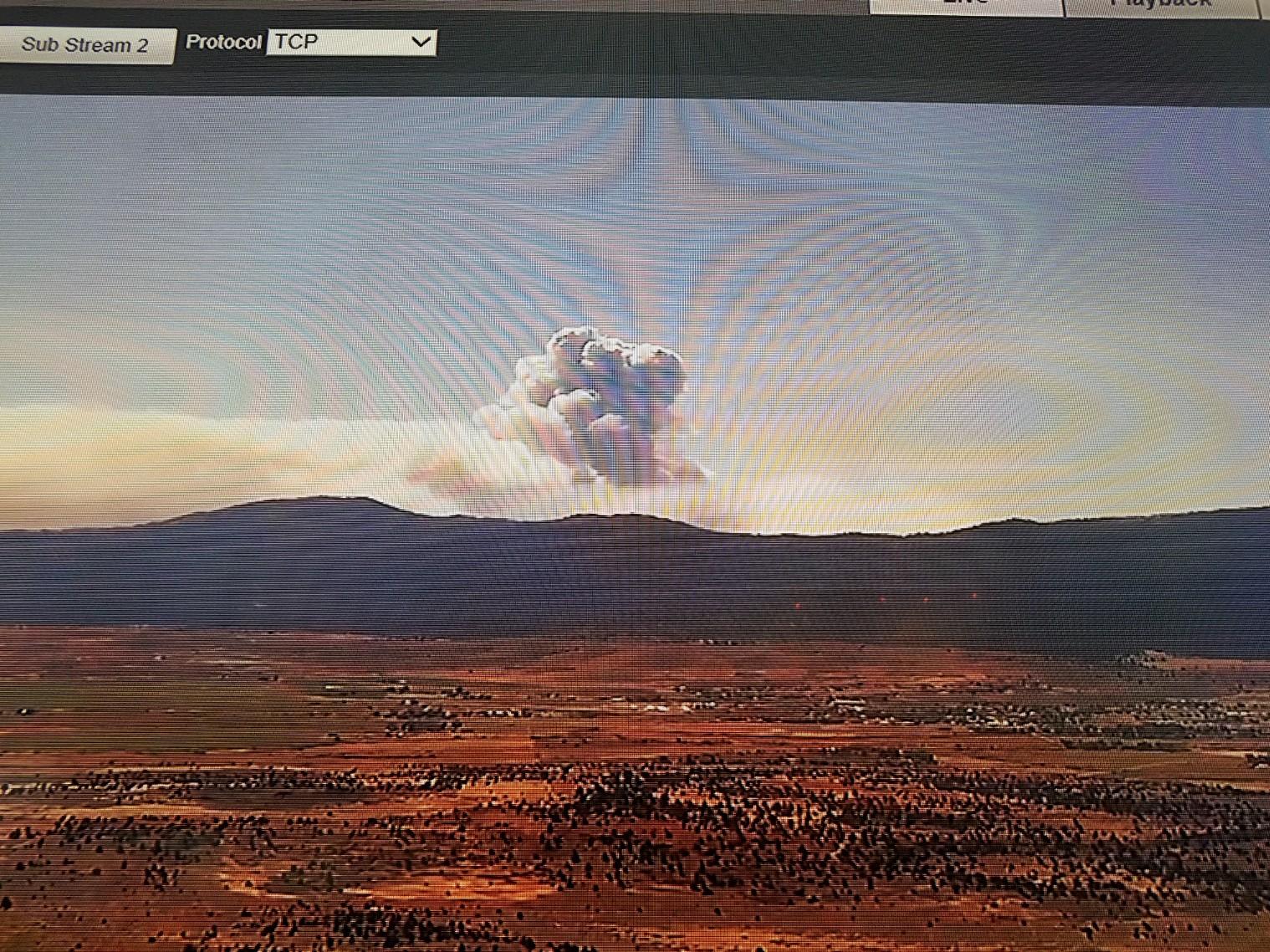
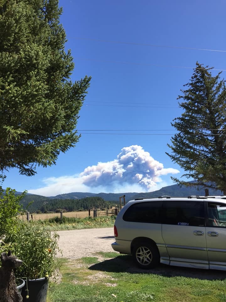
This thing just popped. Massive pyroCb just burst over the horizon seen in Red Bluff. GOES17 IR tripled in size in last hour…
1 Like
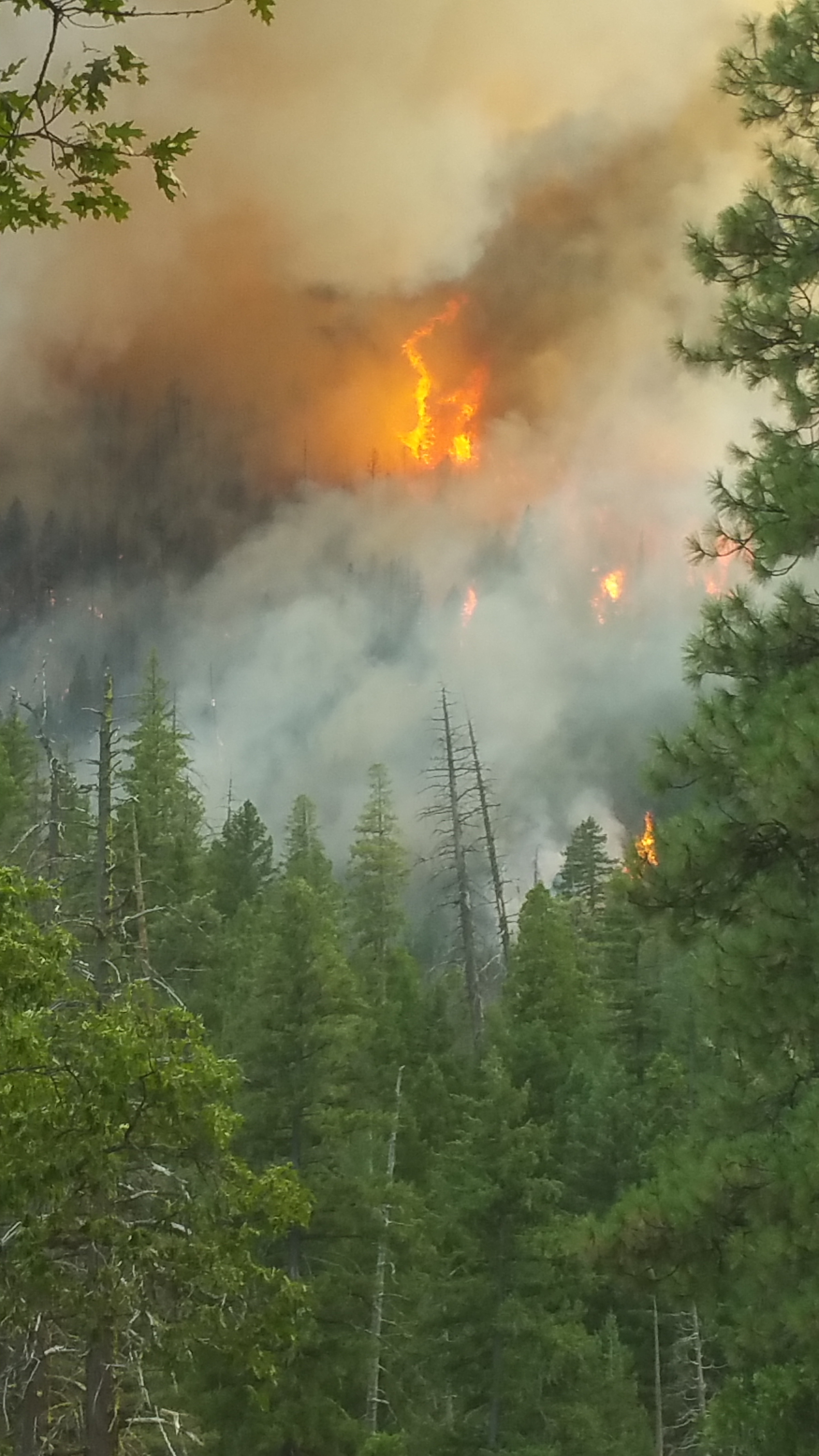
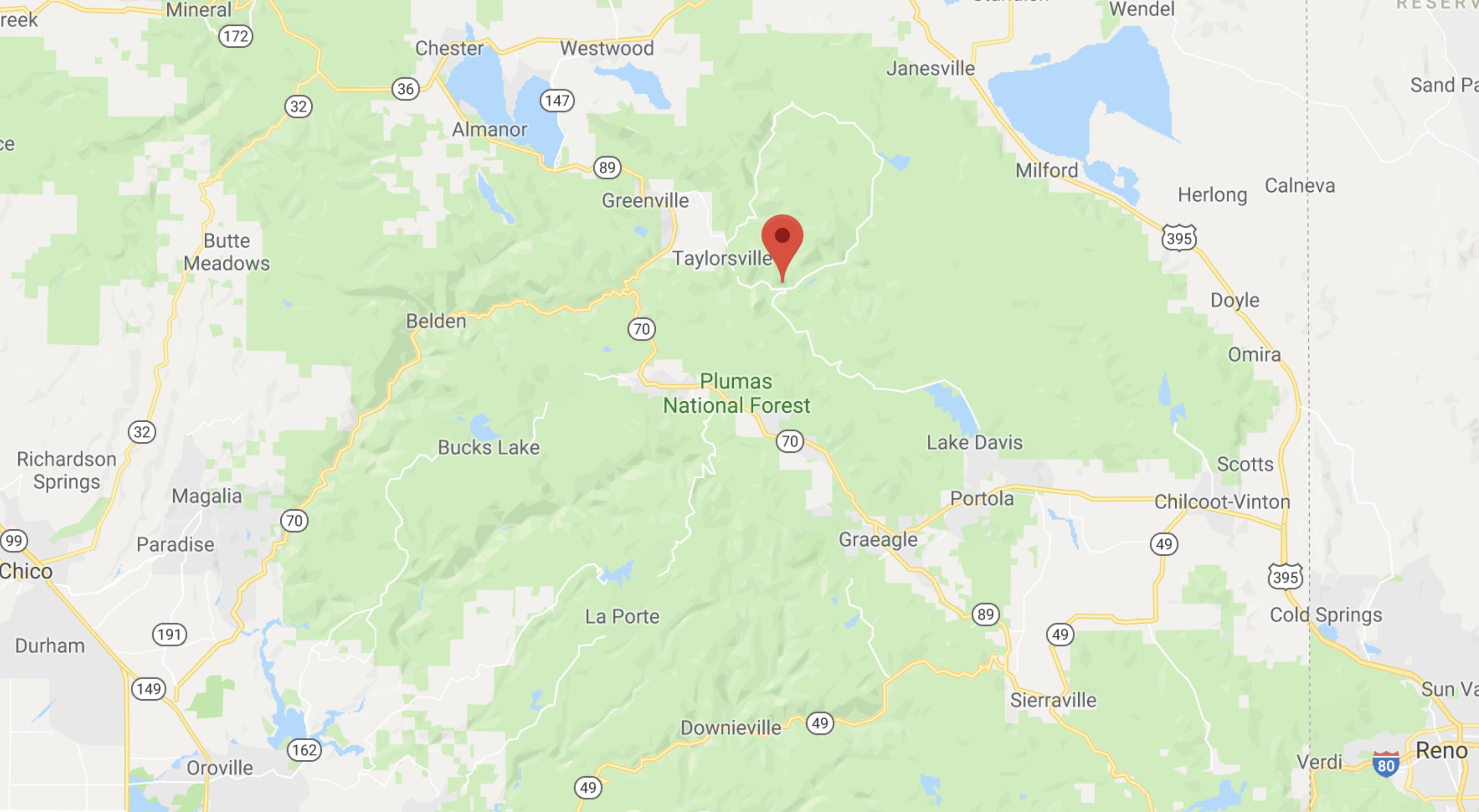
Fire is burning Elephants Playground
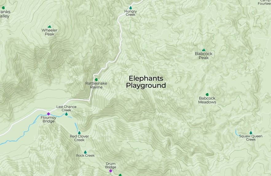
In 1983 the Elephant fire (point of origin near Elephant playground) burned all the way to and through Doyle on Hwy 395. Not in a day but if this gets across to the escarpment it can run like a pack of mustangs down the other side and across 395. It has a ways to go and the vegetation is only 35 years in recovery may slow things some. The general weather forecast suggest some cooling this next week (9/8-14) w/RH 20+ possible cloud cover Wed but with a couple of troughs moving through the NW one may well expect SW to NW winds for the general area with healthy gust (20 to 25 perhaps) at times. Amateur weather forecast for sure.
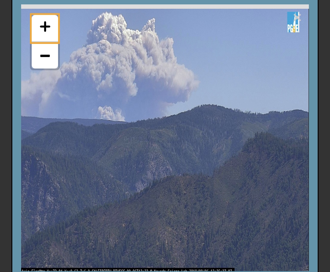
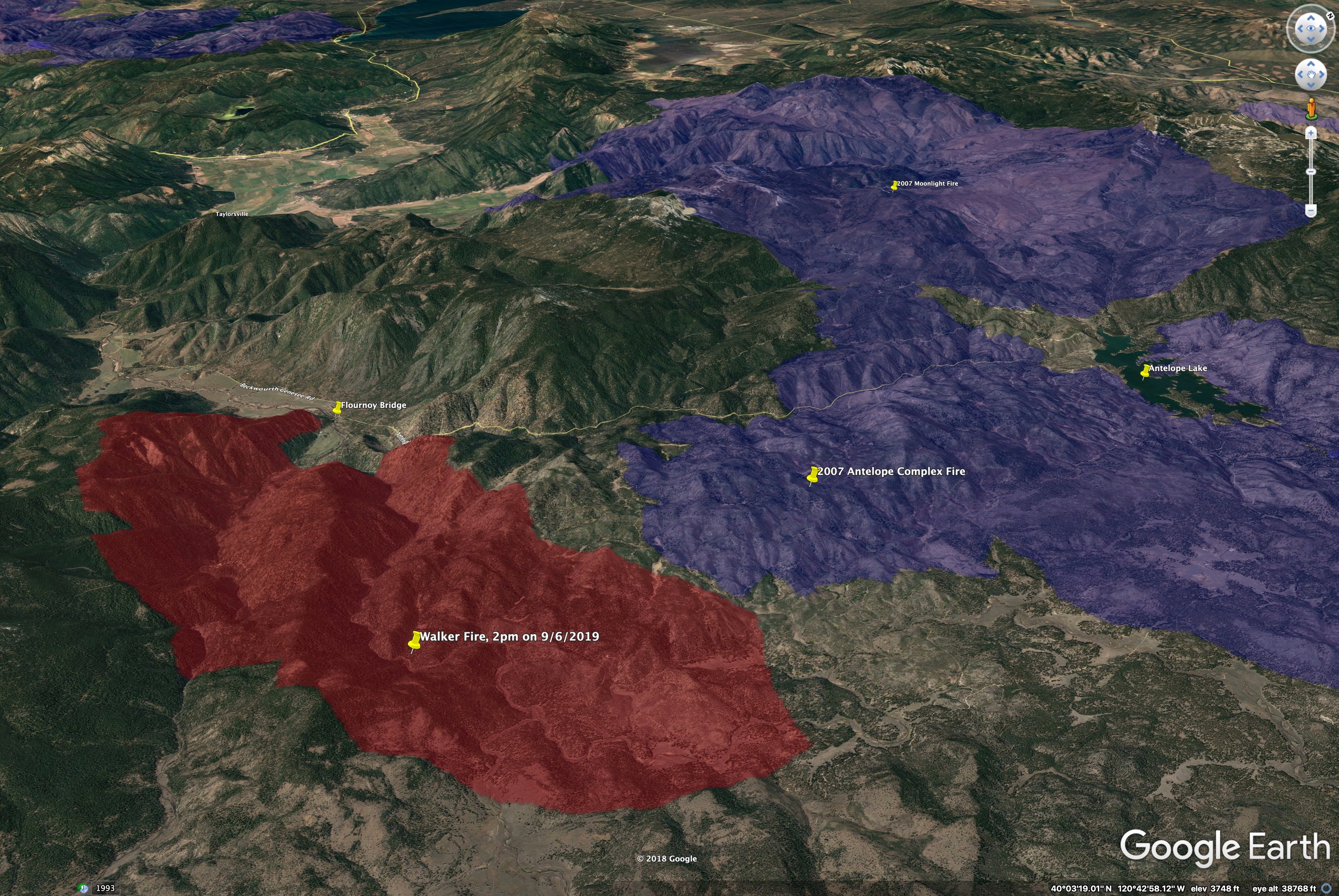
Updated map of the #walkerfire, from satellite heat info at about 2pm, 9/6/2019. View is toward the northwest. Rough acreage is about 15,000 acres.
Purple/blue areas are the 2007 Antelope and Moonlight Fires, with the 2012 Chips Fire at the top of the image. Indian Valley is in the left-center of this image.
7 Likes
Nor Cal is burning. At least 7 fires show from space. The Walker shows well to state the obvious.Rammb Goes 17 time sensative. If you wait a day chances are this link will change. Go to the upper left and hit play. I just stumbled across this site.
2 Likes