AA will estimate. IC goes with last hard number , whether scanner or on paper. Now, IA IC is estimating. After things settle in, I always consider any published number not current.
Correct! Almost sounded like a power move on scanner. Should have been a cell phone conversation!
I wonder if there are some political trigger points involved if it goes to that number?
It’s a fire, there is always politics involved. To my knowledge there are not management action points associated with particular acreage numbers for this fire but they could potentially be used for something like an FMAG request.
The RVC team will keep this, they can handle it as long as it stays out of the State Park/BLM lands to the east, low land values, RVC can handle the finance part
any camera with a current view?
The radar showed rain this past hour, 4-5am. Did that actually happen?
I live about 15 miles from the fire, and woke up to wet ground.
Is there a IAP on forms?
I looked in all the zip files and I don’t see a IAP . I’m I doing something wrong
im at the fire, what do you need?
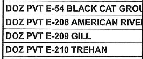
I was looking for a list of what dozers were on what division
only these on suppression repair

Thanks for the info.
The Google Drive with IAPs and Maps.
https://drive.google.com/drive/folders/1kuxdK9ZD-wAdQyBQbNVedWWeBvsIjkEy
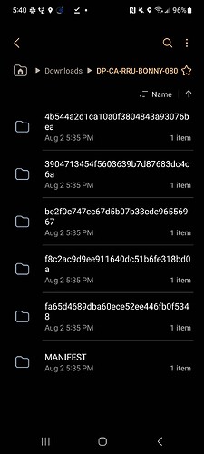
@Doug1 I made this one in ATAK instead of zipping it on my device. When you unzipped it you should have had folders with a longstring string of characters. One of those folders held each of the maps, kmls and the IAP. I normally build them on my PC but this fire been doing it on my phone in ATAK so in that process it adds that extra folder layer. If you have an android and import into ATAK you just get the files and not the extra folder.

