CA-SHF-MCFARLAND(contained)

State ID:CA
3 letter designator:SHF
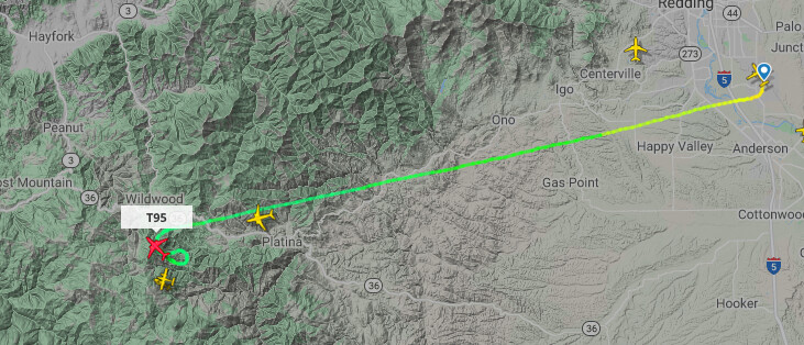
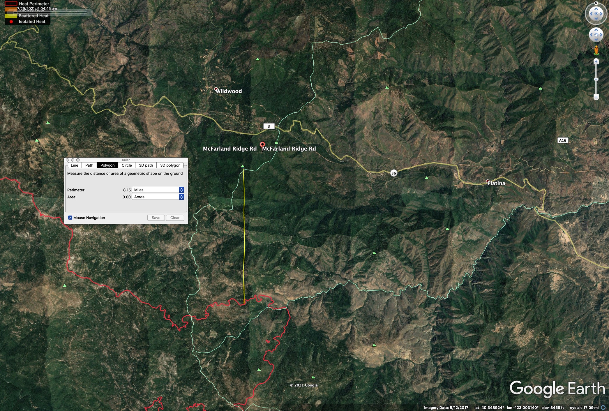
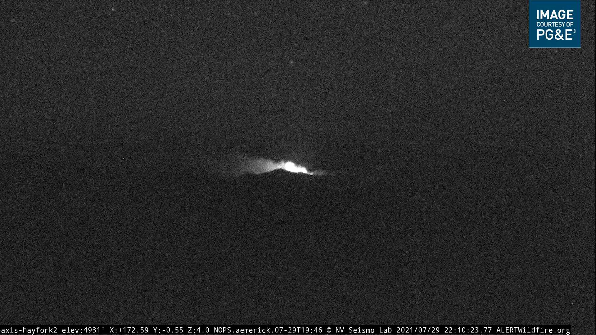
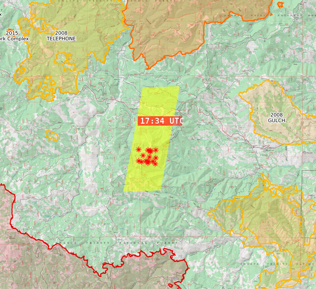
Fire name:MCFARLAND
Location:WILDWOOD
Reported acres:2
Rate of spread:Moderate
Report on Conditions:active on all sides
Structure threat:
Resources:
Hazards:
Weather:
Radio channels:
Scanner link:
Webcam link:
Agency Website:

Per National Fires R.O.C
Nor-Ca
#McFarlandFire (#Wildwood, Shasta-Trinity NF) - AA requested 2 S-2 tankers, 3 large air tankers, 1 medium copter, 1 heavy copter + a load of jumpers out of Redding if available. Fire in steep terrain, upper third of the slope.
——————-
#McFarlandFire near #Wildwood in the SHF, on the Trinity/Shasta Co line @ McFarland Ridge south of Hwy 36. AA reports 2 acres in timber, torching, light wind on it, active on all sides, medium-high potential.

3 Likes

http://www.alertwildfire.org/shastamodoc/index.html?camera=Axis-Hayfork2&v=fd40730

1 Like

Flightradar shows AA on it with a Kaman out of Weaverville, Tnkr 94, 95 out of RDD and Tnkr15 departing the area.

2 Likes

4 acres MRos requesting 2 additional crews, 2 type 3 engines & 2 WTs

2 Likes

Losing the light, but they are giving it a go.

2 Likes

Will this be inside the August 2020 burn scar?

AA requesting Early Up AA, 2 type 3 Tankers and a Type 1 copter @0800

3 Likes

Quite a ways outside of 2020 August Complex.
Location approximate, I just searched for McFarland Ridge.

6 Likes

http://beta.alertwildfire.org/region/shastamodoc/?camera=Axis-Hayfork2

5 Likes

20 acres as of just after midnight.

3 Likes

Looking at camera bigger than 20Ac

2 Likes

Lots of room for this one, no fire hx since 1950 for quite a ways. Surrounded by a lot of 2008 lightning scars, but plenty of room to get up and move before it hits any of those, and plenty of rural residences tucked in along the 36 and Wildwood Rd corridor. Harrison Gulch (residences and SHF station) is right below this down drainage to the east.

Fire is in a Red Flag Warning for isolated tstorms. Fire Weather forecast for this spot is here. It was under a large cell yesterday afternoon (but no strikes on the detectors).

8 Likes

Rule of thumb, take estimated acreage at night and divide by half. They always look bigger at night

10 Likes

SHF states 100acres now, with “rapid rate of spread”

2 Likes

I stand corrected. Guess this year all bets are off :crazy_face:

2 Likes

The scancal.org live scanner is covering this on the IA freqs for SHF Forest, SHF Southfork, and Air Tactics. However it’ll have TGU/SHU local nets on priority, and a bit of Dixie West air traffic mixed in there when they’re up and flying. I can’t fix that until later this evening. You’ll need an mp3 streaming app to listen.

Air Attack, Lead, multiple LAT’s and VLAT enroute.

edit: SHF also working a lightning start NW of Trinity lake, Rush incident. Will add to radio complexity.

edit: think I heard 150-230 acres as of 1010.

6 Likes

Per flightradar - MAFFS02, 03 and TNKR911 have arrived.
edit… now MAFFS02 is headed east (Dixie?)

1 Like

The LATs are doing load and returns at Redding per AA, which is where MAFFS02 is heading. Also have 102 in the mix that already dropped once and is at Redding. 914 is also off the ground from Santa Maria, probably headed here too.

3 Likes

. Looks like it found space to grow. There will be a lot of resource sharing for the next few days.

3 Likes

NWS Hourly for McFarland Ridge area. Couldn’t add Haines Index. The precipitation sure is a mixed blessing.