
McFarland incident base preparing for evac
3 Likes
http://www.alertwildfire.org/northcoast/index.html?camera=Axis-PrattMtn1&v=fd40731

Going to be a long day
4 Likes
Believe AA just ordered 8 Type 1 and 2 VLats
3 Likes
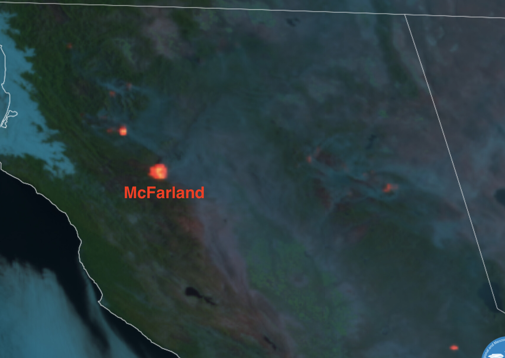
Mandatory evacuation for Platina
2 Likes
1045am Monday: not done yet, but prepping for shutting down Hwy36 from Hwy3 west to Bowman Road east.
TGU IA engine request rolling to R Ranch.
6 Likes
Norcalscan - Do you have a feed up for the McFarland?
WX PGE Bridgeville West - due north of R Ranch (was ICP) on the Tehama Shasta county line. Good indicator of influence on the NE finger on DIV E that’s pushing into R Ranch. Its sister station is Bridgeville Cottonwood, a bit further east on the same 230kV line, validating station for anything coming out of the north.
WX PGE Arbuckle Mtn - just NE of Platina, good indicator of what’s coming out of Beegum Gorge and Platina, left flank/heel.
Scancal.org live scanner out of Red Bluff should have McFarland on higher priority early this afternoon.
7 Likes
Monument IC near Junction City
3 Likes
With current conditions, they expect the fire to reach Pettyjohn Road by early morning for the SE spread, and likely impact Tomhead by late morning for the southern/right shoulder. Tuesday morning will be the tell for how this thing runs in 2020 Elkhorn/August and 2019 Red Bank. The further east this gets, the easier it will be to hook around/skirt the 2019 burn and run south with the upcoming wind event.
Some excellent TGU local leadership jumped on unified command today and will help run the show down in the flats here in the SRA. They’ve unfortunately had lots of experience out here with the 2020 and 2019 fires. Open up some old control lines, maybe get a chance to try some hail marys they were planning last time, but most importantly, stay out of the way of this thing. Conditions aren’t like 19/20.
6 Likes
97,407 acres and 53% contained
5 Likes
107,102 acres and 51% contained.
2 Likes
Wed evening novel write: This thing has been behaving for the most part all night and day. Thankfully it didn’t get too far east earlier so when the NNW winds hit it just hung itself up in the August and Red Bank Fire scars. The open land to spread is more of a flank thankfully, and some bonus ground for iron and firing work. Sounds like they might catch the east side at Vestal Rd, which would be a HUGE win. However wind conditions would create a dirty burn so they were waiting/rethinking a bit. Lots of wind not in their favor for a while.
Spread to the south is limited to pockets of fuel in the August, with a significant spot just below Tomhead Mtn to the west, in 29N 9W S1. Most all of these spots are jackpots in the wilderness, all in the August burn.
Good backing fire now on the NW corner at Beegum (edit: NW corner of this spill into Tehama, not the entire incident.) Sounds like waiting for conditions to ripen and fire off Noble Ridge likely from black to pavement, cutting out any chance for backpedaling into Platina or north. Both old and new Copter 205 were sent up there this morning by TGU to the Beegum area. Wasn’t sure if TGU was sending in their cleaners or what (haha), but I think they were there hoping for aerial ignition project. Either way, both off the fire later and back on IA.
7 Likes
113,328 acres and 51% contained.
2 Likes
115,996 acres and 52% contained.
5 Likes
100% contained.
6 Likes