Air to IC on this channel.
2 Likes
The video replay is worth watching.
Mods: FYI—I tried to load a 2MB PNG and it generated errors.
2 Likes
I also got an error
1 Like
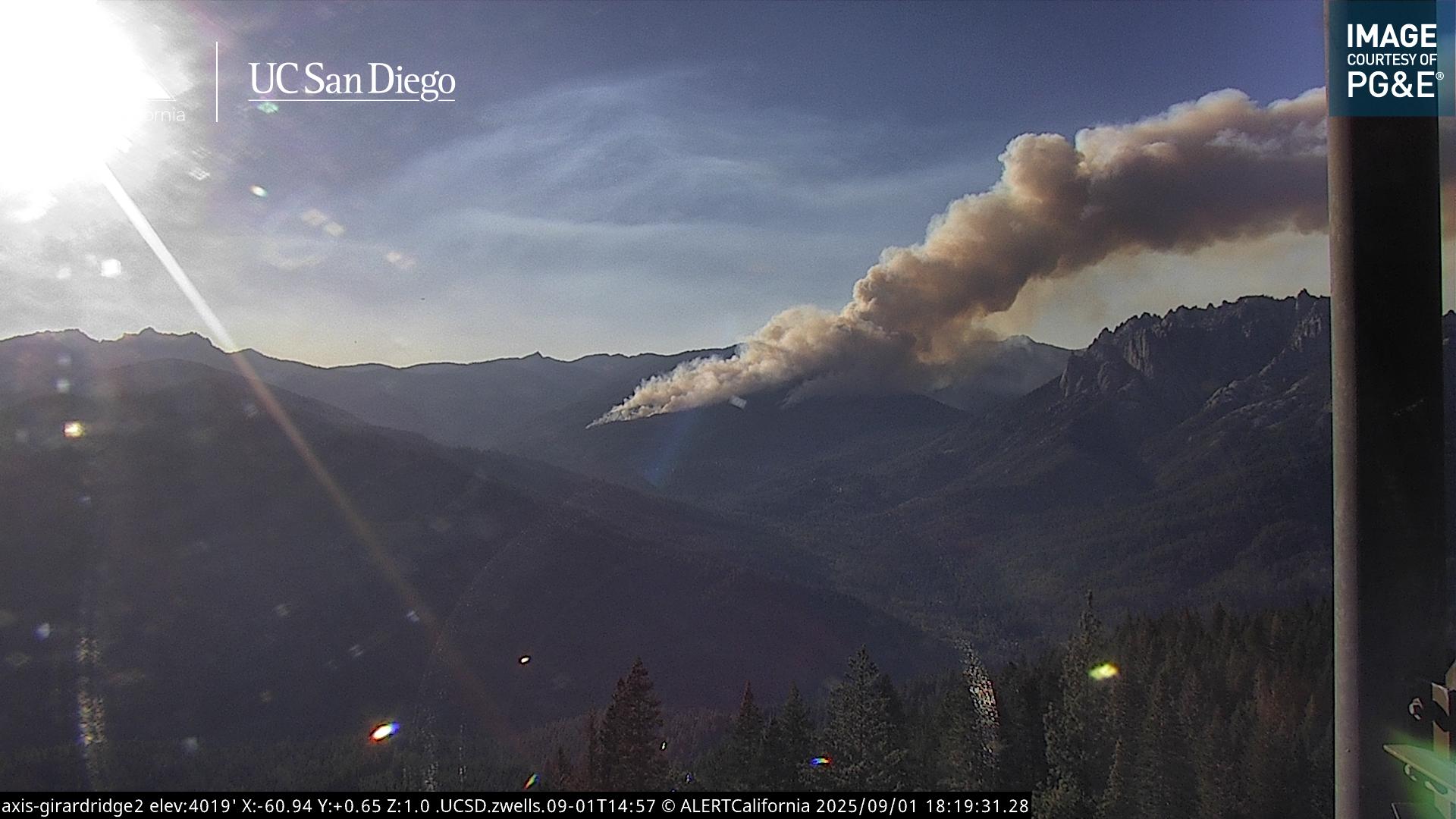
You can see the smoke column from hayfork, looks to be making a pretty good run uphill right now
Sorry, didn’t mean to reply to you
3 Likes
Me too - tried uploading a basic small sized JPG earlier and it errored in this thread.
2 Likes
Air attack reports fire to be 75-100 acres
2 Likes
Mod Note:
We will look into the photo upload issue. No ETA on a fix at this time.
7 Likes
If you’re into weather, it’s an interesting observation to see the column building on this new fire while you look in the distance and see the smoke from the Blue fire still being compressed in the valley,
6 Likes
I don’t know if they are roll-outs or what, but this fire sure has what appears to be spotting ahead of itself. Not way out like the first, but still moving out in spurts.
3 Likes
The normal diurnal & terrain influence sure is more than enough to make for a challenging fire today - feeling thankful that there are no t-cell / outflow winds to worry about at the moment. Also not a bad thing that this one isn’t in a residential area!! ![]()
#thankfullforwildlanders
3 Likes
Fire seems to have made it to the top of the ridge and is losing a little bit of steam
1 Like
Another fascinating view of the twisting column..
3 Likes
Fire is now 300 acres and the spot to the east has merged with the fire. The fire is now working its way down the ridge.
4 Likes
Appears to have a pretty good wind helping it along.
4 Likes
A quick scan of the Sims RAWS at roughly the time of report shows it’s no wonder it took off like a bullet! Temp 96, RH 13%, 10hr 2.4% & a hot aspect/slope..
9 Likes
No mapped fire history within a 300,000 acre box centered on Castle Crags and bounded west of Interstate 5 since the turn of twentieth century. Unable to upload any sexy graphics, so you’ll have to take my word for it.
As described by @norcal74 in NorCal Weather Thread, this is a really complicated piece of ground to try to predict the winds.
The main canyon of Castle Creek canyon comes into the Upper Sac at a pretty acute angle, so at least you don’t have a real straight shot for winds straight up the Upper Sac and right on up Castle Creek.
The fire pushed hard to the north, today, and that seems like the most likely way for it to keep going, even though it has a bigger canyon available to it to the west. The peak winds are forecast to stay relatively out of south for next couple days. It seems likely it will burn out the head of North Fork Castle Creek tomorrow afternoon, around the west side of the Crags, and spot into Camp Creek and Castle Lake. At this point, it be firmly in view of, and on the radar of people in Mt. Shasta.
Or we could get torrential downpours?
Sketchy setup, for now.
16 Likes
Your’s & norcal74 = GREAT intel!
#sketchy++
#fires in convergence zones = no bueno!
1 Like
Extended frequencies assigned for SHF-Root
Air Tactics FM 165.3625
Air/Ground 169.000
Rotor Vic 126.325
3 Likes
All eyes are on the new starts… the Root has a light NE wind on it.. you can see where it has backed down deeper into the drainage…
3 Likes
@norcal74, is that a thermal belt/inversion below it, then?
1 Like