
This fire has 6 fatalities. 2 LODD and 4 Civilians. The 2 LODD Jeremy Stoke, & 81 yr old dozer operator Don Ray Smith. The Civilians are Grandma Emily Bledsoe who perished with her grand children Emily and James Roberts. The fourth civilians name is yet to be released. Reports say there are still several people missing. Lets hope they are found safe.
2 Likes
1645: from some afternoon notes
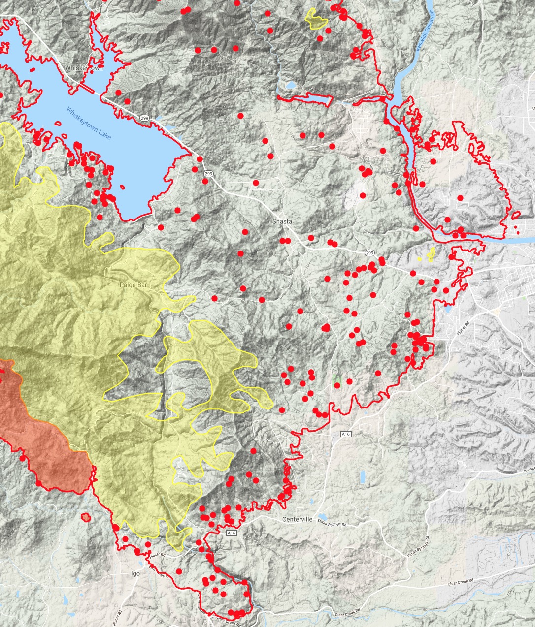
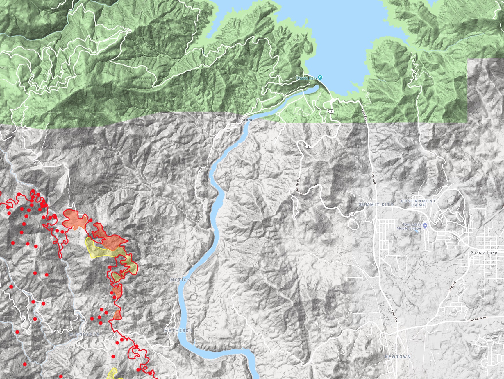
Some T1 copters have been working all afternoon on the heat in Div S (or maybe it’s Div P?) above the upper Sac River Canyon between Keswick and Shasta Dams. This is a small little area that I’ve been watching since Thursday evening - it was the third and northern-most head that was marching eastward Thursday night and thankfully lost steam. I went up at 2am Fri morning to eyeball this one and it was low intensity creep. But it’s the piece of fire that is keeping Shasta Lake City sleeping with one eye open, and has Summit City area evacuated.
Very hot up on the north end. Possibly reaching the very top of today’s Ops map. Per AA fire is in Section 11 up there, but not sure if that’s in 34N 6West or 34N 7W, both are plausible with what MODIS is showing.
Haven’t had a chance to listen much and get intel on Igo/Ono or the Buckhorn Summit area. Helco and a few T1 copters are all I’ve seen so far. AA reported still too smoky for fixed wing.
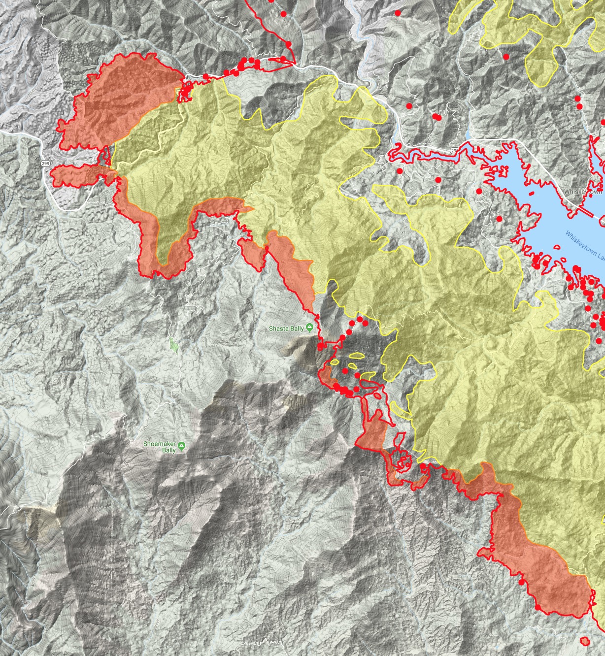
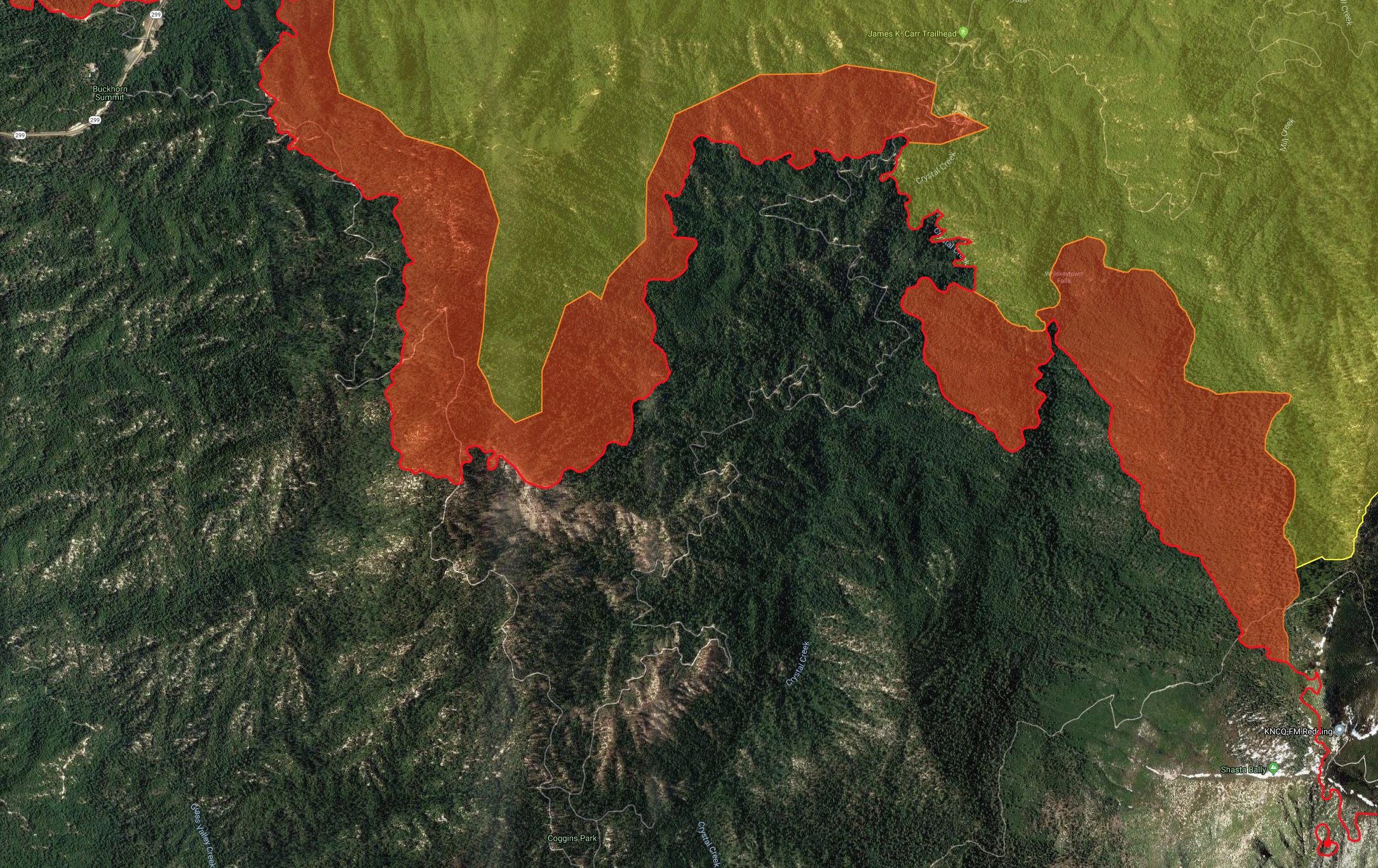
Shasta Bally radio site took some intense heat, some vaults are burned over. TV7 and 9 are still on the air.
At 1700 - spot fire rapid rate of spread Placer Rd at Irish Creek. Division V. Copters enroute. Another spot in Div Y on Igo/Ono side. Here we go.
12 Likes
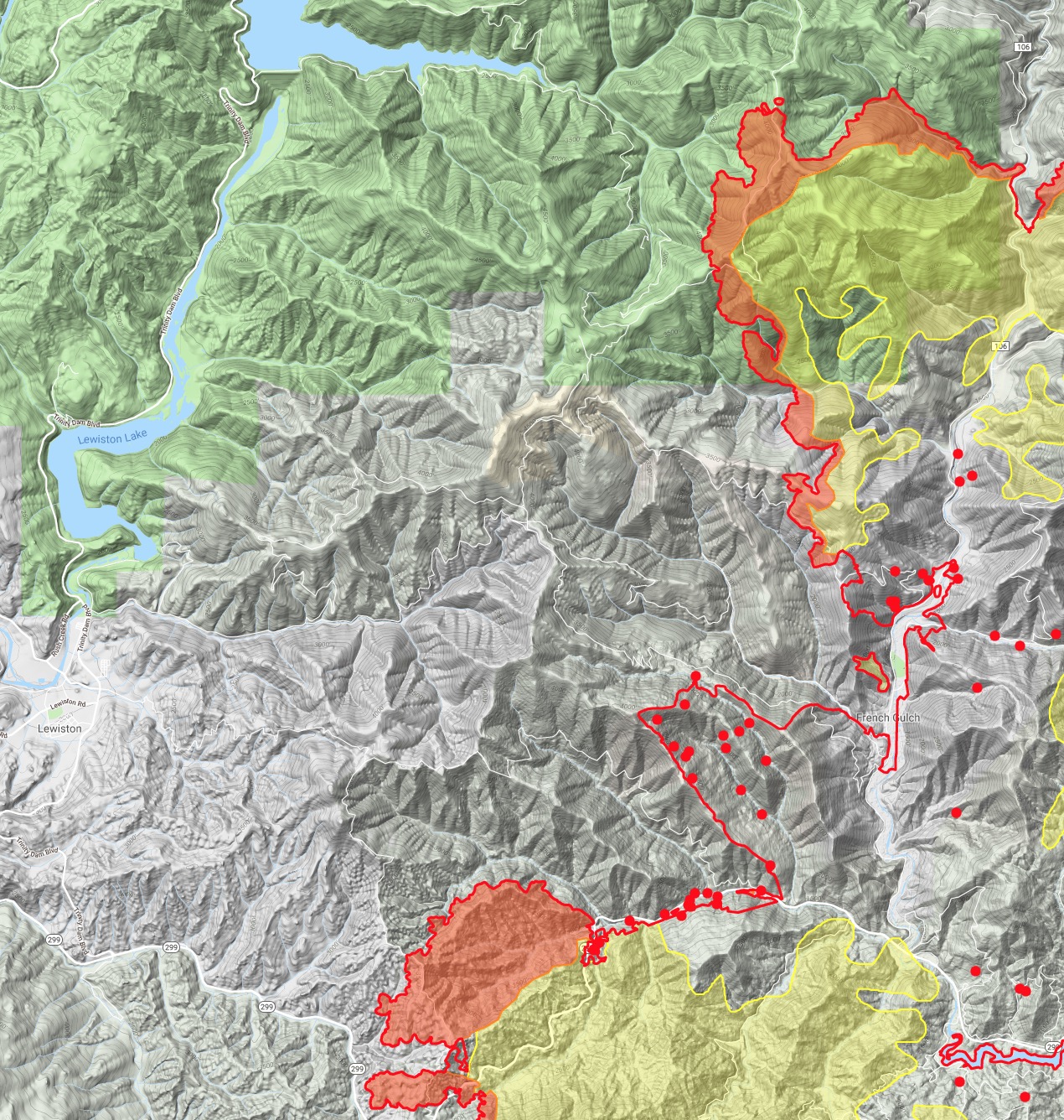
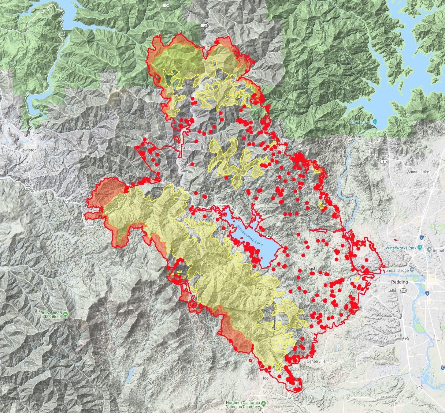
1730: Significant slop over Div C over county line road south of Buckhorn Summit. Getting well established. Box expanding to Grass Valley Creek area now on the Trinity county side.
The spot in Div Y above Igo, sounds like 3-4 acres forward rate of spread stopped. Skycrane working it now with Helco overhead.
7 Likes
Keep up the info. My mother in law lives at poker bar between Lewiston and Douglas city. She is 90 and lives alone
1 Like
Spot at Irish creek has had forward progress stopped.
5 Likes
New evacuations Trinity County:
Law enforcement, including Trinity County Sheriff’s and California Department of Fish and Wildlife rolled that way code 3. Local volunteer fire departments are also assisting with notifications.
Edit:
And since last night, the linked tweet with the information seems to be gone. So, I am not sure if it still applies or not. Power is still out.
I tried to post this last night, bit lost data on my cell. Power has been off in Weaverville since last night Cell service went down to 1x and I could not even get a text out. It was in and out for a bit. Seems to be back up now. Anyway, here is what I was trying to post last night:
Evacuation advisories in Weaverville. At least some people getting pre-alert texts. It does not look like the fire is close at this time.
Edit:
And since last night, the linked tweet with the information seems to be gone. So, I am not sure if it still applies or not. Power is still out.
New IR flown at 2258 last night:
KMZ:
https://ftp.nifc.gov/public/incident_specific_data/calif_n/!CALFIRE/2018_Incidents/CA-SHU-007808_Carr/IR/20180730/20180730_Carr_IR.kmz
Log:
Map:
103,772 Acres per IR
1 Like
The Record Searchlight confirms that an evacuation advisory for Weaverville was issued and rescinded. I am glad someone confirmed, because all I saw was the tweet with the advisory vanish off Twitter.
Last night’s IR on a Google Map.
Things continue to cool off across most of the East side of the fire.
Fire is well-established on Trinity County side of Buckhorn Summit, but backing and flanking now.
9 Likes
Some areas are being repopulated:
1 Like
You have done great work! Thank You for your contributions!
3 Likes
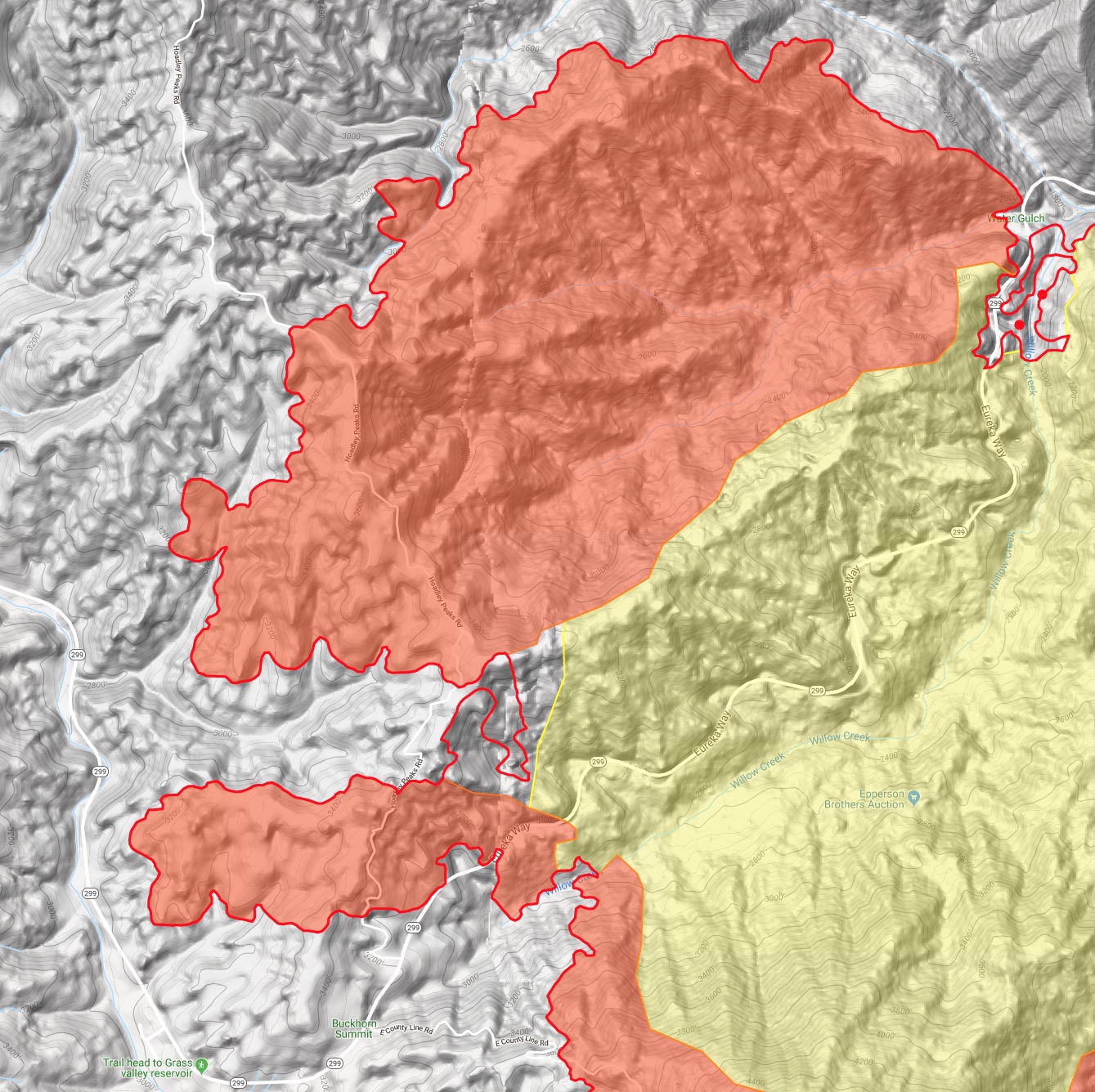
Worked Div. F yesterday. Favorable winds on the line all morning, then around 1430 they stopped, got socked in, and then shifted adverse. Started getting spots which got well established. Interesting thing was that the winds shifted in the opposite direction from what the IMET said in briefing. The whole division was staffed with a Charlie strike team, a golf, out task force and 5 private dozers. Lots of work with limited resources. We ended up regrouping and punching the dozers from below the Hoadley repeater west and tried to hook it into 299W.
8 Likes
Real-time footage from Friday afternoon of the last 4 minutes of video from one of the towers up on Shasta Bally. Not for the feint-of-heart for radio-folk, there is dismemberment near the end…
8 Likes
Norcalscan - Do you know if there are any amateur radio repeaters on the site. Also any TV stations. Thanks
1 Like
1300: Inversion starting to lift, visibility improving (especially on the Trinity side) so air attack is making tanker requests (UTF so far for LAT). Requested 3 scoopers as well. I forgot to mention yesterday I heard the scoopers were approved for either Whiskeytown or Trinity Lake. Tankers need to come in from a southwest approach for smoke, lots of airports from Red Bluff north to Oregon have been in IFR conditions. Rohnerville is favored reload now for the S2’s.
Can’t give much intel on the Trinity side - everything “over the ridge” as well as way up Trinity Mtn Rd is now outside my local knowledge and focusing more on the Igo/Ono piece at the moment. Still significant heat hung up in there above Zogg Mine Rd and Petty Butte. A lot of solid line and contingency dug between it and Igo, but still lots of open (and up and down) between it and Ono.
Watch for the weather feedback loop/catch-22: inversion stays and keeps temps lower and shields the fire area from solar heating, lowering fire behavior, but keeps tankers out and potential to allow winds to push more of the smoke out, thus bringing in solar heating and potentially allowing plume-dominance to occur later or the following operational period. Going to be interesting weather this week over the incident, as well as CA in general.
8 Likes
1720: Fire making a significant run in Div F up to Hoadley Peak radio site now. Everyone pulled off the line and reassembled at Buckhorn Summit until they can reassess.
All rotor wing have been smoked in unable to lift or fly. Some fixed wing have been working the west/Trinity side of the fire, S2’s out of Rohnerville and LAT’s either out of Chico or Santa Rosa as smoke allows.
3 Likes
Air attack requested 2 VLATs, he was told non are Available in the reigon. Sounding more and more like they will have to give up on catching it on county line north of 299, talking about using road systems outside of lewiston
4 Likes
There’s a road we used up above Hoadley Peak called the Lewiston Cutoff. It was our escape route out if the fire cut units off from coming back down Hoadley Peak Rd (also referred to Countyline rd). We traveled it a couple of times for situational awareness. It’s primarily a mid slope road all the way down to to the valley with little to no chance of opening it up with dozers. Sounds like the witching hour for that side of the fire is starting to show itself after two days of repeated weather changes.
4 Likes
I’ve been on the cutoff road before; be careful as it leads to a one lane bridge that your equipment will not be able to pass (narrow & not rated). I’m guessing it’s about 3/4 mike from the turnoff. Be safe.
4 Likes