CA-SHU-Carr (contained)

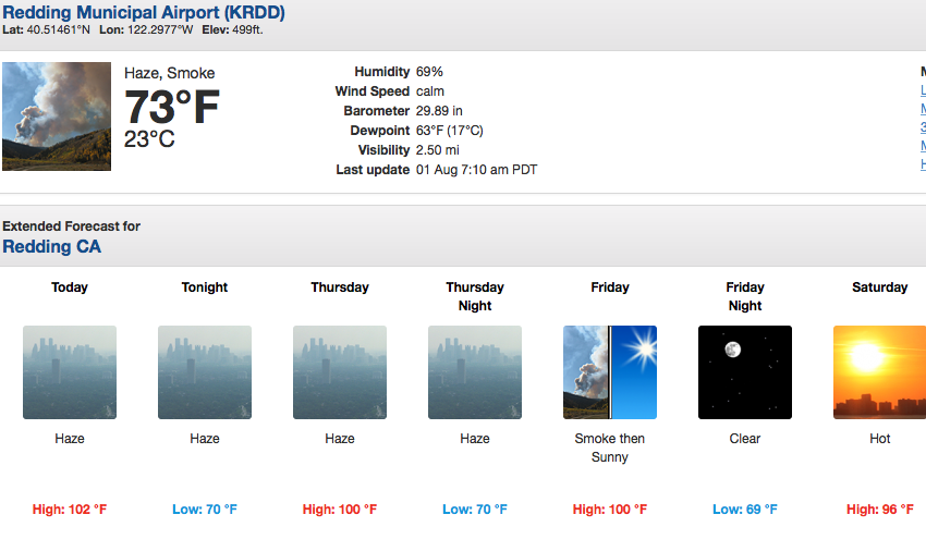
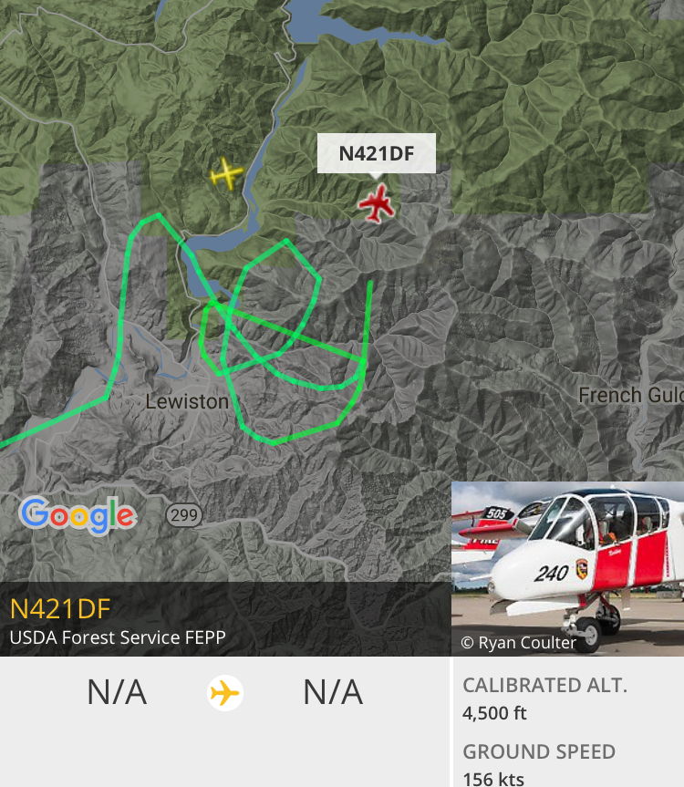
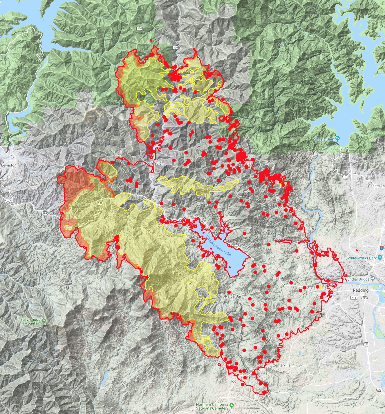
2000 Update from notes: Throughout the afternoon and evening, PGE and REU bringing back online various transmission lines traversing from Keswick to Lewiston, as well as distribution throughout Branch 4, Div S/T/U/V on the valley side. While it’s great for repopulation, it definitely changes the game for the FF cleaning up or putting out spots who have had the comfort of dead lines for the last few days. Had a fully involved structure this evening and lost my notes where it was - somewhere along Branch 4.

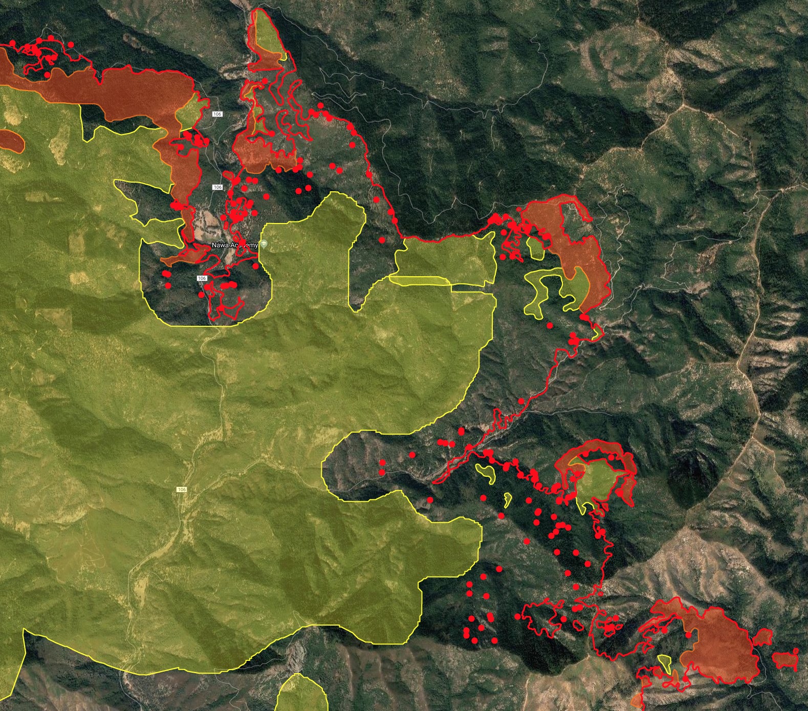
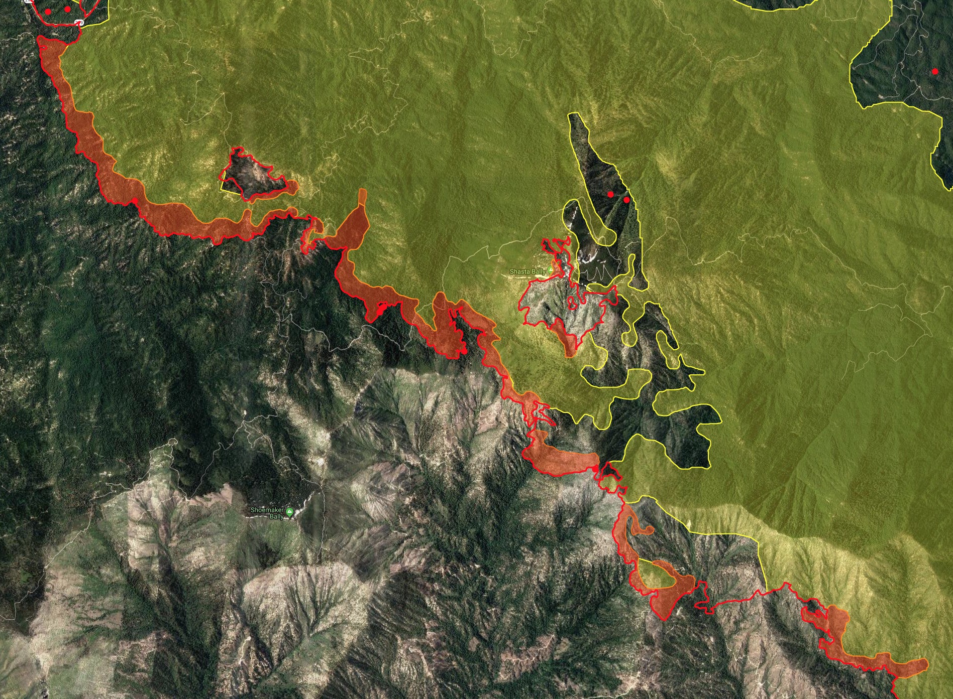
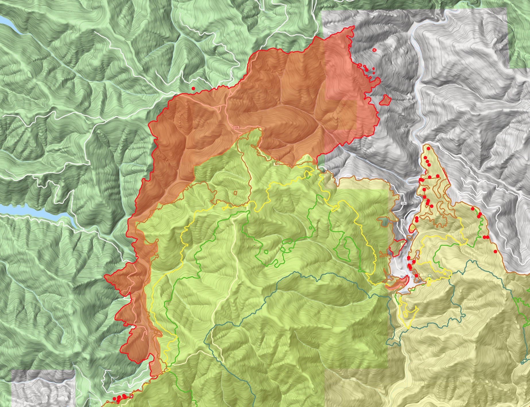
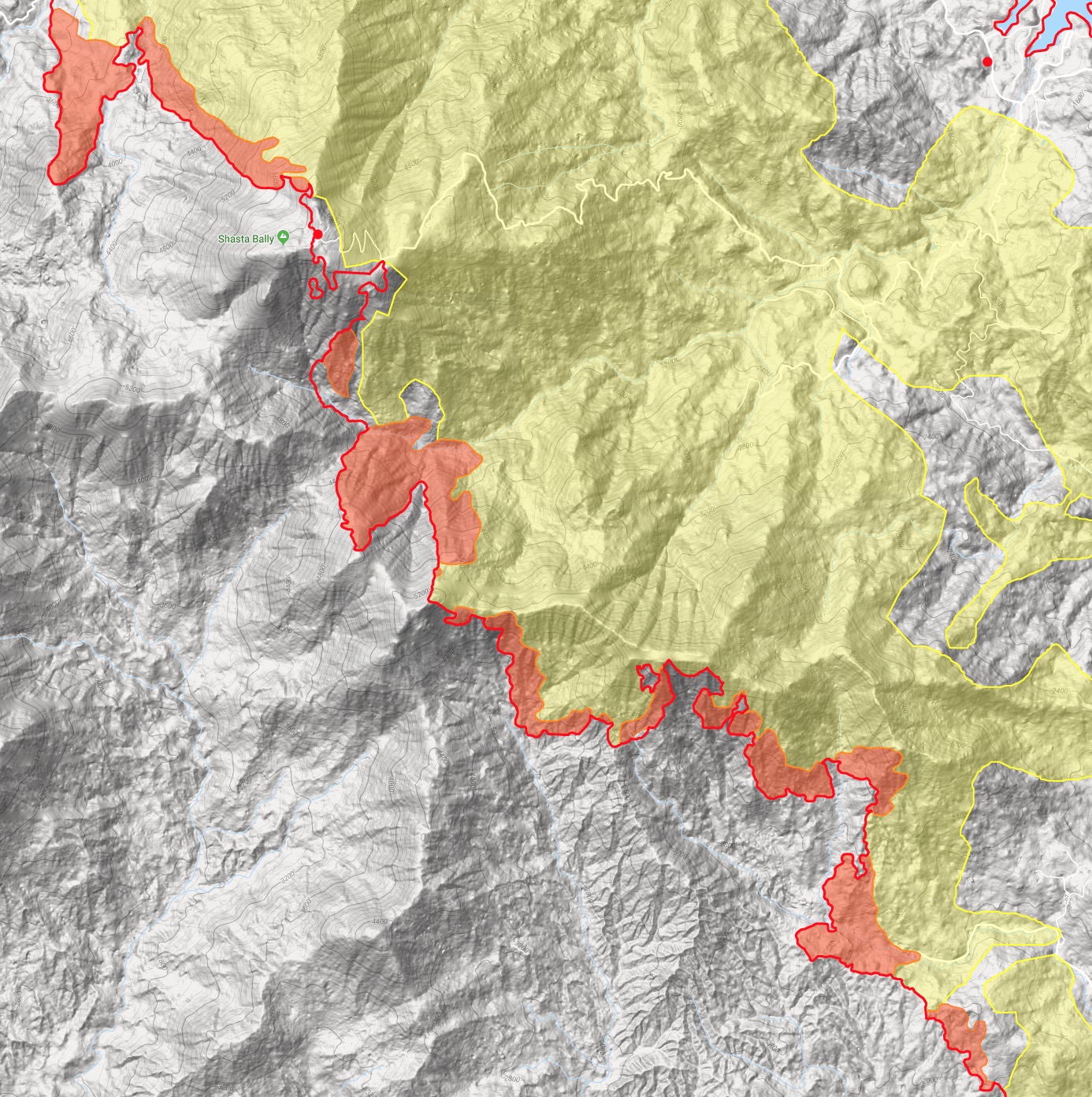
Div Y - above Igo and Ono. Lots of iron work still, with some T1 copters able to get over and help out. Slop overs on some ridges that dozers are trying to line out, with plenty of frustration out there. The copters will slow that down and buy them some time to catch it. They’re putting up a good fight for sure trying to line that area out. A lot of work to go. Sounds like upper Eagle Creek drainage, east of Rector Peak. The fire will eventually make it into lighter fuels around Rector Peak from the 2008 lightning fires. If the fire doesn’t cooperate in the Eagle Creek area, they mentioned looking at a firing op to bring the line down to the southwest, “probably a shift or two out though.”

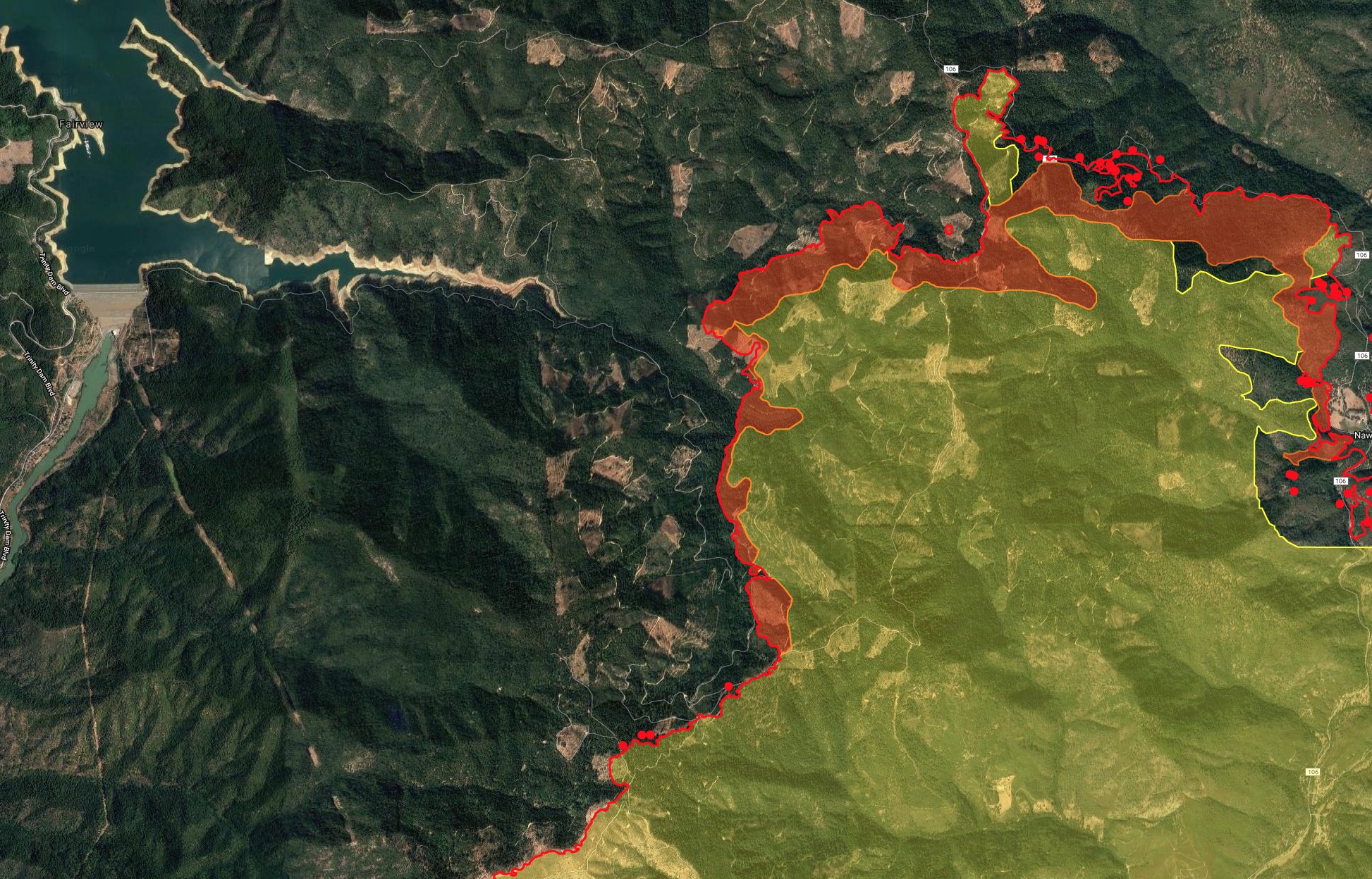
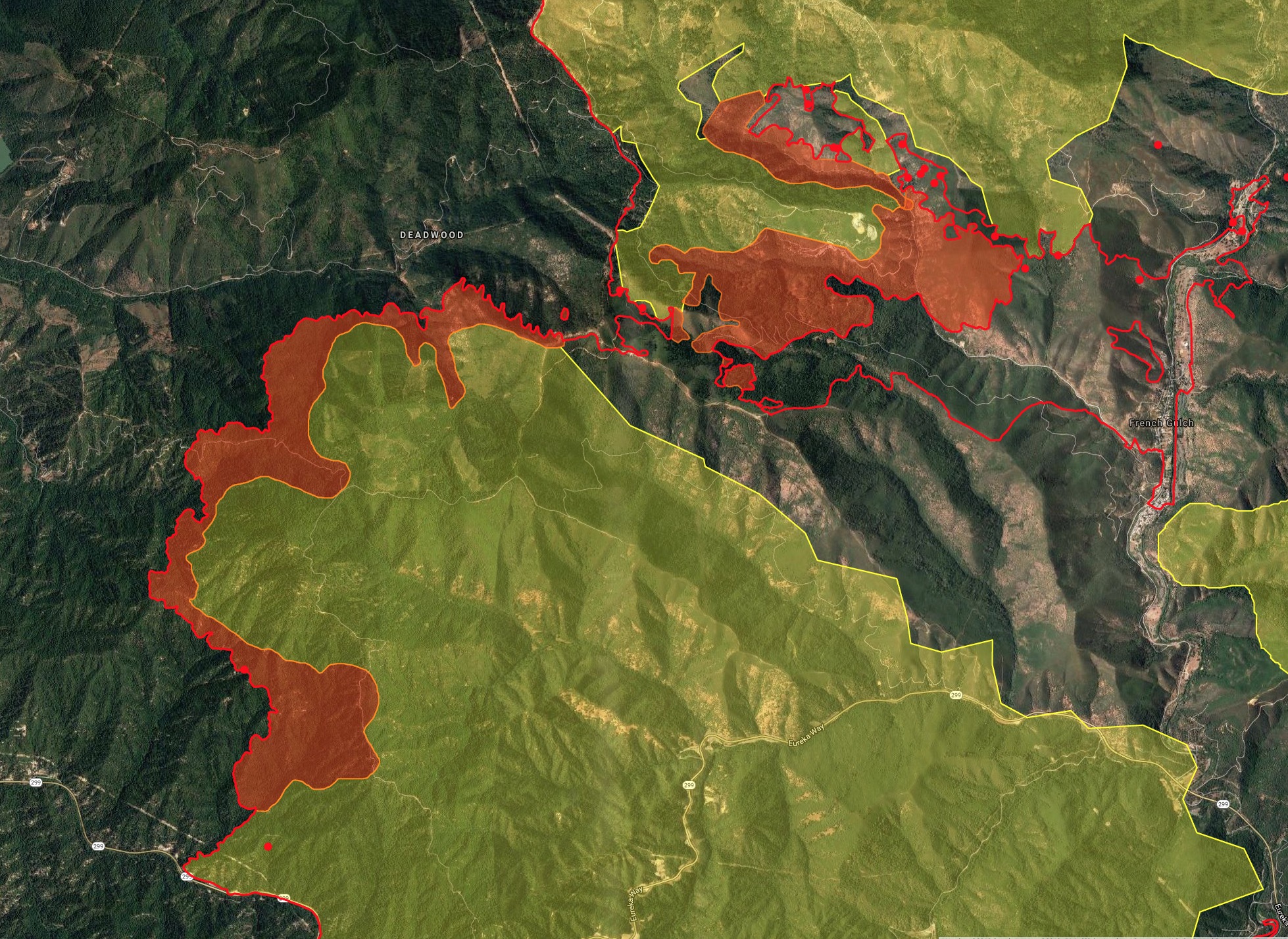
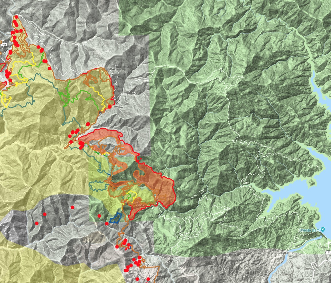
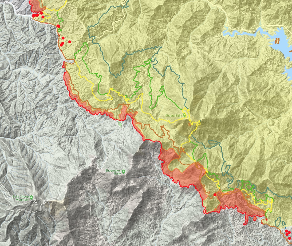
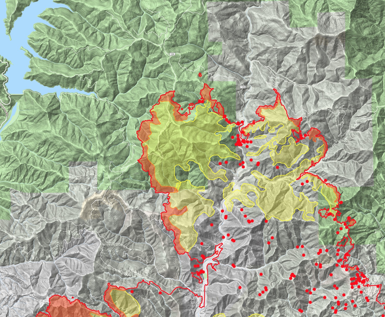
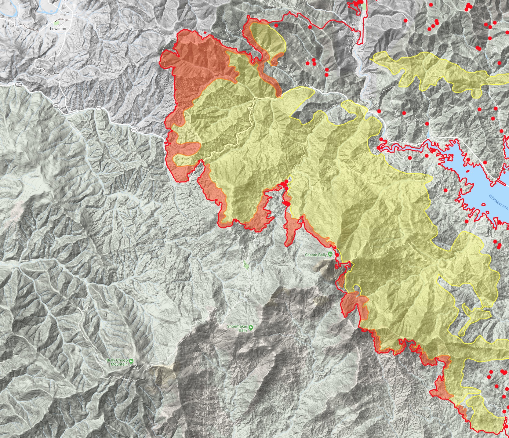
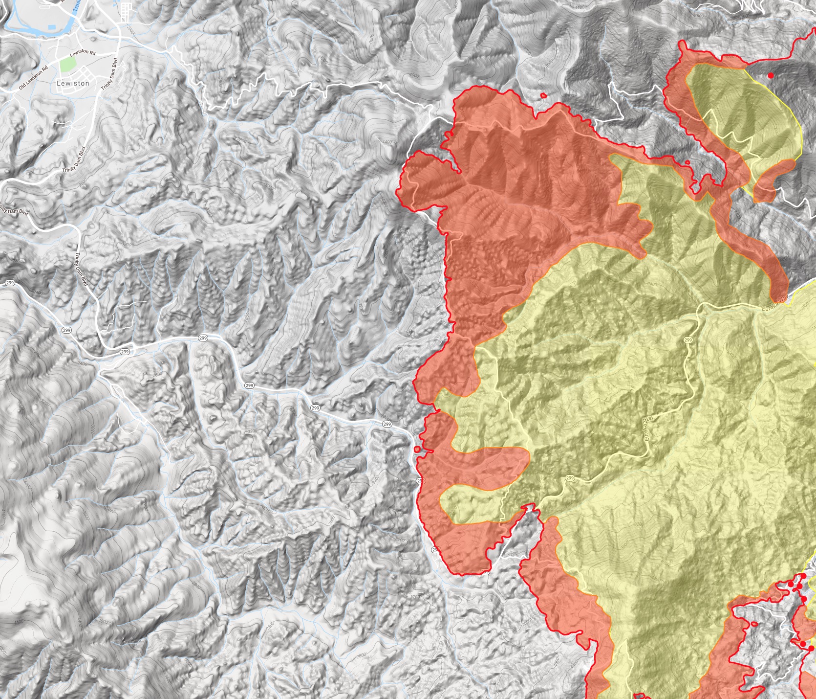
Div C - last report of the night from Air Attack sounds like fire slopping over County Line Road south of 299 is looking real good and if it all behaves tonight, possibly fire off Grass Valley Road to tie it in. (I missed the exact tactic, wasn’t ready for AA to announce this, it’s either holding at the road, or well above the road and will fire from road later if it behaves.)

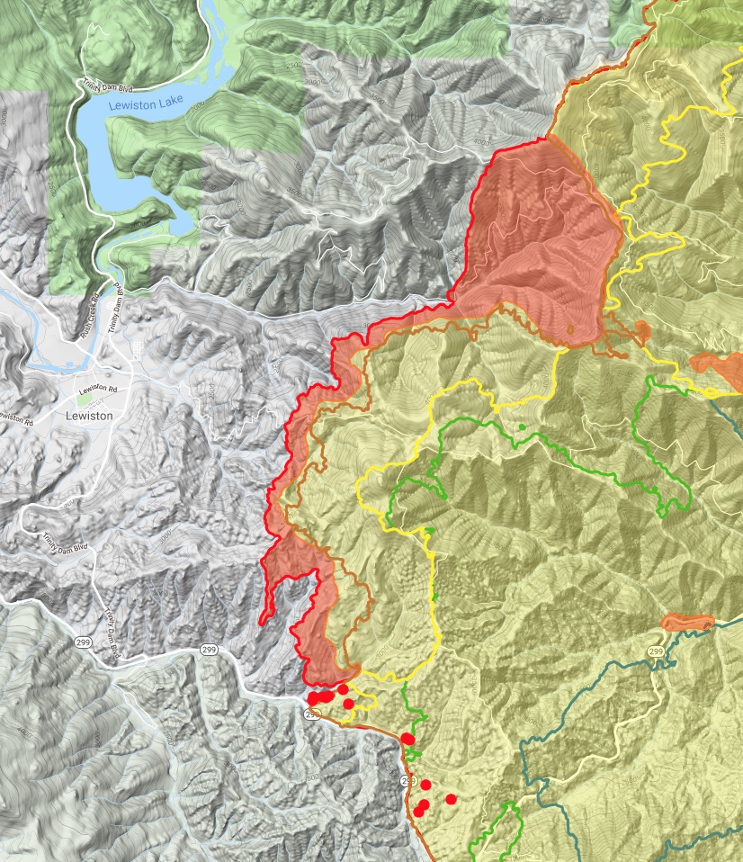
Div F - County Line Road above 299, AA reports the line is holding so far and looking real good. They might not have to utilize the contingency down into Lewiston. Strong work @FireBCKev and others!

16 Likes

Last night’s IR acres were 112888. IR maps and data:
https://ftp.nifc.gov/public/incident_specific_data/calif_n/!CALFIRE/2018_Incidents/CA-SHU-007808_Carr/IR/20180731/

Today’s maps:
https://ftp.nifc.gov/public/incident_specific_data/calif_n/!CALFIRE/2018_Incidents/CA-SHU-007808_Carr/GIS/Products/20180731/

Today’s IAP:

The Record Searchlight is reporting that as of last night thos is the 7th most destructive fire in California history. I believe that damage inspection is still in progress, so that may rise.

2 Likes

Heading back out to Div. F. The division has moved up the line north of Hoadley Repeater. I’ll try and get some pics of it while we’re up there for the radio folks on here. Where it slopped over the line on us the day before yesterday is now Division D, from DP 55 at 299w and buckhorn summit up to the Hoadley Repeater.

6 Likes

IR maps from last night about 8:30.

3 Likes

Damage assessment map by Cal Fire:

http://calfire-forestry.maps.arcgis.com/apps/PublicInformation/index.html?appid=5bbcbed430ad45e5a38e6be155ef5fec

Assessment is ongoing.

5 Likes

1330: Getting copters up, with a long southern route around the smoke to get back up onto the Trinity/west side of the fire. AA ordering up four T1 tankers to the west side as well. MEU-Complex just ordered up a similar order plus VLAT’s so it’ll be a competition on resources. With that intel, AA ordered up 3 scoopers as well incase the LAT’s don’t pan out. Their priorities will be the slop overs over County Line Road in Div C and D.

Spot fire outside the line in Div T, just west of Mary Lake Subdivision. Resources enroute. (in the area nothing found)

Not much else at the moment. Heard mid-morning a dozer plan on the south side in Branch 2 to get a line dug from Shoemaker Bally over to Little Baldy, following the 5200ft contour line. It’s refreshing to look at today’s Ops map and see more and more completed dozer line.

Also heard Fireboat 8845 working with Division H (Trinity Lake, Dam and Papoose Arm area). I wonder if the ICS-204 has a provision for fireboats? :thinking: haha

10 Likes

1400: Copters can’t get around the smoke around the southern route. Weaverville Helibase just came online at the airport. If they could just get around the smoke, I’m sure a lot of rotary will migrate over there in this or the next operational period.

3 Likes

1600: Change in the dozer operations in Div Y and A. Fire’s not letting the original dozer plan from Shoemaker to Little Bally do its thing. (refer to Branch II Ops map, Div A and Y) New plan is to bring iron down from Shoemaker Bally (T31N 7W S6), follow the ridge down sections 6, 8, then 18 and tying into the road system in Sec 19. This will be just north and west of Rainbow Lake.

Some more iron work have been successful pushing north into section 11 around Eagle Creek under Little Bally. Some more iron work successful in Sec 21 around Ducket Creek.

I’ll be on minimal intel rest of afternoon and evening.

11 Likes

Latest IR acres 121049. IR log, maps, and data:
https://ftp.nifc.gov/public/incident_specific_data/calif_n/!CALFIRE/2018_Incidents/CA-SHU-007808_Carr/IR/20180801/

Today’s maps:
https://ftp.nifc.gov/public/incident_specific_data/calif_n/!CALFIRE/2018_Incidents/CA-SHU-007808_Carr/GIS/Products/20180801/

Today’s IAP:

5 Likes

IR mapping of the West and North sides of the fire from last night about 11:45.

5 Likes

Fire making runs in Div, foxtrot, hotel, and mike/oscar, over containment lines, and more than likely spotted over honeymoon ridge, which was the contingency

6 Likes

Capping out in 4 different heads (west, north, northwest and southwest.) Div M/O have all resources pulled out, accounted for andnin safety zones, and trying to move some parked transports out of the way. Sounds like Div F/H were pulling back as well.

8 Likes

Here are IR maps from about 11pm last night.
Colored lines show daily growth over last 4 days.
Data source: NIROPS

7 Likes

Not confirmed from troops on ground, but fire may be getting active again this afternoon

1 Like

Per the scanner, Div O troops pulled back to DP 37.

2 Likes

My husband is over there and yes it has

2 Likes

Not much working as far as air craft goes.