
It’s getting it. From ICP
1 Like
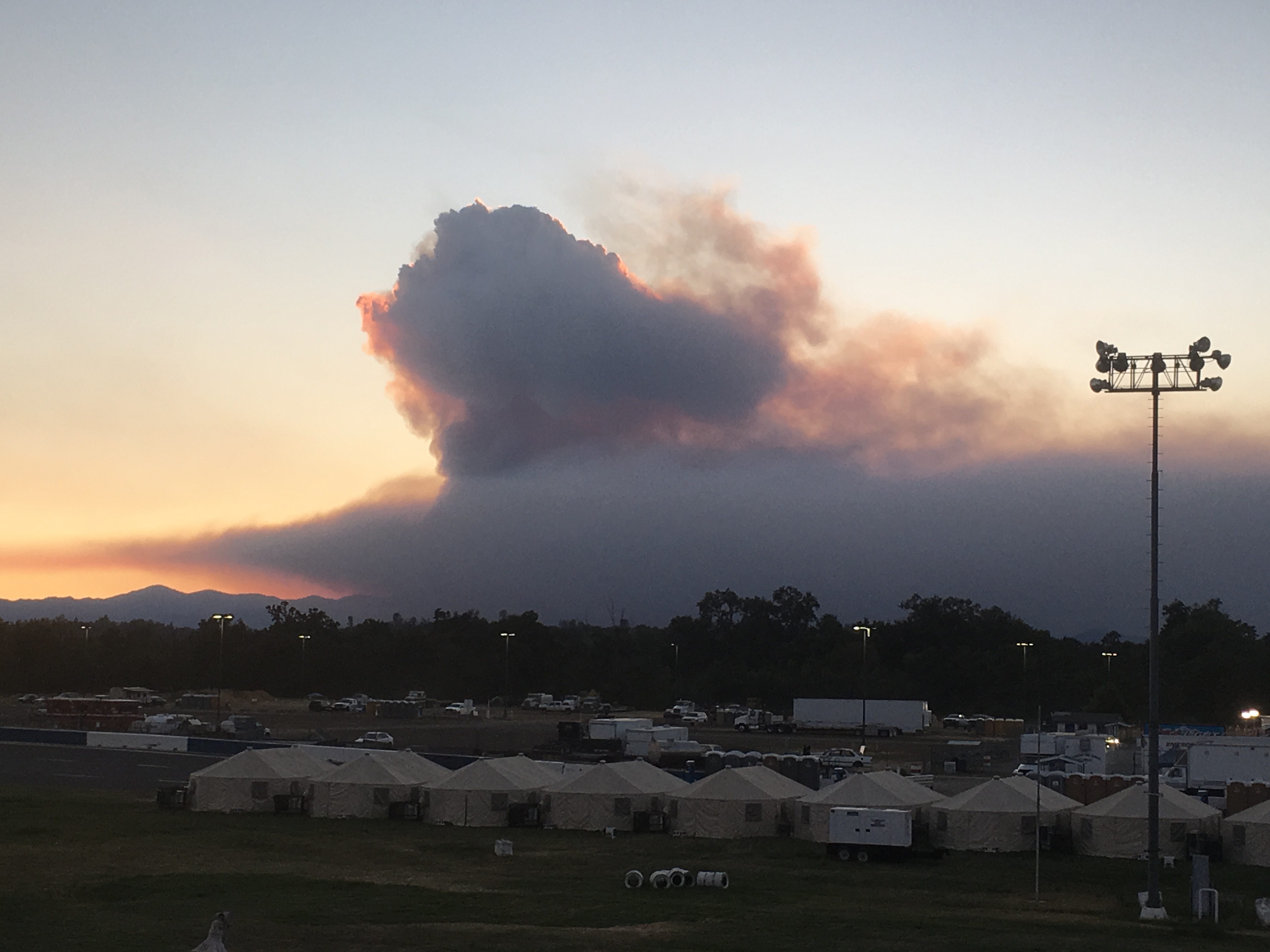
Last night’s IR puts it at 160049 acres, with roughly 15000 acres of growth:
https://ftp.nifc.gov/public/incident_specific_data/calif_n/!CALFIRE/2018_Incidents/CA-SHU-007808_Carr/IR/20180805/
Today’s IAP:
Today’s maps:
https://ftp.nifc.gov/public/incident_specific_data/calif_n/!CALFIRE/2018_Incidents/CA-SHU-007808_Carr/GIS/Products/20180805/
1 Like
Last night’s IR shows 4364 acres of growth:
https://ftp.nifc.gov/public/incident_specific_data/calif_n/!CALFIRE/2018_Incidents/CA-SHU-007808_Carr/IR/20180806/
Today’s IAP:
Today’s maps:
https://ftp.nifc.gov/public/incident_specific_data/calif_n/!CALFIRE/2018_Incidents/CA-SHU-007808_Carr/GIS/Products/20180806/
Evacuation and depopulation map:
http://nifc.maps.arcgis.com/apps/webappviewer/index.html?id=cdd41ecf8575458ea8851c6f76770d50
As of last night, CAL FIRE’s website is reporting:
|Total Fire Personnel:|4,766|
|Total Fire Engines:|390|
|Total Fire Crews:|81|
|Total Helicopters:|16|
|Total Dozers:|123|
|Total Water Tenders:|99|
http://www.fire.ca.gov/current_incidents/incidentdetails/Index/2164
3 Likes
163,207 acres - 45% contained
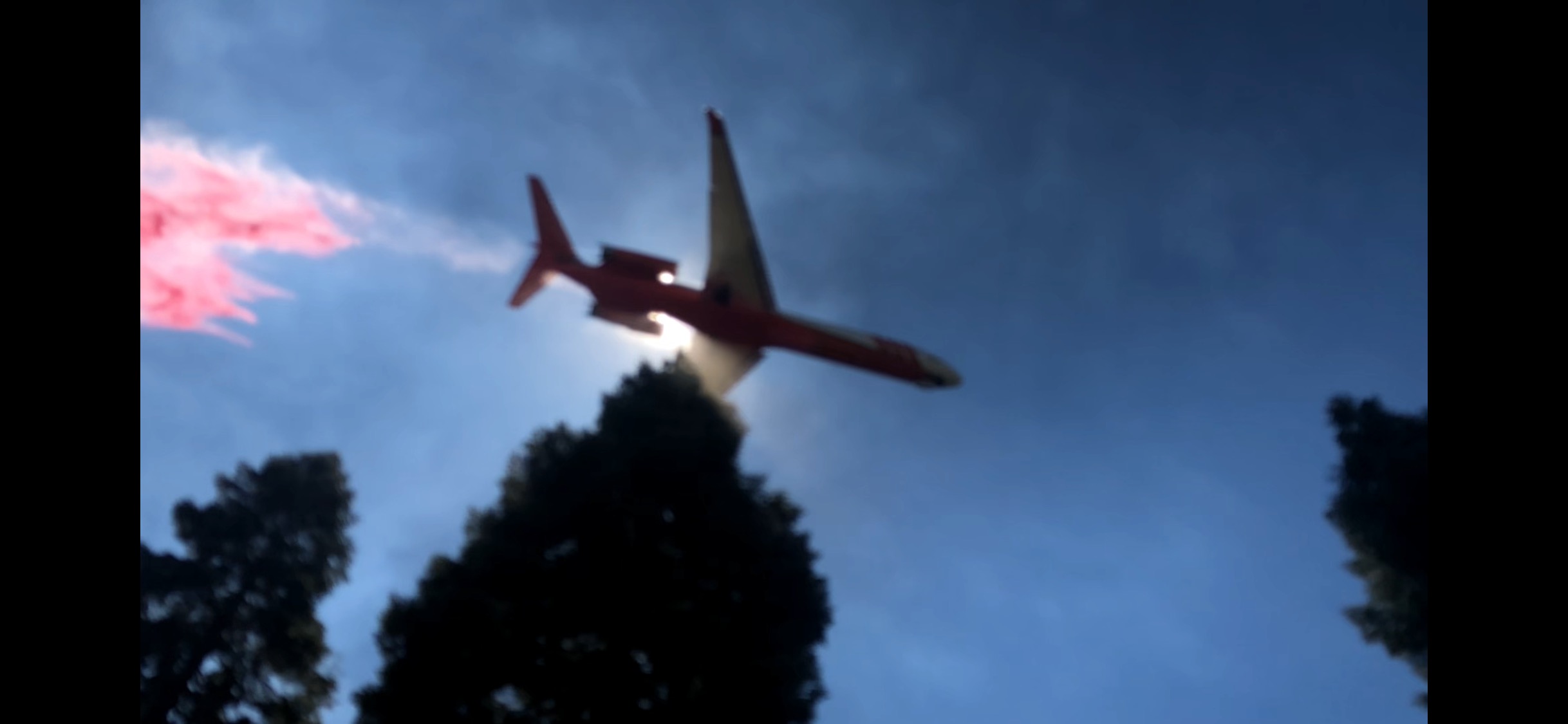
Div B on the Trinity side south of 299, in the Little Grass Valley creek drainage, is the current highest priority on aircraft at the moment. Four LAT’s and two VLATs painting the line and doubling up everything in anticipation of critical winds coming up soon. My brother is on the ground there trying to accomplish something in between the air salvos. Haha.
4 Likes
One of our strike teams was on Bravo yesterday and apparently they spent the shift holding for a burn, I’m assuming from the dozer line on the map. Talked to them this morning while they were still holding while the relief was on its way out, around 9am. They said there was a pretty good column coming up from a ways further back towards the beginning of the burn. Don’t see any other contingencies on the map if I’m oriented right - speaking from the ignorance of the station…
2 Likes
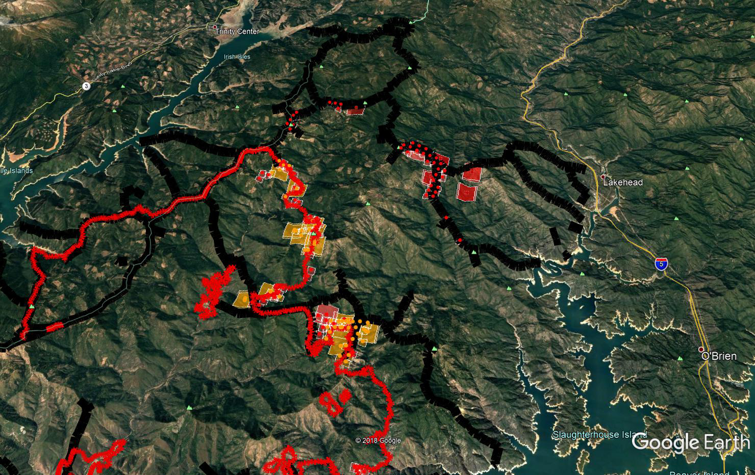
Here are the firelines from Carr overlaid on the IR map from last night.
http://www.firemaps.us/files/carr.html
Kudos to the mapping folks on CAL FIRE IMT 1 for all of the work compiling this info and sharing it online.
4 Likes
Does anyone know if Hwy 299 is still closed?
Yes, west of Redding just short of WhiskyTown is residents only. The remainder is still closed
Thank you for that. My mother in law lives near Lewiston.
Remember that there is a separate thread for questions and discussion. I know on the old site, they were very picky about such things.
New growth, as of last nights IR, was 7642 acres. IR maps and log:
https://ftp.nifc.gov/public/incident_specific_data/calif_n/!CALFIRE/2018_Incidents/CA-SHU-007808_Carr/IR/20180807/
IAP:
Tuesday’s “What We Know” article from the Record Searchlight:
5 Likes
Sounds like a pretty good day on the fire. Quick update for the night:
- Div B (above Shoemaker Bally in Trinity County): Plan and prep all day for firing ops. Starting firing ops now with favorable conditions.
- Div A (below Shoemaker Bally in Shasta County): Lots of good work in there per Helco.
- Div Y (above Ono between Rainbow Lake and Igo): Also lots of good progress, everything still in check. If all goes well should be starting some firing operations tonight as well to bring fire to the line.
Lots of utility work with PGE and subcontractors replacing poles, towers, and restoring many spans in the area.
7 Likes
Has anybody either witnessed today’s activity or have good local knowledge of the activity since yesterday’s update?
Fed resources began burning operation on the north lines near Lakehead this evening.
3 Likes
The updated modis thermal map shows spots on the northern end. Any updates from troops on the ground? Burn op?
Hope I posted this correctly…
https://m.box.com/shared_item/https%3A%2F%2Fwww.box.com%2Fs%2Fdo2rhtx0zkylf0ppl4r0
Massive firing op in anticipation of the red flag winds. Firing went well, hope it holds.
1 Like
Here is this morning’s perimeter, MODIS/VIIRS hits and the dozer line they’re working with on the north end. It is a combination of excellent data from the incident that paints a great picture of what’s going on. You can see the large open line there west of Schell Mtn, and the dozer line along Backbone Ridge that they are firing off, including other ignitions it appears off of Blue Mtn.
4 Likes