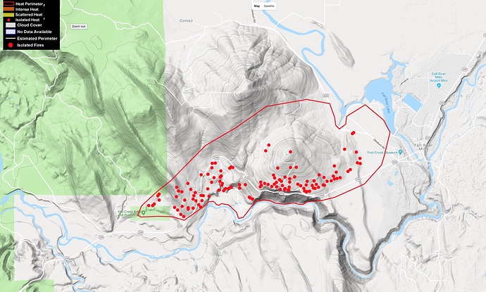
It looks pretty much done on the IR.
1 Like
1900 acres 25%
Between the fuels in the those mountains and the weather conditions it’s still a significant threat.
As a retired SitStat (CalFire IMT 3) I am a little suspicious of the lines and acreage on this map. My guess is that later maps will show a little more topographical influence.
This isn’t a criticism, just an observation. I put out plenty of maps in the early stages of a fire that were best guesses.
