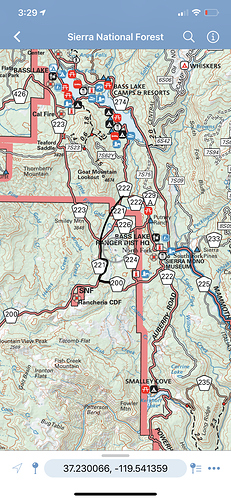
Anyone have an interactive map of the evacuations of North Fork? I know the intel but it’s really hard to pin point between all the roads. I am uploading a map which has some of the roads mentioned. Please send a link if you have an up to date interactive evac map.
Nathan Magsig posted a video from Auberry Rd at Musick Rd, showing Jose Basin in between Alder Springs and Meadow Lakes to be fully engulfed. This would include Acorn.
And we would find this video where?
Maybe this one? I tried To link it.
Thanks. FWIW it shows that I can’t see it due to MIME and unsupported format issues.
Found it on his facebork page.
Sorry, I couldn’t get the link to paste. Darned Mac!
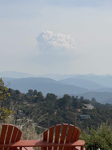
Dolan Fire I believe?
Or maybe 10 am toward creek?
MAYBE a cap visible across the Central Valley, but that whole lower column is visible. And shadows look like 3:30 pm of facing south.
Conducting a very large firing operation on the Dolan Fire today… would be the reason for the large column. Hope the lines hold otherwise we will have another Soberanes Fire in our hands.
It’s definitely a large operation from what’s visible
Folks holding at Sierra Marian, north end of Shaver off 168. https://twitter.com/MichelBrewer/status/1303094906223644672?s=20
Zoom Earth is showing CA smoke joining that of other western states and at 3:50 pm Pacific, it was just crossing the Mississippi border into Alabama. Jeeze.
At the 17:40 timestamp you can see the large dust storm sweeping down from the north thought Wash and Oregon
Sounds like a bad situation up near lake Edison.
Per Fresno Fire Pio:
Currently 10 FFD units and one Clovis Engine are on scene at the airport, initial reports stated possibly 63 patients inbound, 20 potentially critical, Blackhawk helicopters are transporting 20 patients at a time to be transferred to EMS care and taken to local hospitals.
Update:
Updated information has reports of a military Chinook helicopter landing near Lake Edison to rescue people trapped by the Creek Fire. FFD and EMS units are on the ground waiting to receive and render care to all rescued individuals
According to all maps I’ve seen it isn’t anywhere near Edison yet. Do you know what this is about? Or is there an Edison Lake other than the one northeast of the current fire on the back of Kaiser Pass?
Wasn’t this yesterday? A Blackhawk can’t carry 20 people, please before we post let’s check the facts


