
Looking like two heads moving out???
http://beta.alertwildfire.org/region/sierra/?camera=Axis-KingGeorge1
That scar is 2002 Mc Nalley given the Chips had minimal effect on Dixie the only thing I would expect is a lower tree mortality but the fire will go through there.
3 Likes
I was on McNalley as a faller and we took out all snags 300" both side of the line, there were a lot still left in the interior. Plus that it has been almost 20 years, I agree that Mc will maybe slow this fire…but I have my doubts. I would not want to have to go into that area with all of the fire weaken trees and snags…hope that you are right that it slows this one
2 Likes
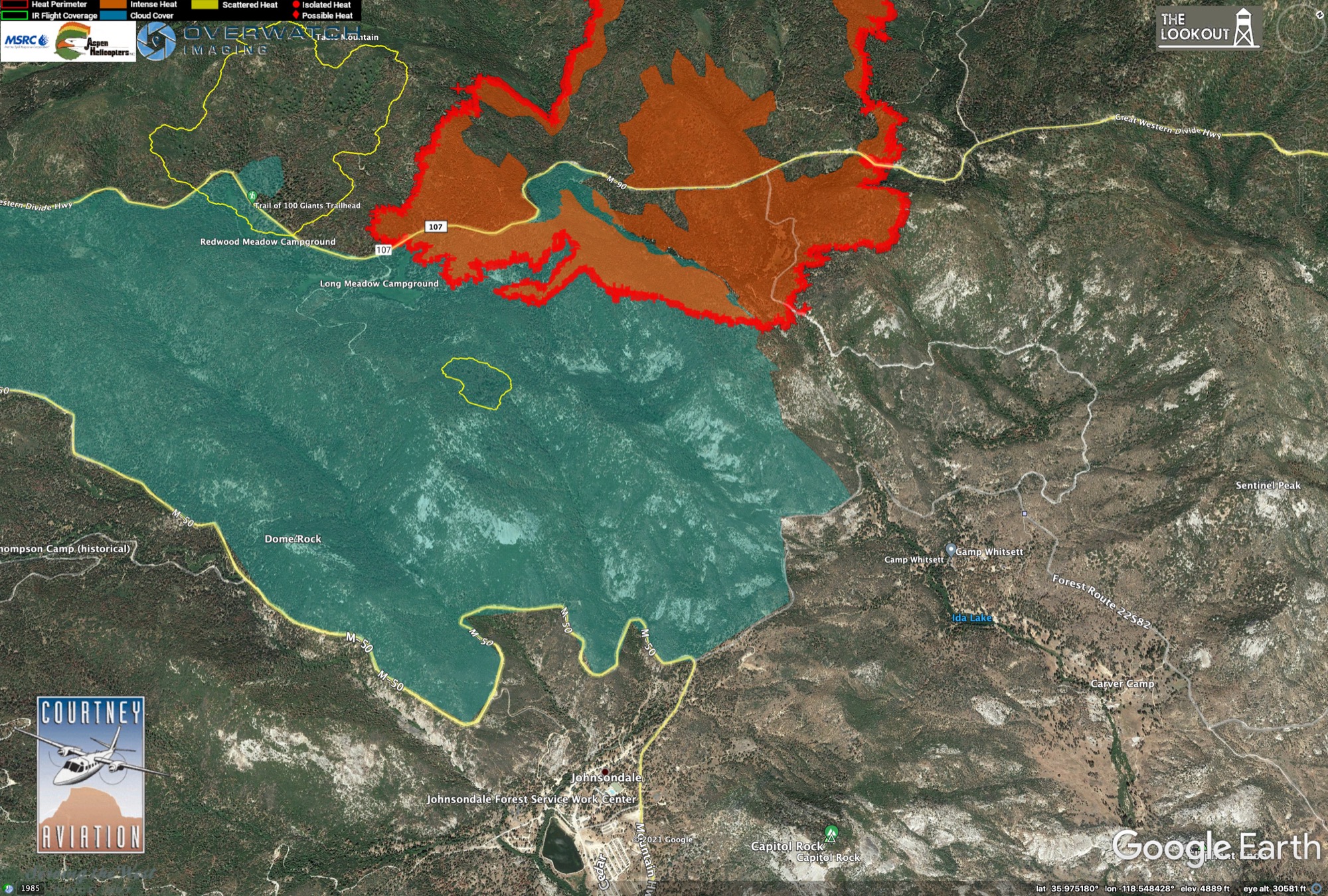
looking at the Tobias cam it looks like it starting to back down the ridge above the Divide highway by the Trail of 100 Giants trailhead.
4 Likes
Anyone have an idea how the 2016 Meadow burn between Johnsondale and the fire might help? What are fuels like in the 2016 burn, and how long do locals expect recent burns to be effective in reducing fire behavior on a backing fire?
I don’t know how current their data is. Menu on left has many vegetation variables to look at. It has the Windy fire perimeter which seems current.
Search for Johnsondale to zoom in.
Wondering if with the wind shift and where the column is building if the west side is picking up now as well? Looking at the Tobias and the Blue Ridge cams that seems possible.
1 Like
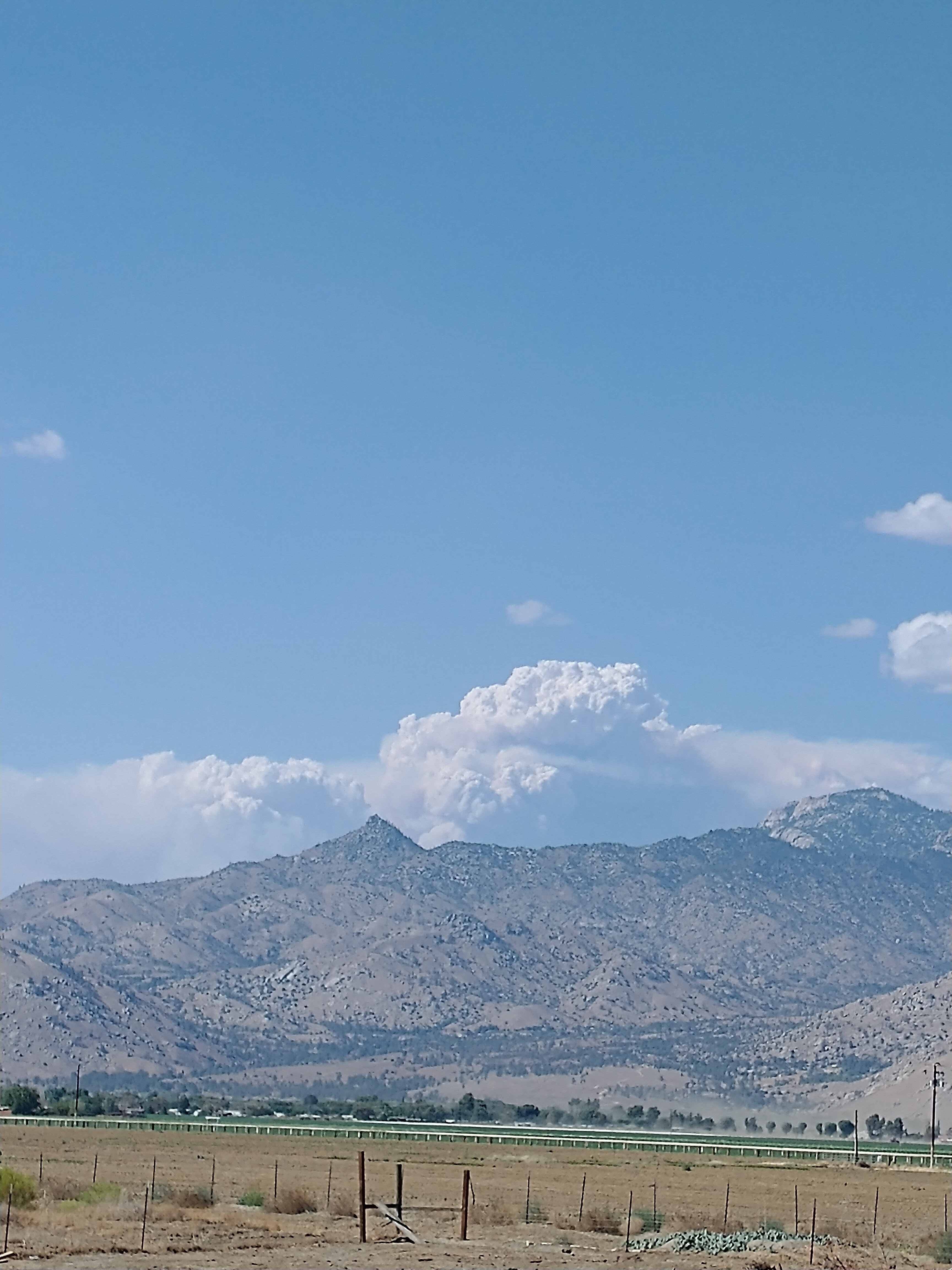
Windy AA over the fire… see what he has to say. I’ll update.
2 Likes
FIRIS Intel 24 also en route and I will post their data once uploaded.
FS units reporting spot into Windy Creek/South fork Tule rivers near Red Hill. Caltopo has that.
Not surprised as Colony fire on KNP is spotting northerly as well.
4 Likes
Windy AA over the fire… update with Lead Plane is to box in Peppermint Helibase.
1 Like
Not sure of accuracy but WIFIRE shows heat a little more than Caltopo
https://firemap.sdsc.edu/
1 Like
I think it was a slim chance that this thing didn’t run up to the top of slate mountain. Might just make it to last years burn scar.-- I wrote this shortly after you posted now it looks like that thing is going to make it to the slate/sqf complex by night fall.
Hey this is a pretty neat interface. I like that you can set it to show raws fuel stick, I don’t think caltopo does that. Is this from UCSD?
Glad you like and yes, UCSD.
Get the feeling the box is at the old fire scars boundaries?? Just an opinion.
Only dozer line showing is western flank Div.M and W.
1 Like
It’s looking that way.
1 Like
Right  I’m getting the same bad feeling.
1 Like