Helitanker 0HT is a exclusive use contract based at Millerton Lake. Normal “up” time is around 0900-0930.
ECC advised dry AA south’s ops offered up the VLAT. They came back with advising they’d take it. Sounds like it’s just now Enroute
WD report 7 fires now. Total acreage 117
ETA of 1130
Anyone know which VLAT is enroute?
911 out of SBD
New Incident: #DryCreekComplex Firefighters have been responding to seven different fires in the area of Dry Creek Road and Mile Marker 4 northeast of Woodlake. These began approximately at 6:43 this morning.
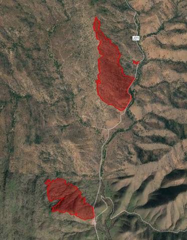
Four of the seven fires have been contained with three acres total between them. Currently, two of the fires have merged together creating the #QuailFire which is at 100 acres and 5% containment. The third fire, the #RobinFire, is at 60 acres with 10% containment.
CAL FIRE Tulare Unit is in command of this incident with assistance from CAL FIRE/Fresno County Fire, Tulare County Fire Department and Tulare County Sheriff’s Office.
Dry Creek Road is closed from Lomitas Drive to Stagecoach Drive in Badger.
The cause of these fires is under investigation.
Updates will be posted as more information becomes available.
CAL FIRE
AA 410 is reporting that the retardant line are being chewed through by the fire. Load and return.
This is probably the Crane and Quail that burned together.
I heard an Air Space Manager ASM ordered up.
A person on a weather blog I belong to says there have been no storms in the area with lightning. Can anyone confirm if there was lightning activity up that way ?
Between 15:00 and 16:00 UTC Blitzortung.org has activity show up. 8 hour record.
https://www.blitzortung.org/en/historical_maps.php?map=35:
Enjoy.
The fires all seem to have started along Dry Creek Road, from Intel 12 mapping @ 351 acres. So probably a human cause… maybe dragging chains or something.

@13:45 B77 lead Plane is load and holding the tankers after this last round of drops. VLAT boxed in one of the fires.
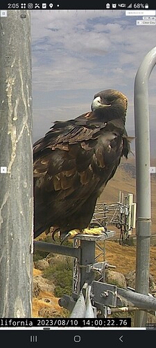
Deleted Buck Rock cam. Offline. Thanks, didn’t catch that.
YNP dispatching a fire, I didn’t hear a location and it’s not on CAD yet.
That camera is showing an image from 8/7 and buck rock 2 doesn’t have a view of that area.
Looking at local Doppler, can anyone confirm wetting rain over the incident?
wouldn’t be surprised if it rained. seeing reports of rain over North Fork, Eastern Madera County, Northern Mariposa County. not wetting per se though… lol
There was wetting rain in the valley to the west of the incident, so very likely there was rain on the incident last night.

