4 additional tankers filled with T72, T73, T75, T133
4 Likes
LAFD Dozer 42 (Caterpillar D-8R) Assigned and Responding from Sherman Oaks.
5 Likes
9330C is responding to the fire from an RRU cover assignment.
6 Likes
9166L just arrived on scene.
6 Likes
VNC TAC 4 - DIV M
VNC VTAC 13 - DIV S
VNC VTAC14 - Unassigned as of now.
DIV M requesting CNF E339 from LPF 54.
LAC Just dispatched a 2nd Alpha to form up at LAC150
5 Likes
LAC 1103A & 1120A have made the scene.
3 Likes
Cell phone contact with Patrol crew member. The fire has crossed Hasley Canyon Rd. New set of problems that will affect Castaic. Very brisk west winds too.
3 Likes
Yea, LAC AC9 requesting more resources for imminent impact in Hasley Cyn.
3 Likes
Request for 3 type 1 crews and 2 Charlie strike teams to operations for division Charlie
4 Likes
Mapped at 1,700 acres
https://x.com/SOCAL_QRF/status/1953658457170882861
Live video: Watch: Water-dropping aircraft attack Canyon Fire – NBC Los Angeles
6 Likes
4,856 acres now.
6 Likes
VNC-CANYON OES Intel 24 has mapped the fire at 4856 acres at 2135 hours.
4 Likes
The fire has burned over 5 miles in 8 hours from the heel to the head, which is near Castaic High School.
4 Likes
WD showing 25% Containment. Good work. Unless that’s a typo.
5 Likes
LFD ST 1001A
(E7/E73/E75/E98/E105/BC2)
En Route to LACoFD Station 76 per Immediate Need Request
4 Likes
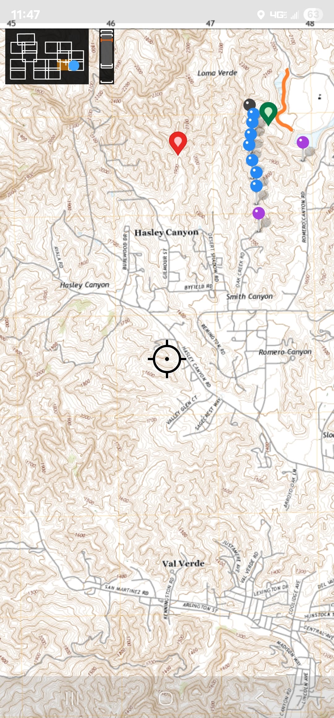
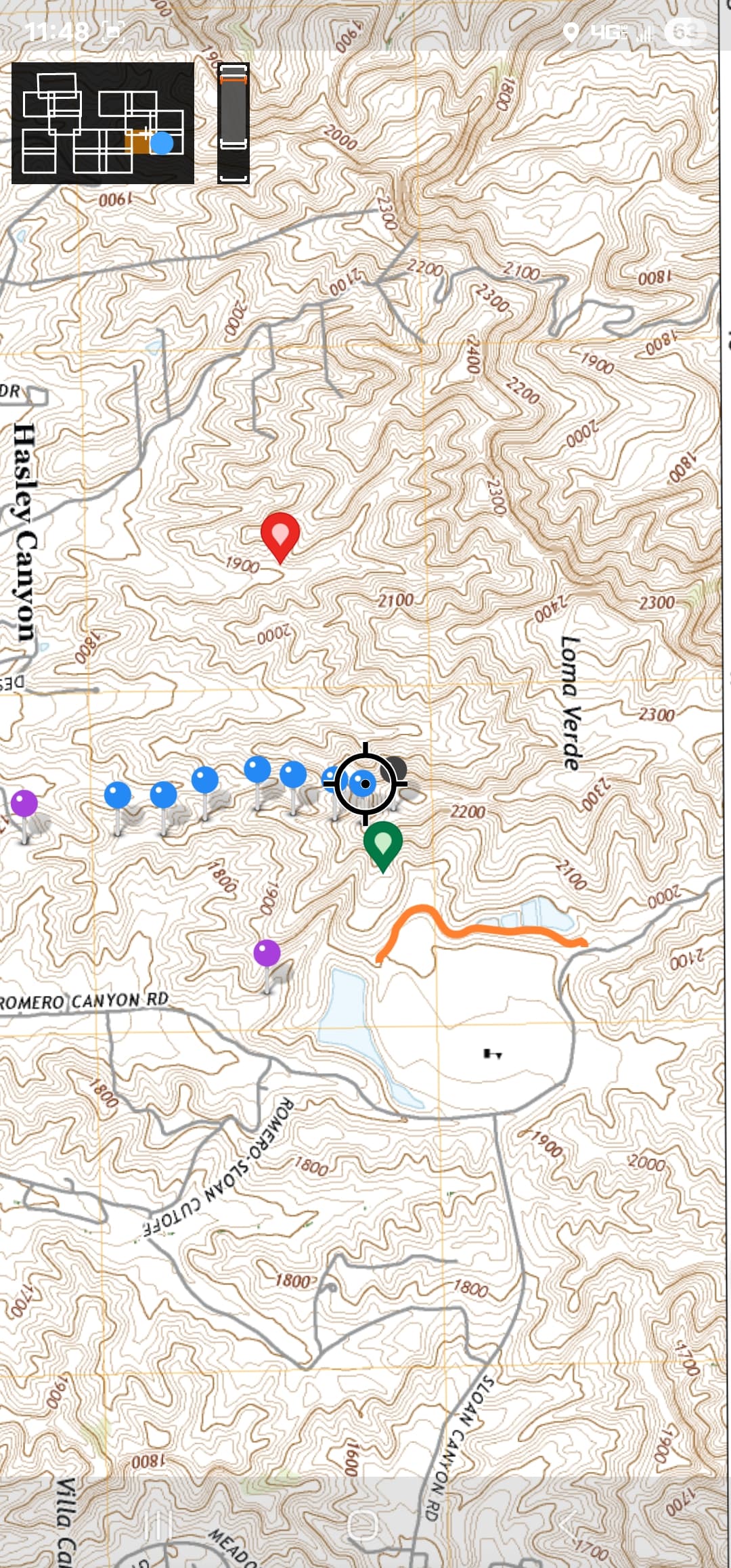
Please note Stone Creek Rd shows as Oak Creek on my map.
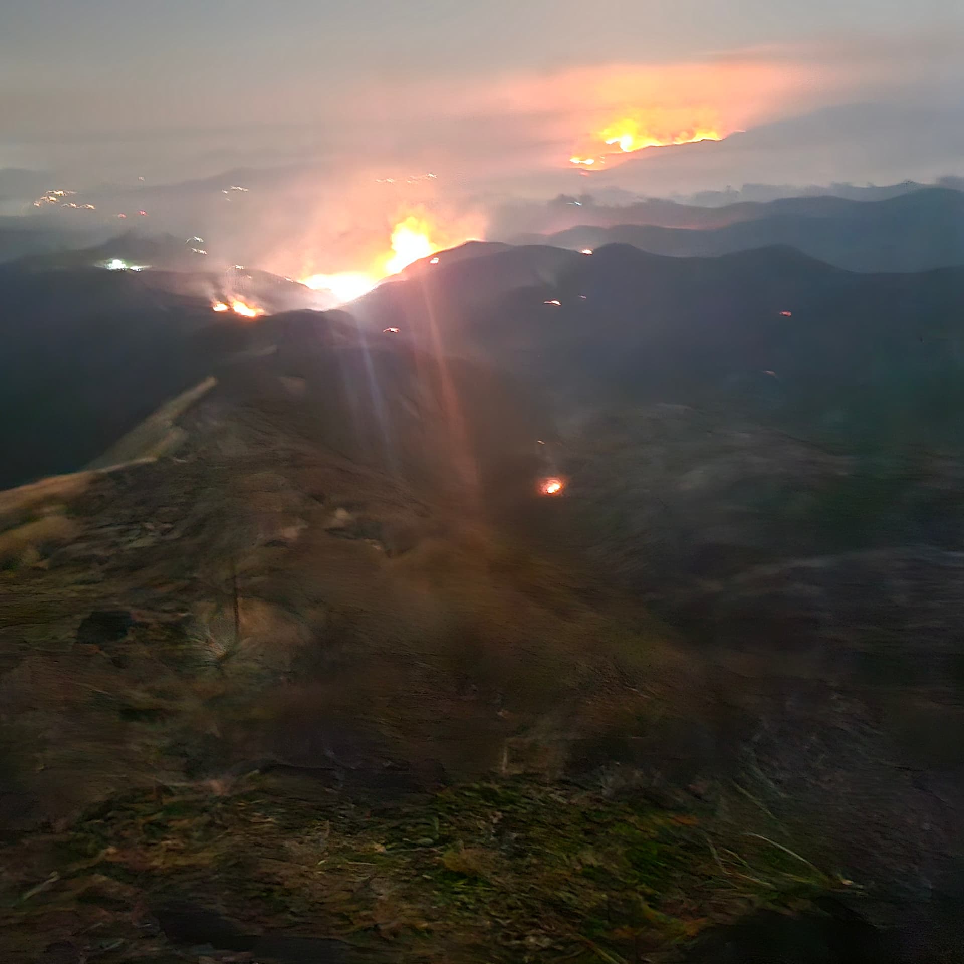
Lots of Dozer work done last night some direct and lots of indirect which is currently holding as fire bumps it in various places.
As the column was very active before sundown it cast embers and spots into drainages where the terrain is steep and fuels are intermittent.
This cuppled with shading from the column and night conditions resulted in what appears to be a dirty burn but in fact is just scattered spots near indirect containment lines.
I attached screenshot of the area that I was working so aside from traffic and visuals as I came off the line the verification of what I’m writing is specific to Div P as of 0800 this morning.
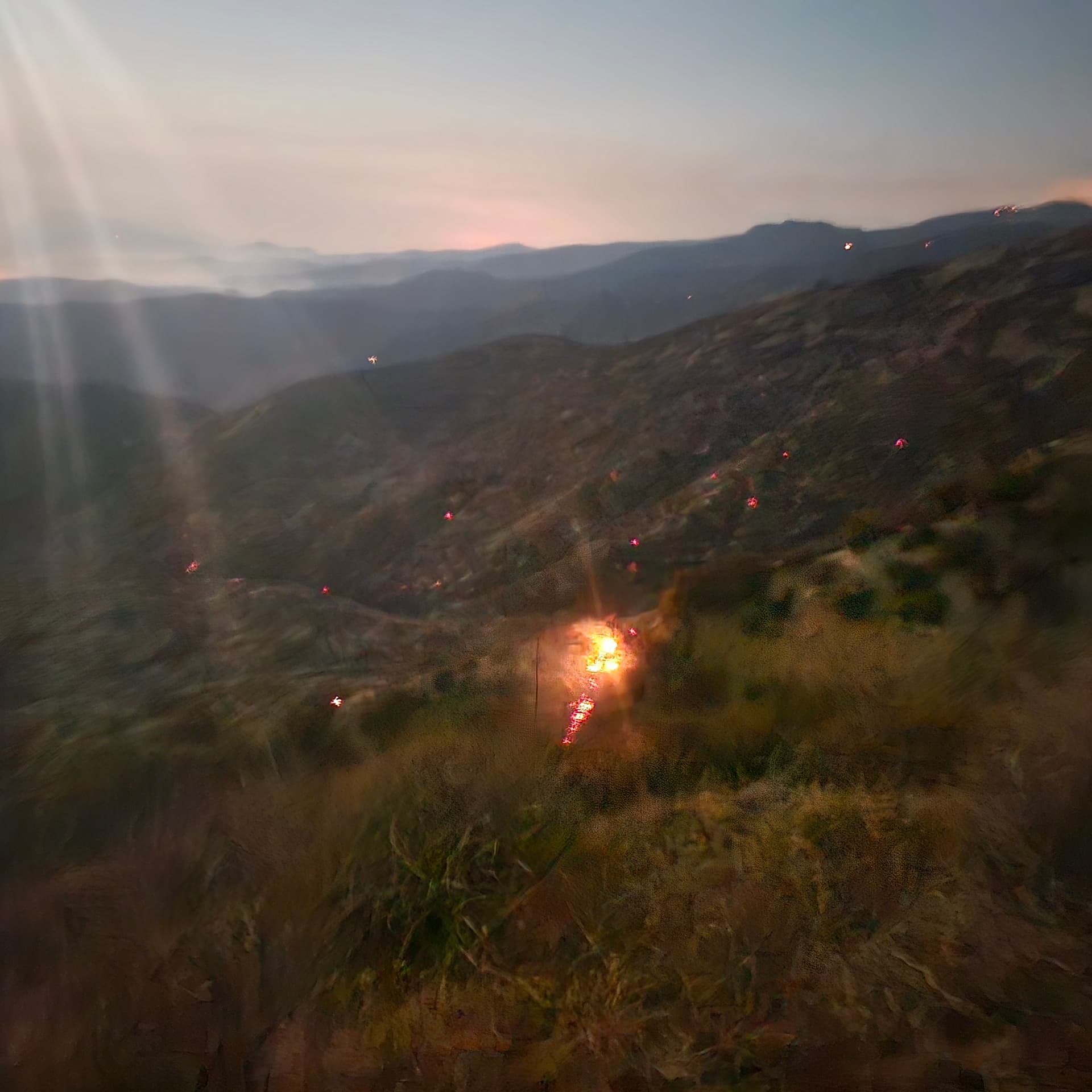
You will also see a picture representing the embercast into the drainage that is unburned but within the dozer line.
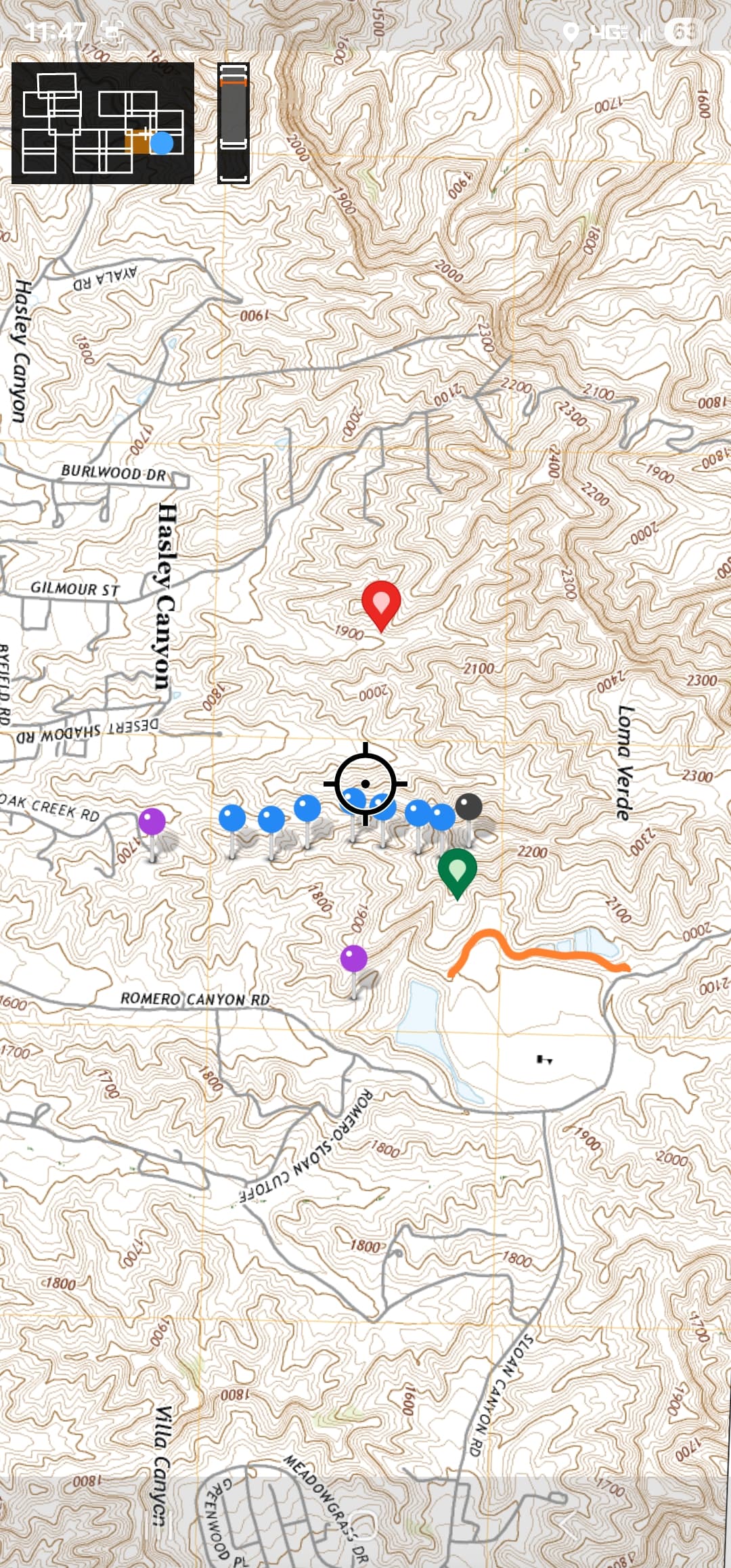
The blue pins are dozer line along the ridge that stretches from the end of Stonecreek Rd to Loma Verde at the peak closest to the High School. Where it hits the peak the black pin is solid edge and heading north from there its mostly direct dozer line to Romero Canyon Road to the north. There are few pockets of green eybrows near Romero Canyon road that are still cleaning up and are concerning due to the winds yesterday and the tight drainage that runs through that area.
Heading south through the blue pins is where the embercast is sitting in the drainage west of the dozer line all the way to Stone Creek where 2 strike teams of Charlie’s linked the line down towards Desert Shadow Dr and chased it towards Div S to tie into Hasley Canyon area.
I believe a big concern is the indirect stuff that can heat up in west of the dozer line and slopping over as well as the stuff furthest north near Romero Canyon.
Little to no handcrews available last night on the line so getting boots up those dozer lines will be pertinent today
.
10 Likes