Scheduled System outage during deadline hours.
The one thing I see on the critical resource needs (been on the list for days) that I find troubling is the NIFC Repeater System. We are only at PL3 and you can’t get critical communications equipment? I have seen this in the past, but we were at PL5 and many more fires nationally.
What’s going on in Boise? This is not a good sign. No communications, no engagement from a safety standpoint.
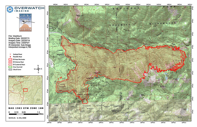
Will have an update pretty soon, firis Intel is mapping the fire.
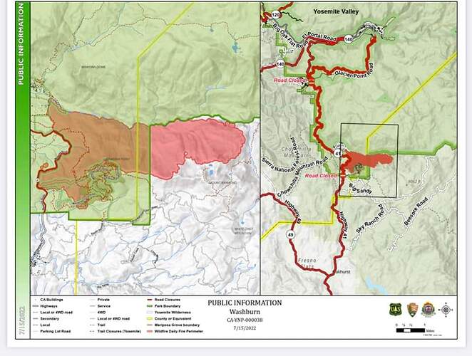
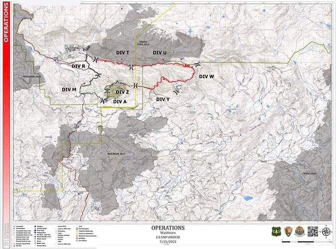
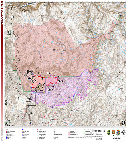
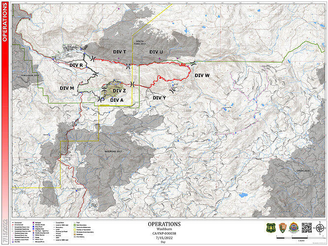
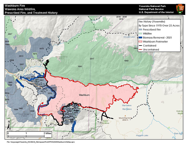
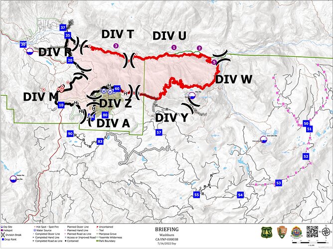
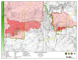
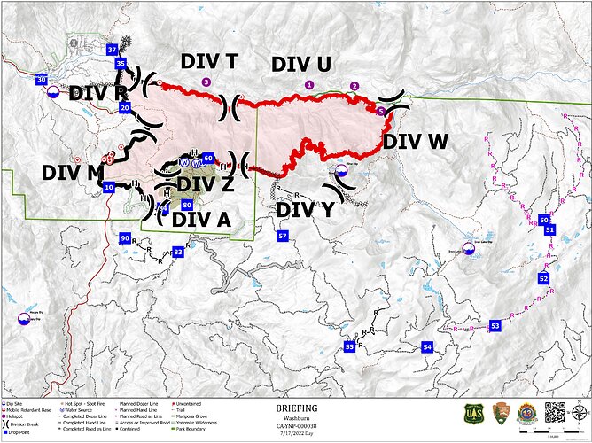
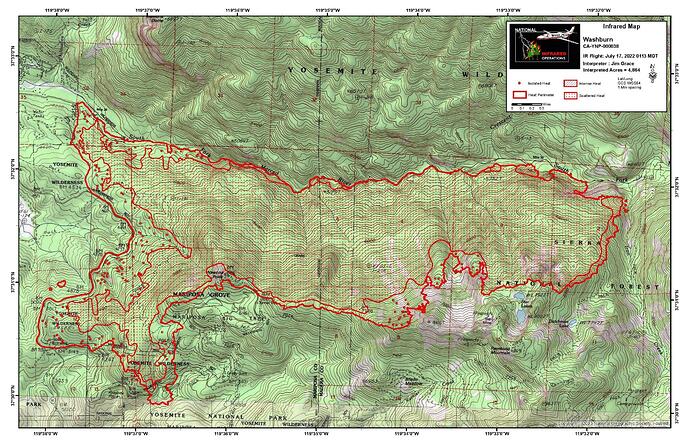
Resized - Mobile Friendly IR, Evacuation and Operations, & a new Fire History Incident Maps for 7/15/22, (no new 209 info this morning):
Between Helco and ground crews they see that the fire is up against the primary retardant line on the the slope above iron creek. Crews are making their way to engage that to help hold the retardant put in.
Crews are also working on the the contingency retardant line to cut line.
Last night community meeting video
Video update
I’m not sure why COMMS keeps getting listed as having critical needs. It was true early in the incident, but after two days of shopping the entire federal system and getting UTFd, they opened up to LG. The radio shop is full right now with 5 COMT’s, 6 RADOS, and we are getting full support from NIFC. All requested items have been delivered and we have solid COMMS, which will be improving today as soon as we can get a flight.
209 will be adjusted. All comms critical needs will be removed.
AA52 working with a helco and 2 helitankers. Someone just mapped the fire again, tail number bgr31. Not much else to report.
4776 acres and 35% contained.
It looks like they are doing better on resources and have what they need for current conditions.
PM 209 7/15 Info:
4779 Acres (+20 acres) @ 35% Contained (+4%)
156 Public/Civilians continue to be evacuated
23 Responders in quarantine
1623 Personnel assigned to the incident.
Continue to defend the primary control lines from Hwy 41 to the South Fork of the Merced River.
Threat Summary/Risk Information:
12 Hours: Secure direct handline along the western and northern edges of the Mariposa Grove. Protect the repeater at Wawona Point. Continue to prepare and defend the community of Wawona. Secure perimeters along Mt. Raymond Ridge. Scout opportunities of control options from Mt. Raymond to South Fork of the Merced River. Establish contingency lines from Hwy 41 towards Fresno Dome. Protect Buck Cabin and other remote cabins within the Sierra National Forest.
24 hours: Build contingency line from Hwy 41 through Long Valley, Star Mine, Fresno Dome, Grizzly Pass to Sky Ranch Rd.
Planned Actions For Next Op Period:
Continue to secure and reinforce the Hwy 41 corridor, Mariposa Grove Rd., and continue to construct handline and dozer line from Wawona Point to the west and north to South Fork of the Merced River. Protect remote cabins within Yosemite National Park and Sierra National Forest.
Critical Resource Needs: Continued aviation support
This evening’s update from South Ops News and Notes:
Washburn, Vegetation Fire, Mariposa County, Update Hwy 41 x Mariposa Grove Road, Fish Camp Federal DPA, FRA, Yosemite National Park ·
4,822 acres (+0 acres), brush and timber, 39% contained (+2% containment)
· Minimal fire behavior with flanking, backing and spotting
· Threat to critical infrastructure and Giant Sequoia grove
· Threat to the community of Wawona
· Mandatory evacuation orders in effect for the community of Wawona
· Repopulation begins tomorrow 07/17/2022 @ 8am
· Road, trail and campground closures in the area
No smoke plume this afternoon over the fire, although plenty of convective activity elsewhere… Didn’t hear any thunder tho…
Crews along Div.W reported lightning activity moving over the fire. Caution for down drafts. I didn’t hear any traffic other then storms were nearby.
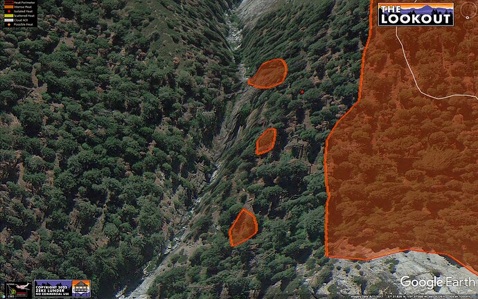
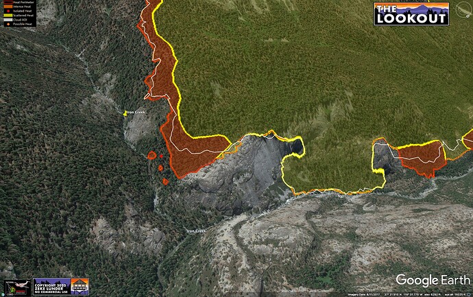
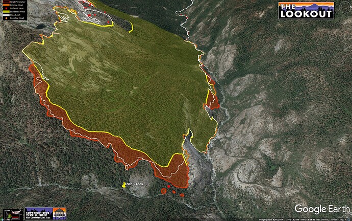
NIROPs IR mapping shows fire approaching Iron Creek just above confluence with S. Fk. Merced River at about 1am, 7/17/2022. White line shows 24 hr fire spread.
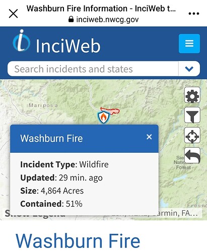
Size: 4,911 Acres
Contained: 50%
Video update
7.18.2022

