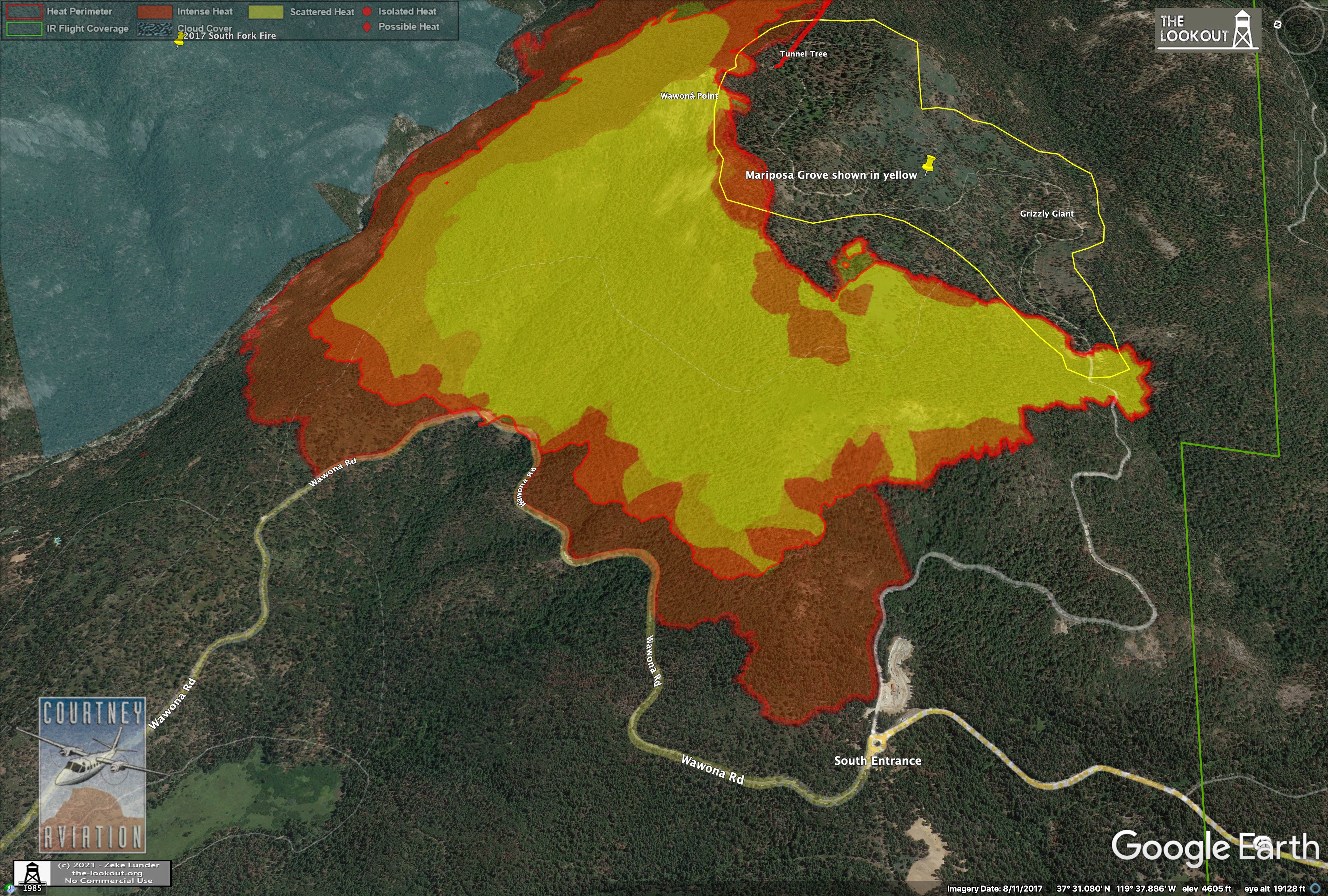
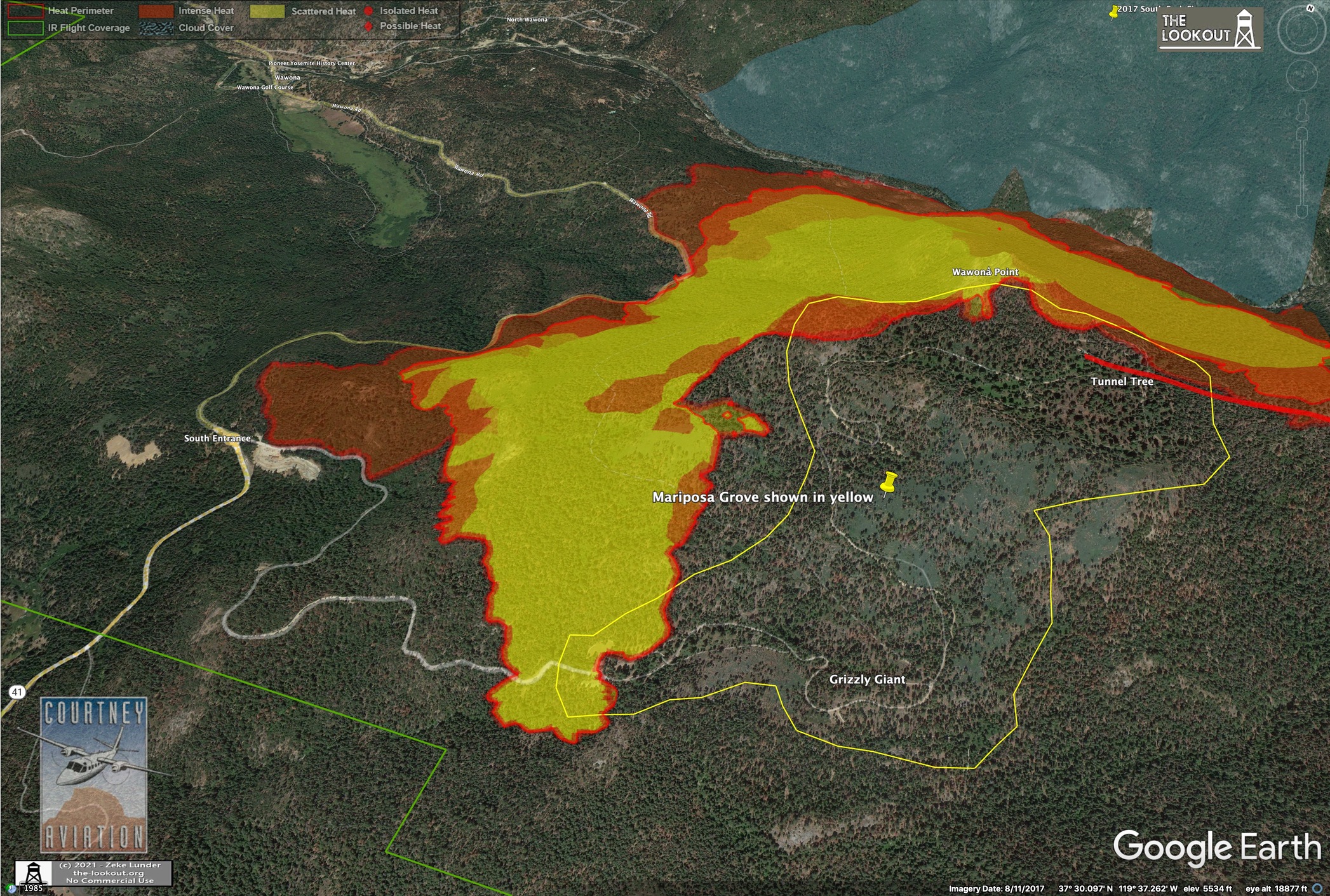
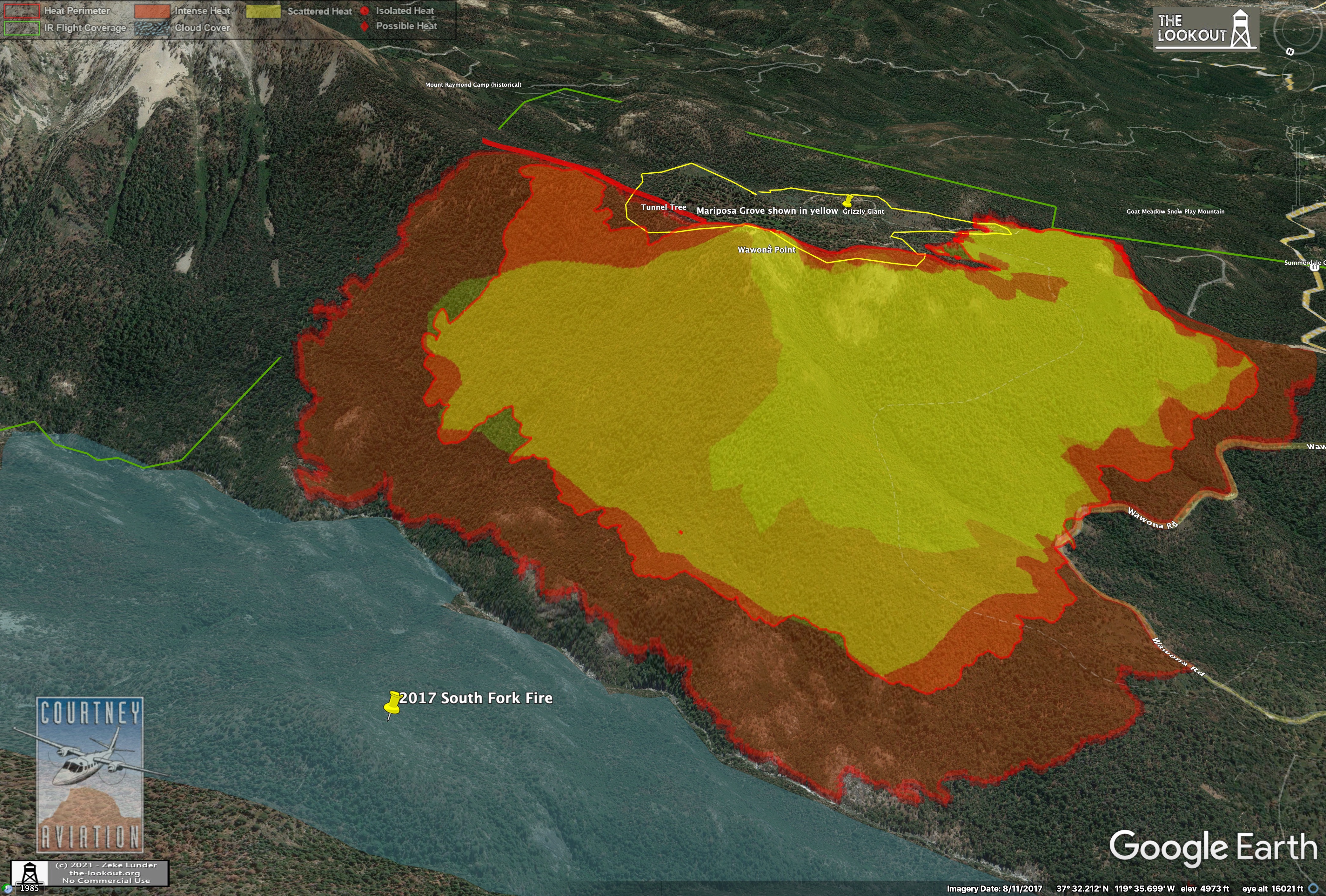
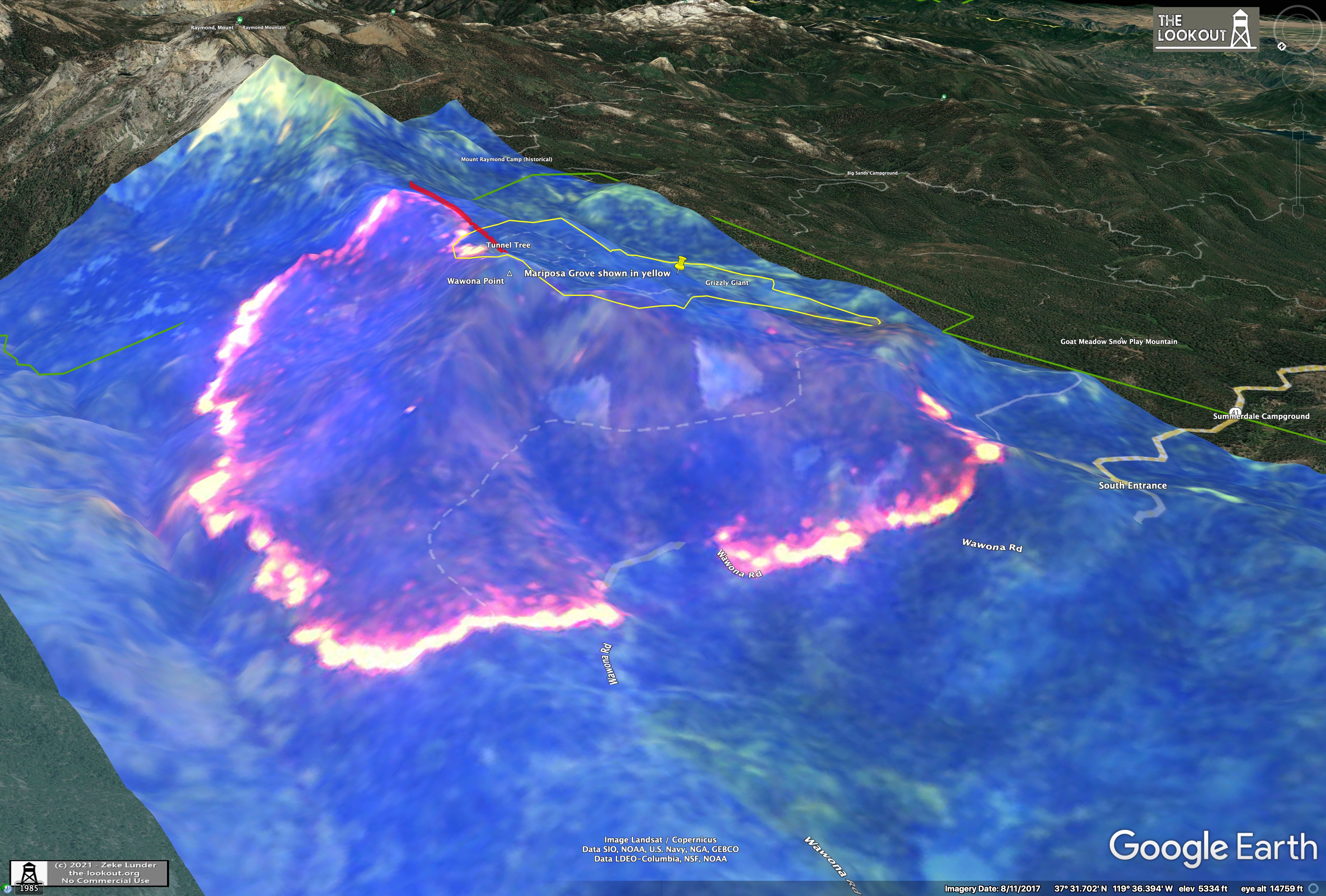
Saturday night (10pm) mapping of #WashburnFire shows despite very heavy helicopter drops yesterday, generally along the white line (fire edge 7/9 3:45pm), fire continued to back steadily toward S. Fk. Merced River and Hwy 41. Very minor spread into Mariposa Grove (yellow line).
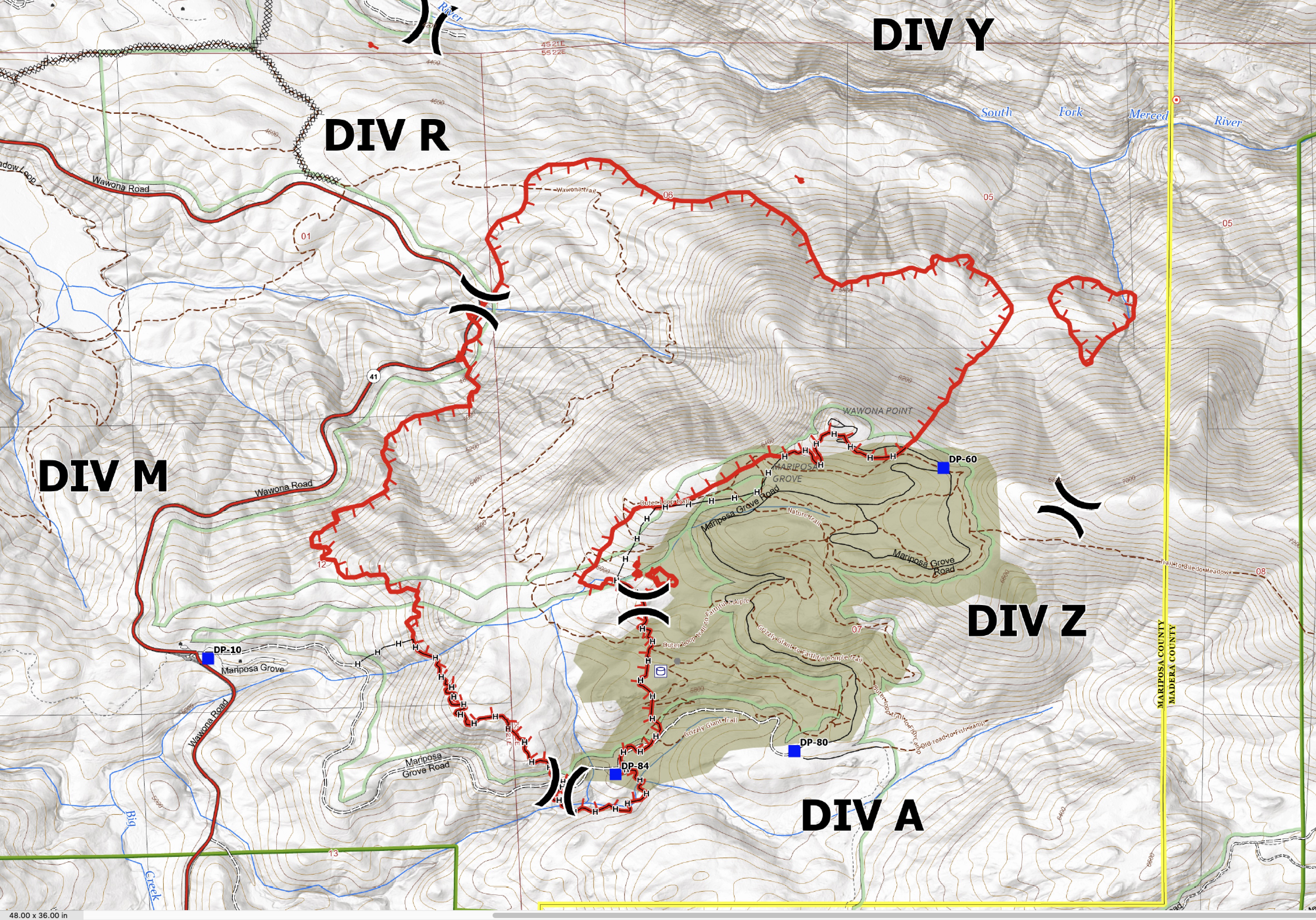
Yesterday’s airtanker show focused mainly on ridge E of DP-60, betw Mariposa Grove and Merced River Canyon. (Thanks@stacey_hb_for mapping this!). Fire pushed toward this line in evening. Ops map shows a lot of completed hand-line around Grove.
FireWatch51 is flying the fire and reports 1,821. Movement in Div.R and M and Y is the greatest.
Will return at 15:00.
Fire is laying down this morning.
AA52 off Fresno enroute. Don’t think there’s much to see with the smoke held to the ground.
EDIT UPDATE @ 09:30, AA52 departed and HelCo came up and patrolled and could not find targets due to smoke. No air ops this morning.
Increasing mid level moisture through Wednesday increases the chances of plume dominated Pyrocu fire behavior. In fact, dry low levels and sufficient moisture could produce a thunderstorm over the fire that produces lightning Monday/Tuesday.
Please refrain from posting non incident questions or information that does not pertain to the current fire. If you need something specific from another member, send them a direct message. This helps the cause by members not having to scroll through the forum to seek out information that’s related to the fire.
AA over the fire and requesting 3 LATS and VLAT to continue the retardant line from Radio Site at Wawona Point to Biledo Fire Scare ridge line. Between fire and Mariposa Grove.
EDIT UPDATE @17:00 Retardant line completed successfully. All fixed wing released. Handed back to HelCo and copter show until sun down shut off.
(1608 hrs) Others can chime on or correct. From FireWatch 51 in exchange with ATGS52: it is mapped at 2,045 acres. In the R/Y DIVS break area (N/W section 6 area) it is right off the river, but still on the correct side. The other active area is in DIVS Yankee, section 5. It continues to push to the N-NE.
Possible plan, implement DIVS Tango on the “other side” (that’s the north side) of the South Fork of the Merced as a contingency. Everything is on the “correct” (that’s the south side) side of the river right now. It’s been very active on the air side as evidenced by Flightradar24 displaying a bowl of spaghetti over the fire. No further reports of tree branches at 8K feet as reported earlier.
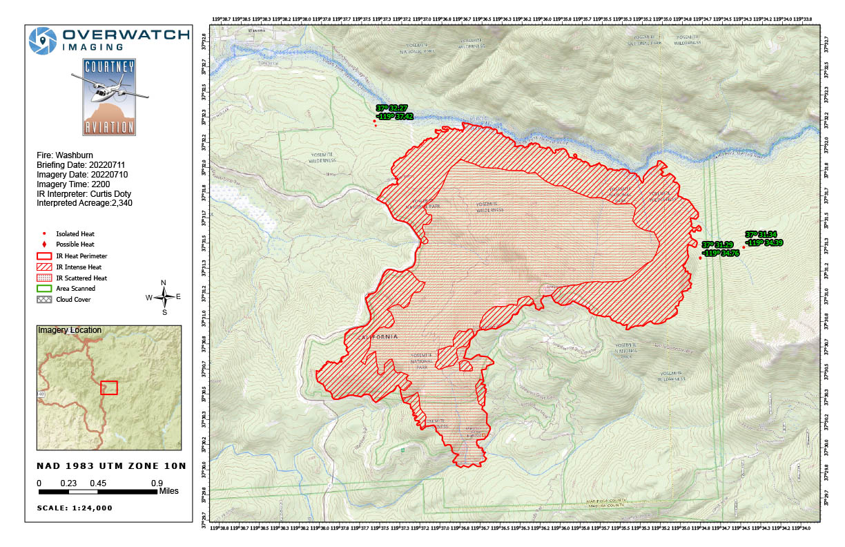
4 views of the Washburn Fire - 7/10/22 10pm. Fire still steadily its backing downhill, being helped by some strategic firing along Hwy 41. Fire moved about 1/3mi upcanyon, backed about 1/4mi toward Hwy 41 and S. Fk. Merced River.
Infrared satellite imagery (captured every 5 days) shows the depth of the flaming front, with most of the burn cooling off, especially on flanks adjacent to the Mariposa Grove. Too much smoke in the image to accurately assess fire severity, yet.
And there are plenty of federal resources available too. If you look at the numbers on acreage, this fire is not running hard or pushing through homes. They’re doing good work, let them keep doing so without criticizing them. I doubt anyones egos are involved. They’ll ask for help when they need it. Yosemite is too much of a political hotbed to not get things engaged.
As it continues to move east along the Merced river it will move further onto the sierra national forest and the 2008 silver/Oliver complex. It looks pretty active this morning.