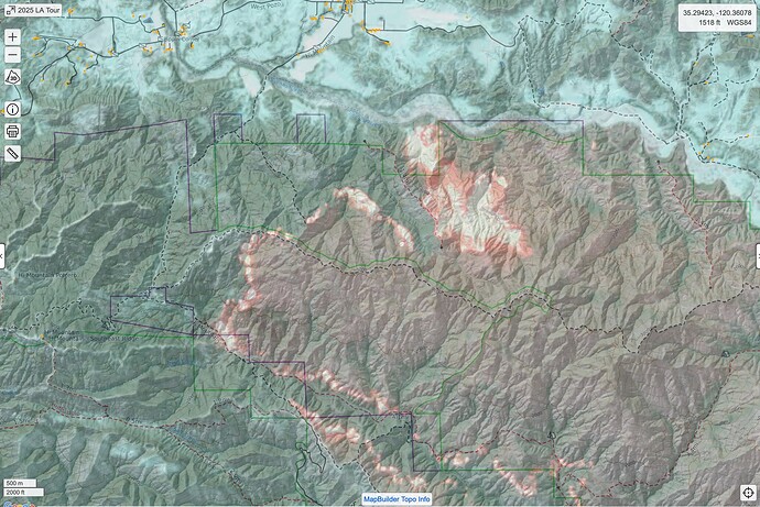
CAIIMT 15 posted a great map this morning of the tactical history of the Smith River Complex area. It is an example of how far we’ve come in saving and using mapping from past fires (something that has always been harder to do than it might seem).
That’s an awesome map. The current revisions of symbology concocted by NIFC are working well. Many other aspects of Incident GISS seem to be suffering from Fed top-down, heavy handedness, but that’s just my personal opinion. I cut my teeth on FIMT Tools so I’m a dinosaur. Jim Kniss is still around, but I haven’t seen him for a while.
What’s going on with NIROPS? We’ve only had 2 or 3 good perimeters for the NW California fires in past 7 days, and I’m getting calls from folks from fires outside California who are also getting UTF Mechanical on their flights. Is the program all contract planes now, or is NIROPS still operating their own 2 planes?
Does anyone have an archive of the NIFC FTP site pre 2014 or so?
That would be great. I wouldn’t mind having maps for a number of historic fires to use while teaching.
@pyrogeography Zeke, you should see a historic folder in each North and South folder. I don’t remember if it holds every incident. Looking for something specific? DM me if needed.
A lot of data got lost when they migrated the old server to a new one in Kansas City. I’m looking for someone who has an actual backup of the site on a hard drive from before the migration.
I’ll take a look "around ". So you’re looking for everything?
I’ve got a lot of the post-2014 stuff for Northern and Southern California, but yes, it would be great to get ahold of everything pre-2014 for California.

