This is worth sharing again - it’s a link to the data I am using to create the VIIRS maps I have been sharing. If anyone else wants to help make these maps, it won’t hurt my feelings!
Use this link to access VIIRs and MODIS heat detection data in Google Earth. You may have to download the KML files to your computer and then use the File>Open> menu in Google Earth to open the downloaded file.
If you want to convert the incident pdfs off the ftp in to google earth go to the link below. There is a folder called “map conversion” and two tutorials. One how to convert a pdf to a tif and another on how to use them in google earth. Then you can have that below any other data like what @pyrogeography mentioned with remote sensing data.
Just a word of caution about the VIIRs data - the latest acquisition, taken about 4am, has significant errors (false returns) on the MNF Complex and around Vacaville. This sometimes happens when the satellite is at a low angle to the target, and heat in the plume can lead to ‘shadowing’ outside the main fire area. One way to spot potential inaccuracies is to look for wide, even spacing between the heat returns.
VIIRS and MODIS are both highly useful tools, especially on rapidly developing incidents where no other intel is readily available. But the data should always be vetted against reality. The maps I published this morning are from an earlier acqusitions, and I vetted the VIIRs against MODIS and GOES17 data.
If anyone reading this is making evacuation maps, please consider publishing them as static images, and not using ArcGIS Online. The Sonoma County Evac map won’t load on my phone, and AGOL stuff always takes forever to load. Simpler is better!
Finally got around to making an updated California Fire History KML overlay for Google Earth. Thanks to @FSFF for the suggestion. I simplified the polygons to make the file size usable in Google Earth an online GIS platforms.
It can be downloaded here: http://deercreekgis.com/files/California_Fire_History_1927-2019.kmz
IAP map pages are not being exported separately and cannot be used in avenza. Is there a way to pull a page out of the pdf in acrobat and upload it in avenza? Otherwise it’s just the index page.
Also I’m on an engine… so whatever workaround there is has to be done on my phone
I have had the same problem on the LNU Complex. Gigantic file, and you only see the index page. If you down load the OPS map it doesn’t give you the detail that a good IAP map file does.
I don’t think it is an ftp issue. I think the GISS techs have a disconnect with what the end user needs and with what Avenza can provide. I have never seen a tiled IAP map as an pdf download intended for Avenva.
What gets posted to the NIFC FTP server is only a fraction of the documents the IMT team puts together. The IMT is in total control of what does or does not get posted there. Some Teams post more documents there than do others even within the CF teams. Remember that the focus of the IMT is to provide for the needs of the incident not what they or the public who views the FTP documents believes they need. As for incident assigned personnel, there are other ways for them to get the vital documents.
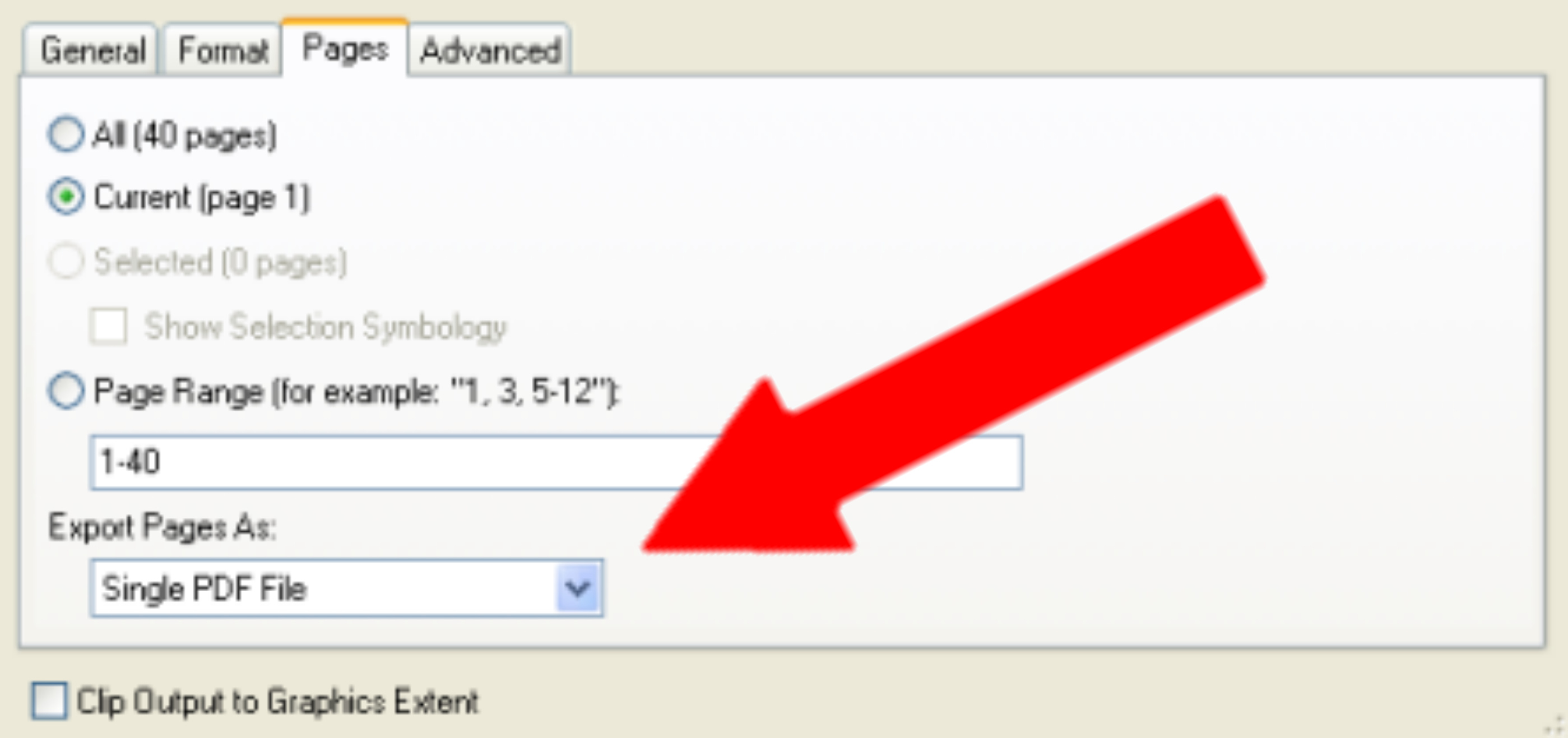
So in arcgis there is an option to export the data driven pages as separate pdfs rather than one giant one. And it is literally just a drop down option.
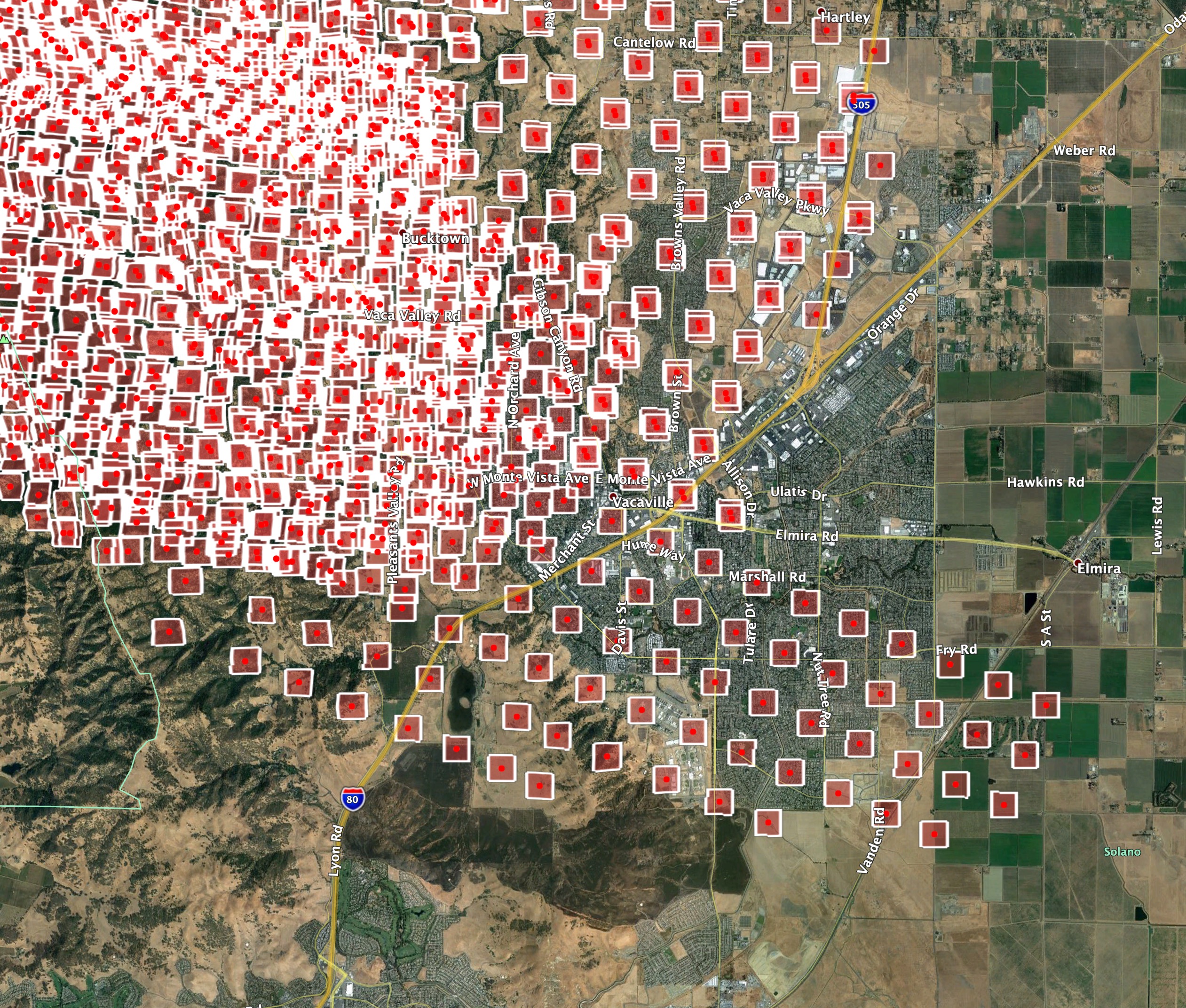
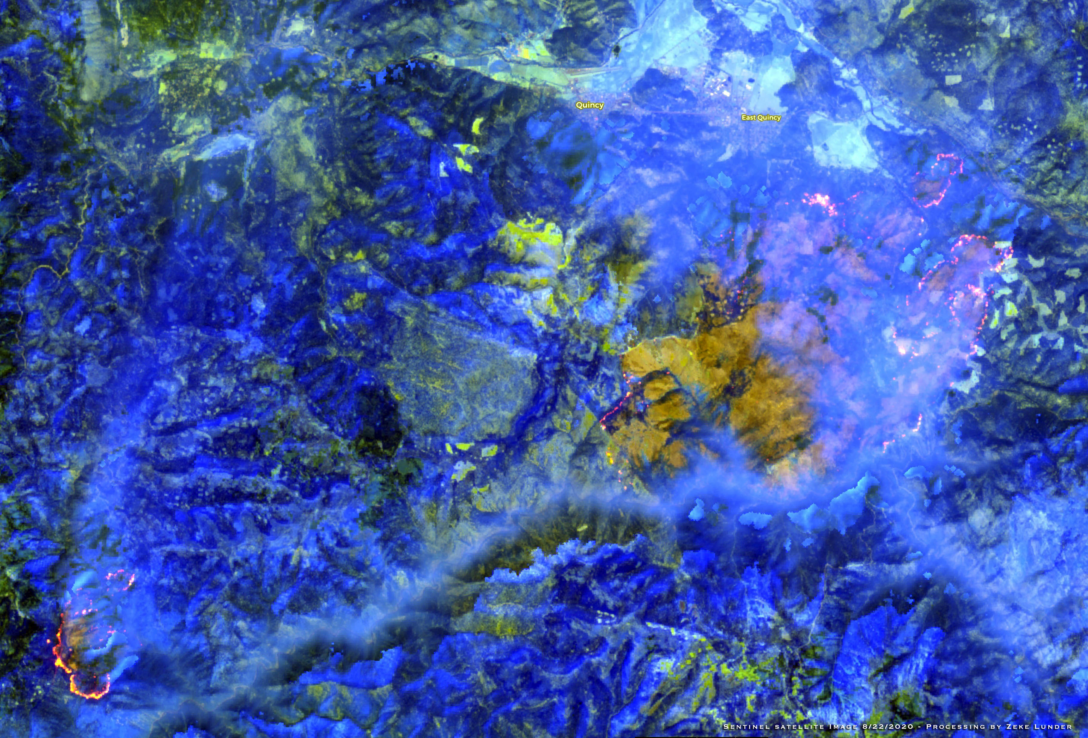
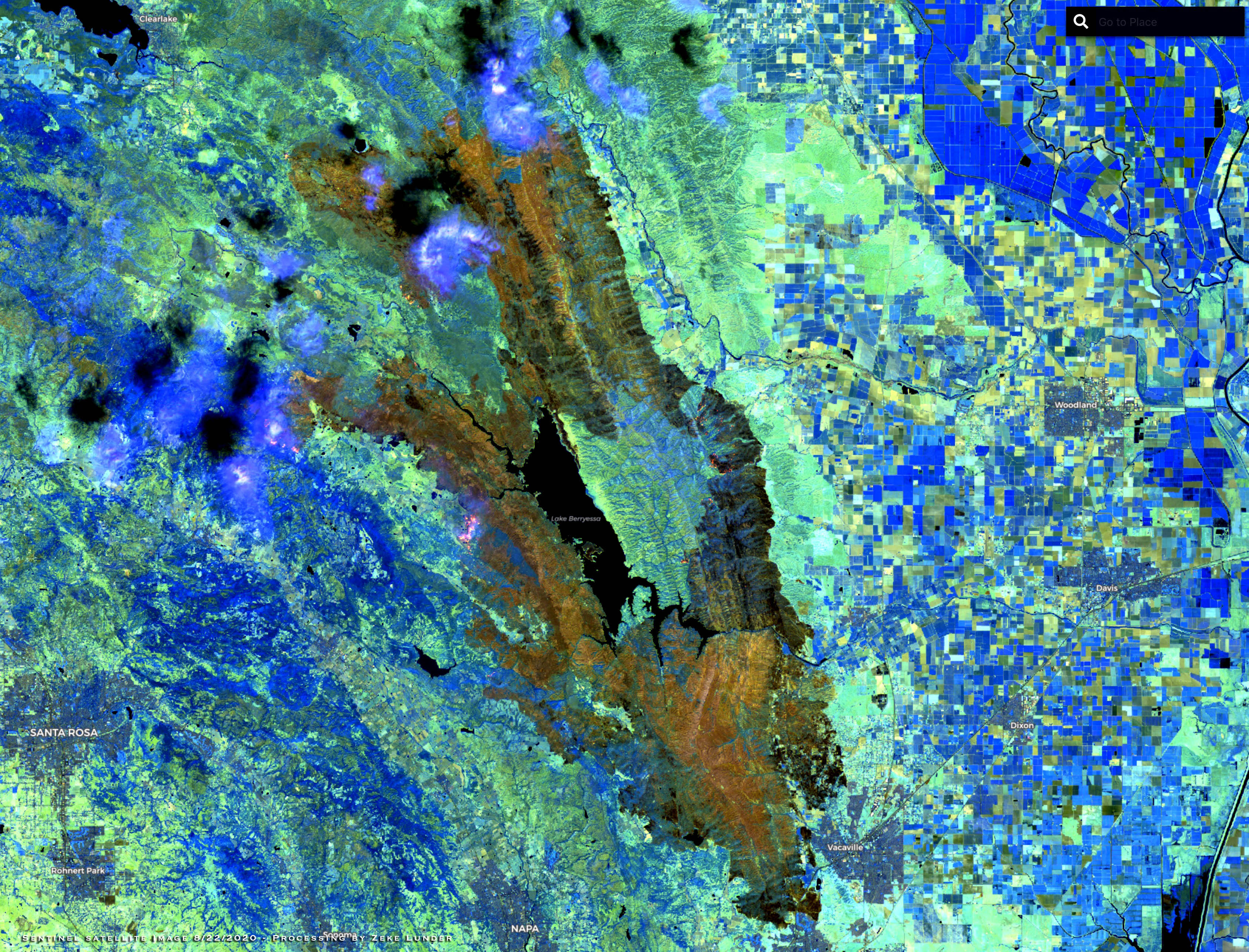
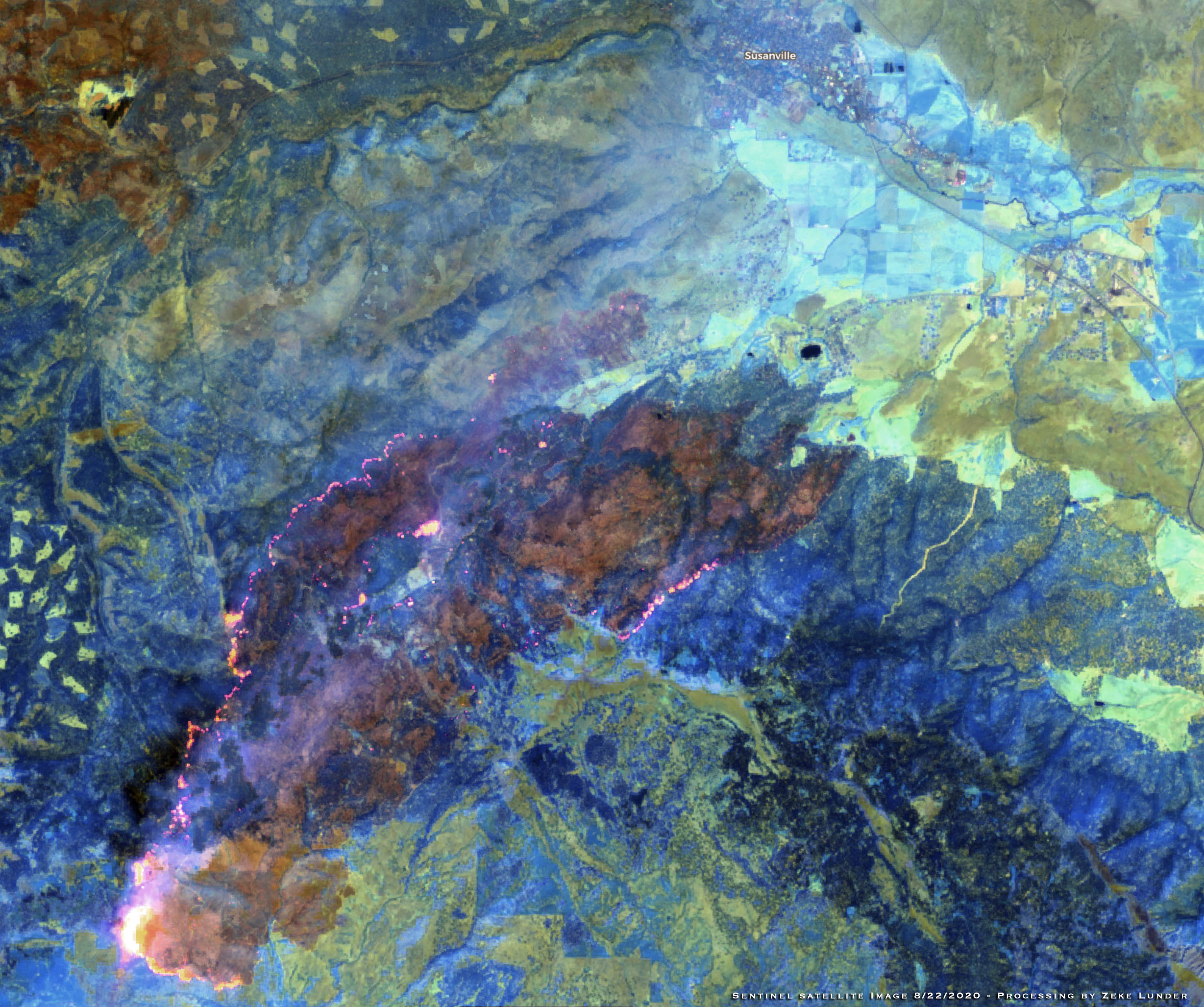
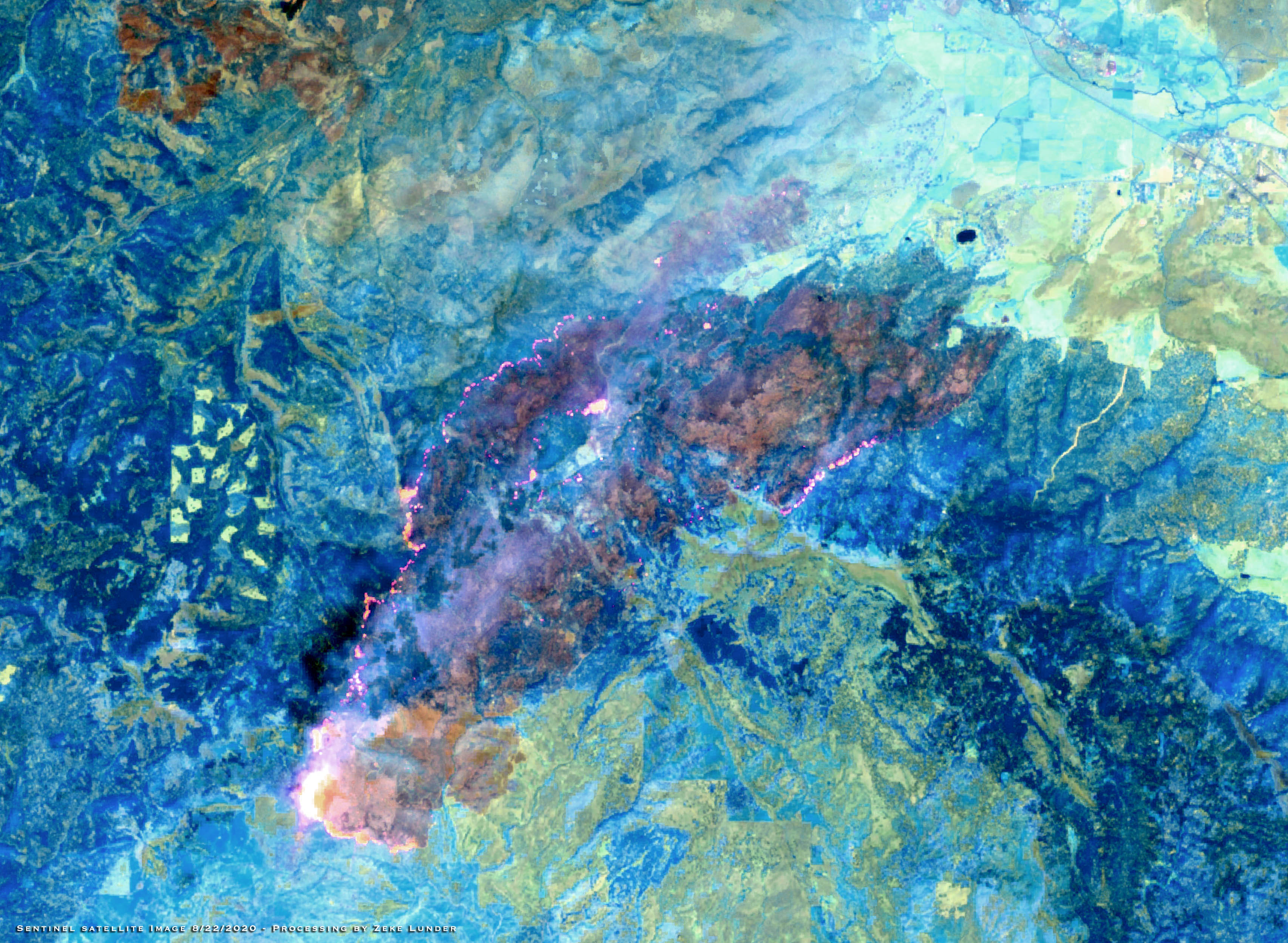
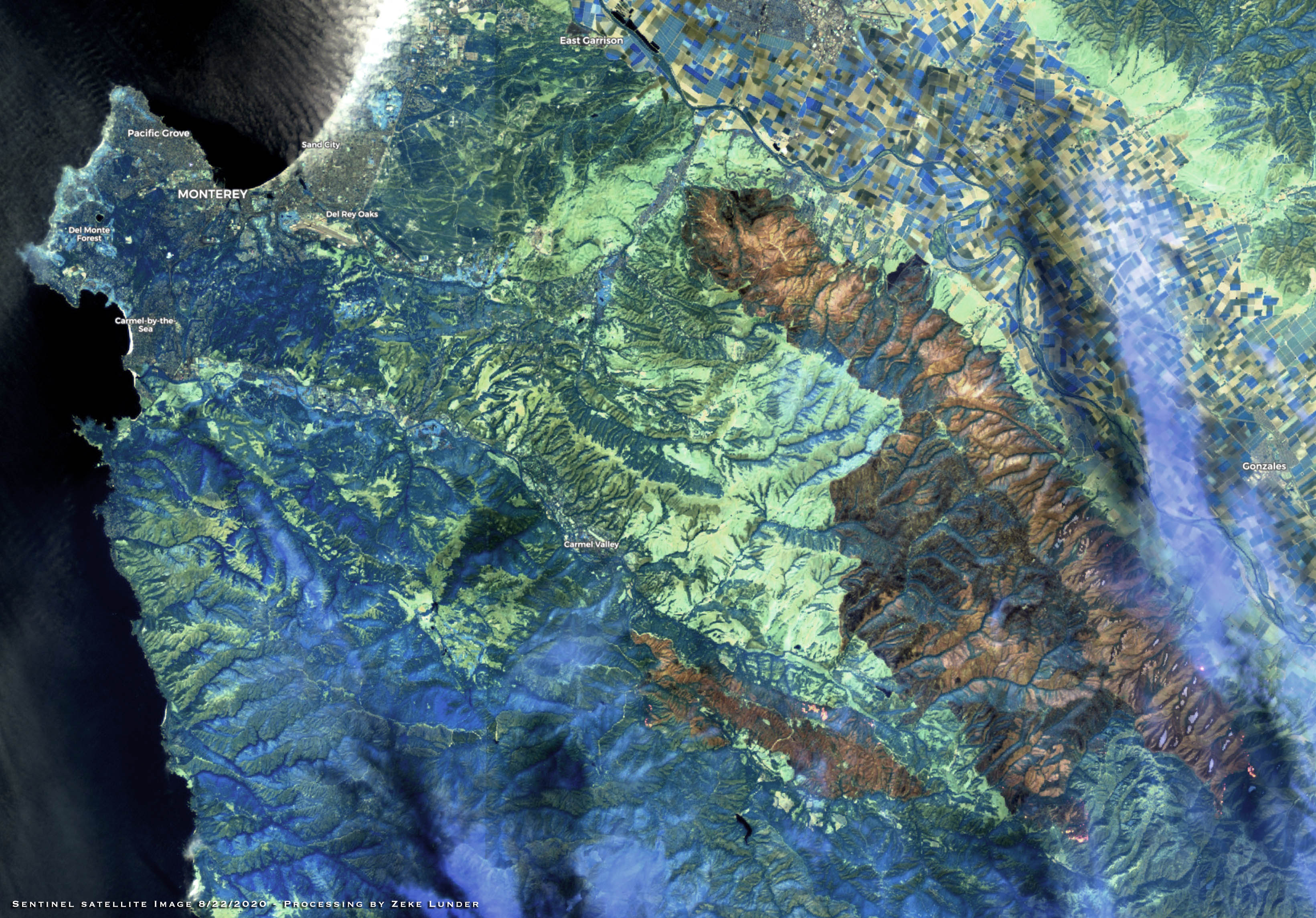
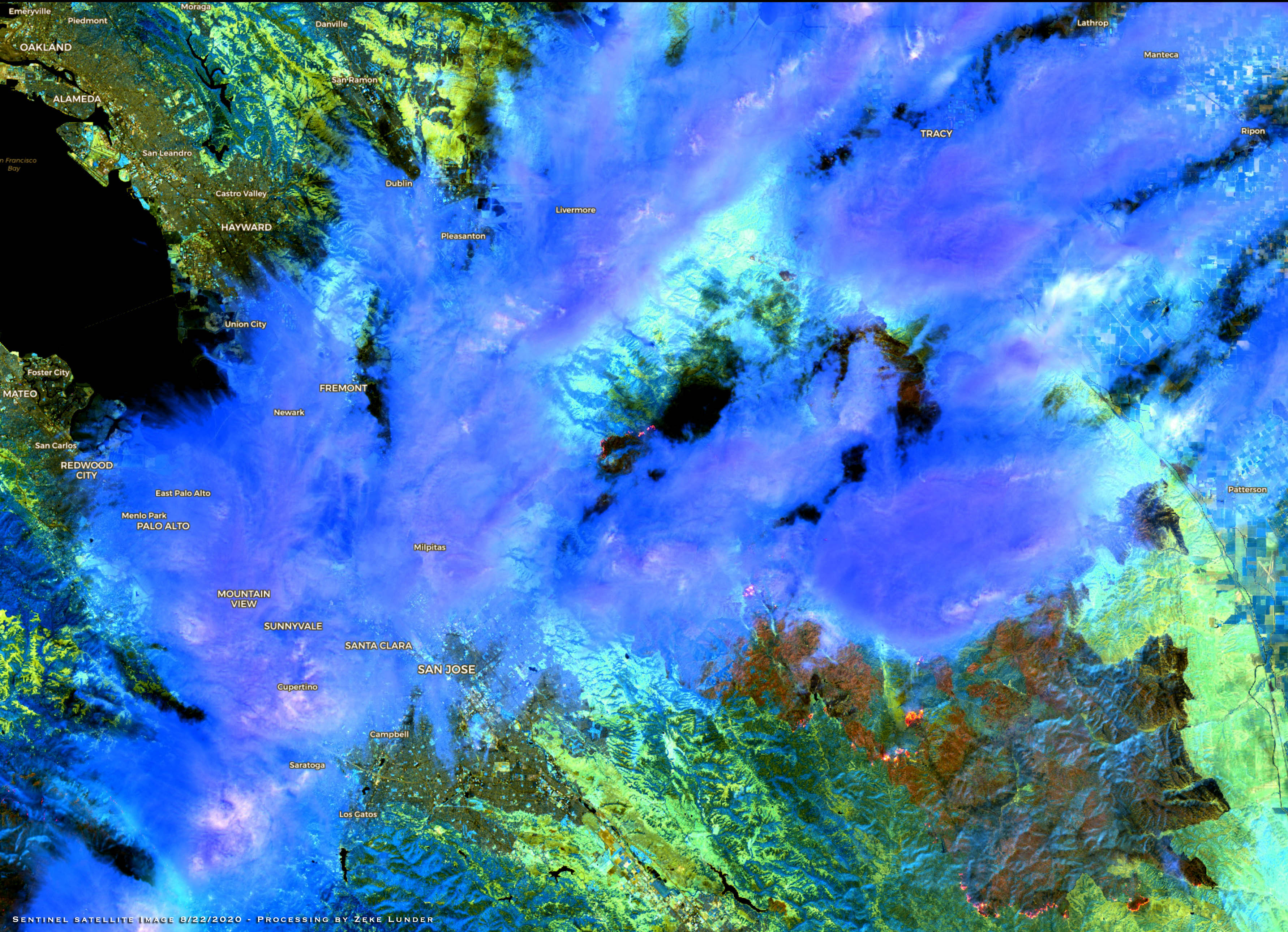
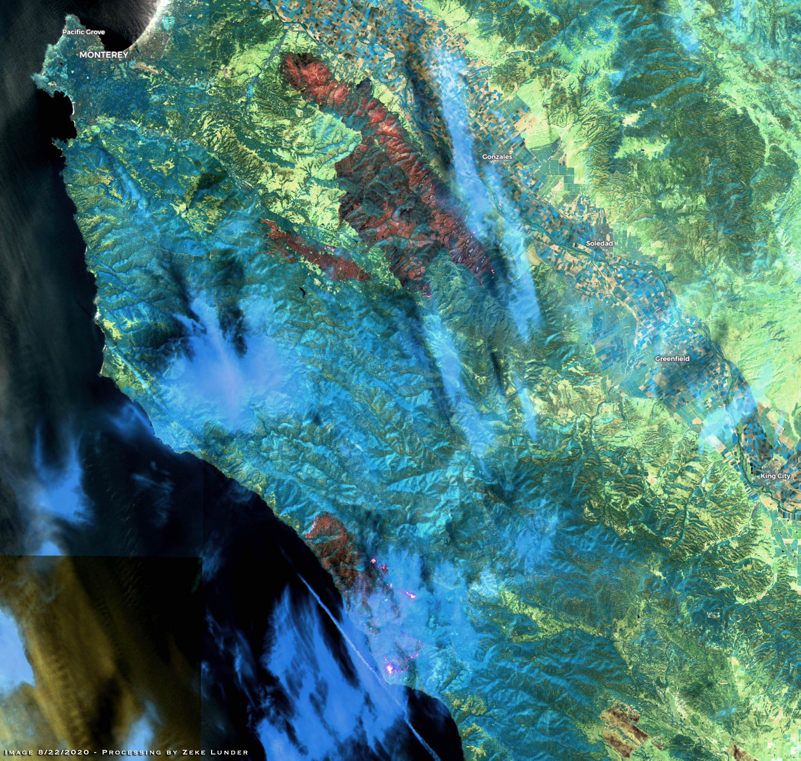
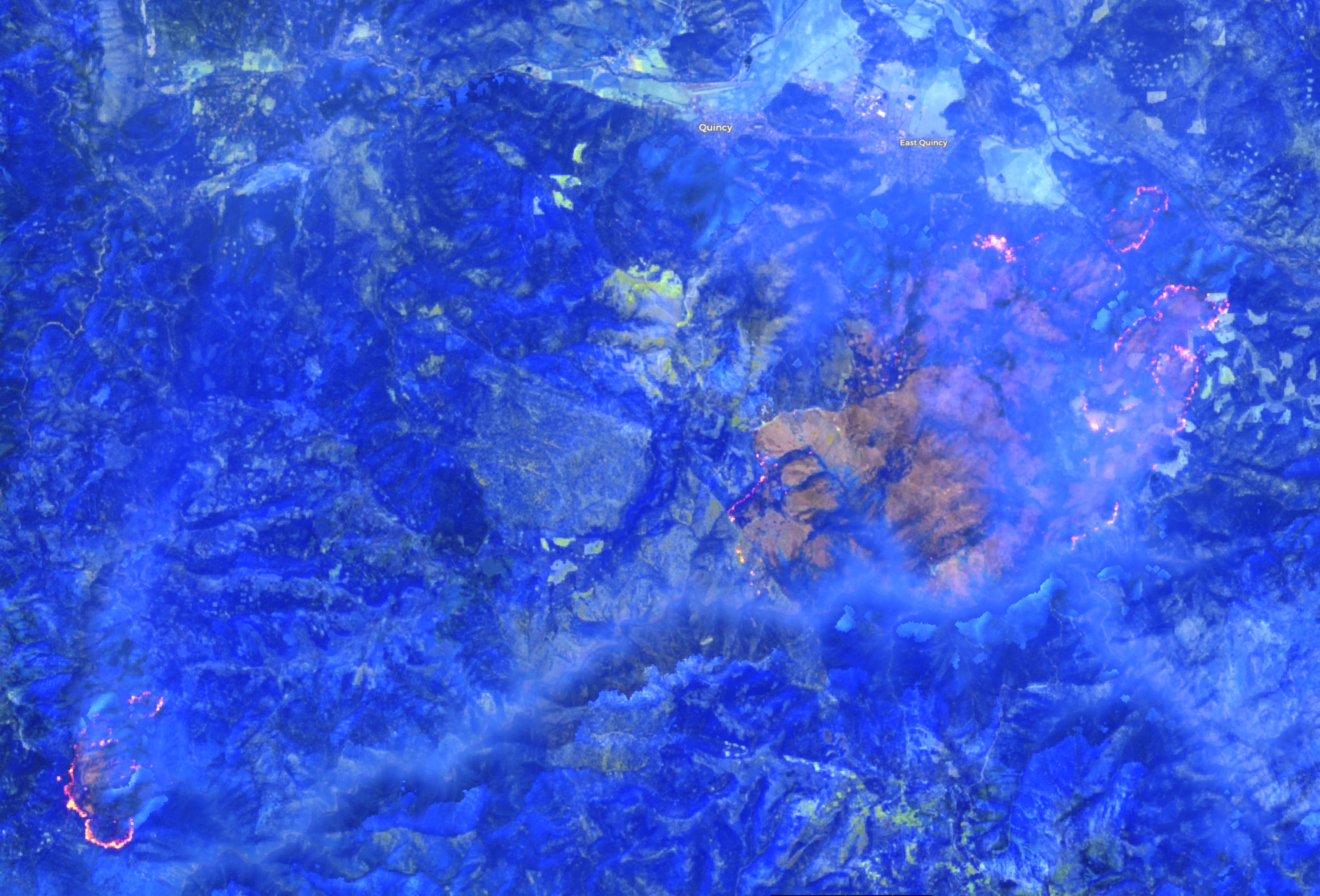
Sentinel Satellite Imagery, from the European Space Agency, is a great free tool for rapid assessment of fire severity, and sometimes, even of fire behavior. You can use their website to slice and dice the imagery to visualize it in many different ways. Here are some maps of our current fires, using Sentinel from yesterday at noon.
The satellite orbits every few days, and data is generally available the next day.
GISS and SITL here, why would you want IAP tiles when they are not as detailed as the Ops map and it is one file. We have plenty of other stuff to do than create more FTP content.
I thought the purpose of IAP map tiles was to provide MORE detailed info in a small specific area… If you can provide all the needed detail on one large map, then why do you need to chop it up into smaller pieces? and why put that large level of detail on an OPs map which doesn’t need it?
You’re saying that the large display-type ops map has better detail than the smaller maps intended for the specific units working in those areas?
Please pardon my ignorance on the newest system these days, I was originally taught to make overlay maps with Vis-A-Vis markers…
The IAP maps are typically just a zoomed in version of the Ops maps , which you can do in Avenza.
The IAP maps are designed to print on a 8.5 x 11 piece of paper.