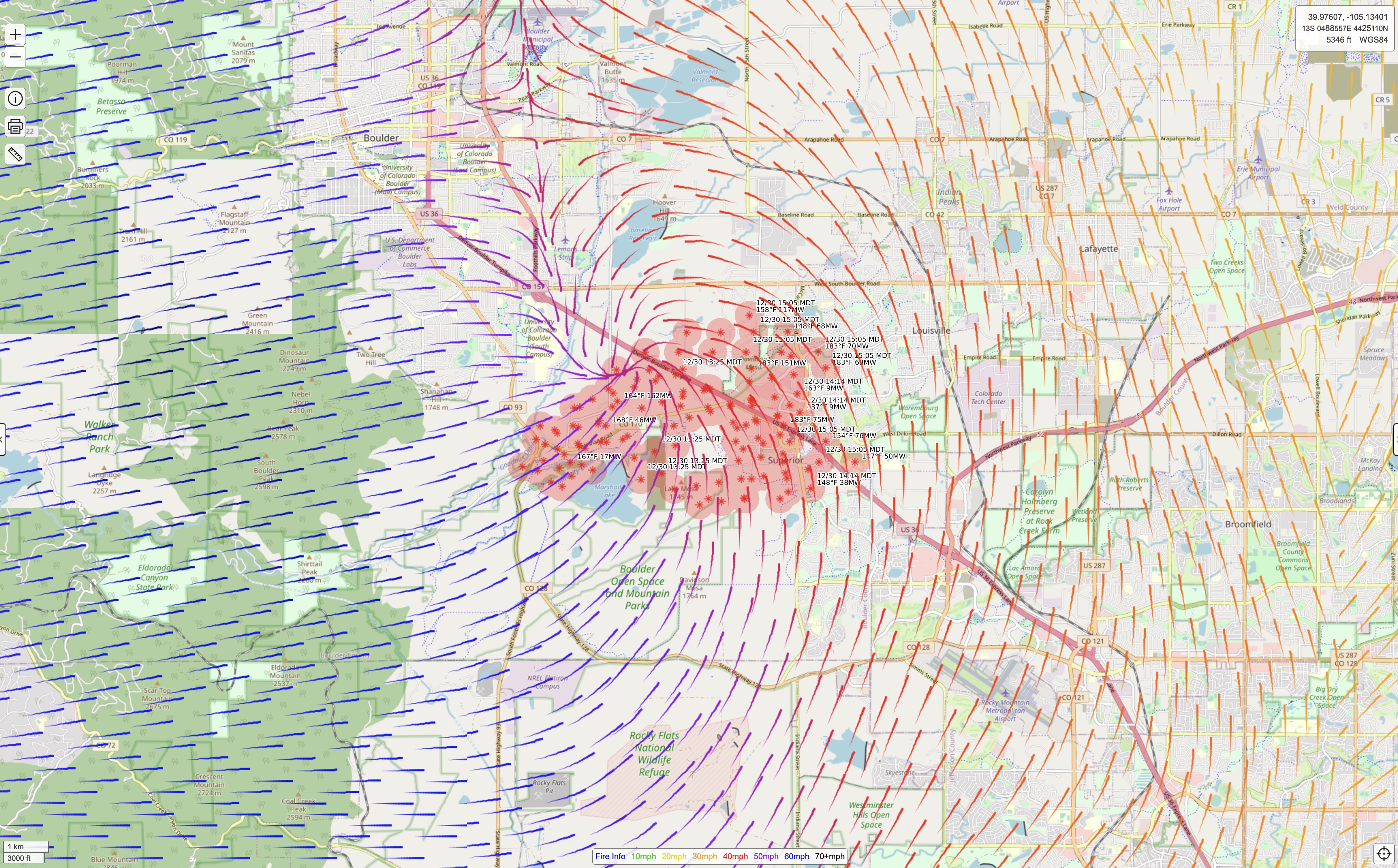
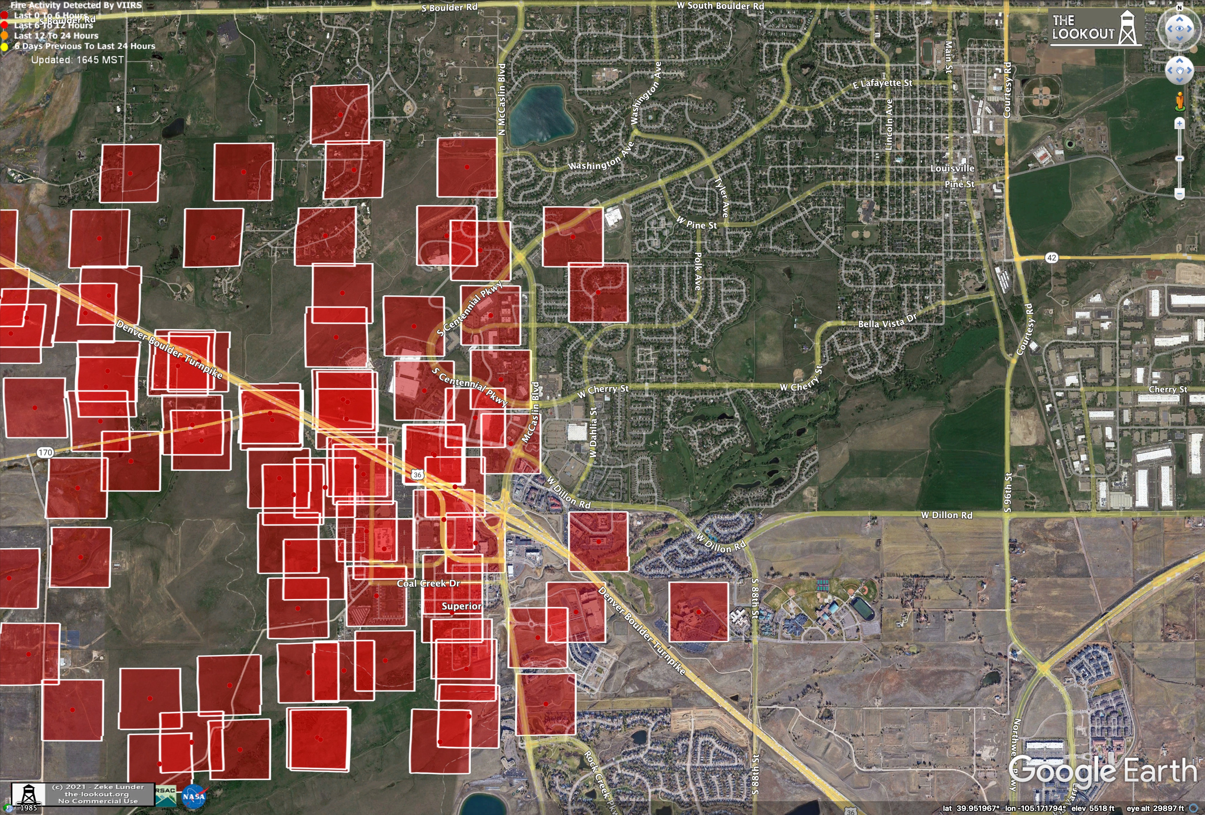
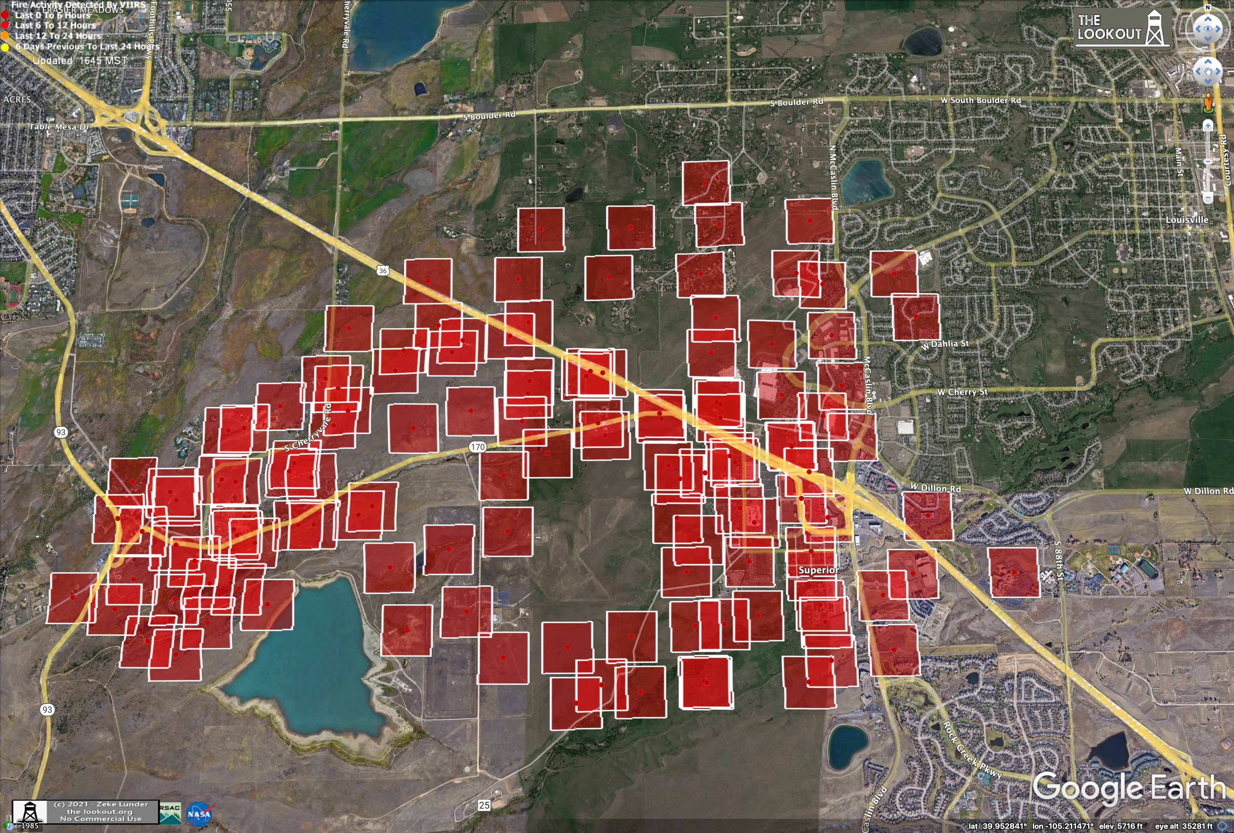
VIIRs from about 15:00 local time:
Wind gusts from CalTopo:

Press briefing @ 5pm stated over 500 homes. Lost a large Target shopping center and a hotel destroyed. Fire @ 1600 acres, no estimated of containment. Winds still gusting 50+ mph. No aircraft used yet due to excessively high winds.
My rough estimate using firms is 5016 acres.
When you say 15:00 Local, do you mean local here, or local there?
Weather observations near superior.
https://www.wrh.noaa.gov/mesowest/timeseries.php?sid=E6155&num=72&banner=gmap&raw=0&w=325
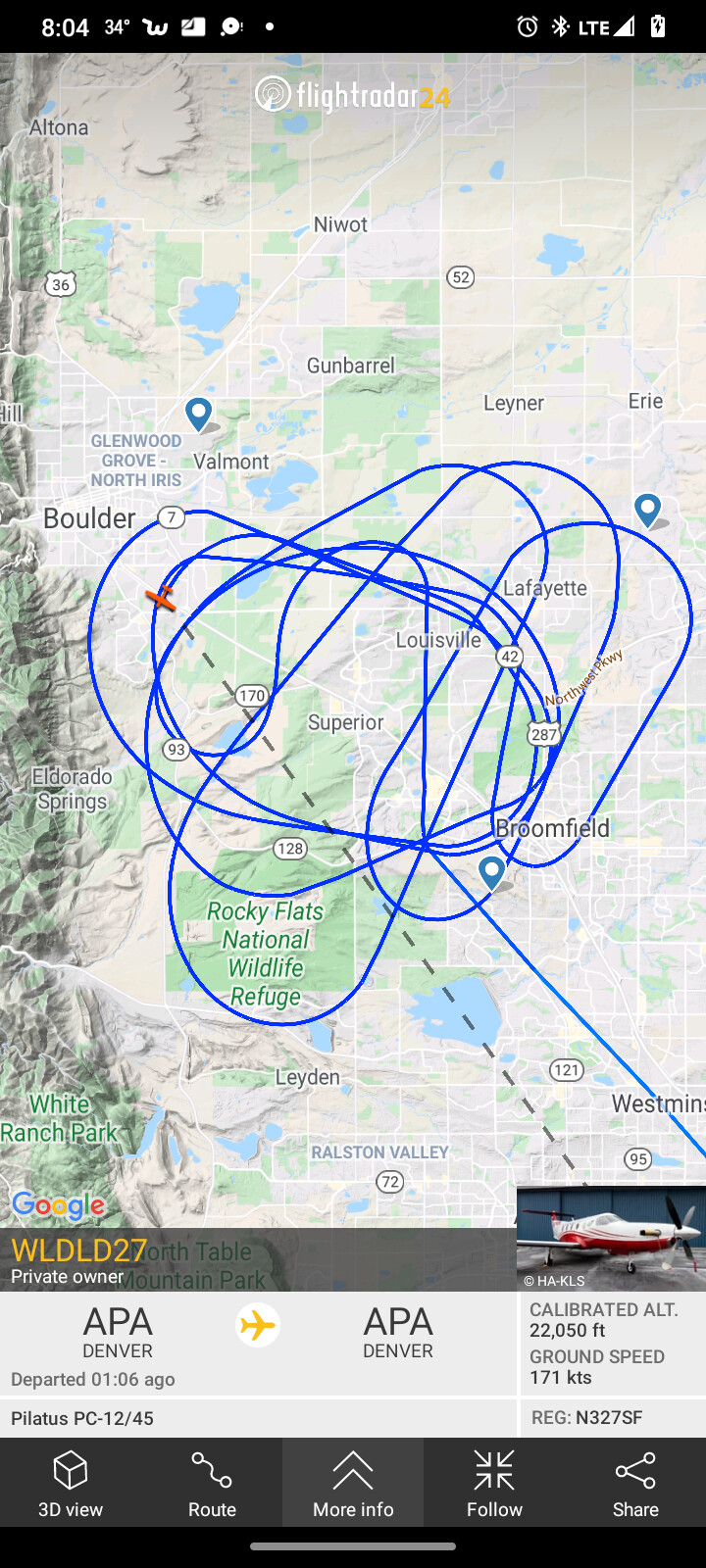
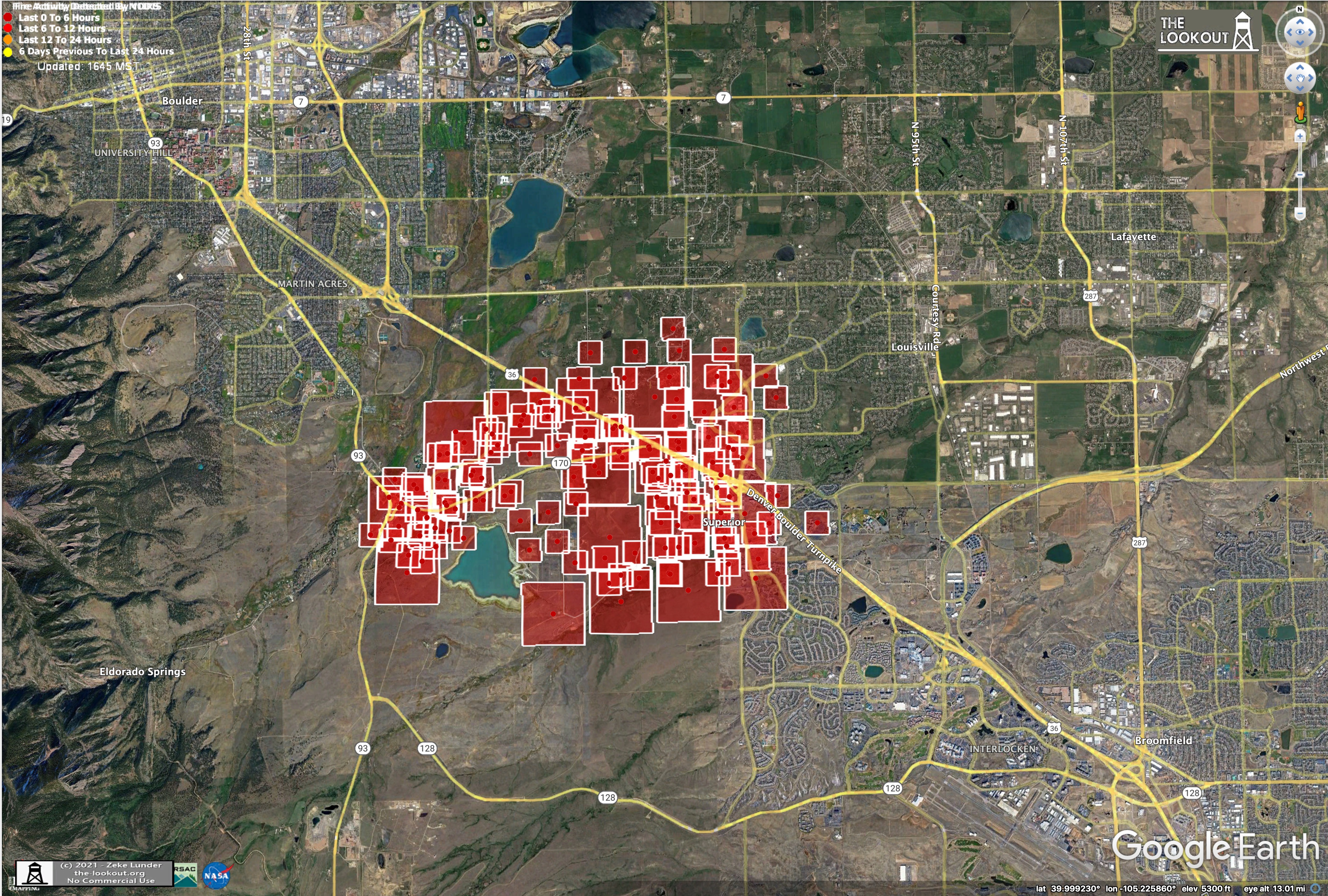
I got a lot of coworkers who live in that area. Anyone have a perimeter map?
They haven’t completed mapping yet.
Generally “local” refers the the area of concern. Otherwise one would say “1500hrs PST” for California in winter.
580+ homes destroyed as daylight shows total destruction.
How to help out those affected by fire.
Any update on acreage?
Wow! That is pretty telling.
Pretty good interview…
Updated structure losses: 1084 homes.