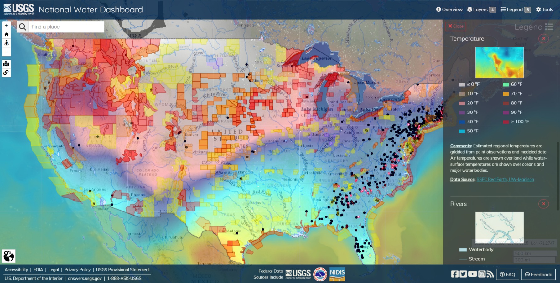
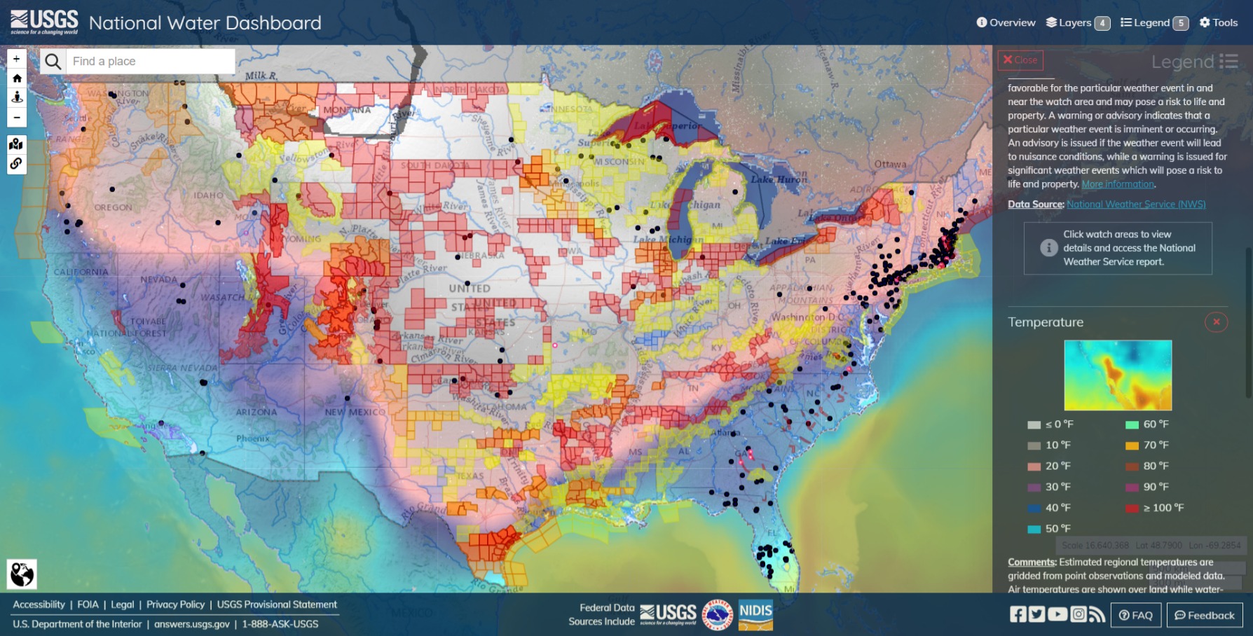
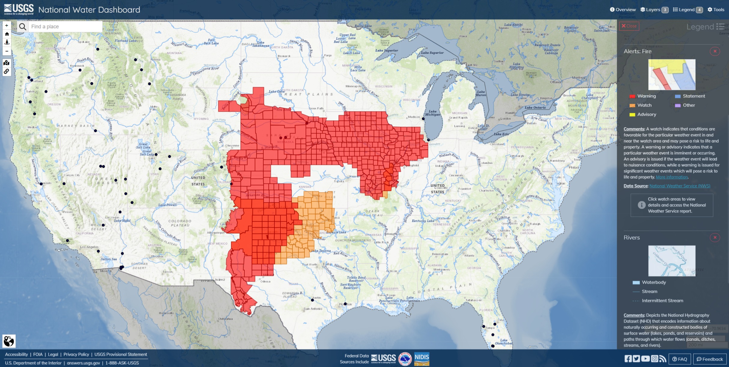
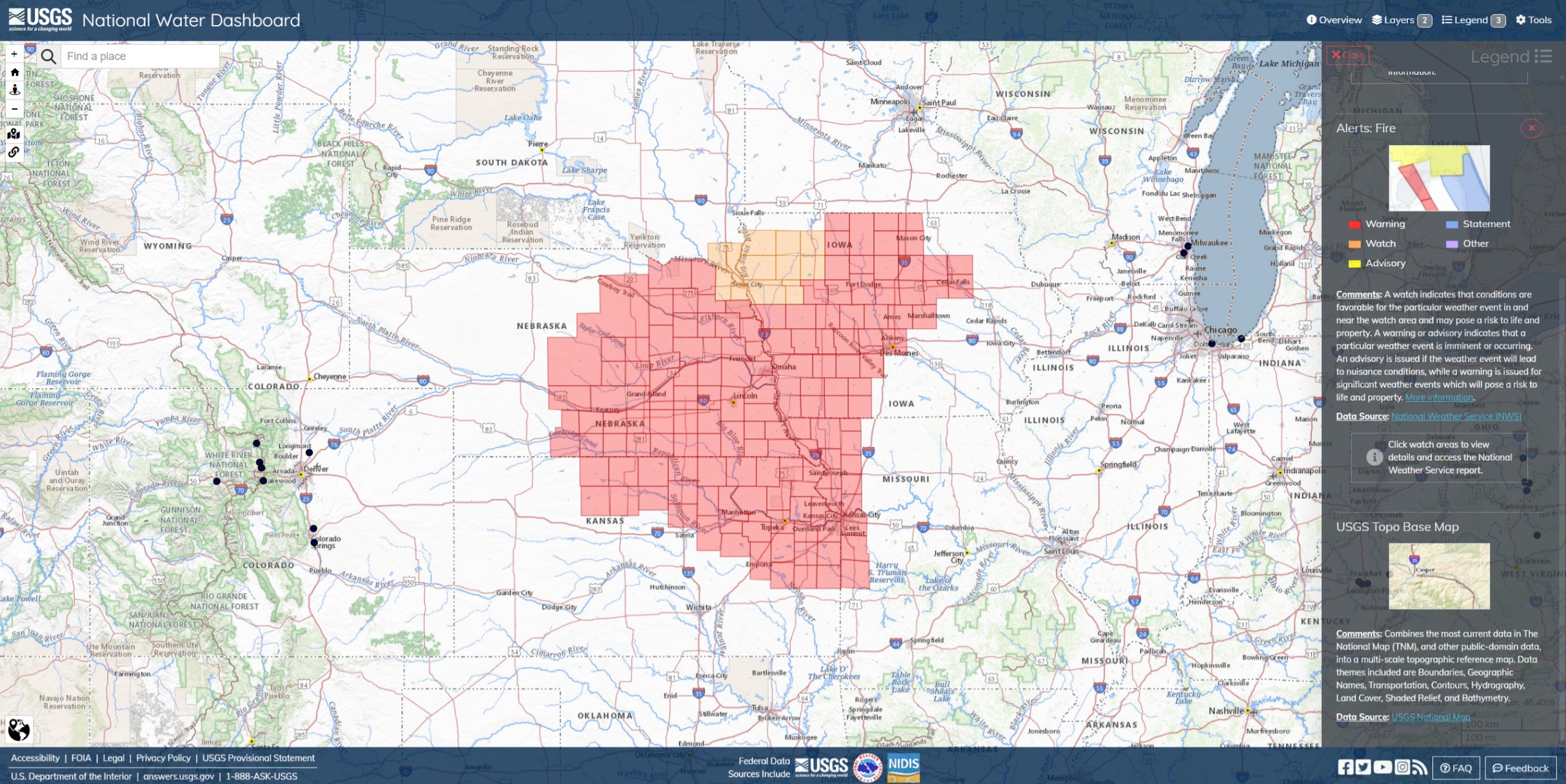
Major storms in progress. Watches and Warnings across the country. Ain’t fit for man nor beast outside in some areas of the Northwest.
Winter Storm Warning issued January 11 at 2:56PM PST until January 14 at 4:00AM PST by NWS Pendleton OR
- WHAT…Heavy snow expected. Total snow accumulations of 16 to 40 inches. Winds gusting as high as 60 mph.
- WHERE…East Slopes of the Oregon Cascades.
- WHEN…Until 4 AM PST Sunday.
- IMPACTS…Travel could be very difficult to impossible. Widespread blowing snow could significantly reduce visibility. Strong winds could cause tree damage. The cold wind chills as low as 25 below zero could cause frostbite on exposed skin in as little as 30 minutes.
Instructions
If you must travel, keep an extra flashlight, food, and water in your vehicle in case of an emergency. The latest road conditions can be obtained for Oregon by calling 5 1 1 or by visiting online at https://tripcheck.com, or for Washington by visiting online at Travel | WSDOT.
Note: NWS updates Watches and Warnings throughout events, check local reports for current conditions in particular zones.
Update: Jan 14 2024 9PM PT
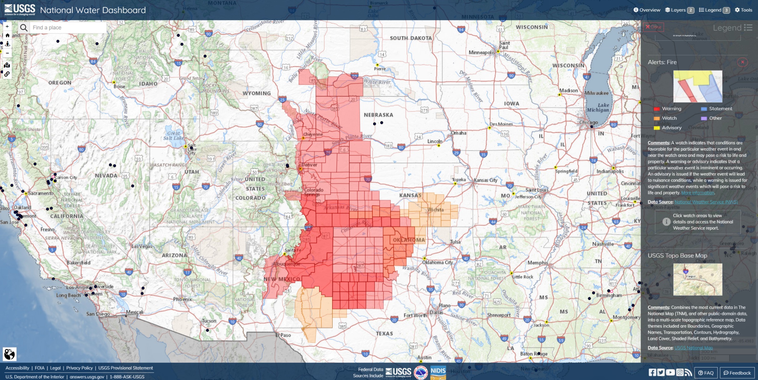
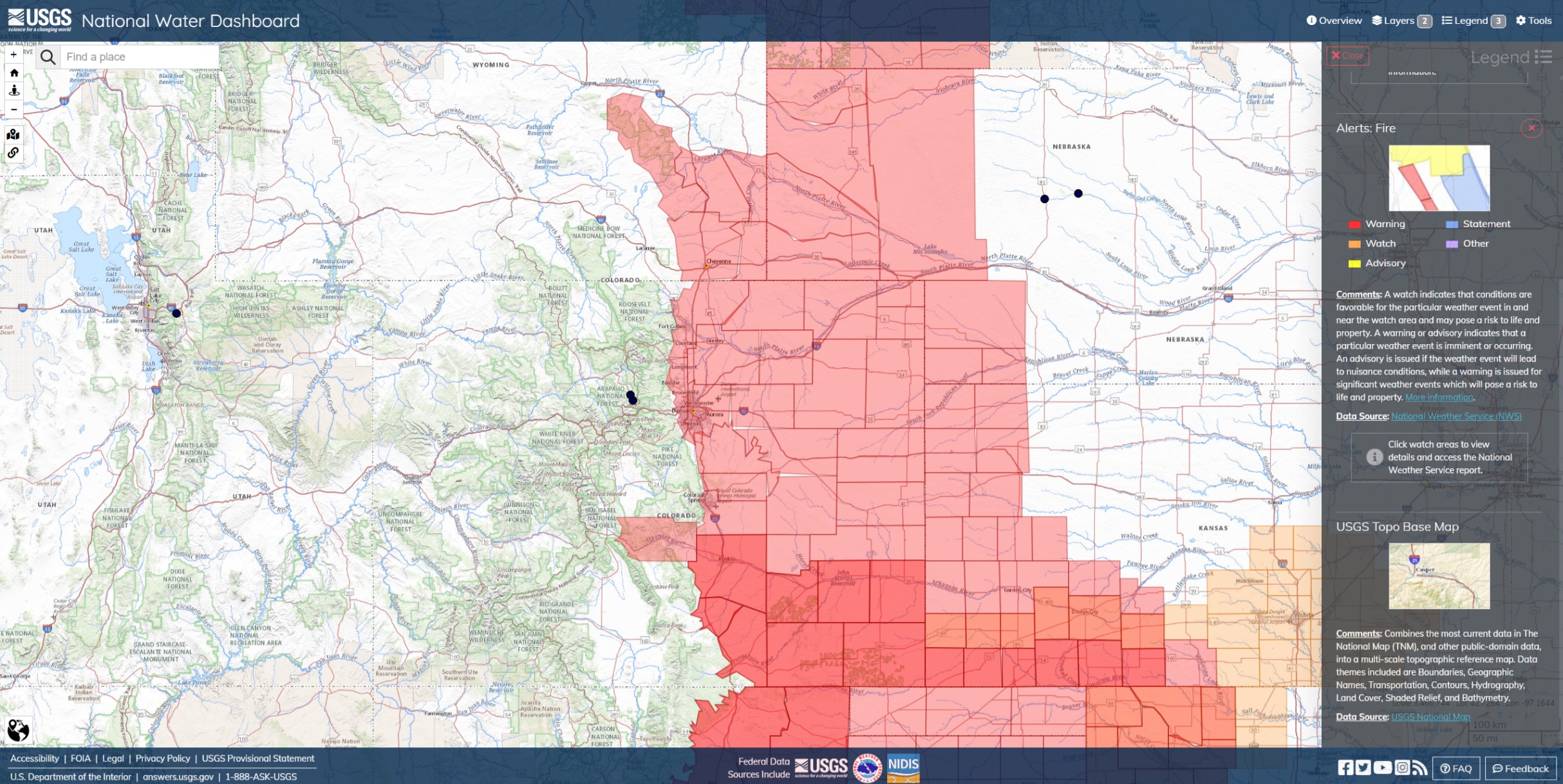
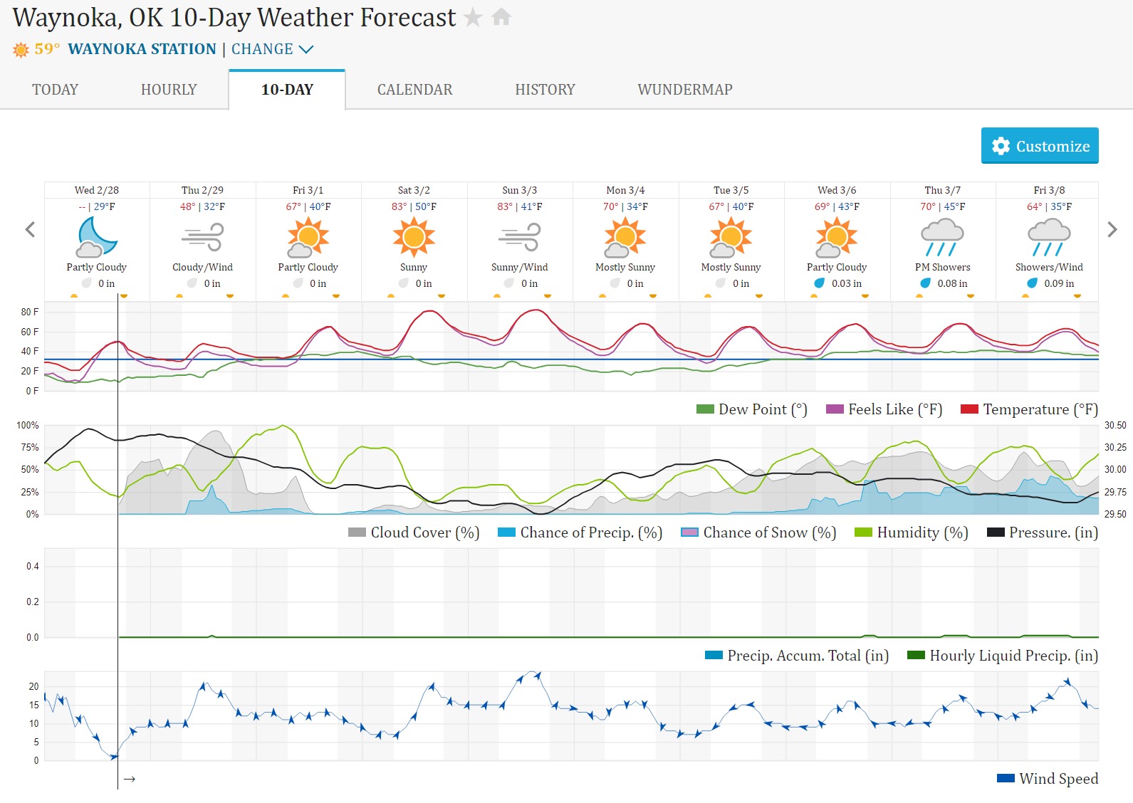
Red Flag and 7-Day Forecast Precip Monday, Feb 26

I haven’t seen that much Red Flag on the map for a while and I’m not seeing any of that forecast for more than about .25" of precip over the next 7 days.
Should know that each succeeding Red Flag day gets worse than the previous one as resources are committed and what fuels moisture that remains gets drawn out into the atmosphere, leading to rapid escalation. Hard to imagine they aren’t blowing the dust off of it at NIFC.
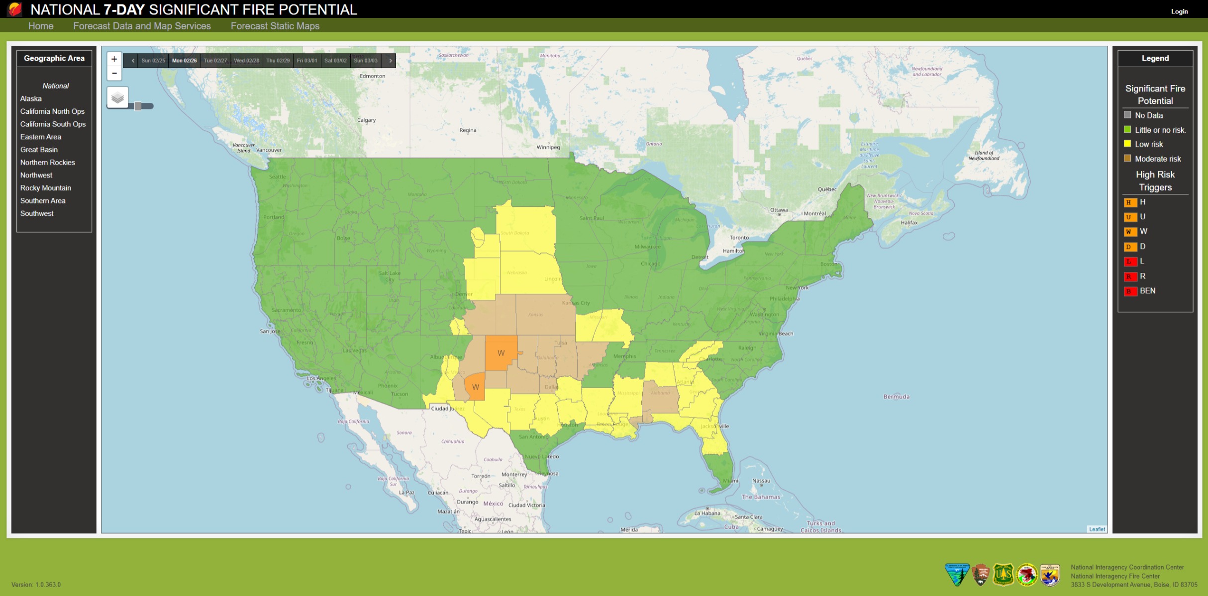
National 7-Day Significant Fire Potential (nwcg.gov)
Outlooks | National Interagency Coordination Center (nifc.gov)
We’re still behind the Spring Predictability Barrier*, but there’s some products worth looking at.
*there’s a known phenomenon (ask a meteorologist) in which forecasting Summer and Fall fire weather becomes much more accurate after certain semi-regular climate turning points occur in the Spring.
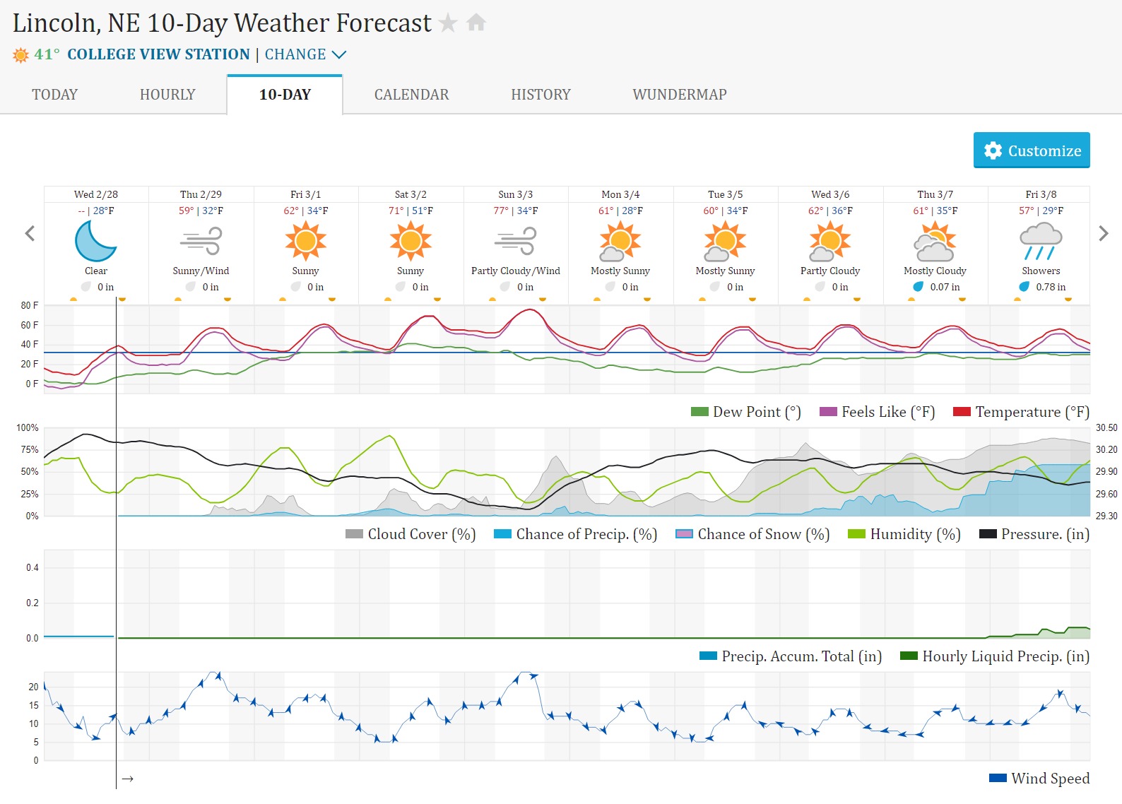

Wi has been in high fire danger the past few days. Alot of IA across the state
1" snow last night should dampen it for a day or 2. Sunday could be tough as high in the upper 60’s windy 20-25 gusts to 35 mph.
Virtually no snow over the winter.
DNR reported acreage is way above average already and we are still 2 months away from our supposed start of fire season.
We should be under 2’ of snow this time of year
Brian
One foot in the black.
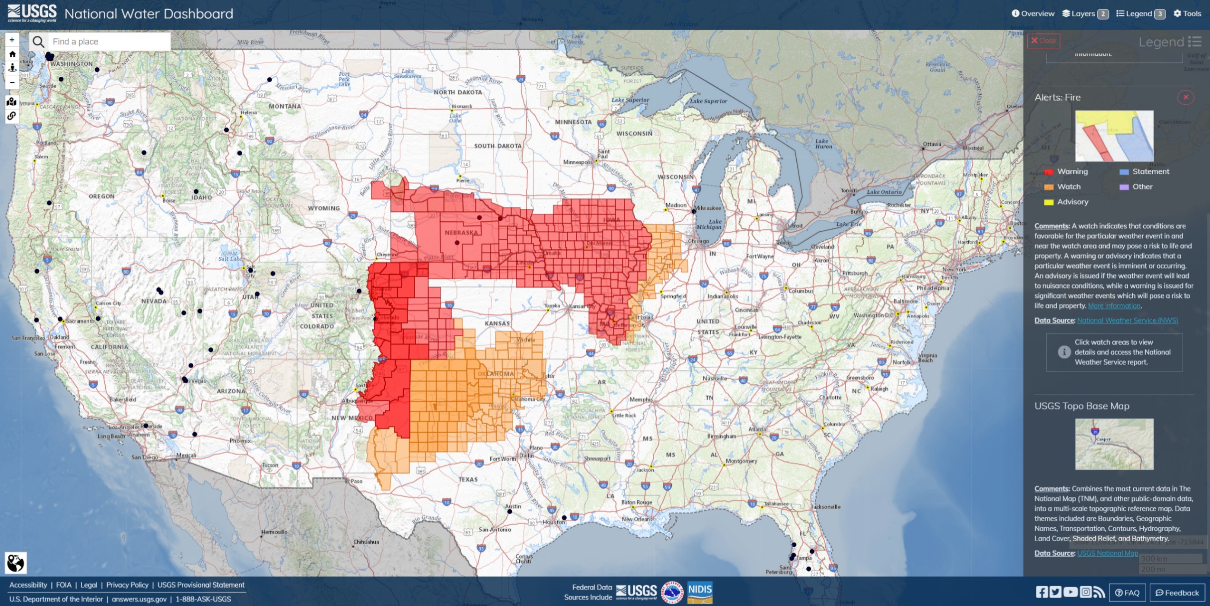
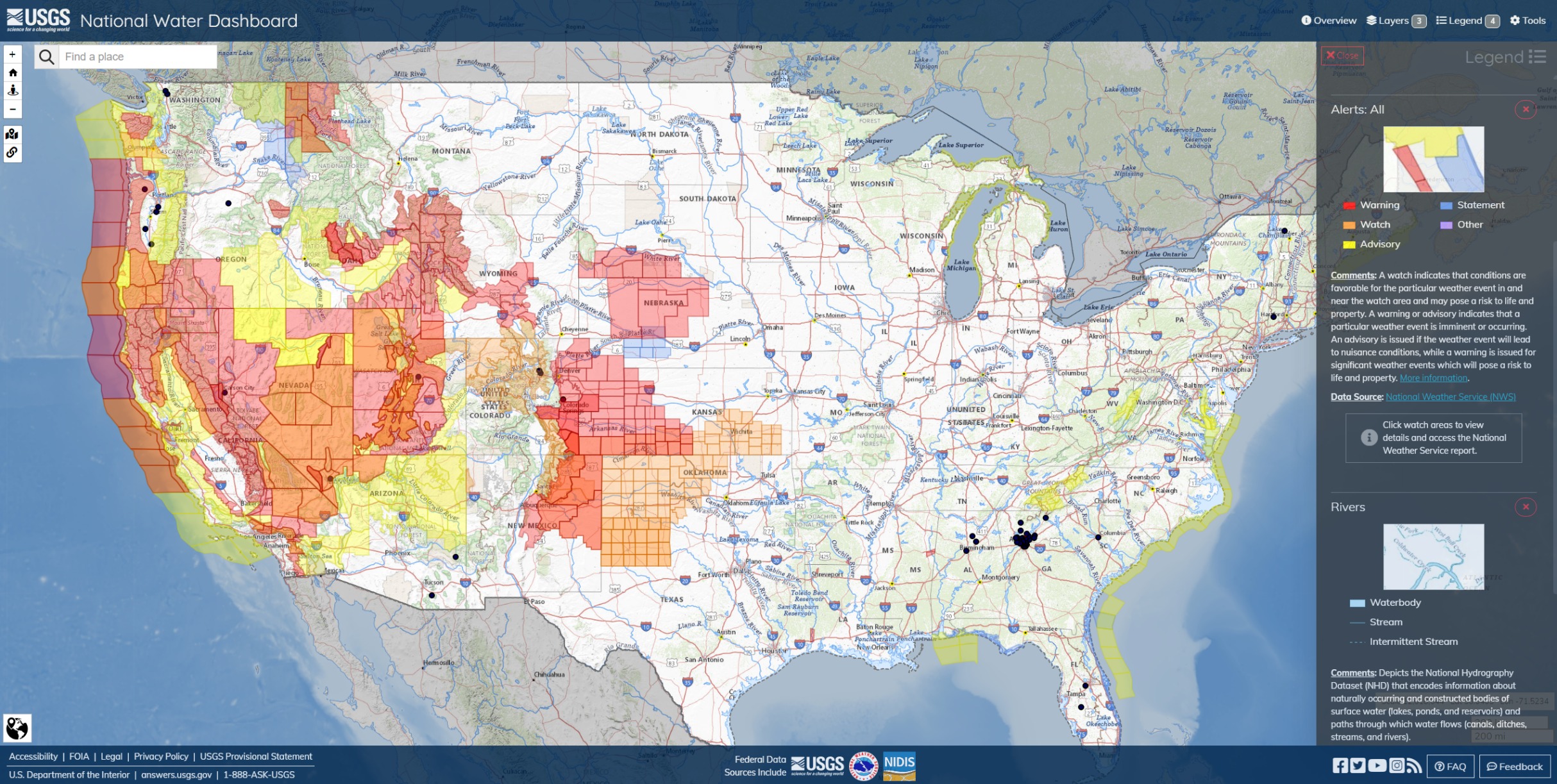
NWS Alerts and Watches Fri Mar 1
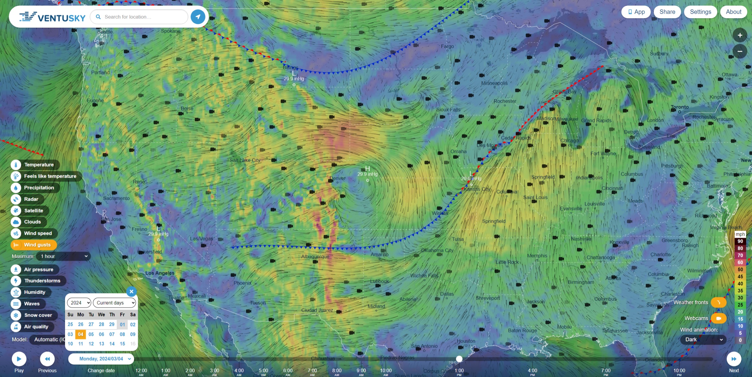
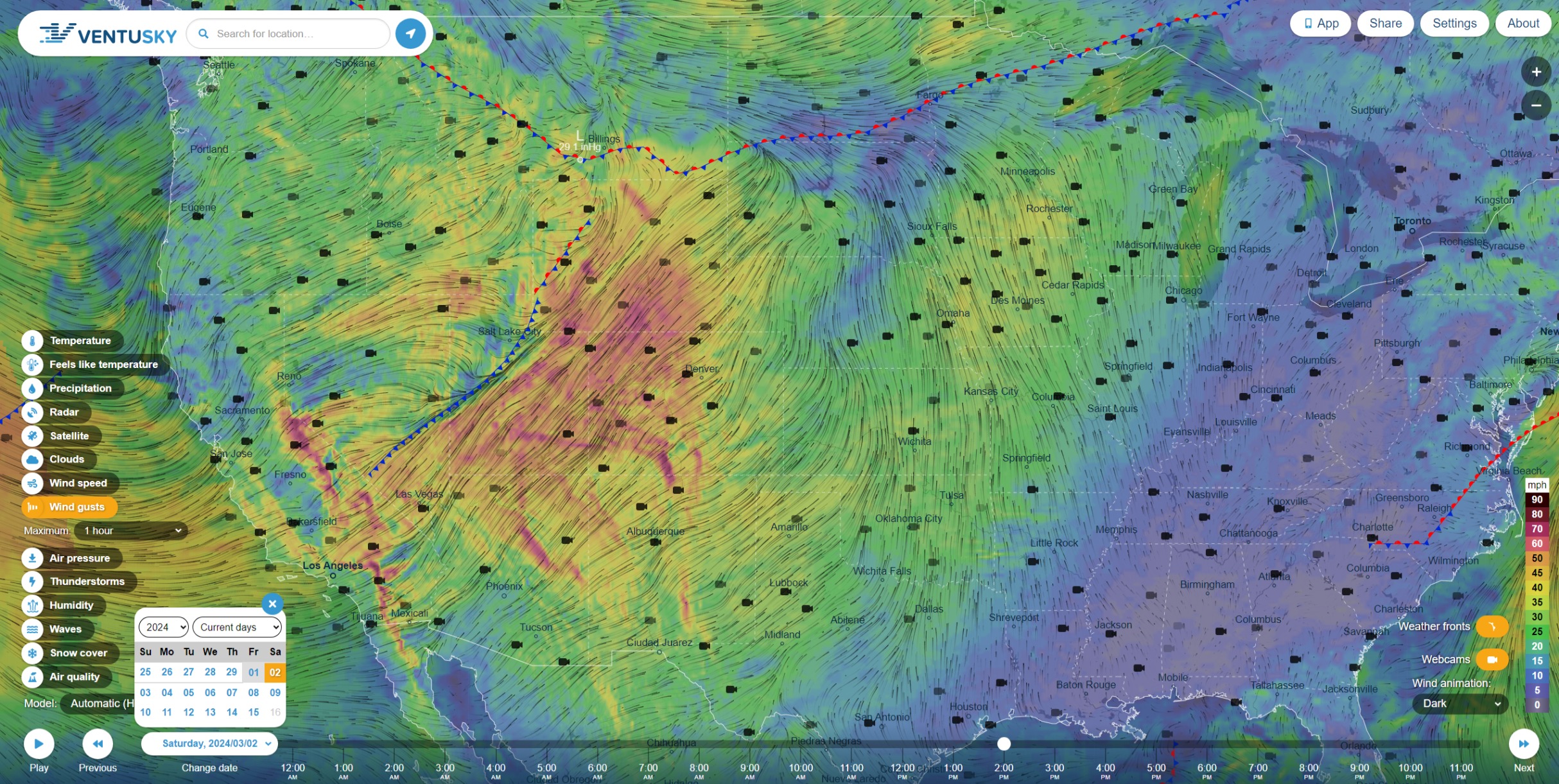
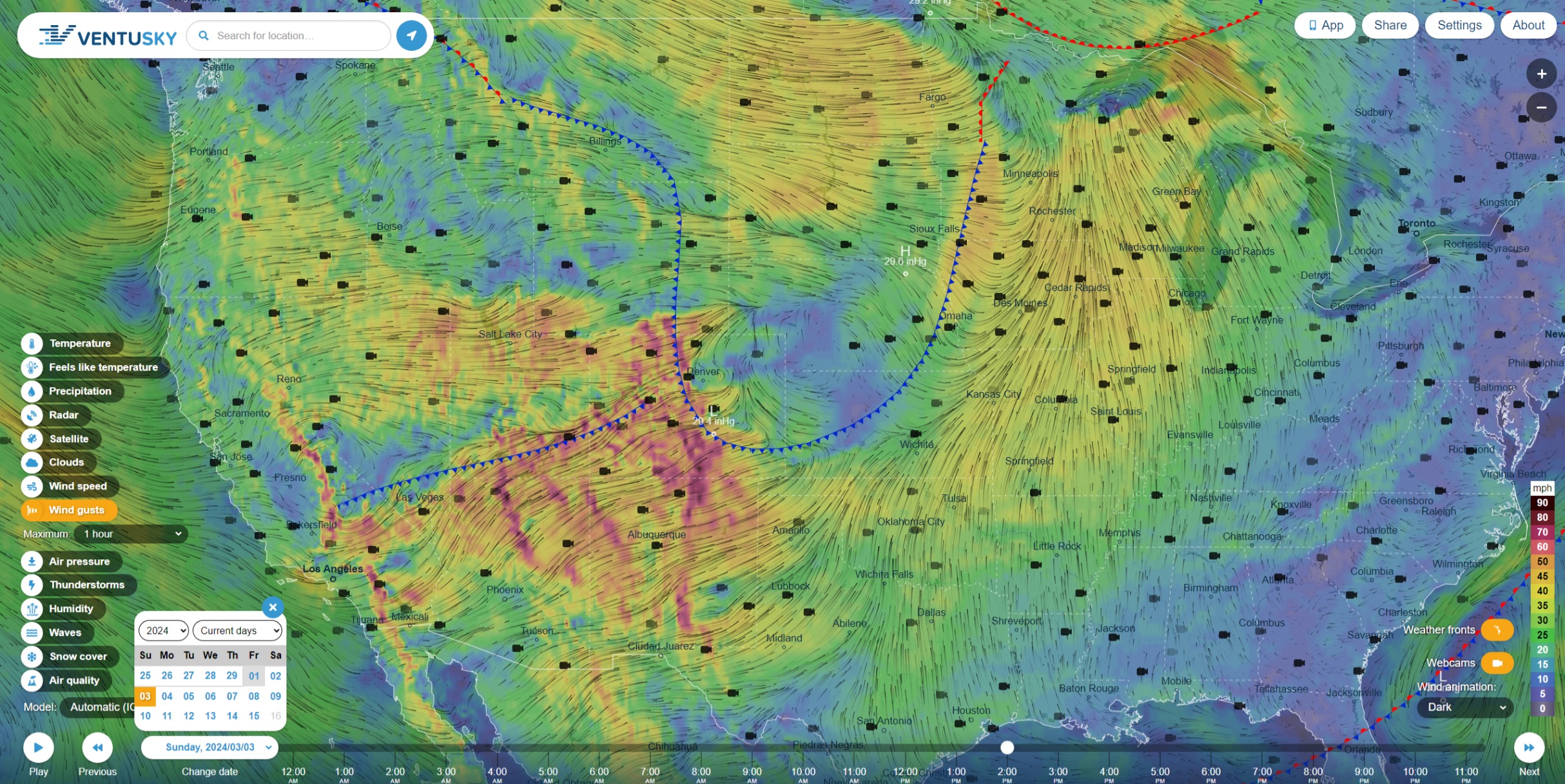
Ventusky HRRR+ICON Weather Fronts and Winds
Sat Mar 2
Sun Mar 3
Mon Mar 4