Do any weather folks here have any intel on potential thunderstorms in southern Oregon this weekend? I heard it through the grapevine but nothing official yet.
NOAA in Medford mentions that as a trough slowly moves in, there might be some cumulus build-ups by Saturday, with possibility of T-storms, however, too early to have any confidence.
Thank you, will try and keep my ear to the ground.
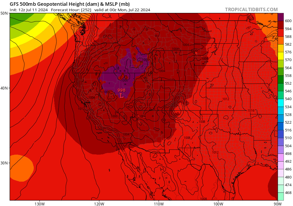
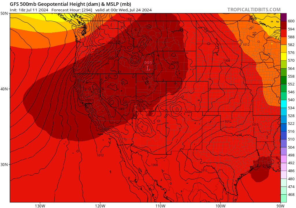
If the GFS verifies… Extreme heat wave coming up around the 19th-24th and possibly thereafter which will bring hot and dry conditions especially east of the Cascades. The gradient in temperature between the interior and coast will promote strong and gusty winds. This could bring an absolutely explosive fire regime to the Cascade crest and points east. This includes WA state. The ECMWF and it’s ensembles are a bit further south with the ridge. Even though relying on the extended GFS (more than 200 hours out). It is important to look at the overall pattern, at some point the ridge has to break down… and there has been run to run consistency. So I am very concerned about this time period.