A control burn is like a controlled fart. It can go to sh!t at any time
4 Likes
This escape got a California IMT assigned to it.
4 Likes
2 Likes
2 Likes

3 Likes
3 Likes
3 Likes
3 Likes
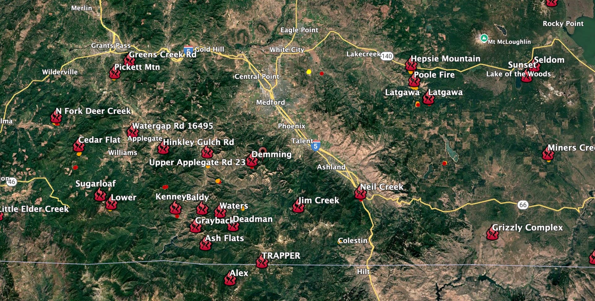
Things are popping heavy in SW Oregon today after yesterday’s lightning bust.
Several major fires appear to be trying hard to dodge initial attack, including the Neil Creek Fire, just south of Ashland off of I-5, and the Demming Fire, about 9 miles straight west of Ashland. Also some larger fires emerging south of the Highway 140 corridor, between White City and Lake of the Woods, at about 3,500’ elevation.
9 Likes
Here is a good resource for fire responders in Southern Oregon, from ODF - if you know the name of the topo map you are working on, you can download a LiDAR version of it here, and load it into Avenza Maps - great for finding old skid trails, overgrown roads.
You can find out which topo you’re on using this index:
Other good PDF maps for Southern Oregon available for download here:
5 Likes
3 Likes
3 Likes
3 Likes
This worked great, used it today, thanks Zeke
2 Likes
2 Likes
3 Likes
3 Likes
3 Likes
3 Likes