Last night we got 1/16 of rain in the gauge(Sonora area). Still dry under a lot of tree and brush canopy. Further up the hill more rain. .25 in Twain Harte. Sounds like more rain coming Saturday.
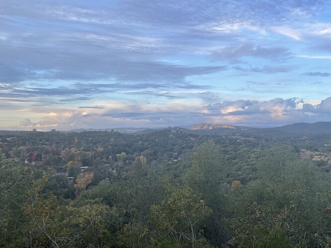
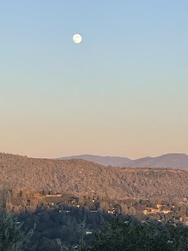
Photo is looking N/NE toward Columbia area and the mountain with the sunset on it is American Camp. Stanislaus Shots would cut line off it down towards the Stanislaus River. A steep piece of ground. Been giving you folks morning pics thought I would change it up.
Yesterday storm started pretty slow. Half inch of rain when I emptied the rain gauge at dark. Last night we had a hard rain and another inch in the gauge this morning. 1.5 total for this storm, not bad. Fire season in my eyes is done here, never really got going which is not a bad thing considering the last ten years. 45 out, RH off the chart and no wind. Hope everyone has safe travels and a great Turkey Day. Looks like great weather for the next week.
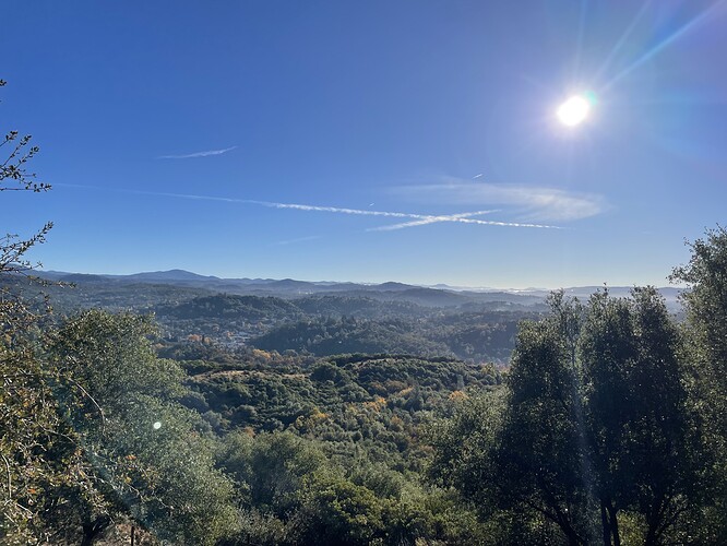
Side note: very clean air this morning could see some peaks in Yosemite. It’s been awhile for that.
I thought it was just the kind of rain we need! Gentle but adding up and soaking in not just dumping and running off. Hopefully we get more like that this winter. I’m not into the snow like we had last year. I still have PTSD from the sound of my ankle breaking… lol. Happy Thanksgiving everybody!
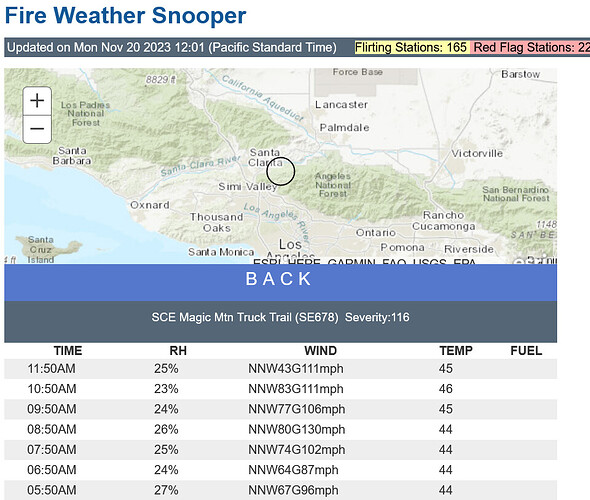
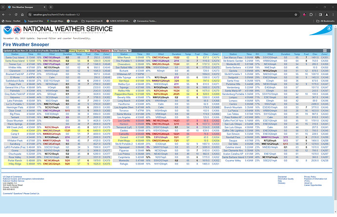
Magic Mountain truck trail recorded a maximum gust of 130 MPH.
Due to the actual cold front under-performing and washing out as it moved into the area, there is a chance that fire weather concerns return after the upcoming heat wave through Thursday. Some areas recorded as little as .20" of rain, and this would mean that about a week of drying brings us back to fire weather concerns in localized to regional areas. Forecast models are suggesting a significant trough moving into the Great Basin around 11/25, and as we get more data points it could manifest as a strong offshore wind event on models soon. In fact, the presence of the core of the upper level low and low level moisture on the lee side of the mountains could drive mountain wave activity for the next one.
A reminder that current fire weather conditions overrides fuel status.
SPC Outlook
It’s 71 degrees and 23 rH at my house in Huntington Beach. Still some wind, but very warm and dry.
Almost a full moon raising over Sonora on a cool evening with the sun starting to set.
56 out, no clouds, no smoke just a gorgeous day in the motherlode. Going to be a chilly one tonite woodstove already cranking. Christmas right around the corner, this year flew by quickly.
From the San Diego NWS Discussion this morning for upcoming weekend.
For Friday onward, offshore flow looks to return as another area of high pressure aloft builds in from the Eastern Pacific. This favors another multi-day round of Santa Anas as well as another warming trend that pushes daily highs roughly 5-10 degrees warmer than normal. EPS and CW3E guidance currently support a more moderate Santa Ana event on Sat/Sun across areas susceptible to easterly winds, so namely across more of the Riverside and San Diego County mountains and foothills as opposed to the San Bernardino County mountains. There is still quite a bit of uncertainty regarding how strong this weekend’s Santa Anas will be as ensemble spread at Campo, per the EPS, is anywhere from peak gusts near 30 mph to as high as 60-70 mph at times
RFW up for parts of LA Riverside, San Bernardino, Santa Barbara, & Ventura counties
National Weather Service San Diego CA
1238 PM PST Fri Dec 8 2023
CAZ248-090600-
/O.UPG.KSGX.FW.A.0001.231209T1800Z-231210T2000Z/
/O.NEW.KSGX.FW.W.0001.231209T1600Z-231210T2300Z/
San Bernardino and Riverside County Valleys - The Inland Empire-
1238 PM PST Fri Dec 8 2023
…RED FLAG WARNING IN EFFECT FROM 8 AM SATURDAY TO 3 PM PST
SUNDAY FOR STRONG GUSTY WINDS AND LOW RELATIVE HUMIDITY FOR the
Inland Empire…
The National Weather Service in San Diego has issued a Red Flag
Warning for strong gusty winds and low relative humidity, which
is in effect from 8 AM Saturday to 3 PM PST Sunday. The Fire
Weather Watch is no longer in effect.
-
WINDS…Northeast 15 to 30 mph with gusts 35 to 50 mph. Locally
stronger gusts are likely below the Cajon Pass. -
RELATIVE HUMIDITY…10 to 15 percent Saturday and 8 to 12
percent Sunday. -
IMPACTS…Any fires that develop will likely spread rapidly.
Outdoor burning is not recommended. -
LOCATION…San Bernardino and Riverside County Valleys -The
Inland Empire.
PRECAUTIONARY/PREPAREDNESS ACTIONS…
A Red Flag Warning means that critical fire weather conditions
are either occurring now…or will shortly. A combination of
strong winds…low relative humidity…and warm temperatures can
contribute to extreme fire behavior.
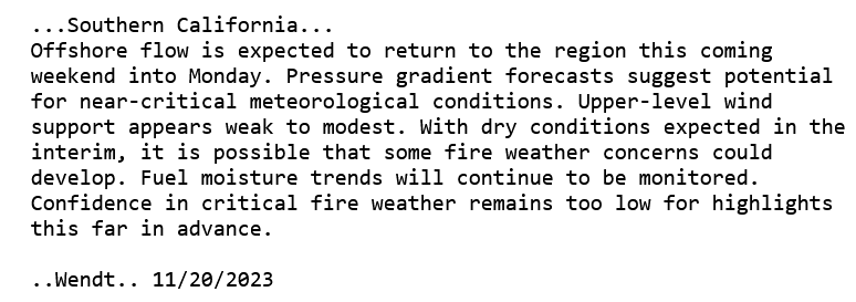
A compact upper level low is forecast to traverse the eastern deserts mid next week, and this will provide a renewed chance of offshore winds and critical fire weather conditions.
From a climatological stand point, the end of December and early January can bring the strongest winds of the year to Southern California… however it is typically after wetting rainfall ends fire season. With the dry and warm weather at present, it is worth watching ever little kink in the jet stream through this peak in windy season.
