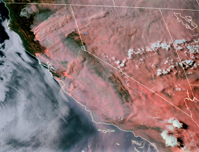
CAL FIRE Incidents
Salt Fire, Calaveras County (more info…)
Northeast of Copperopolis
*1,789 acres, 35% contained
Carmel Fire, Monterey County (more info…)
South of Carmel
*4285 acres, 0% contained
*Evacuations in place
*CAL FIRE IMT 1 Team in command
Hills Fire, Fresno County (more info…)
South of Coalinga
*1,500 acres 35% contained
River Fire, Monterey County (more info…)
East of Salinas
*33,653 acres, 7% contained
*Approximately 2,750 structures threatened
*Approximately 9,000 people have been evacuated
*CAL FIRE IMT Team 1 in command
Ivory Fire, Glenn County (more info…)
Elk Creek
*4,000 acres, 0% contained
*Evacuation in place
*Two structures destroyed
3-4 Fire, Tehama County (more info…)
Southwest of Red Bank
*7,000 acres, 0% contained
Creek Fire, Mendocino County (more info…)
Northeast of Covelo
*820 acres, 70% contained
*Two structures destroyed
3-19 Fire, Mendocino County (more info…)
Southeast of Potter Valley
*62 acres, 50% contained
*One structure destroyed
BTU/TGU Lightning Complex Fire, Butte and Glenn Counties (more info…)
Butte, Tehama and Glenn Counties
*21,042 acres, 0% contained
*Elkhorn 15,250 acres, 0%
*Ivory 4000 acres, 0%
*5-4 Potters 1012 acres, 50%
*2-24 330 acres, 50%
*5-5 200 acres, 50%
*1-8 150 acres, 0%
*1-7 100 acres, 5%
*CAL FIRE IMT- 4 in command
LNU Lightning Complex Fire, Napa County (more info…)
Napa County
State DPA, SRA, Napa County
*131,000 acres, 0% contained
*Hennessey (merged fires) 105,000 acres, 0% contained
*Wallbridge 14,500 acres, 0% contained
*Meyers 3,000 acres, 0% contained
*Round 4,000 acres, 0% contained
*Aetna 4,500 acres, 0% contained
*Estimated 100 residential, 4 commercial structures and 1 outbuilding destroyed
*Evacuations in place
*CAL FIRE IMT-2 in command
Jones Fire, Nevada County (more info…)
Northwest of Nevada City
*705 acres, 10% contained
*Evacuation in place
*5 residential structures destroyed
CZU August Lightning Fire, San Mateo and Santa Cruz Counties (more info…)
San Mateo and Santa Cruz Counties
*40,000 acres, 0% contained
*Waddell fire, 600 acres 0% contained
*Evacuations in place
*20 residential structures destroyed
*CAL FIRE IMT #3 is in command
SCU Lightning Complex Fire, Contra Costa, Alameda, Santa Clara and Stanislaus Counties (more info…)
Contra Costa, Alameda, Santa Clara and Stanislaus Counties
*137,475 acres, 5% contained
*20 fires in the complex
*Marsh 3,000 acres, 99% contained
*Canyon 104,200 acres, 0% contained
*Reservoir 27,550 acres, 10% contained
*Deer 3,000 acres, 70% contained
*Arroyo 190 acres, 90% contained
*Evacuations and road closures in place
*CA IMT-6 in command
Unified Command Fires
Warnella Fire, Santa Cruz County (more info…)
East of Davenport
*290 acres, 5% contained
*Unified Command CAL FIRE and BLM – Central California District
Lake Fire, Los Angeles County (more info…)
Southwest of Lake Hughes
*27,041 acres, 48% contained
*Continued structure threat
*Road closures in the area
*Unified Command USFS and Los Angeles County Fire
*CA IMT Team 5 is in command
Federal Incidents
Dolan Fire, Monterey County (more info…)
Ventana Wilderness – Los Padres National Forest
*2,500 acres, 0% contained
Ranch 2 Fire, Los Angeles County (more info…)
San Gabriel Canyon
*4,237 acres, 33% contained
*Road closures in place
*Federal Type 2, in command
Apple Fire, Riverside County (more info…)
Cherry Valley

