State ID: AZ
3 letter designator: ASF
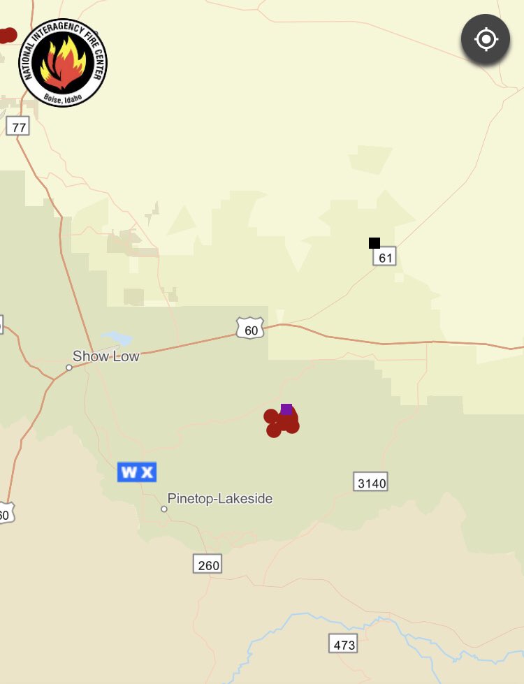
Fire name: Marshall
Location: 34 13.062, -109 49.830
12mi East of Show Low AZ
Reported acres: 80
Rate of spread:
Report on Conditions:
Structure threat: yes, evacuations in progress
Resources: 1 HE1R, 1 VLAT, 5 LAT1, 2 ATS3, 1 FWAA, 2 FWLP, 1 CRW1, 1 CRW2 ordered / assigned.
Hazards:
Weather: winds, red flag warning
Radio channels: 167.175 A/G-34
118.950 A/A-1
Scanner link:
Webcam link:
Agency Website:
2 Likes
Marshall (AZ-ASF, Apache-Sitgreaves NFs). Discovered 5/30. Approx. 12mi East of Show Low AZ (34 13.062, -109 49.830). 6 Acres. 1 HE1R, 1 VLAT, 5 LAT1, 2 ATS3, 1 FWAA, 2 FWLP, 1 CRW1, 1 CRW2 ordered / assigned.
A couple of frequencies if you happen to be in scanner range of the #Marshallfire:
167.175 A/G-34
118.950 A/A-1
 Evacuation Warning #Apache County #AZ #MarshallFire
Set: Vernon: Bruce Alley and the area inside the polygon on the map
Advertencia de evacuación del condado de Apache
Conjunto: Vernon: Bruce Alley y el área dentro del polígono en el mapa
https://www.facebook.com/permalink.php?story_fbid=pfbid02V5AfKpWrmM142gzq352fEw7bdeh68x1SNqQGQLDjwtWU3Tz4xHe3qd92gmentH3el&id=112084342213061 https://twitter.com/CEDRdigital/status/1531445624100401153/photo/1
2 Likes
4 Likes
Last update on Monday was 24 acres and 80% contained
2 Likes