State ID: AZ
3 letter designator: CNF
Fire name: Tonto Canyon
Location: 31.3752, -111.1921
15 miles west/northwest of Nogales
Reported acres: 2850
Rate of spread:
Report on Conditions:
Structure threat:
Resources:3 LAT1, 2 FASM, 1 FWAA, 4 ENG, 3 CRWA 1 HE1R, 1 HE2S, 1 HE3S, 1 CRW2, 1 ENG6.
Hazards:
Weather:
Radio channels:
Scanner link:
Webcam link:
Agency Website:
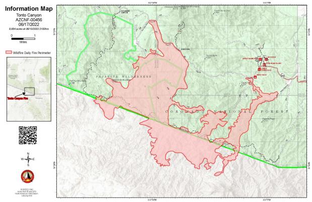
Tonto Canyon (AZ-CNF, Coronado Nat. Forest), discovered 6/12, 30 acres. 15 miles west/northwest of Nogales, AZ (31.3752, -111.1921). 1 HE1R, 1 HE2S, 1 HE3S, 1 CRW2, 1 ENG6.
Tonto Canyon (AZ-CNF), 2850 acres. 3 LAT1, 2 FASM, 1 FWAA, 4 ENG, 3 CRWA (Crews).
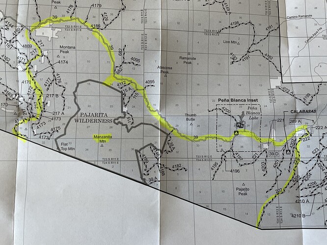
On Sunday, June 12, 2022, the Coronado NF responded to three new starts at approximately 10:45 AM in the Tumacacori Mountains near Manzanita Mountain, Nogales Ranger District. The three starts combined to create the Tonto Canyon Fire. ~2,500 acres
Please avoid the area. https://twitter.com/CoronadoNF/status/1536431942156963840/photo/1
Tonto Cayon and Mule fire Update -
Mule 357 acres 75% contained,
Tonto Cayon 850 acres unknown containment. Multiple LATs ordered this morning.
9,550 Acres
Contained: 25%

#TontoCanyonFire2022
Acres 9,550
Containment 50%
Personnel 158
Ruby Road all containment lines held
Showers began across the fire at about 5:00 PM this evening and are expected to continue throughout the night.
Closure
fs.usda.gov/alerts/coronad…
Inciweb
inciweb.nwcg.gov/incident/8158/
#TontoCanyonFire2022
Acreage: 9,426
Containment: 60%
Personnel: 76 - 1 helicopter, 4 engines, and 1 crew
Transiting fire at 7:00AM tomorrow to a Type 4 Team
Scattered showered across the fire today and tonight
Road closure
fs.usda.gov/alerts/coronad…
Inciweb
inciweb.nwcg.gov/incident/8158/
