Lol… Was just creating a thread for this one
1600 acres
35.372 latitude, -111.437 longitude
4 miles East of Sunset Crater Volcano in the Pipeline Fire vicinity
10 engines on scene
Evacuations in progress
Red Flag weather conditions with gusts up to 40-50 miles per hour on Monday.
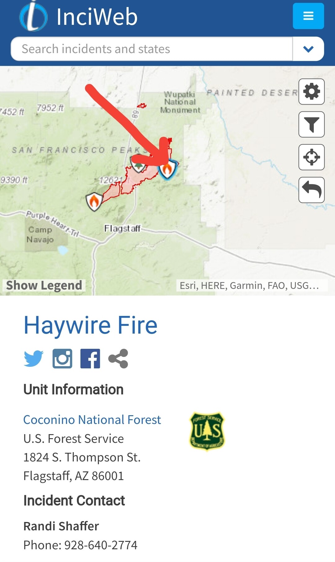


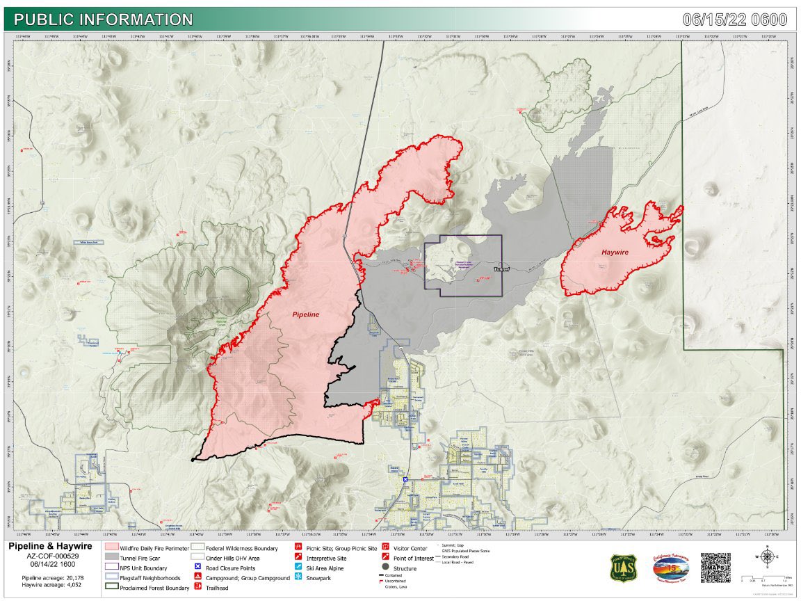
Updated maps for the #PipelineFire and #HaywireFire north of Flagstaff, AZ. https://wildfiretoday.com/2022/06/13/three-fires-spreading-rapidly-northeast-of-flagstaff-az/ https://twitter.com/wildfiretoday/status/1536533162964226048/photo/1
PIO map of the #PipelineFire (20,758 acres) and #HaywireFire (4,052 acres). The Pipeline fire is burning into the Kachina Peaks Wilderness, which has little to no burn history and heavy fuel loads. #azwx #FireWX #Flagstaff https://twitter.com/MichaelWX18/status/1537120414299660289/photo/1