State ID: AZ
3 letter designator: PNF
Fire name: Rafael
Location: 4 miles N/O Perkinsville, AZ
Reported acres: 20,000
Rate of spread: extreme
Report on Conditions: discovered on 6/18, after dry lightning event. Started as 4 fires. Grew from 400 acres to 18,000 acres yesterday. Grass, juniper at lower elevations and chaparral to ponderosa pine at higher elevation. Other lightning fires burning nearby/
Structure threat: yes, South Garland Prairie & Pine Aire Estates should prepare for evacuation order. Everything south of I-40 and west of I-17 now in ‘SET’ and should prepare to evacuate. Just outside of Flagstaff proper.
Resources:
Hazards:
Weather: Winds from passing weather front, outflow winds from isolated mostly dry thunderstorms, high daytime temperatures and low relative humidity
Geostationary Satellite
Radio channels:
Scanner link:
Webcam link: Live Webcam of Flagstaff | Pine Canyon
Flagstaff Arizona Webcam: NAU Campus - AllTrips
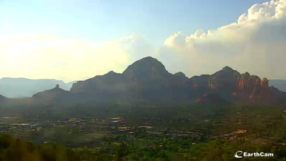
Sedona Mountaintop Cam
Agency Website: Rafael Fire Information - InciWeb the Incident Information System
3 Likes
All areas south of I-40 and west of I-17 are in SET status.
The fire has moved from pinyon/scrub into timber on the north and east sides.
5 Likes
Evacuation SET map: https://sartopo.com/p/7G1R
4 Likes
Pretty interesting from an operational standpoint, as of this morning the fire is divided into 3 branches with the Coconino, Prescott, and Kaibab each managing one until a type 1 or 2 team takes over sometime midweek.
Likely quite a few campers in the evacuation area they’re working to move out.
5 Likes
Live video: Redirecting...
1 Like
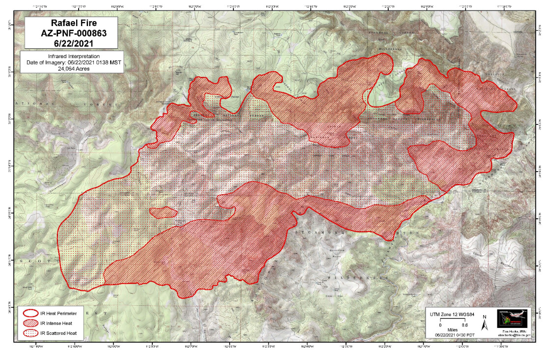
24,064 acres. The fire has made it into the bottom of Sycamore canyon and the concern is that it will get across the other side and start running up into the timber.
2 Likes


2 Likes