https://cameras.alertcalifornia.org/?pos=38.6303_-120.8599_10&id=Axis-Logtown
…. and 109 degrees.
Looks like it’s going again
!
Screenshot_20240706_171527_Flightradar24|225x500
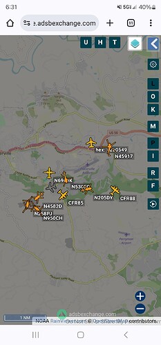
2 Chinooks inbound from Truckee
OCH and 8PJ
KCRA has a reporter just outside the airport. hopefully they will show them again Channel 3 Sacramento
More at 6:00 when the news comes back
Did anyone hear the acreage by Intel 641?
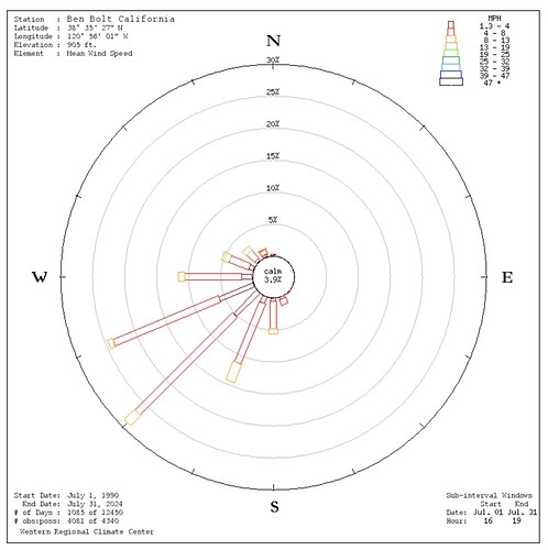
I’ve been finding the wind rose tools from Desert Research Institute to be really useful.
They allow you to view historic RAWS winds for a given time period and time of day.
If you use this map to find a RAWS station, you can Google (e.g. Ben Bolt RAWS) the RAWS, and find the data archive on the DRI website. Wind Rose Graph is one of the options on the page.
For this fire - here is the wind rose for foothills west of Placerville for July, since 1990, between 4 and 8pm.
61 acres from 641
Just looked at the Ben Bolt RAWS data—114 degrees with 10% humidity. I feel for those crews.
I saw engines protecting them and no fire was visible from the hangars.
Sounds like they’re done with the fixed wing tankers
Still dropping.
I was just repeating what I heard on the TAC frequencies, pretty much verbatim.
Mapped at 77.5 acres
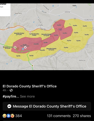
Thanks for the map. Do you know if those evacuation orders are still in effect? My spiritual guru lives behind the head.


