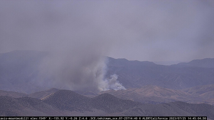
State ID: CA
3 letter designator: ANF
Fire name: Agua
Location: Agua Dulce Canyon Road x Soledad Canyon Road; Acton, CA
Reported acres: 4
Rate of spread: moderate
Report on Conditions: running uphill with potential for 200+ acres, last large fire was the Sand Fire (2016)
Structure threat: are not currently threatened
Resources: LAC 2nd alarm, ANF, AA52, 1 LEAD, T41
Hazards: train tracks shut down in the area
Weather: SCE Soledad Canyon Ranch
SCE Soledad Canyon 2
Radio channels:
Scanner link: https://www.broadcastify.com/webPlayer/829
https://www.broadcastify.com/webPlayer/25757
Webcam link: Mt. Mcdill 1
Sierra Pelona 1
Magic Mountain 2
Agency Website:
11 acres, structures threatened on LAC land, powerlines in the area. RV park threatened
The fire is pushing to the south in medium to heavy fuels.
When the Sand Fire burned through this area in 2016, a lot of the area had not had any fire history… so the vegetation recovery is likely pretty good… further to the east, there is a small gap between the Station (2009) and Sand fire scar.
Anyone else getting July 2016 Sand Fire flashbacks? The potential of this mountain range is very high…
IC stated No structure threat, potential for 200+ acres in the next hour
Live video: https://ktla.com/news/local-news/agua-fire-burns-in-angeles-national-forest/
AA ordering 2 additional LAT’s and 1 VLAT
KTLA Copter just reported a new start at Newhall Pass
just ordered 2 type 3 ST.

