CA-ANF-BICHOTA 2020

State ID:CA
3 letter designator:ANF
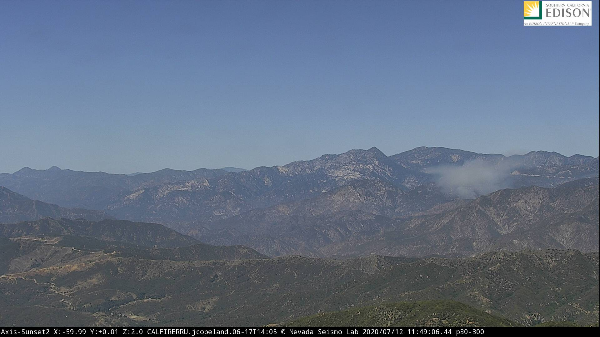
Fire name:Bichota
Location:Hwy 39 and MM 32.18
Reported acres: 2-3
Rate of spread:mod
Report on Conditions:Multiple trapped civilians, with PT21 taking rescue actions. Reported burn victims with LAC requested for EMS, 2nd alarm started by ANF asking for Strike Teams and additional aircraft.
Structure threat:None
Resources:AA-509 BC-21 CRW-1 CRW-2 DIV-2 DOZ-10 DOZ-12 ED-18 ENG-21 ENG-23 ENG-25 ENG-311 ENG-322 ENG-324 ENG-326 ENG-327 ENG-328 ENG-512 HEL-532 HT-37S PAT-21 PAT-25 WT-222 WT-25
IC reporting fire has spotted across Hwy 39, 5 to 10 acres, rapid rate of spread, moving north. Closing Hwy 39 at El Encanto.
Hazards:
Weather:
Radio channels: ANF Forest Net, NIFC T-2
Scanner link:
Webcam link:


Agency Website:

2 Likes

Sounds like the area is significantly impacted with day users and vehicles blocking access to responding resources.

1 Like

http://www.alertwildfire.org/orangecoca/index.html?camera=Axis-Johnstone1&v=81e002f

Johnstone Cam

Map: https://goo.gl/maps/iF8Vfzkh7hnHPzfS6

Air Rescue 5 on scene for medical. SUP 2 states they are attempting to get a count of victims, still unknown how many. Sounds like major access issues due to day users. Update: sounds like only 2 victims now. Minor scratches.

2 Likes

UPDATE at 1235 hours: IC holding resources not on scene yet. Fire holding at 5 acres. 20 x 20 spot handled. 3 civilian injuries, 2 transported, 1 AMA.
UPDATE at 1245 hours: hoseline around the fire. Releasing dozers. Handline will be complete in @ 30 minutes.

2 Likes