Pear Blossom hwy becomes HWY 138 E/O little Rock. The grass crop is solid still, but besides the Joshua Tree’s the further north the less the 1,000 & 100 hr fuels and more 10 & 1. 138 should hold. Its the east progression that is concerning. Past 165th & Hwy 138 it gets think with juniper as the elevation increases towards Pinyon Hills. The WUI would be a slugfest in a normal fire. With draw down of resources it will.be downright scary. The good thing is the aqueduct is close and LAC has MANY predetermined Helispots to load ships at night. Winds will be the game changer, especially with the front pushing onshore.
WILL BE A LONG NIGHT AND THE NEXT FEWS DAYS WILL.BE “SPORTY”
7 Likes
http://www.alertwildfire.org/orangecoca/index.html?camera=Axis-MtnHighWest1&v=81e004f
Just for reference what road is that on the right side?
my guess is hwy 2
could be Big Pines Hwy???
Copter 5 live on FB:
1 Like
That was from yesterday…good footage though
2 Likes
it would be nice to hear or see what is going on the top end (hwy 2 and jackson lake area). I know news media is only looking for flames but a lot of camps and residents in that area…plus it is an approach to Wrightwood. so far Wrightwood only has a warning. we have no smoke and Mt High cams show it a ways away.
3 Likes
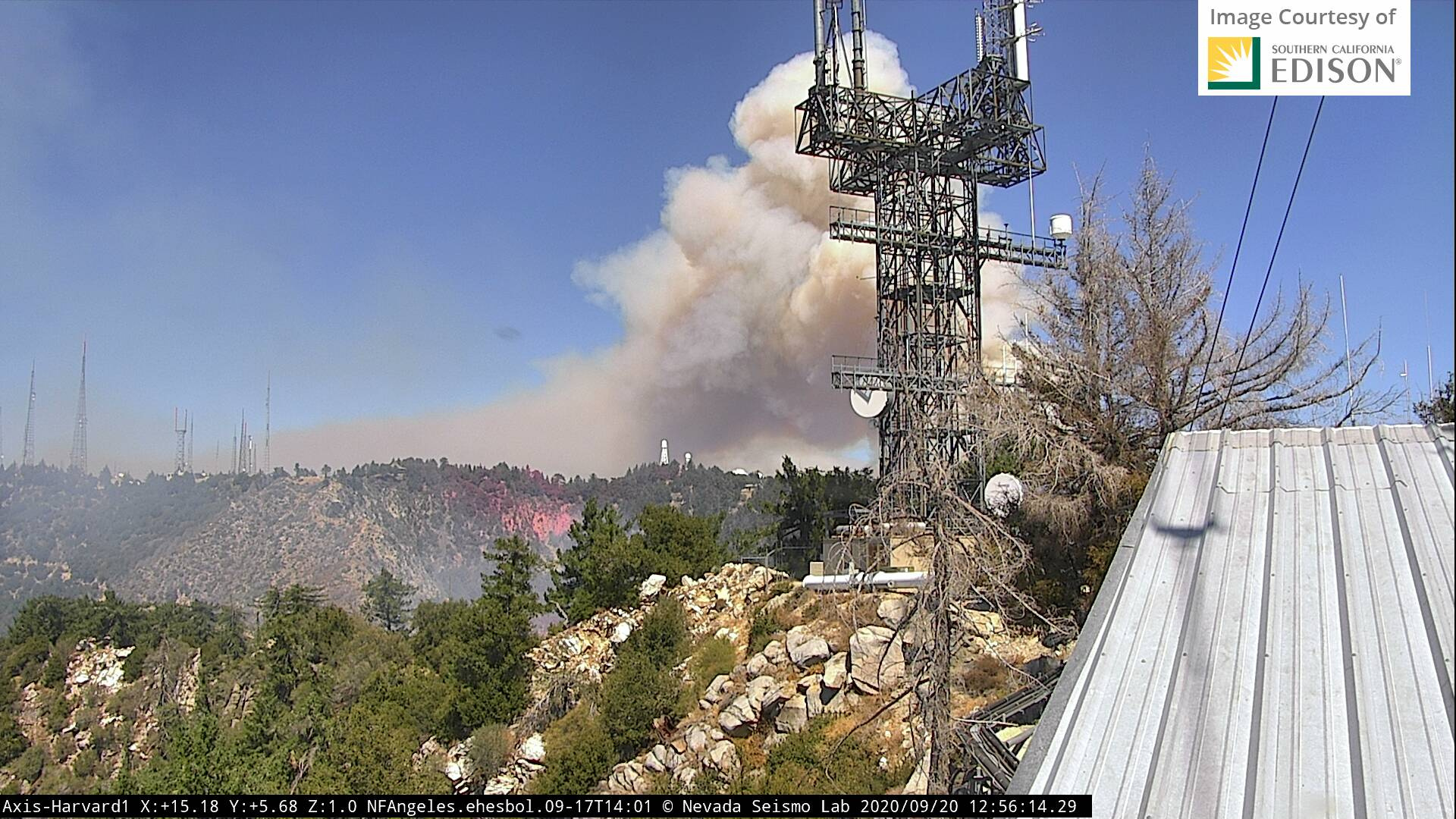
I was just at Big Pines Hwy & Largo Vista. Fire is just a little east of there. Helitankers working it but no significant runs currently.
6 Likes
Anyone know how Fenner Canyon camp is doing?
1 Like
last I herd…several hours ago, it was ok…I have taught there and it is very defensible
1 Like
Is this just something within the lines? Brother on one of the Type 1 copter crew says no - coming to life again…
2 Likes
They are dropping retardant in this area so I assume active perimeter growth.
4 Likes
Does anyone have a updated map, or could attach the link? Thanks in advance.
1 Like
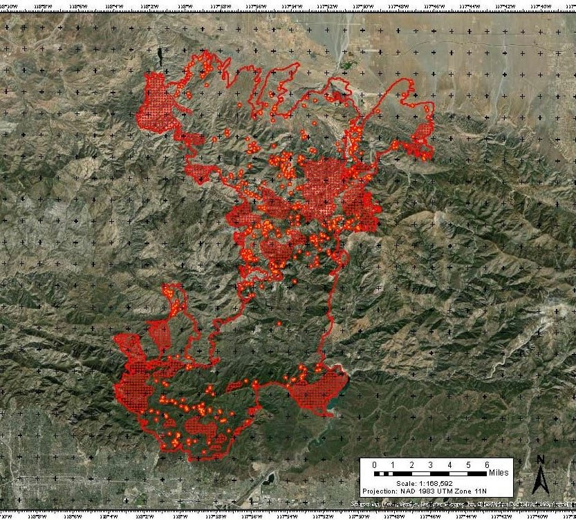
2009 Station Fire: 160,577 acres
2020 Bobcat Fire: Shooting for number #1
3 Likes
Yeah Dali, and if this weekends weather comes to play it could get squirrely again!
5 Likes
Muni_Captain,
I am sure you saw that their was very little defensible space up there with thick stands of trees and brush. maybe they felt safe after surviving the Station fire, but if you or I had that kind of money at stake I am sure it would have looked a lot differently. perhaps if the insurance companies and FS intervened: but that gets into politics and I do not want to go there. alls I know is a lot of resources have been thrown at Wilson and the East end of the fire is marching big time towards Wrightwood and other communities. hopefully all will have a successful ending to this monster.
5 Likes
SCE Equipment tagged as potential source: https://abc7.com/sce-utility-equipment-eyed-as-possible-source-of-bobcat-fire/6524096/
2 Likes
Reporting Date: 9/15/2020 8:22:44 PM Incident Date - CA.gov
www.cpuc.ca.gov › SCE Incident Report 20200915
Sep 15, 2020 - Incident Date: 9/6/2020 @ 12:20 p.m. … Utility Name: Southern California Edison Company … Email Address: paul.pimentel@sce.com … September 15, 2020, at 8:00 a.m., the United States Forest Service (USFS) reported the.
1 Like