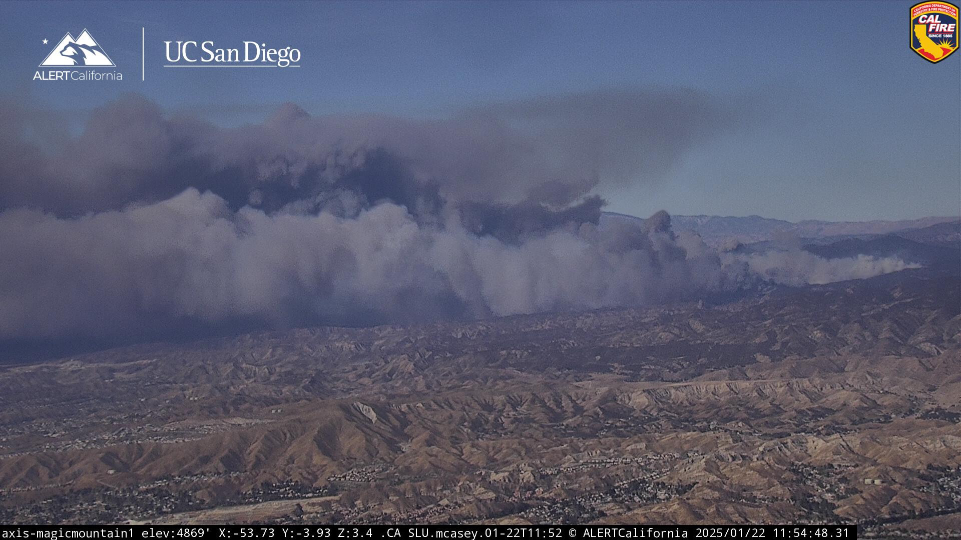
Grasses and other flashy fuel regrowth has already been established after the wetting rains of 2023 and 24. Can easily carry spotfires.
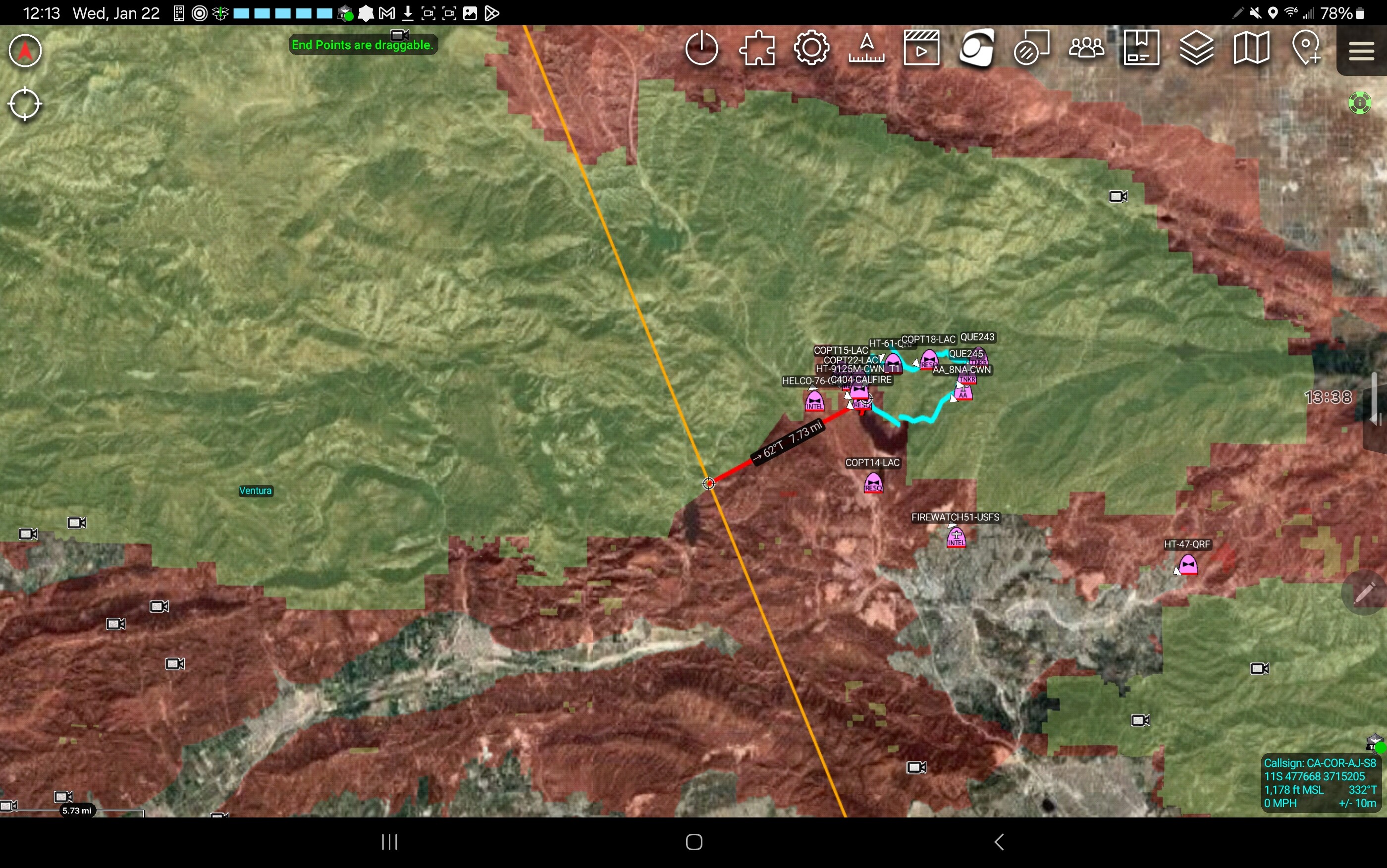
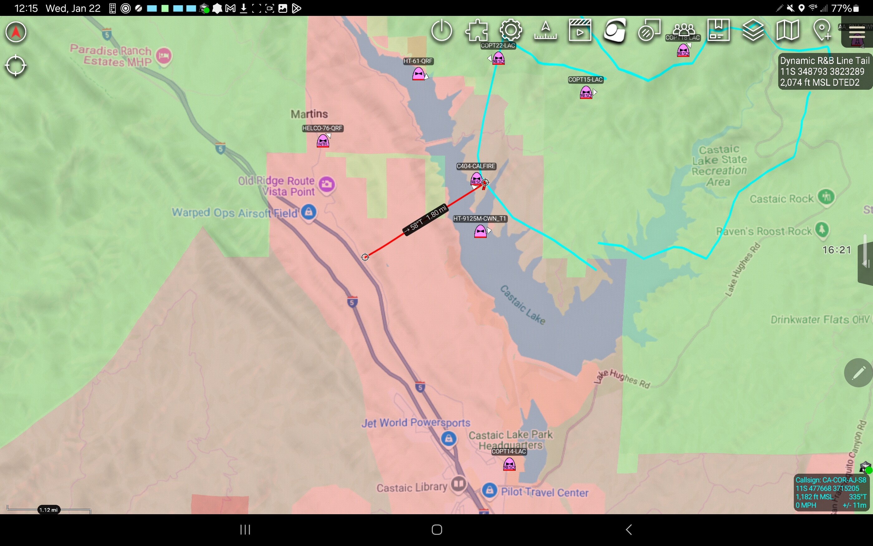
We need to consider the very real possibility that if this crosses both Lake Castaic AND the 5, this may becoming a very longlasting ordeal for the Ventura area as well.
Current accumulated rainfall since October 1 for Warm Springs in the fire area is only.48 inches for the season according the CA DWR on CDEC. Grass Mountain east of the fire shows only .35 inches of rain so far. Seems low, but if it is accurate things are dry.
Use this for audio stream, coverage from Santa Clarita, if you use winamp to stream it, you can see alpha tags for what each channel is assigned to. https://www.broadcastify.com/listen/feed/829
Looks like chp has already closed the 5.
My mistake cal trans says one thing and chp has something different. Just the off ramps in the area are closed.
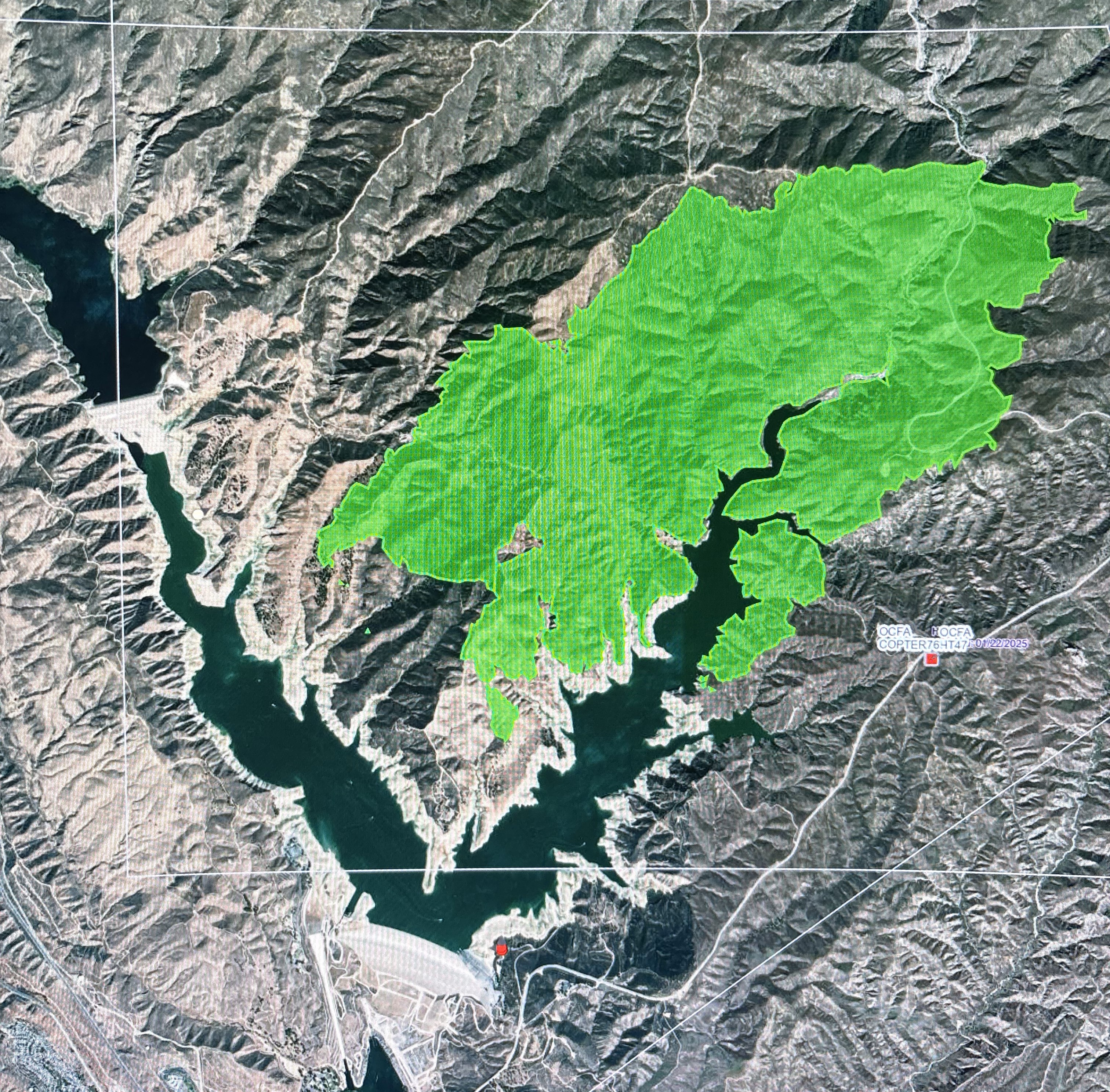
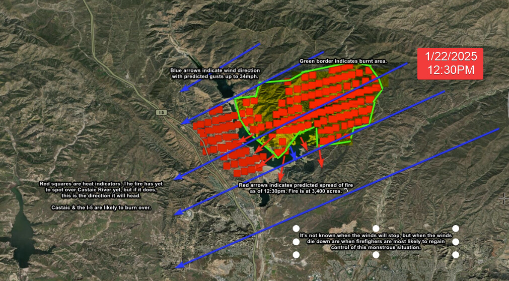
Note that the burnt area isn’t totally accurate. FIRIS Intel 24 just updated the impacted area. A two mile area from the shore of Lake Castic on the furthermost west (left) green line should be pushed back for a more accurate estimation… The rest is deemed accurate. But look at the FIRIS map too. An easy way of seeing this is on WatchDuty, which uploads FIRIS data.
Further more, on the south-eastern area of the fire (to the right of the bottom area-lake) could burn regardless of fire retardant. – though it’s likely fire retardant should hold given that the fire is shooting towards the lake. There’s no arrows to help indicate this but a heads up is nice. (edit never mind – this is where Lake Hughes Rd. is, fire just crossed here.)