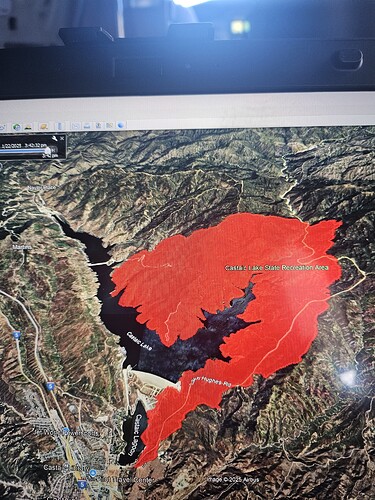
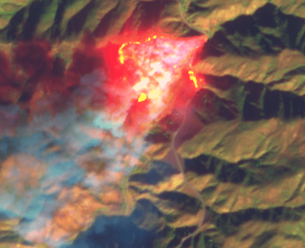
Haven’t seen any spots over the lake, but very obscured with the smoke.
The real question is holding it at the 5 and to the SW and with the amount of aircraft I see then really putting this thing on check before pumpkin time.
Whitaker ridge view makes it seem like its west of the lake now
Definitely a possibility, hard to tell. They are hitting the East edge hard with retardant, hopefully they can hold I5.
Predicted winds higher tomorrow too, might get sporty if they aren’t able to wrap it.
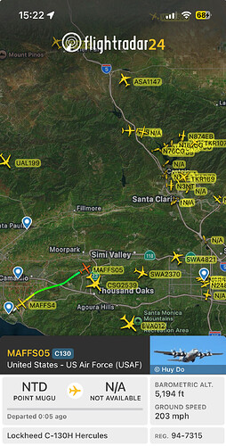
MAFFS 5 and 4 en route to an already crowded airspace.
Sounds like helos are working north and fixed to the south.
With the amount of fixed wing wouldn’t they order up another lead etc just so they are not out of there span of control due to the contested airspace.
Good question. Speaks to span of control
Correct, span of control and safety.
Yikes anyone have the vertical separation on that last drop!
Not sure if the same span of control exists for aircraft. Both Air Attack and Lead are up over the fire. Remember only one fixed wing is engaged at a time, with maybe a second trailing. Everyone else gets parked in an orbit and self-babysits. Incoming aircraft have the 12 and 7NM rings to call and not approach until given permission, and then placed in orbit or handed straight to Lead for a drop if nobody else around.
They have 5 lead planes assigned to the incident.
KTLA says the Cal Fire puts the size at 8000 acres
8,096 Acres per Cal Fire
0% containment 8096 acres per radio traffic
Only one Lead will over the incident at a time. Communication is the key and AA has overall airspace, also Helco has their hands full.
LCES applies in the airspace as well
Looking at the cameras and the decrease in smoke production coming from this thing and with the amount of aircraft they have, I would hope they are making good progress getting around this thing.
Sounds like Air Attack is putting some Tankers on Load and Hold at SBD and Mugu.
load and hold because it’s getting dark.


